6 Beautiful, Historic Canoe Routes You Can Do in Ontario
The truth is, nearly every waterway in Ontario has a rich history. To travel by canoe or kayak in this vast, watery province is to recognize that paddles have dipped these same rivers and lakes for thousands of years.
Long before European exploration, trade and colonization, Indigenous peoples swung their blades in rhythm with the seasons. Travelling in birch bark canoes, they moved from winter hunting grounds in the province’s interior to summer fishing camps on the shores of the Great Lakes, James Bay and countless smaller lakes. Modern paddlers can thank these first peoples for the existence of today’s canoe routes, portage trails and even the graceful craft itself.
From rivers and coastlines made legendary by the exploits of the voyageurs, to lake country routes linked by ancient footpaths, here are my top picks for Ontario’s most storied canoe routes.
French River
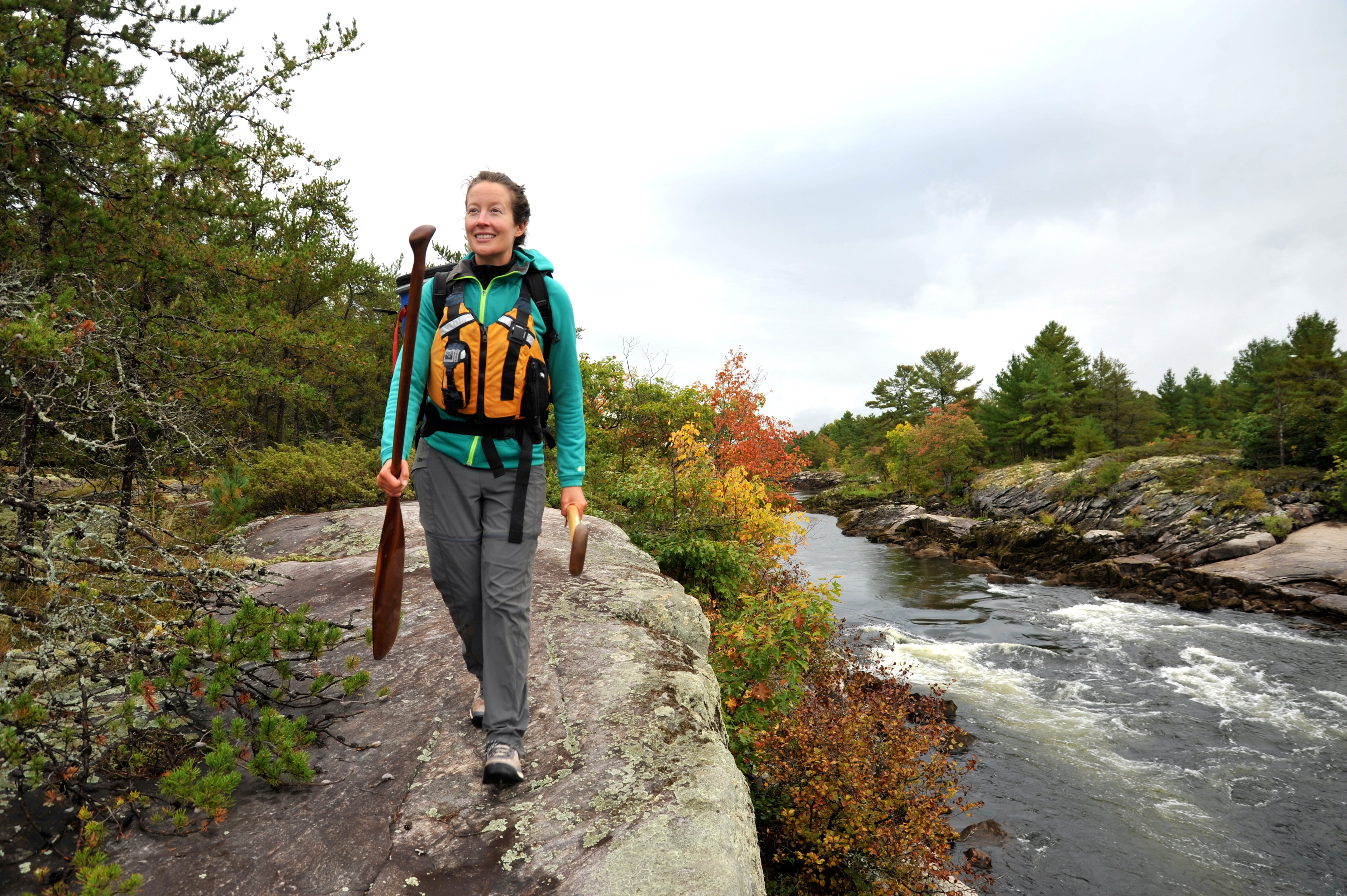
Just about anywhere you point your bow on the French River, you are travelling in the footsteps and paddle strokes of early explorers, missionaries, voyageurs, Indigenous peoples and loggers. The country’s first designated Canadian Heritage River, the French formed a key link in a historic waterway connecting the upper Great Lakes and the rest of Canada. For centuries, the river’s scenic channels were a crucial transportation route and focal point for trading. Place names like the Voyageur Channel and Recollet Falls recall an era when travel was by birch bark canoe and the river’s thundering rapids were daunting—and sometimes fatal—obstacles.
Today, easy access, beautiful campsites and friendly whitewater mean the French River offers some of the best canoe tripping in Ontario. Flowing 110 kilometres from Lake Nipissing west to Georgian Bay, the river’s three channels make for plenty of rewarding route options—from short-and-sweet downriver runs to longer loops exploring the sprawling, island-studded delta. Numerous access points and outfitters—all readily accessible from Highway 69 just north of Parry Sound—keep logistics simple.
For a three-day canoe trip, I love the exciting rapids and stellar campsites of the Wolseley Bay to Highway 69 route; or you could opt for the easy flatwater of the French-Pickerel loop. With five to seven days, you could embark on the 18 Mile Island loop, or complete the classic Figure 8 loop from Hartley Bay down to Georgian Bay. I can’t get enough of this delta archipelago—the pull of the voyageurs feels strongest here, where the river’s sheltered passages meet big water and the open horizon beckons.
- The most commonly used French River canoe access points are French River Supply Post and Marina and Hartley Bay Marina for trips west of Highway 69, and the Lodge at Pine Cove for trips on the upper French east of Highway 69. All of these outfitters offer canoe rentals, overnight parking and trip planning assistance.
- Develop paddling skills and a deeper French River connection on a beginner-friendly guided canoe trip with Black Feather or MHO Adventures.
- Be sure to stop in at the French River Provincial Park Visitor Centre, where award-winning exhibits bring the river’s history to life.
- Treat yourself to an old-fashioned milkshake or unique souvenir at the French River Trading Post, just north of the bridge on Hwy 69.
Mattawa River
Along with the French River, its neighbour to the west, the Mattawa formed a crucial link in the original “Trans-Canada.” Travelling by canoe, anyone headed west from the St. Lawrence and Ottawa rivers would next navigate the Mattawa River before crossing the height of land near present-day North Bay and descending the French River to Lake Huron, Lake Superior and beyond.
Rocky and rugged for nearly all of its 64 km, the Mattawa River punches well above its weight. During the Montreal fur trade of the 18th and early 19th centuries, westbound voyageurs counted down the 11 treacherous portages as they lined, poled and carried their 36-foot birch bark canoes upstream. Returning east from Lake Superior later in the summer, the Mattawa’s steep rapids and violent waterfalls threatened disaster for the heavily laden freight canoes and their precious cargos of furs.
Making the three-day descent from Trout Lake to the river’s confluence with the Ottawa at the town of Mattawa, I am struck by how tangible the history feels along this beautiful waterway park. The shores remain undeveloped and thickly forested; the portages and campsites where I shoulder my canoe and pitch my tent are the same ones paddlers have used since time immemorial. The raw power of Talon Chutes and the cascading waters of Paresseux Falls stop me in my tracks, as they surely have every paddler humbled by the Mattawa.
- For a spectacular day trip, put in at Pimisi Bay and paddle to Portage Campion in Samuel de Champlain Provincial Park. Your reward for portaging around several short rapids is paddling right up to the base of six-metre-high Paresseux Falls.
- Algonquin North Wilderness Outfitters provides rentals and shuttles for one-way trips, as well as complete trip outfitting or fully guided trip packages.
- Nestled on 485 acres just 15 minutes north of Mattawa, Nature’s Harmony Ecolodge offers unique cabin, camping and glamping accommodations set amid the Laurentian Mountains.
- Check out this Mattawa River trip planner to learn more.
Temagami
No matter where you choose to paddle in Temagami, you’ll be immersed in primeval forest, crystal-clear lakes and the deep sensation that travellers have explored these same waters for millennia. Nestled in the heart of Ontario’s canoe country, Temagami’s 2,400 km of ancient canoe routes are steeped in Indigenous history. When you journey the lakes, rivers and portage trails in this mosaic of interconnected provincial parks and waterways, you are part of a way of life dating back thousands of years.
Obabika Lake anchors one of the most popular canoe routes in all of Temagami—the five-day (72-km) Diamond-Wakimika-Obabika Lake Loop. Perfect for novice- to intermediate canoe trippers, the entire route boasts exceptional camping and lovely scenery, but Obabika Lake’s old-growth forests and Ojibwe spiritual sites are truly awe-inspiring. Plan an extra day to explore the famous Wakimika Triangle Trails, which lead visitors through a forest of 350-year-old red and white pines to the sacred cliffs of Chee-skon (Spirit) Lake. Pulling up your canoe on polished bedrock to walk among these four-century-old giants is an incredible privilege that’s possible nowhere else on the planet.
Today, the forest here is protected within Obabika River Provincial Park, but in 1989—threatened by logging—this peaceful grove was the site of the province’s largest act of civil disobedience. I think it’s a marvellous place to reflect on the importance of conservation and traditional teachings.
- Temagami Outfitting Company offers lightweight canoe rentals, vehicle shuttles, complete outfitting and trip planning services, as well as an all-inclusive guided Diamond-Wakimika-Obabika canoe trip.
- Backcountry camping permits are required in Obabika River Provincial Park. Permits are available from local outfitters or through Ontario Parks’ online reservation system.
- Centred on the creation of birch bark canoes, Temagami First Nation’s Bear Island Canoe House offers a welcoming place to connect with traditional Teme-Augama Anishinabe art, culture and heritage.
- Treat yourself to a cozy stay and delicious, locally sourced meals at Ojibway Family Lodge, nestled on Devil’s Island at the peaceful north end of Lake Temagami. For the best of both worlds, ask about their lodge stay and canoe trip packages.
Gargantua, Lake Superior
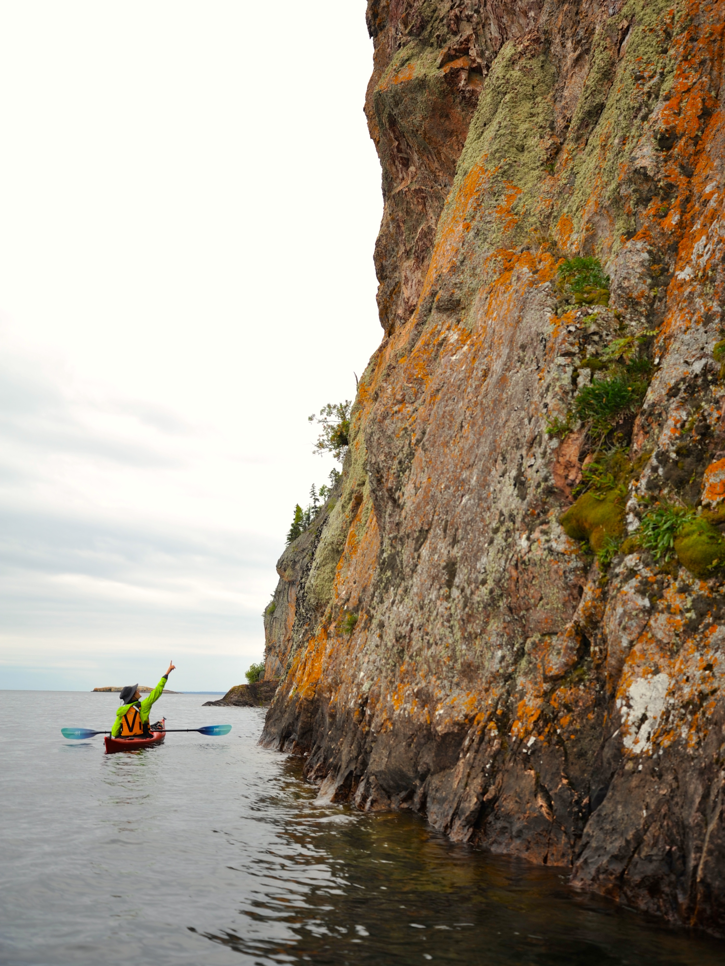
Long before what is now Lake Superior Provincial Park welcomed campers in canoes and Subarus, the coastline here echoed with the paddle salutes and songs of the voyageurs. The spacious sand beach at Warp Bay, cradled by the rocky arms and scattered islands of the Gargantua headland, was a favoured layover for these colourful characters of the fur trade.
Camping here today, it’s easy to imagine a dozen or so voyageurs springing ashore in their scarlet sashes and woollen toques, weary from 12- to 14 hours of brisk paddling on the fickle waters of Lake Superior. They would have been grateful for the shallow sandy shoreline as they hauled their 36-foot canot de maître and its two to three tonnes of cargo onto the beach, and settled in for a brief night of rest under their enormous canoe.
The voyageurs named this area after a well-loved, fictional 16th-century character, King Gargantua. But the name also hints at a more complex history. The French canoemen likely took inspiration from the Ojibwe manitou, Nanaboozho, who figures prominently in both Ojibwe storytelling and the Garagantua area. It’s said Nanboozho’s giant stride could take him from the twisted volcanic rocks of his seat at Devil’s Chair, to the dramatic cliffs of Devil’s Warehouse Island in a single step. These sinister-sounding names—given by French missionaries—expose early colonial views of Indigenous beliefs. Yet for the voyageurs, whose lives depended on a deep respect for these waters, accepting local wisdom seemed more prudent. Halting for a moment, the big canoes would follow Ojibwe custom and leave a tobacco offering in the fathomless water beneath the cliffs.
Backcountry campsites at Warp Bay and Gargantua Harbour make an ideal basecamp for exploring this storied coastline.
- Learn more about the natural and cultural history of Gargantua on a guided kayak trip. Naturally Superior Adventures’ all-inclusive Spirit of Superior Weekly Escape includes six days of wilderness camping and paddling.
- Based in nearby Wawa, Naturally Superior Adventures also offers shuttles, canoe and kayak rentals, lessons and lakeside accommodation.
- Reserve a campsite at Gargantua or Warp Bay in Lake Superior Provincial Park.
Missinaibi & Moose Rivers
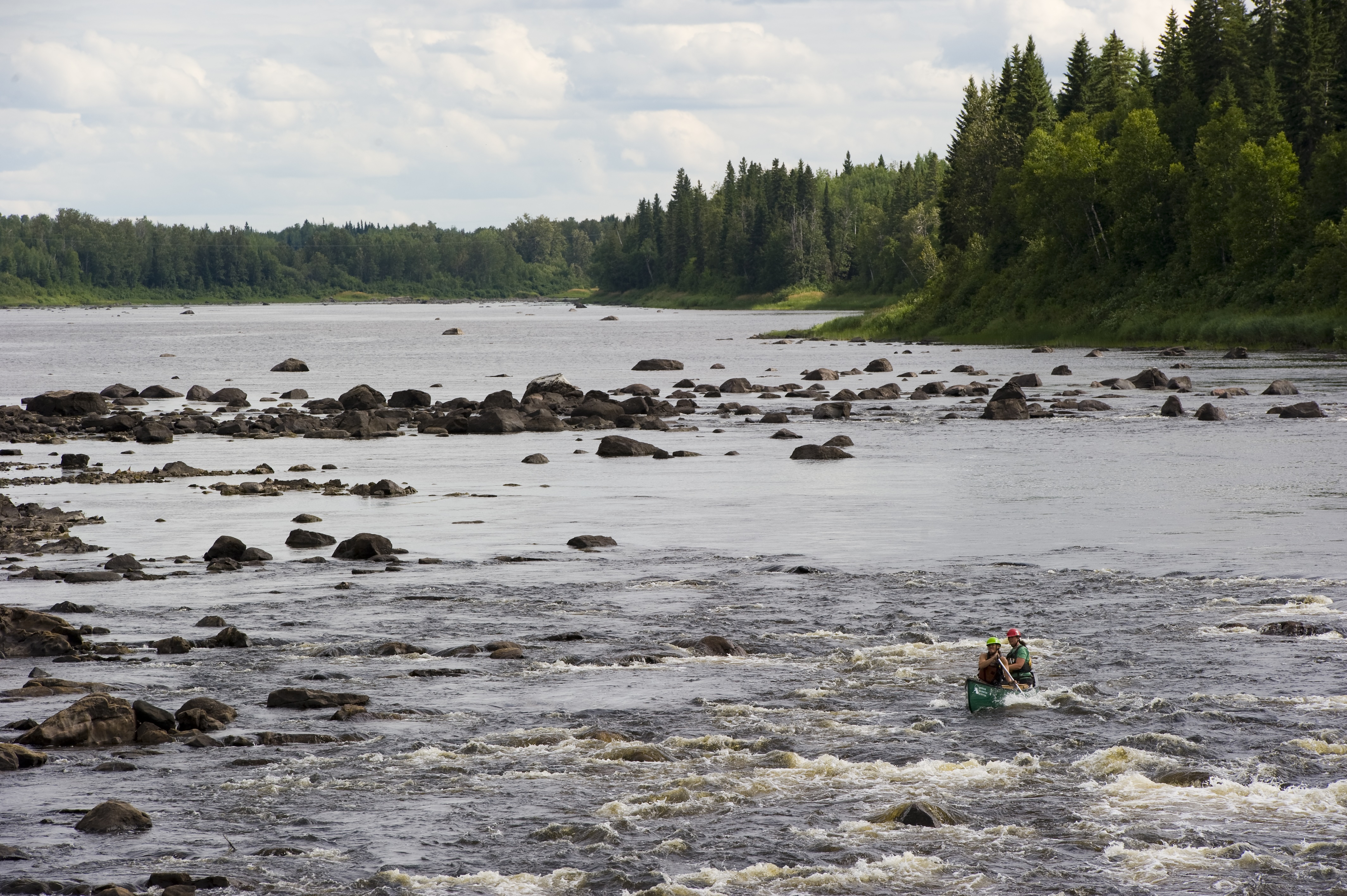
A canoe trip down the free-flowing waters of the mighty Missinaibi and Moose rivers is a journey through the natural and cultural history of Canada. Spilling north from the height-of-land at Missinaibi Lake, the Missinaibi River plunges dramatically over the edge of the Canadian Shield at Thunderhouse Falls. Below this spectacular gorge, the river slows and widens into the James Bay Lowlands, converging with the Moose River less than 100 km from saltwater.
More than 500 km in length, the Missinaibi/Moose rivers were a travel corridor for Ojibwe, Cree and Moose Cree people long before Europeans discovered the waterway provided a direct link to Hudson Bay for the fur trade. As the fur trade declined, the newly established railway brought settlers, trappers, prospectors and a thriving logging industry. Today, remnants of trading outposts and lumber camps mingle with ancient pictographs and Indigenous spiritual sites.
Railway, road or floatplane access allow paddlers to plan shorter trips, focusing on the changing landscapes and character of the river. You’ll need 10 to 14 days to complete each of the Missinaibi’s two distinct sections—the upper river is classic shield country with rocky campsites and pool-and-drop rapids; below Thunderhouse Falls, the river settles into the lowlands for its final, brisk push to tidewater.
- For those planning a trip on the lower river, finishing at the communities of Moose Factory and Moosonee means paddlers can return south by train aboard The Polar Bear Express.
- If you’re not prepared to undertake a remote river journey, consider a backcountry basecamp at Missinaibi Lake Provincial Park. This sprawling lake offers 20 quiet, canoe-in campsites around its perimeter, outstanding fishing and fantastic pictograph sites.
- Contact Missinaibi Outfitters for guided river trips, outfitting and shuttles.
- MHO Adventures offers a variety of all-inclusive guided Missinaibi canoe trips, including nine-, 19- and 26-day whitewater journeys and a four-day Moose River family flatwater adventure.
- Learn more about this Canadian Heritage River here.
Quetico
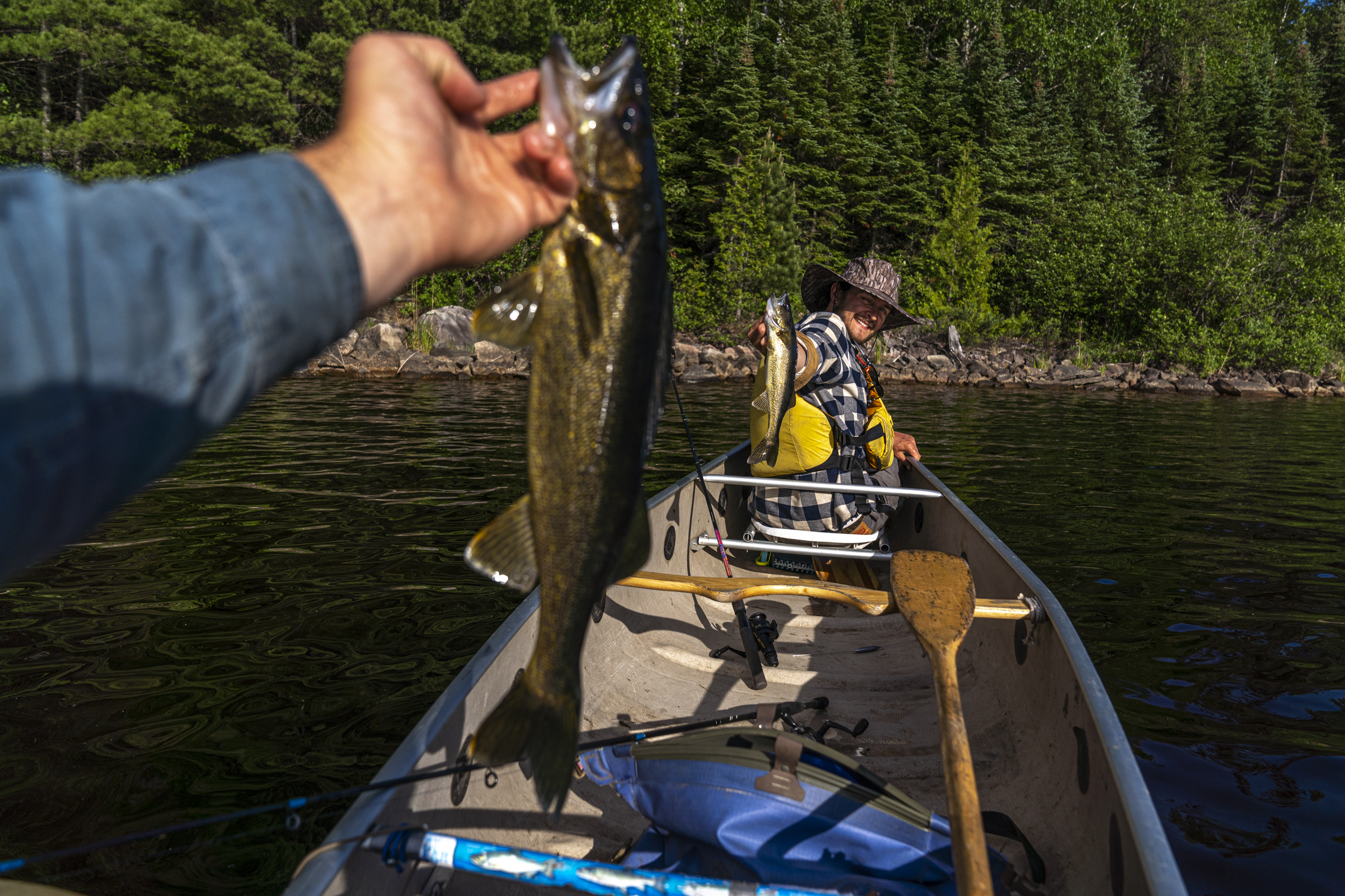
To explore Quetico Provincial Park by paddle and portage is to feel a timeless connection with an ancient land and its people. Whether you visit for a weekend or plan an extended wilderness journey, a rich heritage of Indigenous and fur trade travel adds cultural depth to the beautiful landscapes of this nearly half-a-million-hectare park.
For an introduction to some of the finest wilderness canoe tripping in all of Ontario, begin your adventure at the park’s Beaverhouse Lake access point and take the short portage into the west end of Quetico Lake. The arms of Quetico Lake reach across the northwest corner of the park, drawing paddlers deep into a world of primeval forest, sandy beaches and dramatic rock faces adorned with centuries-old pictographs. The lake’s size can make for humbling winds, but the island-studded bays and rocky point campsites so perfectly encapsulate the beauty of Quetico Park, you’ll need a layover day just to take it all in.
Quetico Lake anchors a number of fine three- to five-day loop trips, or use a shuttle service for a one-way journey across the secluded northern edge of the park.
- Voyageur Island Lodge on Nym Lake offers comfortable accommodations where guests can enjoy a lakeside sauna, paddle a replica 36-foot voyageur canoe and feast on amazing food. Stay here before or after your canoe trip, and let them help with all your planning and outfitting needs.
- Seine River Lodge is a family jewel of the Quetico region. Tucked at the park's northwest corner, the Branch family can offer you everything from partial gear outfitting to full meal plans, shuttles and accommodations.
- Quetico Park first-come, first-served camping reservations are available online or by phone up to five months in advance of your arrival date.
- Discover more Quetico canoe routes and outfitters in The Ultimate Guide to Quetico’s Best Canoe Trips.
Recommended Articles

Ontario’s Blue-Water Lakes
Algonquin Park Canoe Trip Guide
Kayak Lake Superior
Killarney Canoe Trips
8 Secret Paddling Hotspots In Ontario

Easy River Tripping
No Roughing It Here
Hidden Gems: Best New Canoe Routes
Find Wilderness South of Algonquin
Best Canoe Maps in Ontario
The Massasauga Provincial Park Guide
Missinaibi River Canoe Trip
Temagami Canoe Trip Routes
Philip Edward Island Camping Guide
The Spanish River
Quetico’s Best Canoe Routes
Mattawa River Canoe Trip Guide
more savage than the nahanni
It's Time for a Paddle
