Plan Your Perfect Point Grondine Canoe Trip
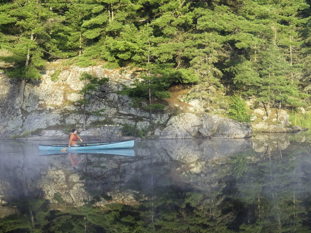
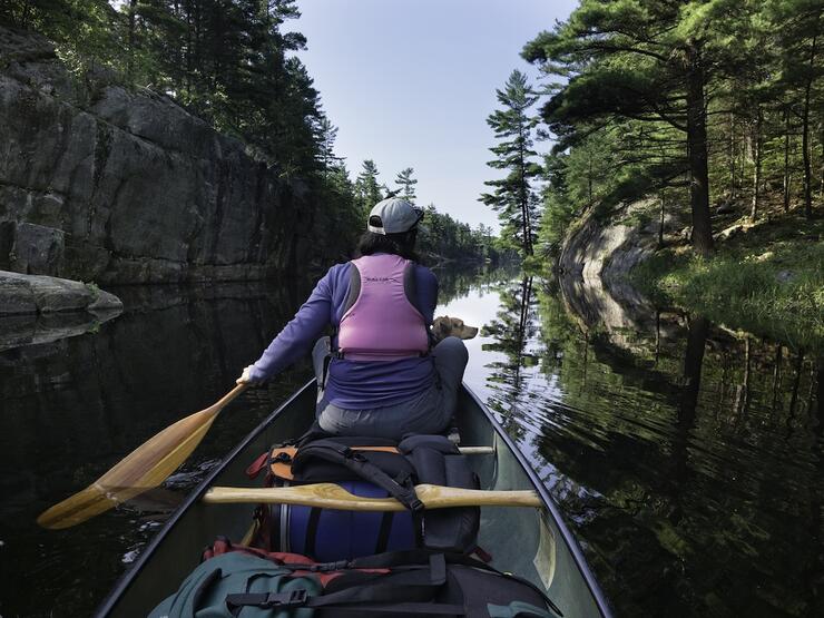
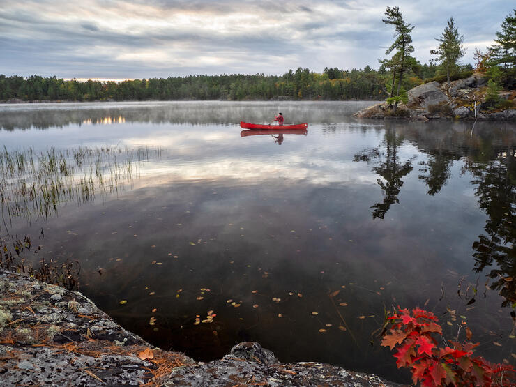
Point Grondine is an Indigenous Protected Area nestled between Killarney and French River provincial parks on the Georgian Bay coast. This 7,300-hectare expanse includes rocky shorelines, inland lakes and waterways, and old-growth forests, as well as 26 backcountry campsites. Point Grondine Park is managed by Wiikwemkoong Unceded Territory, the traditional stewards of this amazing landscape, and open to paddlers and hikers looking for an immersive wilderness experience in an ancient land.
The Point Grondine trailhead is located on Highway 637, 38 kilometres from the Highway 69 turnoff. You’ll find a parking area here, with portage access to Mahzenazing Lake and about 20 kilometres of interior canoe routes with several portages. A portage connection to Collins Inlet on Georgian Bay allows for longer trips, with connections to the village of Killarney, the mouth of the French River and beyond along the 48.5-km Coastal Water Trail, for more experienced paddlers.
Point Grondine Park makes a unique access to the scenic 75-km circumnavigation of Phillip Edward Island, offering expert canoeists with a combination of sheltered inland waters, the historic Collins Inlet, and the polished granite islands of the outer Georgian Bay coast.
Point Grondine also offers Indigenous guided canoe day trips and hikes, as well as programs delivered in conjunction with Killarney Provincial Park. New opportunities for outdoor adventures at Point Grondine are being developed every year and the area is emerging as a great option for backcountry enthusiasts looking for an authentic Indigenous cultural experience in a hidden pocket of wilderness in Ontario’s near north.
Making Reservations
Point Grondine provides online reservations for day and overnight visitors, including campsite permits and season day use passes. The park is open from mid-May through the end of October, depending on the weather. Permits can also be purchased on a first-come, first-served basis from the Point Grondine Trading Post, located on Highway 637 about 35 km from the Highway 69 turnoff. Call the park’s reservation hotline at 1-844-945-8687 for more information.
Point Grondine Canoe Routes
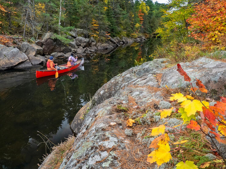
Point Grondine is located at the transition between the smaller interior lakes of northeastern Ontario’s La Cloche hills and the open water of Georgian Bay. As a result, it offers a dynamic canoeing experience for day-, overnight and multi-day trips. The Kaa-Gaa-Genhs water trail is a 20-km circuit in Point Grondine’s interior, starting and ending at the Highway 637 trailhead with a portage to reach Mahzenazing Lake.
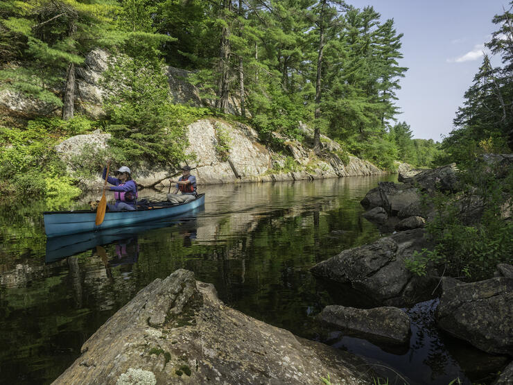
Point Grondine’s quiet inland lakes make it a magical destination for anglers and nature enthusiasts; you can day-paddle and cast for pike and bass on Mahzenazing Lake, or challenge yourself with six additional portages (on maintained trails ranging in length from 45 metres to 1,200 metres) to access solitude for overnight camping. Designated canoe campsites can be reserved along the way. Highlights include waterfalls and the opportunity to stretch your legs and explore more of Point Grondine on the park’s backcountry hiking trails, which intersect the canoe route in several locations.
Experienced paddlers can extend the Kaa-Gaa-Genhs route by following a traditional link to Collins Inlet, a sheltered arm of Georgian Bay. It’s easy to see why this narrow passage has always served as a watery highway for paddlers. From here it’s possible to make a 75-km circumnavigation of Phillip Edward Island or trace the shoreline east or west to the mouth of the French River or the village of Killarney.
Both of these options will expose you to open water conditions on Georgian Bay. Point Grondine Park maintains three backcountry paddling campsites on Georgian Bay, with other undeveloped sites available for low-impact camping. An online interactive park map reveals all of Point Grondine’s possibilities for paddling.
Only experienced paddlers should venture out on Georgian Bay beyond Collins Inlet. The coastline is rugged and subject to high winds, and landing a canoe can be difficult, especially in rough water. Great Lakes weather is unpredictable and the water is cold. Stick to inland trips unless you’re experienced in big water conditions. If you choose to paddle on Georgian Bay use a high-volume canoe, ideally with a spray cover for additional seaworthiness.
Point Grondine Campsites
Point Grondine campsites for paddlers are divided into several categories: Standard canoe-access campsites accommodate up to six people ($18 per person, per night); canoe-access group campsites are available for larger groups of up to 16 people ($60 per group, per night); and premium canoe campsites feature picnic tables and more space for up to six people ($18 per person, per night). Additionally, a group site is located at the end of the portage to Mahzenazing Lake, featuring two large wooden tent platforms and a comfort station ($60 per group, per night). Check availability and book your campsite online.
Campsites include fire pits and pit privy toilets to use responsibly. Point Grondine has a zero-tolerance policy on cans and bottles for day use and overnight visitors. Campers are advised to take the time to secure their food away from wildlife in a proper bear hang for overnight storage, and to adhere to the principles of Leave No Trace. Dogs must be kept on-leash in Point Grondine Park.
Canoe Rentals
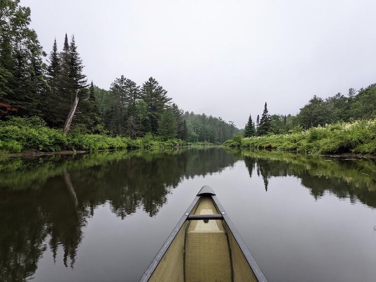
Point Grondine canoe rentals are available for day use and overnight trips. Call 705-859-2900 on weekdays and 705-790-5431 on weekends to inquire. The rental fee is $44 per day for one to four days and $41 per day for five or more days. Local canoe rentals are also available from Killarney Kanoes and Killarney Outfitters.
Point Grondine Maps
Point Grondine’s online interactive park map is a great resource for planning your trip. The park also produces a printed map ($12) with everything you need for a backcountry adventure. Order your park map online.
More to Explore
Hiking is the other big attraction in Point Grondine Park. The park features two day hikes ranging from 3 km to 6.9 km, as well as a 22-km backpacking loop for overnight trips. All three trails start at Point Grondine’s Highway 637 trailhead and portions of each intersect the park’s backcountry canoe routes, making it possible to break up your paddling adventure with some hiking.
The best way to discover Point Grondine Park is with an Indigenous guide. Wikwemikong Tourism offers authentic Indigenous experiences on traditional lands, ranging from short interpretive hikes, guided paddling tours and custom programs for larger groups. Call 705-859-3477 or make an inquiry through the Point Grondine website to learn more and book a custom package.
Recommended Articles

Temagami Canoe Trip Guide
Ontario’s Blue-Water Lakes
Algonquin Park Canoe Trip Guide
Best Sites on the French River
The Massasauga Provincial Park Guide
Missinaibi River Canoe Trip
Best Canoe Maps in Ontario
Ontario’s Moose Hotspots
The Spanish River
Hidden Gems: Best New Canoe Routes
Paddling with ghosts
Find Wilderness South of Algonquin
It's Time for a Paddle

Easy River Tripping
Best River Canoe Trips
Temagami Canoe Trip Routes
Paddling Laws
Kayaking in Northern Ontario
Woodland Caribou Canoe Trip
