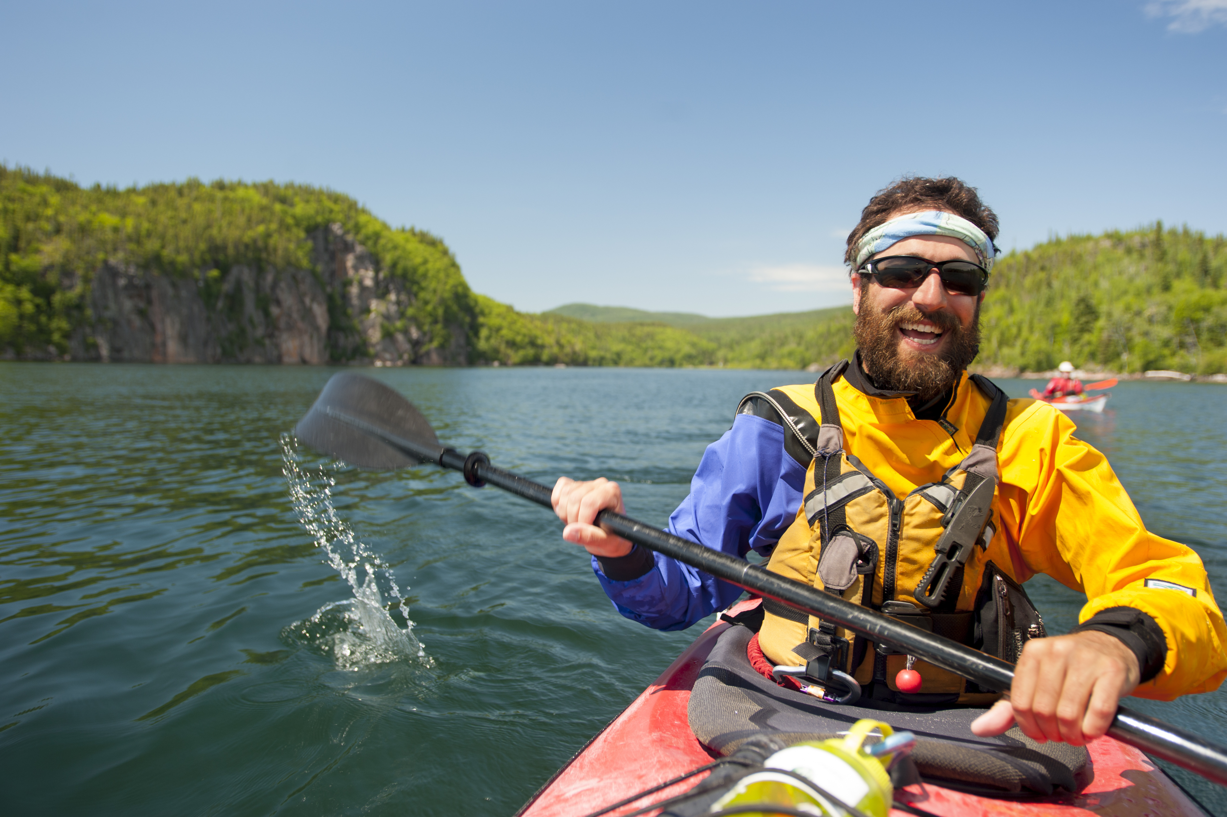
Kayaking Lake Superior’s Spectacular Water Trail
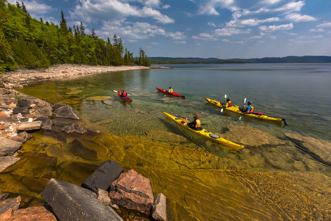
Looking for the paddle of a lifetime few have experienced? The Lake Superior Water Trail is the Appalachian Trail of water trails and deserves a spot on every paddler’s bucket list.
Spanning two countries, one province, three states, and the traditional lands of many Indigenous communities, the Lake Superior Water Trail’s shore length is an awe-inspiring 2,783 km—not far off the Appalachian Trail’s expanse of 3,500 km.
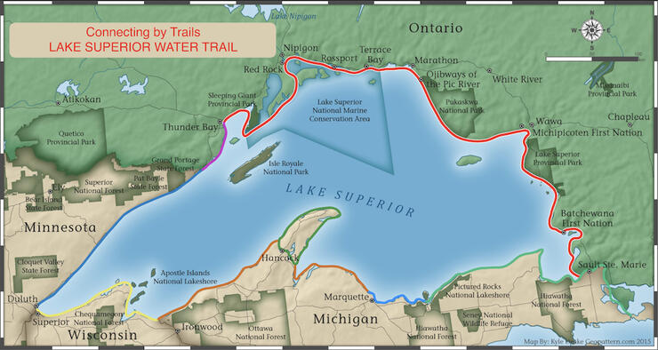
The most scenic and wild section of the Lake Superior Water Trail (LSWT) is the North Shore segment, running between Sault Ste. Marie to Thunder Bay in Ontario. Whether you choose to experience all 1,000 km or just a portion of this segment, it promises to be an epic adventure.
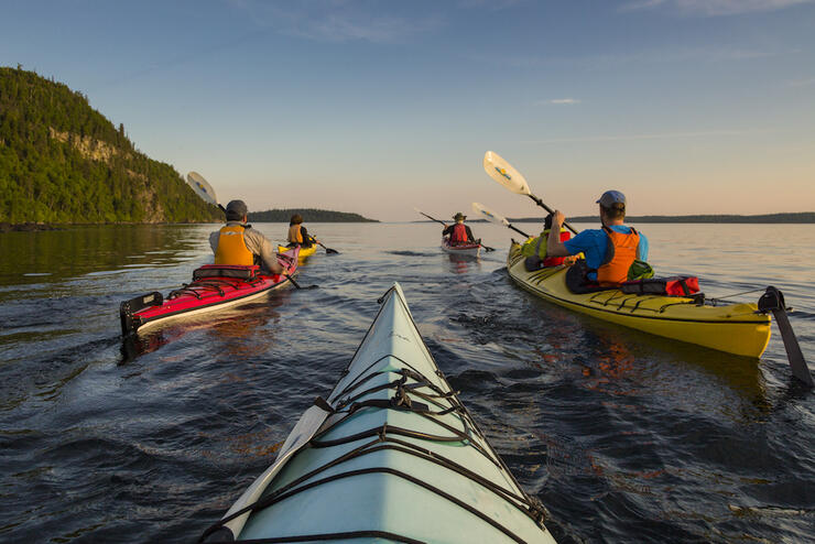
Paddlers on the north shore of the biggest body of freshwater in the world will face cold water and sometimes unpredictable conditions, so it’s best to go with a guide and brush up on your paddling skills.
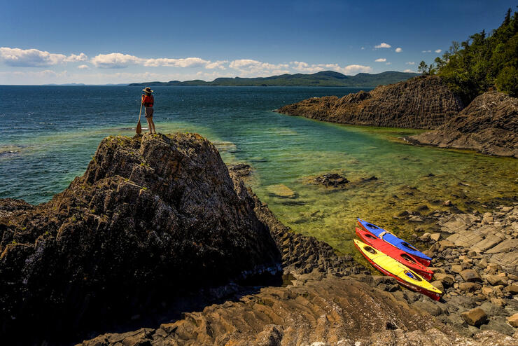
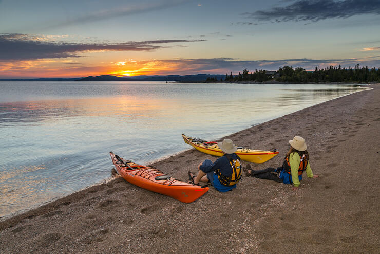
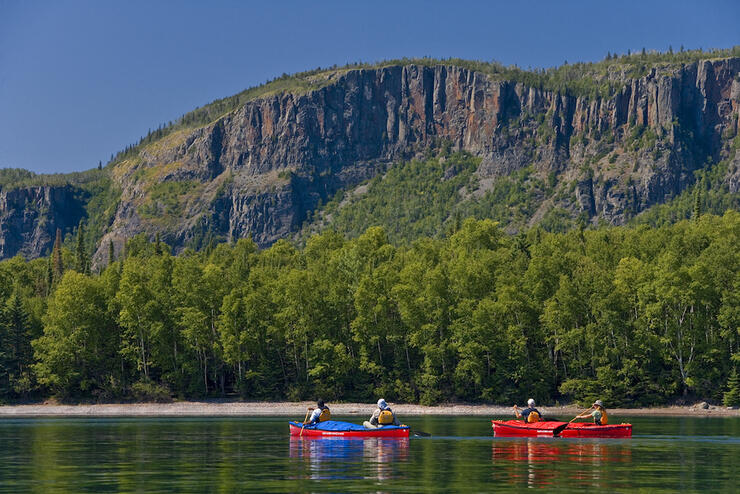
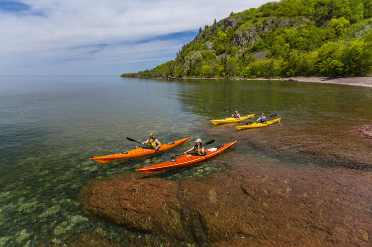
The reward is landscapes so breathtaking the renowned Group of Seven artists immortalized them in hundreds of their paintings. Paddlers will see craggy, windswept pines atop smooth glacial rocks, pristine secluded fine sand and skipping-stone beaches, hidden grottos, true Canadian wilderness, and the everchanging blue waters of Lake Superior. Look closely and you might spot moose, bald eagles, hawks, great blue herons, deer, foxes and falcons, and even caribou, wolves and bears.
Top Highlights of Kayaking Lake Superior
- The Agawa Rock Pictographs in Lake Superior Provincial Park are a reminder that this water trail traverses the Anishinaabe people's traditional land. There are 35 red ochre images still visible at Agawa Rock, some of which can only be seen from the water.
- Pukaskwa National Park features the longest stretch of undeveloped wilderness coastline remaining on the Great Lakes. Its stunning scenery and sheer isolation rank Pukaskwa amongst the best sea kayaking in Canada; however, this trip should be tackled only by experienced paddlers. Naturally Superior offers multi-day guided sea kayak trips in this area. Parks Canada’s Backcountry Paddling Route Planner contains a wealth of knowledge and maps for exploring this area and is accessible here.
- Just offshore at Terrace Bay sit the Slate Islands, an archipelago of more than 20 islands where you might spy the endangered woodland caribou. Or you can visit the world's largest known shatter cone, created by a meteorite impact. If you like geology, don't miss the fossils (stromatolites) as you continue North at Schreiber Beach or agates on the beach at the Number Ten Lighthouse, further north again.
- Thunder Bay’s Lorne Allard Fisherman's Park is either the last or first stop on this water trail section. Paddlers should make time to explore the magnificent Sleeping Giant Provincial Park and pay a visit to the Fort William Historical Park to stretch your legs. Don’t miss fine dining to stretch your stomach at Bistro One, The Silver Birch or Caribou Restaurant.
Lake Superior Kayak Rentals and Guided Trips
Join a guided sea kayak or voyageur canoe trip with Naturally Superior Adventures near Wawa, Ontario. They also offer rental canoes and kayaks. Superior Outfitters offers rentals from the village of Rossport. In the Thunder Bay area, Wilderness Supply will get you set with all the gear and rental options you need. Canoes for Conservation and Horizon Adventures also offer guided experiences along the North Shore. Find more local rentals here.
Lake Superior Water Trail Kayak Lockers
Boat lockers are located at select access points along the trail. This innovation by the Lake Superior Watershed Conservancy allows paddlers to head into town to buy provisions or for accommodations and not worry about the watercraft, paddles and gear left behind. Kayak lockers are available at five locations along the trail, including Gros Cap Marina Park, Terrace Bay Waterfront, Nipigon Boat Launch, Red Rock Boat Launch, and Lorne Allard Fisherman's Park in Thunder Bay. The lockers require you to bring along your own two padlocks for the doors on either end.
Lake Superior Map and Launch Points for Kayakers
Sixteen access points along the North Shore offer an endless number of out-and-back day trips or point-to-point explorations.
The best source of access point information is on the Lake Superior Watershed Conservancy website since they worked with the communities, lighthouses, Ontario Parks, Parks Canada, and First Nation community to make the trail a reality, finishing this section of The Great Trail. Check out The Great Trail’s interactive map; by navigating to Lake Superior, you can link to various areas of the trail.
Kiosks at each access point display safety information, photos and maps. They also provide info to connect the Lake Superior Water Trail to local hiking trails, parks, B&Bs, food services, local cultural attractions, and other services in nearby communities and businesses.
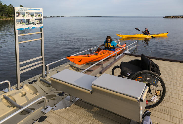
The water trail infrastructure has also opened the door to another community of paddlers by following Ontario's accessibility guidelines. Full universal access from the parking lot to the lake is available at four of the 16 sites (Gros Cap Marina Park, Terrace Bay Beach, Nipigon Boat Launch, and the Red Rock Boat Launch). There are day trip and point-to-point explorations possible with universal access. The remaining main access point sites have varying degrees of accessibility, with full access expected within the next few years.
Safety Considerations for Kayaking on Lake Superior
Kayaking on Lake Superior is recommended for experienced paddlers unless you are traveling with a local outfitter. This is no regular, calm, inland lake. Superior requires that you be prepared with the right gear, boats and skills. Some tips are available here for general water trail safety. Although the water near the shore may be warmer, the lake's average temperature hovers at only 4°C year-round. Be especially cautious of strong current near river mouths and paddling around exposed points. Fog is common and can last for days. Be prepared to navigate using a compass.
When is Best to Kayak Lake Superior?
Late May to early October is your window for paddling on Superior. Each month has its pros and cons related to weather, bugs, foliage and temperature. You can expect to spend roughly one day in every five windbound during July and July, and up to three of every five days windbound in August and September. Consult one of the outfitters listed above to help you plan your trip—or let them do the planning for you when you go on a guided adventure.
Spectacular Lake Superior Hikes for Kayakers
Several of the Lake Superior Water Trail access points connect to The Great Trail's designated hiking trails, such as the Voyageur Trail, Casque Isles Trail, Nipigon River Recreation Trail and the coastal trails in Lake Superior Provincial Park and Pukaskwa National Park.
Where Can I Camp on Lake Superior?
Camping is available in the various provincial parks, Pukaskwa National Park, and at the following kayak locker locations: Gros Cap Marina Park, Terrace Bay Waterfront, Nipigon Boat Launch, and Red Rock Boat Launch. Learn more about camping along the Lake Superior Water Trail here.
Kayak Around Lake Superior
Is 1,000km not enough? Then go full-monty and circumnavigate the entire lake. More information about circling Lake Superior is available from the Wisconsin Water Trail, The Minnesota Water Trail and the Michigan Water Trail network. On the Michigan Lake Superior water trails website, the Upper Peninsula identifies three official water trails on the Michigan section of Lake Superior shoreline. The Keweenaw Water Trail, The Hiawatha Water Trail and the Superior East Water Trail. In Michigan, don’t miss the stunning, wildly colourful Pictured Rocks National Lakeshore.
Plan Your Trip Now
Looking for the paddle of a lifetime few have experienced? The Lake Superior Water Trail deserves a spot on your bucket list.
Recommended Articles
Temagami Canoe Trip Routes

Easy River Tripping
Ontario’s Blue-Water Lakes
Algonquin Park Canoe Trip Guide
Best Sites on the French River
Quetico’s Best Canoe Routes
Go With the Flow
No Roughing It Here
Mattawa River Canoe Trip Guide
Killarney Canoe Trips
Paddling the Pukaskwa National Park Coast
Hidden Gems: Best New Canoe Routes
Find Wilderness South of Algonquin

Songs About Canoeing
Paddling in Lady Evelyn Smoothwater
Discover Paddling Escapes In Timmins
Chips and Canoes
Philip Edward Island Camping Guide
Best Fly-in Canoe Trips
