
The Massasauga Provincial Park Guide
What to know to plan your paddling and backcountry camping trip.
By Conor Mihell


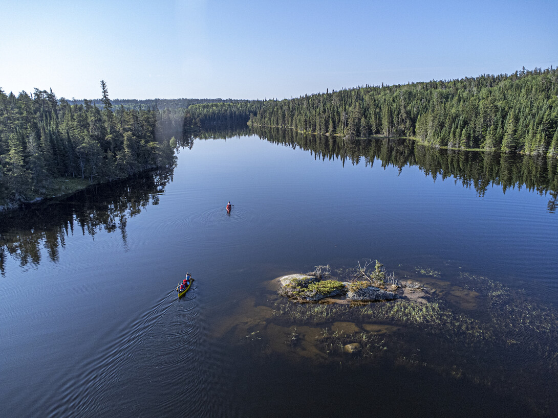

Ontario is renowned as a destination for paddlers, but the Path of the Paddle is its best kept secret. Spanning 1,000 kilometres across Northwestern Ontario, the trail is a labyrinth of lakes, rivers, creeks and portages encapsulating everything canoe country is famous for. Best of all, it’s almost entirely on Crown Land.
The route comprises six sections known as the Animikii, Omimi, Quetico, Maukinak, Migizi and Iinoo Oowan trails. Each one is accessible from different regions of Northwestern Ontario near the towns of Thunder Bay, Atikokan, Dryden, Vermillion Bay and Kenora, giving paddlers the opportunity to plan a trip for one day, one weekend, one week or one epic adventure across the trail’s entirety.
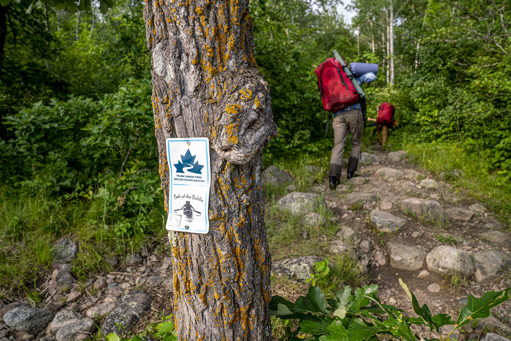
The route is a water segment of the Trans Canada Trail, meaning that along the way travellers will find marked portages with official TCT and Path of the Paddle signage, as well a connection to the larger network of trails spanning Canada from coast to coast to coast.
Path of the Paddle was founded in 2013 as a water segment of the Trans Canada Trail and was originally mapped by Hap Wilson. The route, named so in honour of legendary canoeist Bill Mason, has since varied slightly from the original trail but still travels essentially the same corridor across Northwestern Ontario.
In 2020 and 2021, Path of the Paddle was awarded an Ontario Trillium Foundation grant to implement major trail updates by employing portage crews to maintain the entire route. In normal years, the trail is maintained by volunteer regional trail committees who seek to keep the trail alive and open for the thousands of paddlers who visit different sections of Path of the Paddle each season.
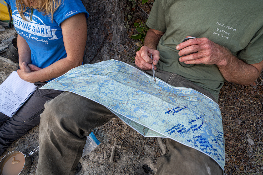
In 2020, Path of the Paddle launched an official route planning map denoting access points, portage lengths and locations, and trail sections, making it that much easier for paddlers to plan their trips. Following this launch, the association employed a cartographer to create detailed maps of the entire route so paddlers could feel confident in their travels by getting into the minute details of what the route overview map laid out.
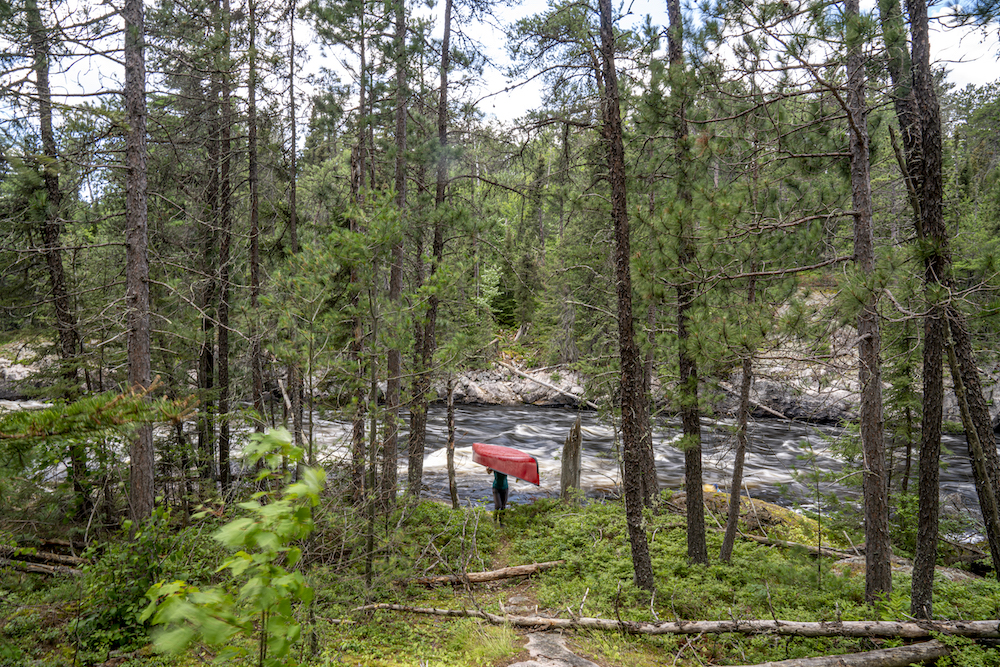
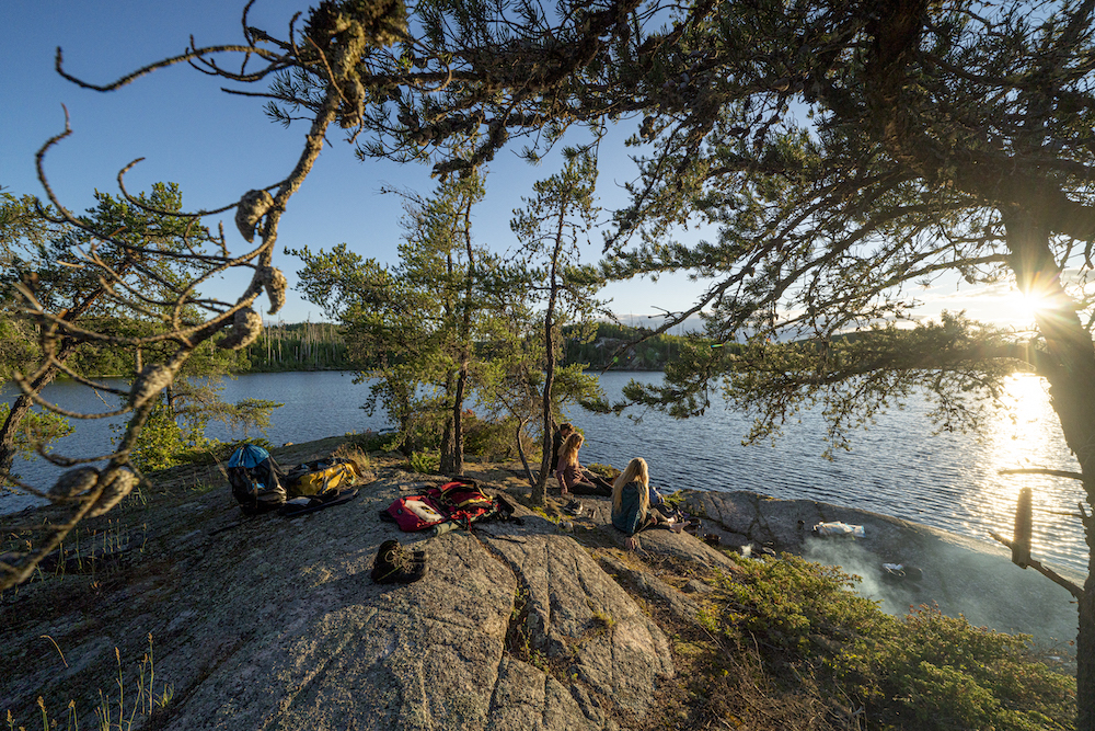
In 2022, I travelled with a team of three other paddlers along the entire route in 30 days, amassing a wealth of knowledge on one of the province’s best paddling routes in the heart of Northwestern Ontario’s famed waterways. Across the 1,000-kilometre route, we found incredible opportunities for paddling trips suiting every visitor’s desire on a route maintained by volunteers and founded on the basis of preserving the ancient water trails travelled for thousands of years by First Nations of the area. While the portages were once trails to a subsistence lifestyle of hunting, fishing and harvesting, paddlers today will find recreation and connection to the land and its people.
Along with my partner, Leah, and our friends Bruce and Branwen, we set out to challenge ourselves on a long-distance paddle with copious amounts of portaging to test the accuracy of the new maps created by Path of the Paddle, as well to enjoy the remarkable efforts of the big maintenance undertaking that took place along the entire route in 2020/21.
We spent many days between sunup and sundown travelling at a feverish pace to make our daily kilometres. While I wouldn’t recommend travelling the entire route in just one month, I would highly recommend canoe tripping whatever portion of the route you have time for—this countryside is the place I truly fell in love with canoe tripping. Mirrored lakes with high bedrock shores reflecting pines, a deep connection to those who once walked these same trails, and a sense of vastness connected by a maintained route is what paddlers love to dream, or act, upon.
What you’ll find in the following articles is the knowledge we gleaned from the trip, places we wish we could have stayed, chains of lakes we were amazed by, and the information you need to make the most of your paddling holiday without the guesswork of wondering what a particular area has to offer.
The route has all the exposure to wilderness that floatplane and train trips farther north offer, while still allowing for the beauty of historic lodges, the meals of a wonderful restaurant, and the creature comforts offered by outfitters waiting to help. Where the roads end, that’s where Path of the Paddle begins.
The route makes available the ease of planning short or long forays into the backcountry with the confidence of knowing there will be a portage, a route, and all the information individuals or families alike need to access wild spaces.
Planning a major, or minor, paddling trip is the most exciting and nerve-racking part of every journey. What area to explore, which maps to use, what the portages are like and, hardest of all, what route to do, are factors that feel daunting to even experienced paddlers.
We’ve created four in-depth articles to help you plan your wild summer adventures in Northwestern Ontario full of route suggestions, outfitter options, accommodation ideas, inspiring photos, and best of all, free maps provided by Path of the Paddle to get you on the trail.
Region: Thunder Bay
Distance: 100 km
Beginning at Fort William Historical Park, the trail follows Lake Superior as part of the Animikii Trail—Ojibway for thunder bird—passing under towering cliffs and past inspiring campsites set on the crystal clear waters of the world’s largest freshwater lake.
Read: The Ultimate Guide to Paddling the Animikii Trail
Region: Thunder Bay
Distance: 125 km
After climbing onto the plateau, the route weaves through big lakes and small, steep rivers along the United States and Canada border as it mazes into the high lake country of the Omimi Trail—Ojibway for pigeon—before it enters the storied Quetico country that is famous for canoeing.
Read: The Ultimate Guide to Paddling the Omimi Trail
Region: Atikokan
Distance: 125 km
Through the wonder of the falls chain and down the length of Kawnipi Lake, the trail continues north through some of the cleanest water and wildest fishing Ontario has to offer along the Quetico Trail.
Read: The Ultimate Guide to Paddling the Quetico Trail
Region: Atikokan / Dryden / Vermillion Bay
Distance: 300 km
Considered the most rugged and beautiful stretch of the route, the Maukinak Trail is a long section of Path of the Paddle with many access points, a variety of trip lengths and easy access to outfitters. The word Maukinak is Ojibway for turtle, and this long, portage-laden section will have you moving slow and steady like its namesake.
Read: The Ultimate Guide to Paddling the Maukinak Trail
Region: Vermillion Bay / Kenora
Distance: 125 km
The Migizi Trail, Ojibway for bald eagle, travels through the wonderful hills in the high country east of Kenora. This section begins on the northern tip of the sprawling Eagle Lake at Vermillion Bay and heads west through some of the most lovely paddling lakes you’ve likely never heard of where it reaches Lake of the Woods and arrives in Kenora.
Read: The Ultimate Guide to Paddling the Migizi Trail
Region: Kenora / Minaki
Distance: 130 km
Just below the Keewatin Dam, begins the Iinoo Oowan Trail—an Ojibway phrase meaning canoe route—and heads down the Winnipeg River’s lovely bedrock shores to Minaki, Ontario. It then leaves the province and finds its end a short distance into Whiteshell Provincial Park, Manitoba.