
Fat Biking Hot Spots in Ontario
Find out the best places to pedal this winter.
By Melanie Chambers


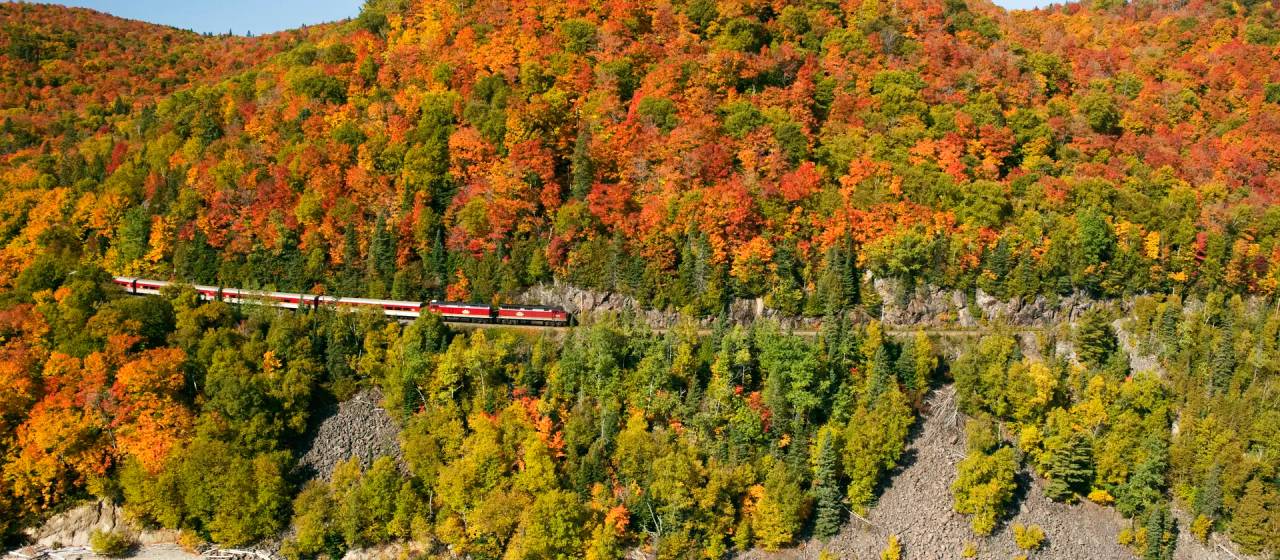
Ontario is home to vast and diverse swathes of natural landscapes for outdoor enthusiasts to revel in, yet few places capture the imagination of adventurers like Northwestern Ontario. With its rugged beauty, unique geological formations and sheer remoteness, this region offers a bikepacking experience unlike any other that conveniently departs from the city of Thunder Bay.
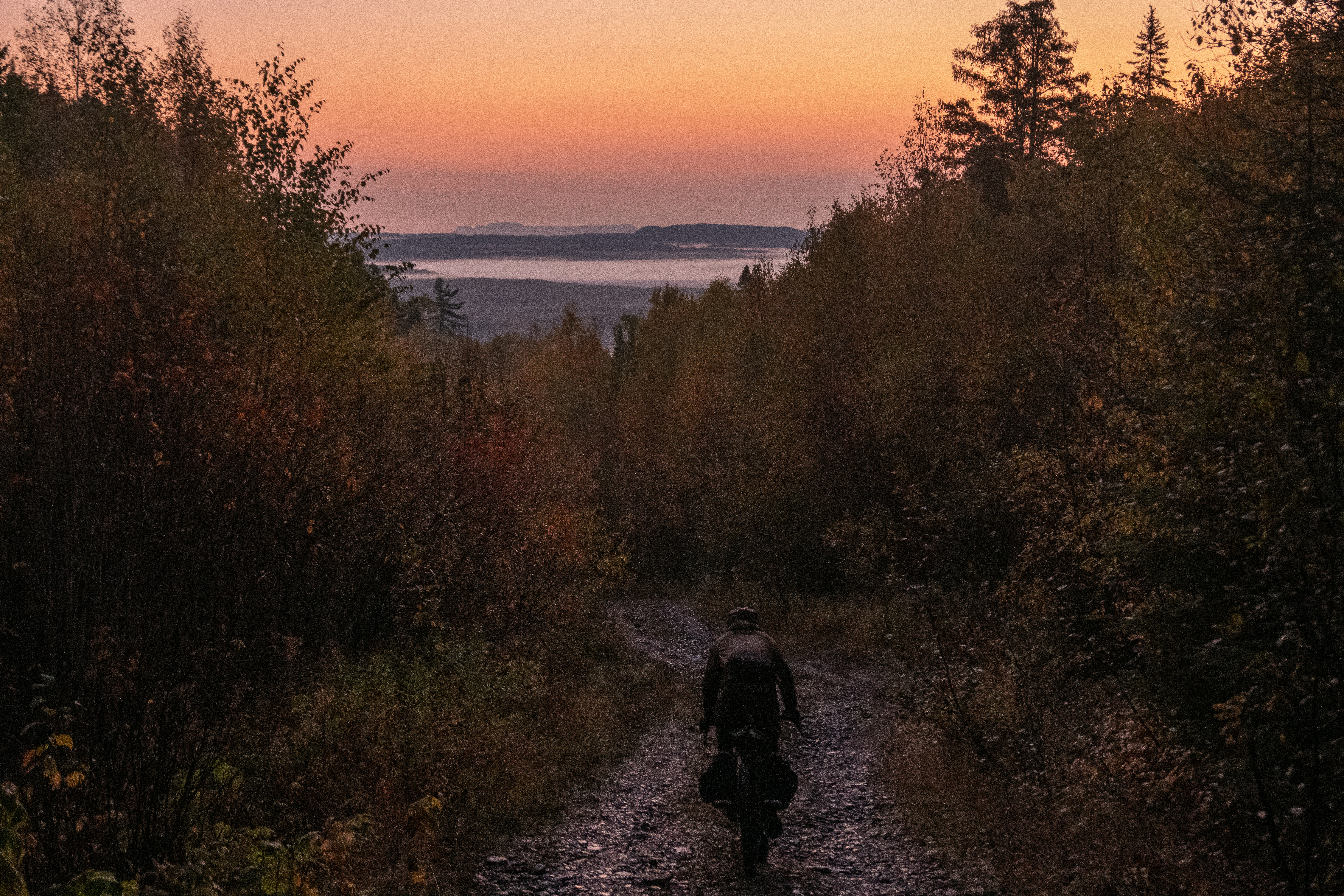
The Northwestern Ontario Rambler, an 800-kilometer route meticulously designed over four years, winds its way over quiet gravel roads, bumps along forgotten trails, and disused rail beds, offering a trip that will challenge you physically yet leave you feeling fulfilled with every Northern Ontario sunset you gaze upon during your tour. You can ride the whole thing or pedal sections of the figure eight-shaped route.
What led me to dream up and map out the Northwestern Ontario Rambler? I developed this route while I was living in Thunder Bay, doing my undergrad at Lakehead University in outdoor recreation, parks, and tourism. I like to think that it was a healthy mix of wanting to see what was out there, beyond the scenery of the many day rides I’d made in the area, along with a good dose of procrastinating writing papers and shirking my academic responsibilities.
So, with that in mind, I gathered up my maps, physical and digital, and began to plot. Before I knew it, I had more than a few red lines traced on maps. They haunted my dreams, so I called up my good friend and trustworthy adventure partner Theo and we began a series of scouting trips that culminated in our autumn trip to ride the Rambler route in its entirety.
Distance and Elevation Gain: About 800 km with 8,300 m of climbing
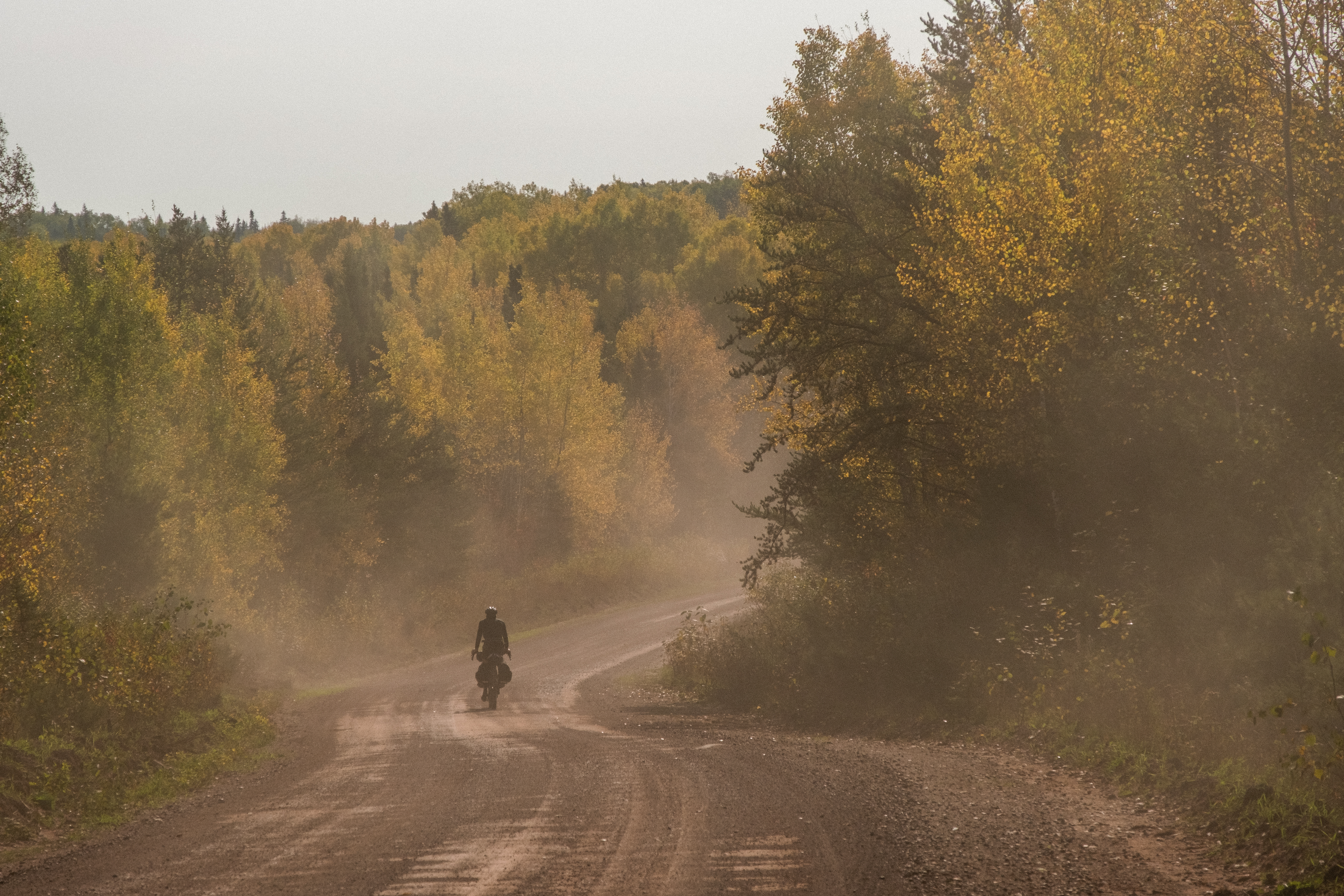
Terrain: A mix of gravel roads, overgrown bush tracks, disused rail beds, steep forestry haul roads, and just a sprinkling of singletrack
Best Time to Ride: Late summer to early autumn, when the weather is most stable and the bugs have calmed down
Challenges: Steep, loose climbs, unpredictable weather, and the need to be self-sufficient in remote areas

Day 1: Thunder Bay to Hurkett Cove
90 km/1,075 m elevation gain
Starting from the iron bridge across the Current River in Trowbridge Park, depart Thunder Bay rolling across asphalt and smooth gravel and heading north up Highway 527. When you turn onto Moran Road the climbing intensifies, with 15 percent grades and loose terrain challenging every pedal stroke. Reward comes in the form of thrilling descents, including a memorable one from the Greenwich Wind Farm. A short jaunt along Highway 17 takes you to an ATV track linking to a disused rail bed, arriving at Hurkett Cove. A serene sunset over Lake Superior awaits and the adventurous might spend some time exploring derelict fishing vessels to end the day on a high note.
Day 2: Hurkett Cove to Outward Bound Homeplace
84 km/641 m elevation gain
You’ll rise to morning light dancing off the fishing hulls at Hurkett Cove as your journey continues up Black Sturgeon Road. If you had a chilly night, fear not, the warming sunshine will break over the treeline soon enough. Consider breaking for lunch by Eskwanonwatin Lake, just a short detour off the Black Sturgeon Road. The end of your day reveals a hidden gem in the form of Homeplace, an erstwhile Outward Bound base that’s been lovingly maintained by community members, so please tread lightly and respect this once-bustling outpost of adventure. Dinner by the lake is welcome respite after a day of rolling terrain.
Day 3: Outward Bound Homeplace to Albert Lake Mesa
85 km/870 m elevation gain
Begin the day with breakfast and a tranquil view of Black Sturgeon Lake. Venturing deeper into remote territory you enter the route’s most isolated section. A steady 20 km climb offers rewards of panoramic vistas and exhilarating descents through little known bush tracks. The day ends tracing gravel ribbons toward Mawn Road, with the rhythm of pedaling and the sound of gravel crunching under your tires defining the experience.
Day 4: Albert Lake Mesa to Cavern Lake
80 km/752 m elevation gain
You might see a theme emerging here — brew up a sunrise coffee by a lake to set the tone for a good day. Today’s route traces a line down the Black Mountain Road as it narrows from a wide forestry road into an overgrown primitive trail, leading into the unknown. Cross your fingers that mechanical issues don’t test problem-solving skills, as they did ours, but persistence shall prevail! Steep climbs and rugged tracks define the route to Cavern Lake, where the day ends with a sense of hard-earned accomplishment.
Day 5: Cavern Lake to Old Truck Road
111 km/1,463 m elevation gain
The day begins along a narrow bush track to the top of Ouimet Canyon, yielding breathtaking views. The descent from the canyon provides a thrilling ride, followed by a climb back into the Greenwich Wind Farm. Cross your fingers for dry weather, as rain turns these sandy haul roads into grueling slogs.
Day 6: Old Truck Road to The Bog
52 km/395 m elevation gain
Loose gravel and steep pitches will challenge you in the morning. Dog River offers a chance to stock up on water, a critical provision for a dry camp ahead. Highlights include photo stops at an old iron truss bridge and the eerie Flett Tunnel. The brave will continue to the bog crossing, where water reaches above the waist. Strategic gear shuttling keeps your essentials dry in this adventurous stretch. The map reveals that a wiser choice is to double back at the tunnel and rejoin the route at the crossroads.
Day 7: The Bog to Aldina Fire Tower
73 km/421 m elevation gain
Navigating the bog’s waterlogged terrain takes hours, with beaver dams adding to the challenge. Once you make it through, a network of weaving and flowing snowmobile trails delivers some of the best riding of the trip. A final push up to the base of the Aldina Fire Tower will test your endurance, but the reward — breathtaking views from Ontario’s fourth-highest peak — is unforgettable.
Day 8: Aldina Fire Tower to Cloud Lake Sugarbush
96 km/1,479 m elevation gain
After a few technical sections, flowing terrain leads you down toward the Pigeon River before turning north toward Cloud Lake. Be sure not to miss the turn off the main road leading to a punchy climb up to the Cloud Lake Sugarbush, concluding your evening sitting atop cliffs overlooking Northern Ontario countryside, a perfect setting for your final night.
Day 9: Cloud Lake Sugarbush to Thunder Bay
130 km/1,214 m elevation gain
An early start will be to your benefit on this long day as you navigate snowmobile trails, right from your camp spot. The pace quickens toward Kakabeka Falls Provincial Park, with fast-flowing gravel roads leading you back to the outskirts of the city. The journey ends as it began, at Trowbridge Falls, treating you with the option to close out the trip by flowing through ribbons of singletrack, and completing your epic journey of adventure and discovery on the iron bridge you departed from eight days earlier.
Bikepacking the Northwestern Ontario Rambler requires thoughtful preparation to ensure both safety and enjoyment. Here are some tips to help you plan.
Preparation
Fitness Level: The NWO Rambler’s combination of steep climbs and long stretches calls for a solid level of fitness. Train on similar terrain and practice riding with a loaded bike to build endurance.
Gear: Weather conditions can vary, warm layers and waterproof clothing are essential. I like to keep a pair of woolly socks at the bottom of my sleeping bag, for tent use only!
Bike: A mountain bike or large tire gravel bike is essential for this route. Tires in the 2.5- to 3-inch range are an asset, and 2.3-inch tires are the minimum I’d recommend. Provisions for racks on your bike are also a good idea, as you’ll need to carry a lot of food and equipment.
Food Capacity: Remote sections of the route have limited resupply points. Plan meals carefully and carry enough food and water for extended periods. More than anything else, food will take up the most room in your kit. The good news is that your bike will get lighter every day!
Safety Considerations
Navigation: A reliable GPS device is crucial, as cell service is limited in many areas. Download offline maps and familiarize yourself with the route.
Self-Sufficiency: Inform someone of your itinerary and carry essential tools for bike repairs. A first aid kit, bear spray, and a satellite communication device are also advisable.
Wildlife: This bikepacking route is in bear country. In camp, store food and other smelly items away from your sleeping area, preferably employing a bear hang.
Local Gear & Bike Shops
Thunder Bay is the ideal starting point for stocking up on gear. Shops like Rollin’ Thunder and Fresh Air Experience provide excellent options for last-minute supplies and bike servicing.
Accommodations on the Trail
While most camp spots on the NWO Rambler route involve wild camping on Crown (public) land, there are campgrounds, private accommodations, and hotels in Thunder Bay for before and after your adventure. These options offer a comfortable alternative for those seeking a break from an air mattress and nights in the tent. The Timberland Motel (km 522) also offers a place to sleep indoors just over halfway through the route.
Food & Drink
Resupply points are sparse, but small towns like Hurkett (Canyon Country Co-Op) and Shabaqua (Chill Grill/Timberland Motel) have modest offerings. Pack lots of snacks and essentials, and plan meals ahead to avoid shortages. When we rode this route in 2021, we decided to have zero resupply points, opting to carry in (and out!) everything we needed. Heartbeat Hot Sauce, local to and widely available in Thunder Bay, is sure to jazz up any freeze dried meal.
Maps & Navigation
The NWO Rambler route map is available on Ride with GPS, an indispensable tool for navigation and route planning. Connecting with local bikepacking communities can provide valuable insights and updates on current trail conditions. The Thunder Bay Cycling Club and Blacksheep Mountain Bike Club are both active in the region and great sources of local knowledge.
At its core, the Northwestern Ontario Rambler is a test of endurance, resilience, and spirit. It’s not just a bikepacking route — it’s a journey through time, nature and geology. From the quiet beauty on the shores of Black Sturgeon Lake to the technical descent from the Aldina Fire Tower, every moment on the trail offers something unique and unforgettable. Whether you’re an experienced bikepacker or a curious adventurer, this hidden gem in Ontario’s northern bush is waiting to be explored.
It must be stressed that the route is entirely unsupported and unsanctioned with no insurance provided. All riders are responsible for their own well-being on the Northwestern Ontario Rambler route and ride at their own risk. The route developer takes no responsibility for personal injury, damage to personal property or any other circumstance that might happen to individual riders cycling the Northwestern Ontario Rambler route. There is no guarantee of route conditions at any given time and the route developer takes no responsibility for disrupted route conditions. You are entirely responsible for your own safety and decisions that are made including provisioning, accommodations, camping and necessary detours. It is advised to study the route map and make note of your supply options as well as some possible detours (these are marked with a Caution symbol). If you are not comfortable riding a section of the route take any necessary alternatives. Planning and due diligence is imperative as is riding within your means. People “racing” the route do so at their own risk.


