11 Top Road Cycling Routes in Ontario
Imagine gushing waterfalls and rushing rivers, pristine lakes, rocky cliffs and expansive forests. Layer on top of that ribbons of country roads and secluded abandoned rail lines.
It’s a road cyclist's dream to ride in Ontario.
From routes through pretty farmland to those that take you through delightful historic villages and towns full of locally run markets, restaurants and bakeries, there’s great riding throughout the province. That said, heading north gives you access to roads that are almost entirely car-free and scenery so dramatic you’ll forget you are in the middle of the country.
In a province almost two-thirds covered in the world’s oldest rock called the Canadian Shield, and a good portion of the world’s freshwater lakes, it’s no wonder road cyclists flock here. Following you’ll find some of the best road cycling routes in Ontario.
Sault St. Marie
The Lines
Strava users love the route called The Lines, a 50- to 75-kilometre route that begins in Sault Ste. Marie and tours around the surrounding countryside north and west of the city. The linked map shows the general route, but a great place to begin is at the Roberta Bondar Park and Tent Pavilion on the Soo watefront. There is lots of public parking here and public washrooms are also available. Most conveniently, the John Rowswell Hub Trail runs past the pavilion and along the St Marys River. You can hop on here and ride the trail until it intersects with Black Road, at which point you can begin following the route outlined on the link. There are lots of other places along the Hub Trail where you can start and end your ride, too.
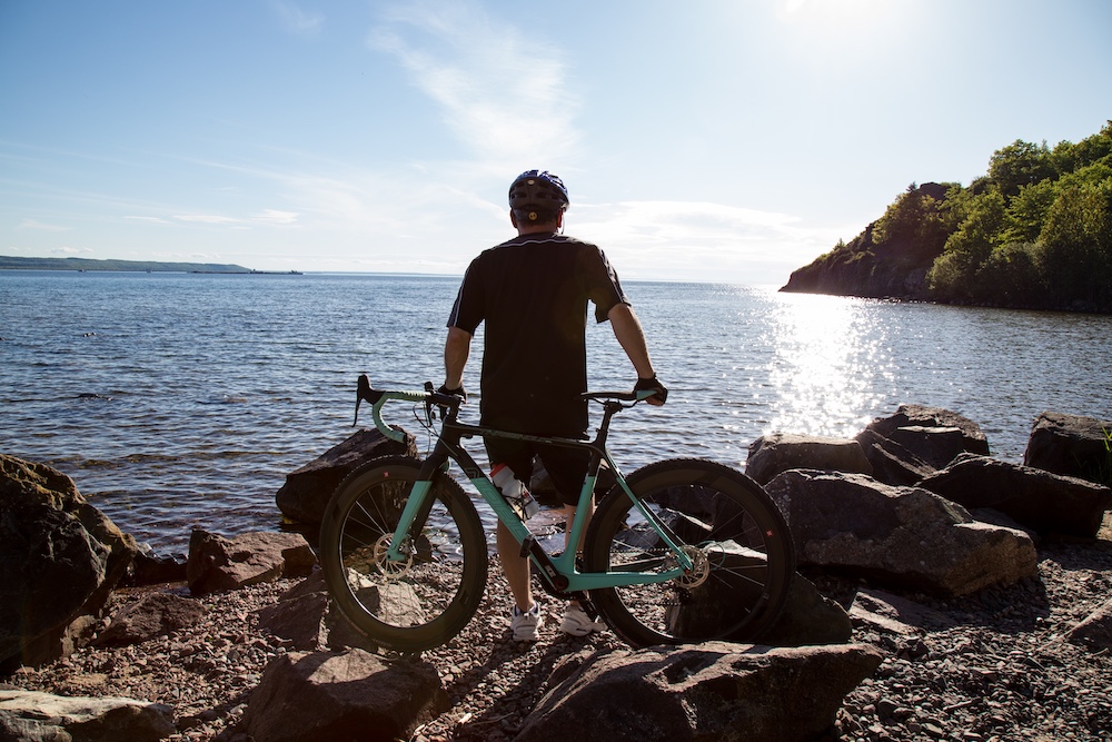
Riding up and down the edge of the Canadian Shield, ‘the lines’ starts with Fifth Line to Old Goulais Bay Road. From there, you’ll ride Fourth Line to the end, Third Line to the end and finally Second Line to end at Gros Cap. This finale has a spectacular view of Lake Superior.
For the return home, you can choose to follow Second Line—which is a section of the Great Lakes Waterfront Trail that extends from the Soo to Sudbury and Manitoulin Island along the Lake Huron North Channel—or go south to Baseline for a less busy ride back to the city’s waterfront. You can also take a 10-kilometre ride down Airport Road to Pointe Des Chênes Beach overlooking the mouth of the St. Marys River.
It's a hilly, robust ride for intermediate road cyclists.
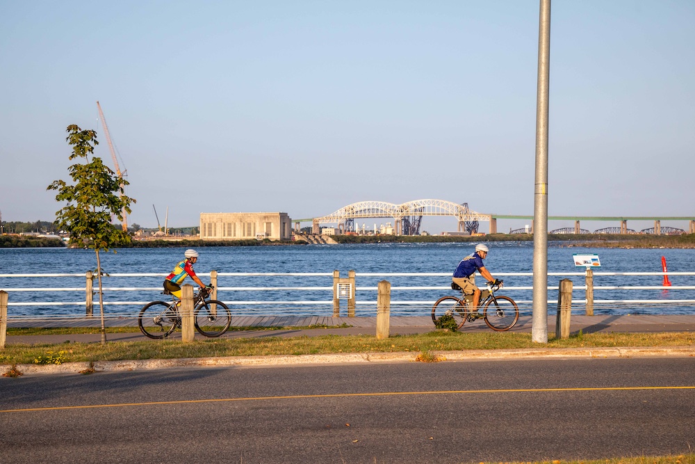
John Rowswell Hub Trail
The 25-kilometre Hub Trail is a perfect place to begin any road ride in The Soo, no matter your riding ability. The paved, segregated, circular trail highlights the vibe of the city. A great starting point is The Soo’s bike shop, Velorution, where owner and cyclist Jan is a wealth of knowledge about the region and bikes. He can also set you up with an e-bike rental if you didn’t bring your bike.
Accessible from almost anywhere in the city, the Hub Trail takes you through wooded forests in Fort Creek Conservation Area, and down and along the edge of the Korah Bench; also known as the Nipissing Bench, this is a 4,500-year-old sedimentary rock ridge formed during the glacier period.
Bike shops & bike-friendly sites
The Soo loves cyclists. This is evident in the paths, bike events, and downtown shops and cafes that have patios and bike stations for parking. Cycle along the multiuse path along Bay Street and drop by one of the local cyclists’ hangouts, OutSpoken Brewing, next door to Algoma Bicycle. Another option is the Duke of Windsor Sports.
The Soo has wonderful restaurants. The Whisky Barrel has a cozy ambiance and comfort food—imagine live music and mashed taters with hearty pot pie. For classic pizza with a longstanding history in The Soo, Uncle Gino’s Pizzeria is sumptuous any way you slice it.
One of the most famous tourist attractions along the historic St. Marys River, the Canadian Bushplane Heritage Centre is a one-of-a-kind museum. Behind the museum, taste some fine craft beer at Northern Superior Brewing Company.
Where to stay
Glenview Cottages and Campground is located just outside of downtown, and has pools, a sauna, a hot tub, a playground and bonfires. The one- and two-bedroom cottages back out onto 142 acres containing hiking trails.
Thunder Bay
Kakabeka Falls Loop
The Kakabeka Falls Loop is 83 kilometres of rolling hills—and some steep ones, too.
Referred to as the Niagara Falls of the North, Kakabeka Falls is part of the Lake Superior watershed and stands at 40 metres tall within Kakabeka Falls Provincial Park. At the bottom of the waterfall, in the Kaministiquia River, you can find rocks containing 1.6 million-year-old fossils.
Expect farmland riding on the north shore of Lake Superior. The posted ride starts at Lakehead University on Oliver Road, which runs east-west a few kilometres north of Hwy 11/17. Be mindful of traffic at the beginning of the ride, as the road shoulder is narrow. Ride west on Oliver Road towards Kakabeka Falls.
For maple lattes and scones (so many flavours) in a cozy log cabin, stop at the Metropolitan Moose.
Bike shops & bike-friendly sites
Rollin’ Thunder sells accessories and all types of bikes, from road to mountain and commuter. They also offer rentals (albeit not road bikes, regrettably). Fresh Air Experience sells bikes and rents mountain and fat bikes, even though it’s not listed on their website. 3ride Bicycle Co. is located downtown and has all manner of bikes and repair services.
The Growing Season Juice Collective does wild things with vegetables and healthy food. To truly refuel with tasty concept food, stop here. For more comfort food—like duck poutine, pizza and burgers—The Sovereign Room has cozy pub vibes.
For the stargazers, Fort William Historical Park is a must. The park also includes the David Thompson Astronomical Observatory, which has one of the largest publicly accessible telescopes in Central Canada.
Where to stay
The Courthouse Hotel is a 100-year-old red brick building located downtown with free breakfast. It is also pet-friendly.
North Bay
Bonfield-Callander Loop
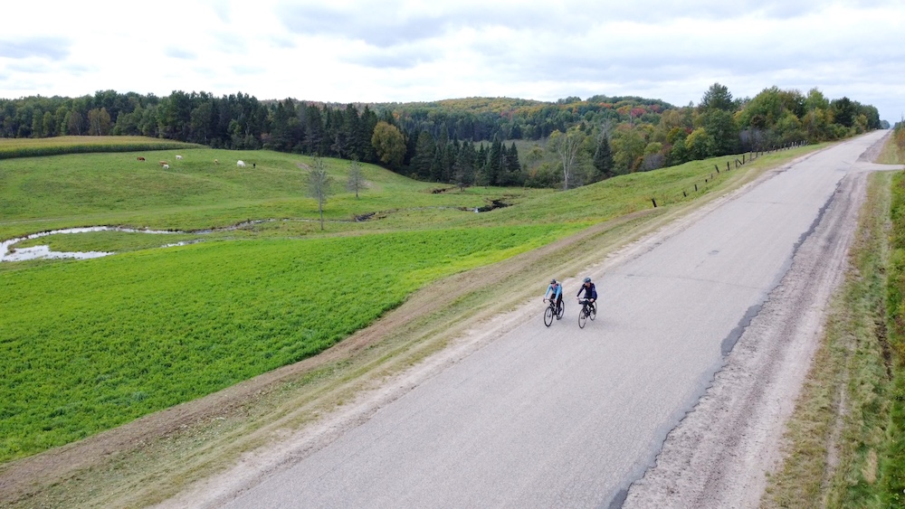
The Bonfield-Callander Loop is a 50-kilometre route through sweet towns with great spots to stop and take in a view or munch on a butter tart.
The road between Bonfield and Callander is part of the famous Voyageur Cycling Route; a 645-kilometre route starting in Ottawa and ending in Sudbury, it follows along the historical trade route of the Metis and fur traders. Beyond Callander to North Bay, there are many alternative routes. Pass by natural wonders like waterfalls—or artist Peter Camani's Screaming Heads outdoor art installation near Burk’s Falls. Called The Midlothian Castle, the strange screaming rock sculptures are also the site of a popular music festival called Harvest Festival in September.
Vive le Nord
Discovery Routes, a charitable trails organization, has created over a dozen routes along the Voyageur Cycling Route.
One ride that covers culture, history and nature is the Vive le Nord. The many towns along this route are nestled on the shores of the historic French River, a fur trading route. In the late 1880s, French-Canadian settlers from Quebec came to this region to celebrate their unique dual language culture, which is still evident today. The 178-kilometre route includes signs in both French and English as the region is Francophone.
Starting at the Minnehaha Bay Marina in Sturgeon Falls at the Twiggs Coffee Roasters, the route spans gorgeous wheat fields before unfolding into wetlands, deciduous forests and rugged lakes. Noëlville is glorious for its cute chip stand and cafes, and a “share shed” (pick up a souvenir!). The route includes bike fix stations in Sturgeon Falls (located on Front Street in the parking lot of the Sturgeon Falls Lookout Park), Noëlville (located in Joe Chartrand Park) and Lavigne (south of the general store, Chez Courchesne).
Bike shops & bike-friendly sites
Cycle Works rents and repairs bikes. Cheapskates sells bikes and clothing. Wheelhouse, a hub for the bike community, does sales, repairs and local events.
Callander’s waterfront has a great vibe and restaurants, including 1886 Lake House Bistro. The Fork chip stand is more than awesome fish and chips—they also have corn dogs and “one of the best poutines in Canada.”
Gateway City Brewery is a giant supporter of cycling events. Stop in for some great food and wild beer flavours like prickly pear and lime. The Fox & Fiddle has a cozy atmosphere and comfort food like mac and cheese.
For a truly unique experience, take in a show or browse the art gallery at the historical Capitol Centre. An artistic and theatrical hub since 1927, the likes of Johnny Cash and Jann Arden have played here.
Where to stay
For a girls’ getaway or couples retreat, Gray's Log House is a 19th-century cabin with tons of charm just a stone’s throw from Trout Lake and trails. They have an amazing breakfast cyclists will surely appreciate.
The Finch Beach Resort is a hygge-inspired, retro-chic cabin on Lake Nipissing. Imagine enjoying a barrel sauna and dip after a long ride, and memory foam mattresses to rest those tired muscles. It’s a place that pays attention to details and comfort.
Muskoka
Lake Rosseau Loop
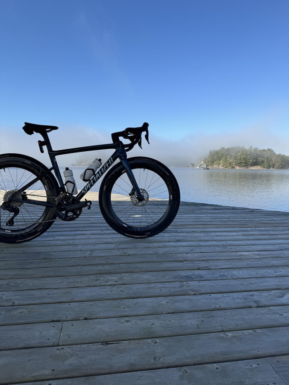
The Lake Rosseau Loop spans 64.6 kilometres, but has a giant elevation gain of over 1,000 metres.
This ride takes in the best of the Muskoka cottage country: lakes, dense forests and cottages alongside slabs of the Canadian Shield.
While the distance isn’t a lot, the terrain packs a punch: climbs are intense. The loop can start at a variety of locations and be ridden in either direction. If starting in the town of Rosseau, make sure you begin early in the morning at Peninsula Road as Highway 118 gets busy in the summer.
Tour-of-Waterfalls Route
For a less arduous ride, start in Bracebridge for the 27-kilometre Tour-of-Waterfalls ride, along which you’ll stop at not one, but three waterfalls: Bracebridge Falls, High Falls and South Falls. Ride through charming Bracebridge before getting out into the countryside.
Bike shops & bike-friendly sites
Muskoka Bicycle Pro Shop is a great bike hub with friendly, knowledgeable staff. In Bracebridge, Liv Outside has bikes, boats and gear.
The Port Carling Wall is the world’s largest historic photo mosaic mural. The kids will love Santa’s Village, a theme park with ziplines and tons of rides.
The bakeries and restaurants in this area are quite impressive. The Rosseau General Store is a popular spot, selling everything from hardware to home-baked bread and pies. On Fridays, the Rosseau Farmers Market has live music and vendors.
Where to stay
The Touchstone Grill in Bracebridge, located at the fancy and beautiful Touchstone Resort on Lake Muskoka, is memorable. Consider sleeping here and throwing in a post-ride massage, too.
Paddle the lake or sit in a Muskoka chair beachside to take in the view.
Meanwhile the Fairy Bay Lakehouse provides great value in a beautiful lake setting.
Parry Sound
Parry Sound to Muskoka Lakes
The Parry Sound to Muskoka Lakes route is a 114-kilometre loop from Parry Sound around Lake Joseph, taking you through incredibly beautiful scenery on roads that are almost car-free. The punchy climbs are real on this ride and you’ll ascend about 1,130 metres. But the views of the luxurious cottages—even some dating back to the 19th century—are truly spectacular. There are loads of washroom stops and services along the route in the towns of Mactier, Port Carling and Rosseau.
Northern Long Loop
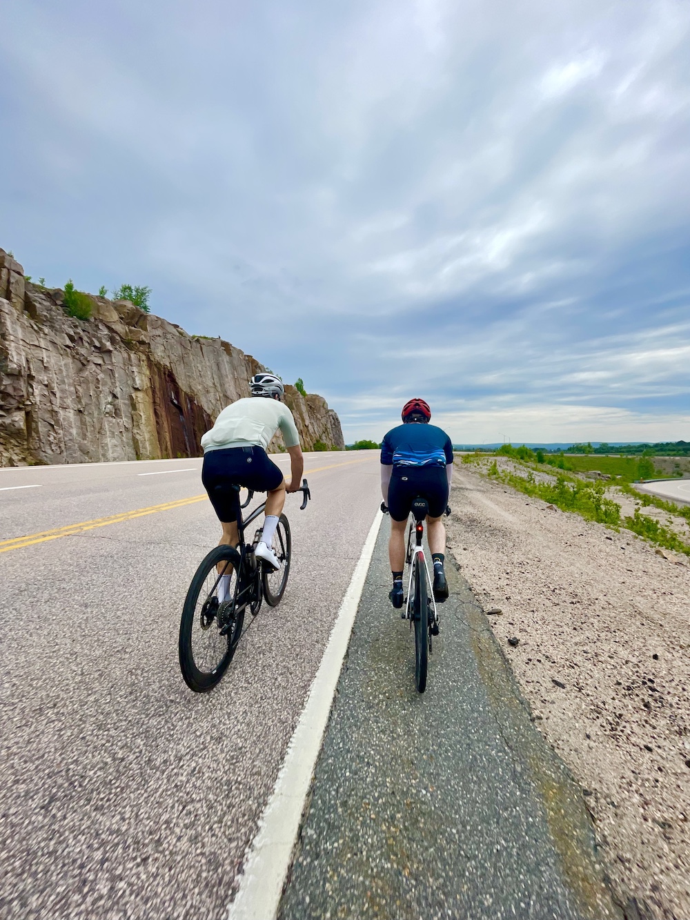
The Burk’s Falls to Parry Sound Loop is 161 kilometres in length and starts at the Burk’s Falls Information Centre. If you don’t want to do the loop all in one go, you can stay overnight in Parry Sound and then head back to Burk’s Falls the next day.
Heading south on Highway 11, you’ll encounter cute townships such as Katrine, which is surrounded by 3,200 square kilometres of lakes, rivers, and pine and maple trees. As with the other routes in this area, you’ll ride up and down punchy hills and through rockcuts of gorgeous Canadian Shield.
Bike shops & bike-friendly sites
Parry Sound Bikes offers mountain bike rentals and repairs. South of Parry Sound in the town of Orillia (about an hour’s drive), Crank & Sprocket Bicycle Co. rents hybrid bikes—a cross between a road and mountain bike—as well as mountain bikes, e-bikes, fat and road bikes.
In Parry Sound, Dent Bay Baking Company is an award-winning bakery of next-level artisan sour dough breads and pastries. Check their Instagram for daily specials.
Duck Rock in Dunchurch has Kawartha Dairy ice cream and other treats. In McKellar, Bisto 685 has wood-fired pizza and coffee.
For off-the-bike fun, the Museum on Tower Hill, once the community’s fire tower, has cool exhibits including the history of the tower and local firefighting. Find interesting interactive exhibits on geology, logging, shipping and First Nations history.
Where to stay
The Log Cabin Inn is cozy and close to amenities. They also have a lovely restaurant on-site.
Sudbury
South End Ride
Many of Sudbury’s road routes are part of the Rainbow Routes trail network, an association that promotes active living in the Greater Sudbury area. There are so many paths around lakes, through downtown or beyond.
To get you started, try out the South End Ride, a 62.8-kilometre paved route that’s accessible from downtown Sudbury. The loop hits a few beautiful spots, including Secord Falls—not quite a waterfall per se, but it’s a beautiful picnic spot on a bridge that overlooks a rushing river over the rocks. The route passes through the town of Estair to the south. In the north, it passes through the sleepy town of Wanup, which was popular among Finns back in the early 1900s because it is geographically similar to Finland. Who knew?
Grand Tour de Sudbury
The Grand Tour de Sudbury is 102 kilometres of punchy climbs for the intermediate road cyclist. The route passes through small towns, but you should plan to make a stop in the slightly larger town (it has a few sets of stoplights, after all) of Val Caron to refuel on pancakes at Stacked Pancake House.
Bike shops & bike-friendly sites
For your bike needs while in the Nickel City, Adventure365 sells high-end road bikes and gear. Or find a great road bike, gear and snazzy clothes at The Outside Store.
Restaurants are quite diverse in Sudbury. Known for their vegan options and Tuesday night trivia, Tucos Taco Lounge is popular, while Lot 88 Steakhouse & Bar is on the more elegant side. Nikki’s Jamaican Kitchen is low-key and casual, but is great value.
The Big Nickel, the largest coin in the world, is near Science North, an interactive science and mining museum.
Where to stay
The Lodge at Pine Cove offers sophisticated cabins in the wilderness, about an hour from Sudbury. Imagine a copper bathtub overlooking the pine trees outside and a bunch of outdoor activities like boating and fishing.
Recommended Articles

Mountain Bike Races & Events in Ontario
Gravel Grinders

Ultimate Guide to Road Cycling Events
Ontario Bike Law

Sign up for a Fat Bike Event in Ontario
Ontario's Best Ebiking Routes
The Voyageur 200

E-Biking Bliss
Best Bikepacking Routes
13 Spectacular Bike Rides
Pedal Into Spring
200-km Bike Routes

Best Ontario Bike Routes on Strava
Sudbury’s Best Bike Rides
Bikes and Beds
Go Now
Ride Gravel
Guide to Biking in Northern Ontario

LOOKING FOR KICKASS MOUNTAIN BIKE TRAILS?
