A Guide To Year-Round Biking At Sleeping Giant
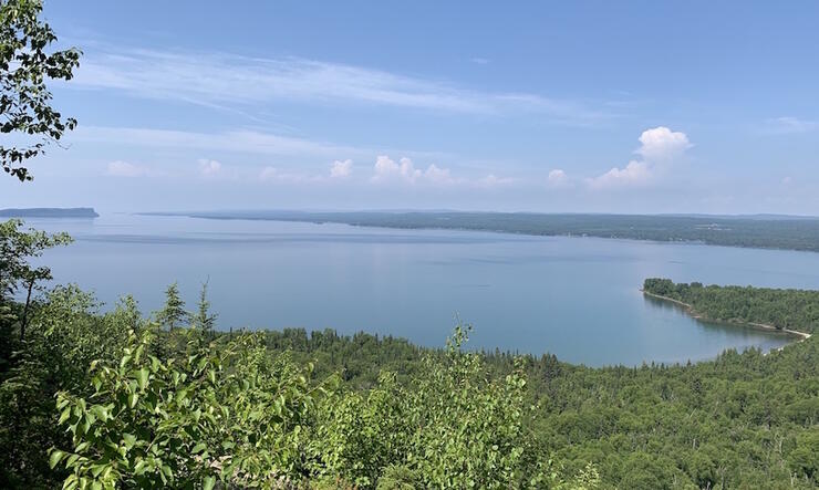
There is a magical place where, from atop the highest vertical cliff face in Ontario, you can view the crystal-clear water of the world’s largest freshwater lake over 1,200 feet below. What an amazing place this is. Named after the massive rock formation resembling a mythical giant lying on his back, Sleeping Giant Provincial Park is less than an hour drive from the city of Thunder Bay and offers endless opportunities for outdoor adventure seekers throughout the year.
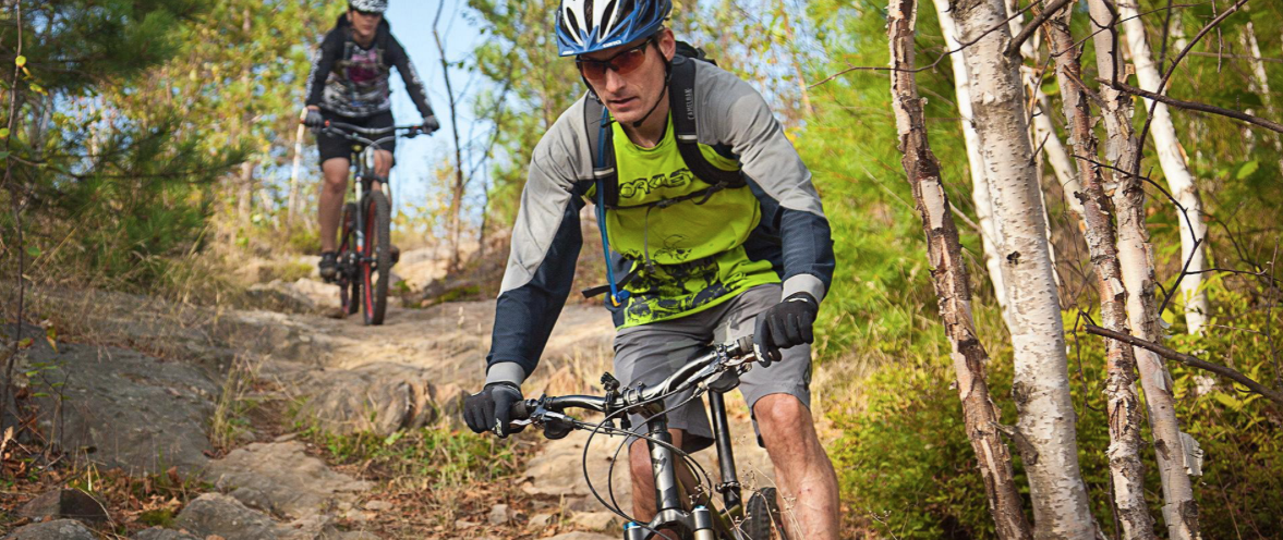
The park is a popular place for campers and hikers, but it also boasts some amazing paddling opportunities, spectacular cross-country ski trails, and a network of trails and gravel roads that will delight every cyclist from the novice to the enthusiast.
Sleeping Giant Bike Trails
Kabeyun Trail (easy, 14 km return)
The most popular trail at the park, the Kabeyun, is a beginner-friendly trail accessible from the Kabeyun South Trailhead. While the full trail is 37 km long, only the first 7 km are rideable. Shortly after the beach at Tee Harbour is Lehtinen’s Bay, and beyond this point the trail quickly turns into a challenging hiking trail that twists its way through giant boulders, talus slopes and other challenging terrain as it winds along the shoreline of Lake Superior.
Cyclists should use this trail with caution as it is very busy, being primarily used by families as well as groups of hikers accessing the Giant, backcountry sites, or the water access at Tee Harbour and Lehtinen’s Bay.
Sawyer Bay Trail (easy with challenging hills, 11.4 km return)
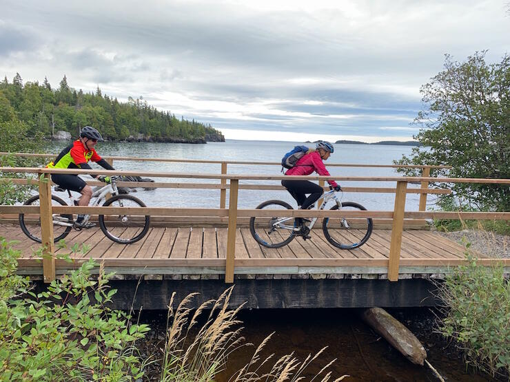
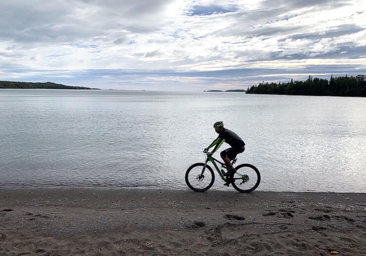
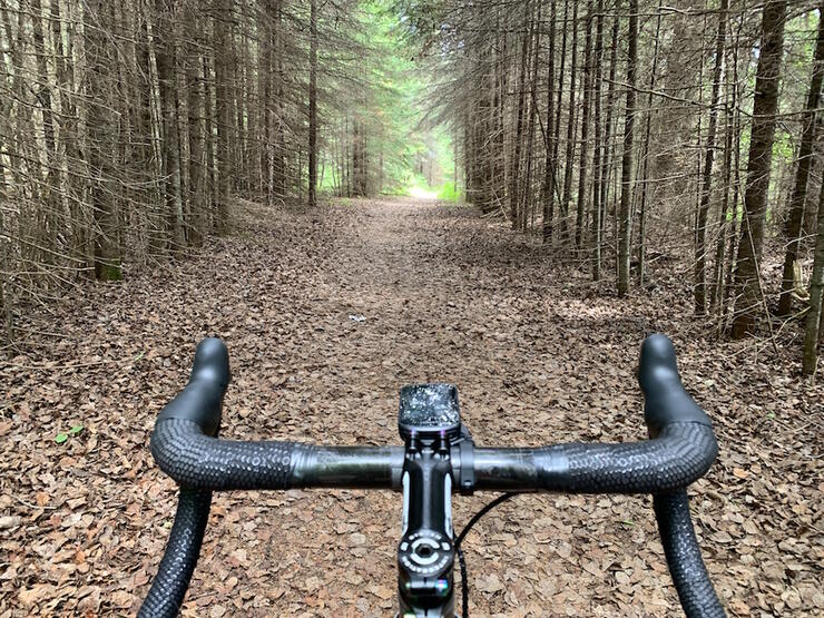
This trail branches off the Kabeyun Trail a few hundred meters from the trailhead. Once a logging road used to haul wood to fuel the Silver Islet Mine, this trail now leads to a secluded beach at Sawyer Bay at the base of the Sleeping Giant’s head. While most of this trail is wide and easy, some loose rock and steep hills will make biking it a bit of a challenge for some. Still, the lakeside view from Sawyer Bay is well worth the effort.
A new section of hiking trail leading to the Nanabosho Lookout on the chest of the Giant was opened in 2020. You can ride to Sawyer Bay, then hike up the Talus Lake Trail for 1.8 km and then take the Nanabosho Lookout Trail for 0.8 km to reach one of the most stunning lookouts in Ontario.
Sawbill Lake Trail (easy with one challenging hill, 2 km linear)
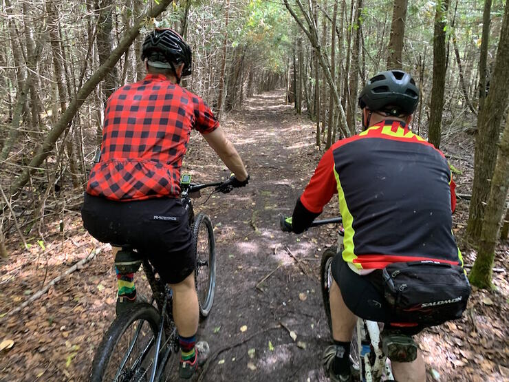
Another abandoned logging road, this trail connects the Sawyer Bay Trail to Marie Louise Lake Drive, allowing cyclists to access the Sawyer Bay and Kabeyun trails from the campground without having to ride down the highway to the Kabeyun trailhead.
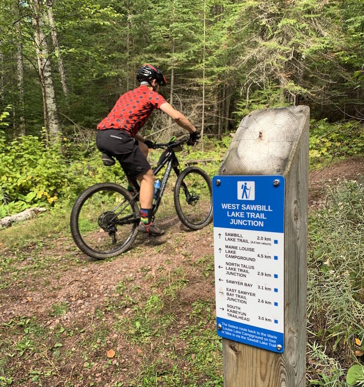
It’s a fun and easy ride except for one very steep hill near the Sawyer Bay Trail junction. Many cyclists enjoy the challenge of trying to climb this hill without stepping off the bike.
Ferns Lake Trail (moderate, 9.5 km loop)
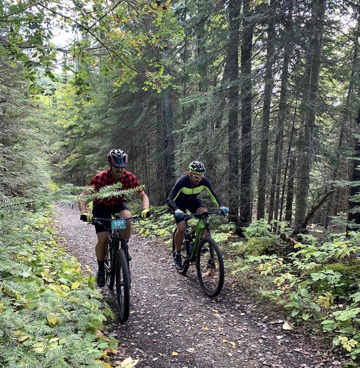
This loop is the centerpiece of the Sleeping Giant XTERRA off-road triathlon that is held at the park each year. When the grass is cut short, it makes for a relatively short but rewarding loop right from the beach area of the campground. The trail would be an easy ride except for some very bumpy sections on the western portion. Substituting this rough piece of trail with the secondary highway #587 makes this loop much easier and more enjoyable.
Lake Marie Louise Drive (easy, 11.5 km linear)
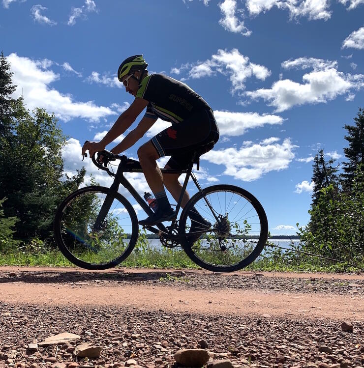
This gravel road is well maintained and accessible from the main campground. It circles Lake Marie Louise and is very popular with cyclists. A few vehicles will use the road to access the remote campsites on the western side of the lake as well as the Sawbill Lake Trail, but chances are you will see far more rabbits and deer than cars on this road. A few moderate hills make it interesting and, at the northern end of the road, you can take Hwy 587 back to the campground to complete a 17.5 km loop.
Thunder Bay Lookout Road (easy with several challenging hills, 18 km return)
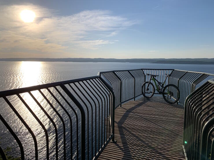
The Lookout Road is 9 km in length and is accessible by the Burma Trail, the Pickerel Lake Trail extension or from Hwy 587 at the Rita Lake parking area. Conditions on this gravel road vary from silky smooth to rough and rutted. It weaves up and down a number of hills as it climbs and eventually flattens out at the Thunder Bay Lookout where you will find a boardwalk that juts out over the side of the impressive vertical cliffs. Here, you will have an indescribable and unobstructed panoramic view of Lake Superior and the city of Thunder Bay from the perspective of the Sleeping Giant.

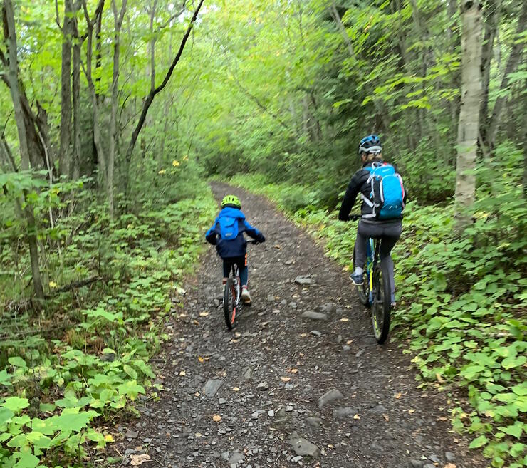
This road makes for a good family ride with some great opportunities for a lunch break at the top or at one of the lakes it passes along the way: Joeboy Lake, Lizard Lake and Poundsford Lake.
Winter Fat Biking
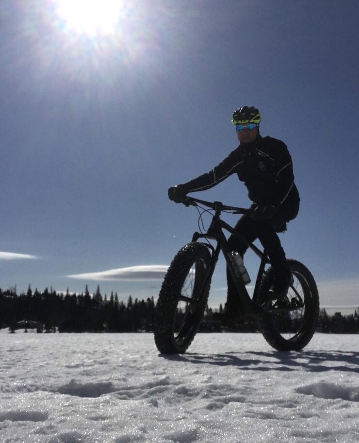
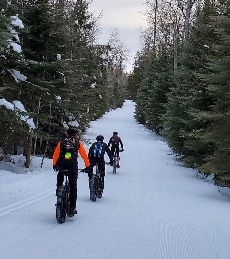
Sleeping Giant Provincial Park is famous for the Sleeping Giant Loppet cross country ski festival, which has run every year since 1978 on the first weekend of March. This event draws over 800 skiers and over 200 volunteers to the park and appeals to families, recreational skiers and competitive athletes alike. Fortunately for us, the full 50 km of groomed trails are now open to winter fat biking as well.
Fat bikers are asked to use good judgement and not use the trails if the snow is soft and they are sinking in. Respecting the trails will ensure the quality of the skiing is not compromised. While Marie Louise Lake Road and the Thunder Bay Lookout Road are part of this winter trail network, the very best winter riding is on the Pickerel Lake and Burma trails.
Pickerel Lake Trail (easy, 11.7 km linear)
This beautiful trail feels unique because it isn’t nearly as wide as the other groomed trails and it features some of the rare flat terrain in the park. It also includes some sweeping corners, rolling terrain and one really big hill for a bit of excitement. It is suitable for beginners and is accessible off Marie Louise Drive.
Burma Trail (challenging, 11.4 km linear)
The Burma connects Marie Louise Drive to the Thunder Bay Lookout Road by winding between a number of small lakes, past impressive stands of white pine trees, and over some challenging hills. This is the most remote groomed winter trail, so it is very likely you will encounter some wildlife as you silently pedal your way through this winter wonderland.
The Fat Bike Loppet Loop (challenging, 41.4 km loop)
Each year, on the day after the Nordic ski loppet, the Thunder Bay Cycling Club and Blacksheep Mountain Bike Club host a fat bike loppet that follows a course along Marie Louise Drive to the Burma, up to the Lookout Road, then across the Pickerel Lake Trail before merging back onto Marie Louise Drive. This loop makes for a fun long distance ride any time the trails have firmed up in some cold weather after being groomed.
Backcountry Camping at Sleeping Giant
There are 27 backcountry campsites in the park and many of them are accessible with a mountain bike. The most popular sites are the scenic sites available down the Kabeyun Trail at Tee Harbour and Lehtinen’s Bay. Other backcountry sites ideal for bikepacking can be found at Sawyer Bay. These interior sites can be booked online or by calling 1-888-ONT-PARK.
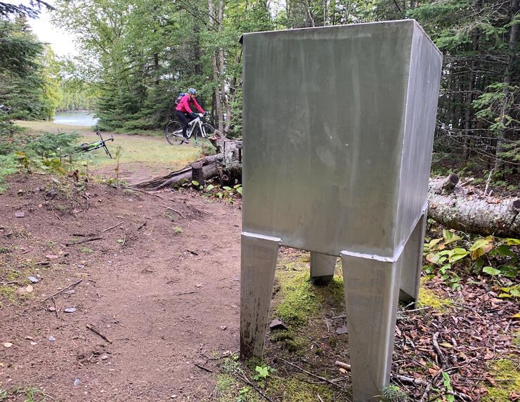
Park Superintendent Christian Carl reports that the popularity of these backcountry sites has skyrocketed lately and he strongly recommends making a reservation prior to arrival. Backcountry permits are valid at any of the park’s backcountry sites. Individual sites are available on a first-come, first-served basis. There are nine sites at Tee Harbour, three at Lehtinen’s Bay and three at Sawyer Bay, all of which have designated metal firepits, access to bear-proof storage lockers and privies nearby.
Bike Rentals at Sleeping Giant
Along with canoes, kayaks and standup paddleboards, the park rents out mountain bikes for $30 per day at the WestWind Store (located in the Visitor Centre). The bikes are also available for shorter four-hour rentals at just $20, and two-day rentals are $50.
Alternatively, the Silver Islet General Store offers rentals close by, plus Thunder Bay has three top-notch bike shops: Fresh Air, Rollin’ Thunder and Petrie’s Cycle & Sports. Each have great selections of bikes, bike parts, helmets and rental options. Plus, their friendly and knowledgeable staff can help you find the many other great cycling spots in the Thunder Bay area.
Sleeping Giant Provincial Park Trail Maps
A useful map that shows the trails at the park can be found on the Ontario Parks website, but there are other options too. The park Information Guide is free and can be picked up at the Marie Louise Lake Gatehouse. It contains a basic trail map with some trail descriptions. The high-resolution topographic trail map available at the park has been extremely popular with visitors. Alternatively, the South Kabeyun Trailhead has a great map board that can be photographed on your phone prior to commencing your ride.
Where to Stay
Sleeping Giant Provincial Park has 198 car-camping sites, 27 backcountry sites, and five rental cabins. The rental cabins are available year-round. For visitors looking for a hotel, Thunder Bay is 85 km to the west and has dozens of options, as outlined on the Visit Thunder Bay website. East of the park, the Township of Nipigon has several options for accommodations as well.
Fees
Day passes are available 24/7/365 at the Joeboy Lake fee station and the Marie Louise Lake Gatehouse parking lot. Pay and Display machines at these two sites can process credit card transactions and print a valid vehicle day permit.
The current cost for a vehicle day permit is $15.50 (including HST). Alternatively, an annual vehicle permit costs $175 (including HST), a summer vehicle permit costs $125 (including HST), and a winter vehicle permit costs $85 (including HST).
Park facilities and car-camping are open mid-May until the Tuesday after Thanksgiving. Backcountry camping and roofed accommodations are open year-round. The park is also open for day use year-round, meaning trails are fully open and accessible as well. Most are kept clear of fallen trees from May to September and the trails groomed for skiing are maintained year-round.
While You’re There
A trip to the park and the north shore of Lake Superior also presents visitors with plenty of other opportunities for sightseeing.
Kakabeka Falls
Kakabeka Falls is the largest waterfall in the Lake Superior watershed. Here, you will see the mighty Kaministiquia River drop 130 feet into a deep gorge carved out of the Precambrian Shield. The falls are accessible right off the Trans-Canada Highway in the village of Kakabeka Falls.
Terry Fox Monument
The Terry Fox Monument, located just outside Thunder Bay, is a public monument commemorating Terry Fox's Marathon of Hope. The location of the 9-foot-tall bronze statue is very close to where Fox’s cross-Canada run was cut short by cancer in 1981, and it offers a breathtaking view of Lake Superior, Thunder Bay and the surrounding landscape.
Ouimet Canyon
The Ouimet Canyon is a large gorge located in Dorion, Ontario. The canyon is so deep and cold that three species of Arctic plants flourish there. The canyon is in a day use provincial park and is just 70 km from Sleeping Giant Provincial Park.
Fort William Historical Park
Fort William Historical Park is one of the largest living history attractions in North America. Located in Thunder Bay, this park is devoted to re-creating the Canadian fur trade. It showcases life inside the walls of a fort like the one used by the North West Company in the early 19th century.
Trowbridge Forest
Trowbridge Forest, also in Thunder Bay, is quickly becoming a major destination for mountain bikers travelling to the region. Popular single-track trails are found in the area known as Shuniah Mines, within Trowbridge Forest. Here, nearly 20 km of trail wind through the old mining grounds, over piles of mining tailings, across sections of exposed Canadian Shield, and along a series of hills and ridge lines. Trails like Grand Chasm, Conveyor Belt, Hilltop and Drift are so fun you will want to ride them over and over again. The best way to access these trails is to park at the Kinsman Park trailhead where you can take Conveyor Belt directly into the heart of Shuniah Mines.
Advice From a Local
I must warn you that spending a lot of time at Sleeping Giant Provincial Park will inevitably lead you to fall in love with the solitude, beauty and recreational opportunities the park offers. In fact, our family started out camping at the park during our summer holidays and then rented the park cabins in the winter months. When it became evident that we simply could not get enough of this area, we decided to move in and purchased a cottage in the community of Silver Islet on the southern end of the park.
Here our property is literally bordered by the park boundary and it provides us with the ultimate base camp for adventures at Sleeping Giant. Based on my personal experiences and the adventures I have found in the area, I must recommend some of my favourite places in and around the park:
See the Sea Lion
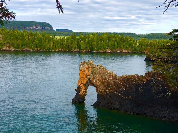
The 400-m hike off the Kabeyun Trail to the Sea Lion is a worthwhile detour that leads you to a lookout where you can observe the remains of a geological rock formation that once looked exactly like a lion looking out over Perry Bay. Even though the head and mane have crumbled into the lake, the rest of the lion remains. On the trail to the Sea Lion there is a small beach made of small stones, each one rounded by the relentless waves of Lake Superior. This is one of the best places to take a dip in the cool waters surrounding the Giant.
Find the Secret Road
There is a quiet and secluded road called Bay’s End Lookout Trail that connects the Thunder Bay Lookout Road to the community of Pass Lake north of the park. The road is gated at both ends to prevent trucks and off-road vehicles from entering, but it makes for a really fun ride and provides some fantastic views of Caribou Island and Lake Superior.
Take a Detour Down Plantain Lane
Even though it is only 300 m long, I always make a point of swerving off the main road and taking this scenic trail when I’m riding from my camp to the park’s campground. This trail is actually a section of the abandoned Silver Islet Road, originally used by miners to access what was once the world’s richest silver mine. At the midpoint of the trail, be sure to stop on the small bridge and look down to admire the series of small waterfalls in Sibley Creek.
Visit the Historic Silver Islet General Store
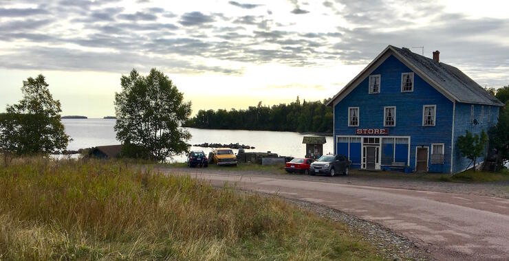
This little piece of history is located just 4 km from the main park campground and is set to reopen in June 2021. The Silver Islet General Store is the place to stop after your bike ride or other adventure for a hot chocolate or cinnamon bun, some unique shopping, or just to admire the store that once served the miners who lived and worked here. The store will offer outdoor and camping supplies, bike and kayak rentals, unique Canadian and locally made gifts, ice cream, gelato and penny candy.
The general store has been a meeting place and hub for activity since it was built 150 years ago. Here, visitors will find plenty of interesting things, including information about other tourism operators such as Canadian Lighthouses of Lake Superior, Sail Superior and Such A Nice Day Adventures.
Silver Islet General Store will also feature a living museum, offering a look into life at the historic mine through artifacts on display throughout the store. The Tea Room will serve up homemade soups and desserts, including the famous Silver Islet Cinnamon Buns along with coffee and other treats.
Plan Your Trip Now
Sleeping Giant Provincial Park is less than an hour drive from the city of Thunder Bay and offers endless opportunities for outdoor adventure seekers throughout the year. Start planning your trip now.
Recommended Articles

Sign up for a Fat Bike Event in Ontario
Lakeside Bike Rides

Fat Biking Hot Spots in Ontario
Ultimate Guide to Road Cycling Events
Gravel Grinders
Best Of: Bike Towns
Best Bikepacking Routes
Walden Bike Guide
12 Best Ontario Parks for Bike Rides
Plan a Bike-Cation In Thunder Bay

Ride Like a Local
Sudbury’s Best Bike Rides
Ride Gravel
Mountain Bike Races & Events in Ontario

Pedal-Powered Camps for Kids
13 Spectacular Bike Rides
Hiawatha Highlands Bike Guide
Cabin Rentals for Cyclists
Cycling Events
