The Ultimate Road Trip Guide to Chasing Waterfalls in Northeastern Ontario
Nine stops, nine waterfalls — from Duchesnay Falls to New Post Falls
By Hollie Demore


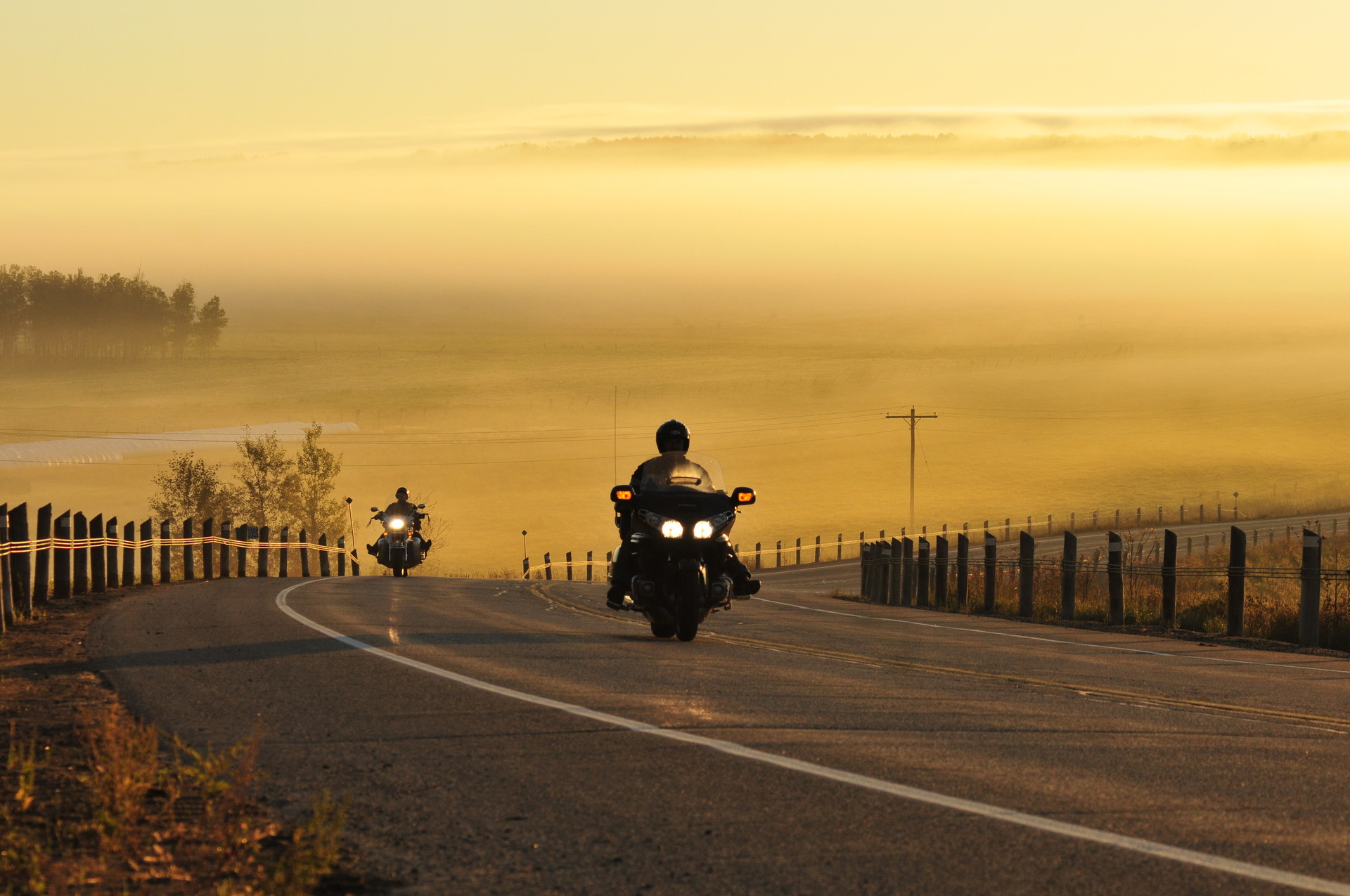
The Dirty Seven is a roughly 700km adventure motorcycle route looping through Northeastern Ontario and Quebec, built around the Lake Temiskaming area. Starting and ending in Mattawa, the route travels north through the VMUTS trail network west of town, up through Temagami and Temiskaming Shores, before crossing the Ottawa River into Quebec.
From there, riders tackle 150km of unserviced dirt road skirting the southwest edge of Zec de Kipawa — with no services of any kind for roughly two hours and forty minutes — before looping back into Ontario via Temiscaming and the twisting curves of Highway 533 into Mattawa. With terrain ranging from sandy forest cuts and rocky hill climbs to deep mud and stream crossings, the route is designed for adventure motorcycles and best stretched across a minimum of three days.
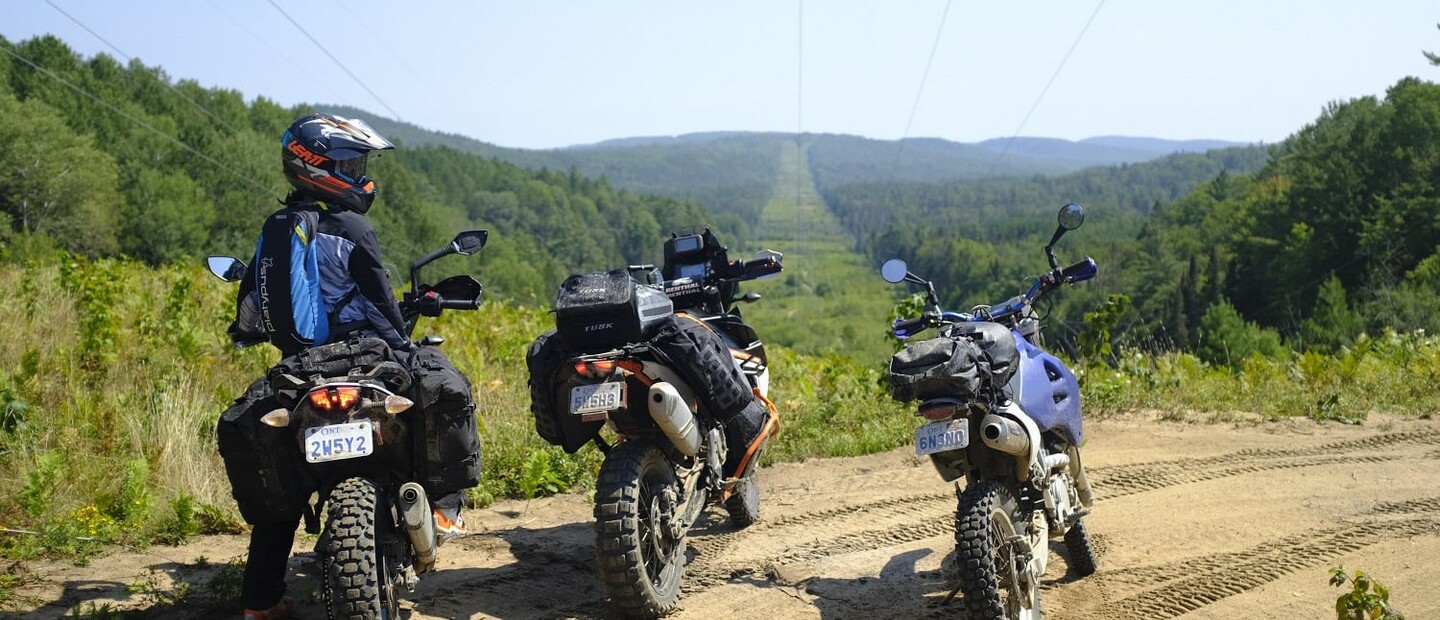
This past summer, accompanied by a couple of trusted riding companions, I delved deep into some of the wilder areas surrounding Lake Temiskaming while covering roughly 700 km of roads and trails in both Ontario and Quebec.
With so many of the area’s best roads (and I use the term “roads” very loosely here) being unpaved, Adventure Motorcycles and Northeastern Ontario are a match made in heaven. I just needed a couple of solid riding buddies to come along… Cue my good friends Cecilia Lai and Darren Cerkownyk, two avid off-road motorcycle enthusiasts. Not only did they bring along some much-needed levity in some challenging situations, but they also provided some great feedback with the planning and execution of the ride, and took some great pictures along the way.
Northeastern Ontario is a region that offers a perfect mix of rugged yet accessible, seemingly open wilderness, but with plenty of services and amenities to accommodate any sort of trip that you’re after. It helps immensely that this ADV route is loosely based on the existing Lake Temiskaming Tour, which is a paved route around the lake from Ontario into Quebec. I would encourage anyone riding The Dirty Seven to also check out the Lake Temiskaming Tour, as you will get to know many of the available attractions in the area.
Our ride follows a similar route, and as a result, this ride can be built to suit many different riding options. If you are short on time or want to avoid technical sections, there are always alternative routes, with a nice hiking spot or a hot coffee and poutine generally nearby (there are some exceptions, but it wouldn’t be an ADV ride without some sense of remoteness and adventure, right?).
The roughly 700 km route forms a nice loop, so feel free to start your route at any point along the way. Below is a suggested route description going clockwise, which is good for those arriving from southern Ontario as we did. I would encourage anyone who can to stretch the ride over at least three days, so you don’t feel rushed. One of the great things about the route is that it gets you access to so many areas with a vast network of forestry roads and trails that are wide open for exploration—an ADVer’s heaven. Don’t rush it if you don’t have to.
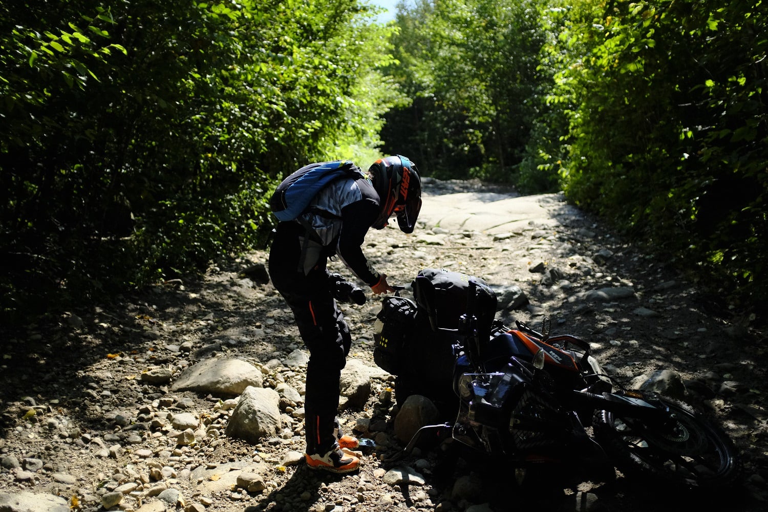
Fair warning to anyone trying to complete the full loop. With trail conditions inevitably varying at different times of the year, there may be certain times of year when washouts and flooding make some portions of the route difficult or even unpassable. We have tried to build some alternative routes in, as needed. But, this is all a part of the adventure, after all.
After work on Friday, we trailered the bikes up to Mattawa to spend the night at Le Voyageur Inn, which non-coincidentally has some of the nicest rooms in town and is home to the best Thai food in the north, hands down. The hosts are wonderful people who are super passionate about the community. Also, you can access the VMUTS trails right from town the next morning.
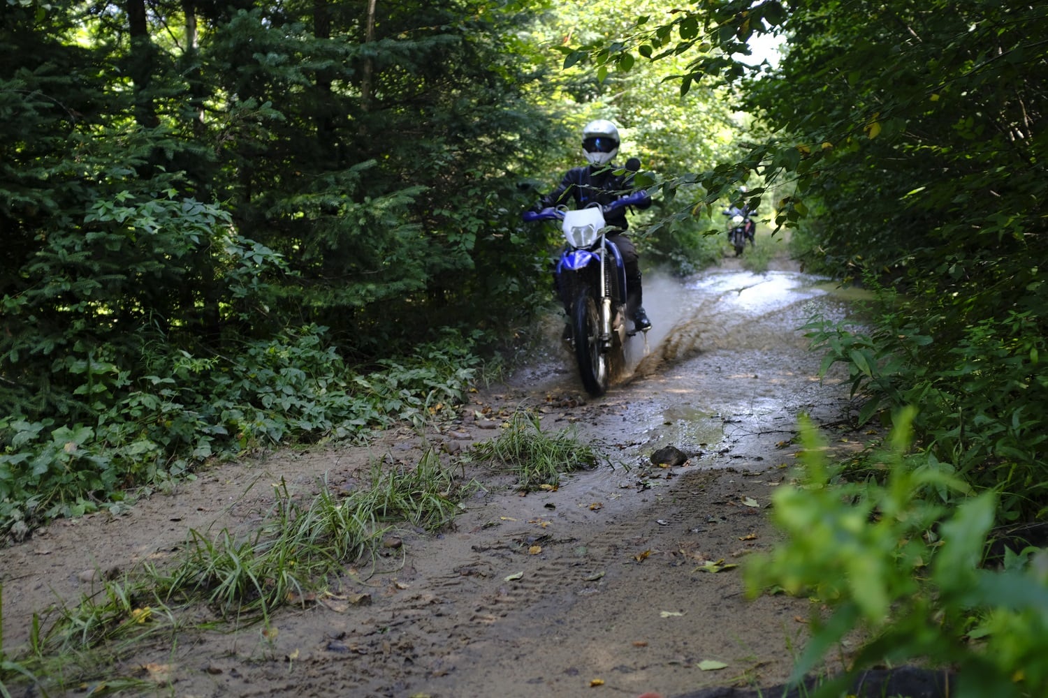
After some classic breakfast fare at Myrt’s, we hit the trails just west of town. You’ll want to get a permit for VMUTS and scout out their website for any trail closures in advance. But, for your troubles, you will be treated to hundreds of kilometres of the best riding around with incredible vistas and trails cutting through a tremendous variety of terrain, everything from sand to rocky hill climbs and wide open cuts giving you spectacular views you don’t often get in Ontario. And, don’t forget the mud, there’s plenty of that, too. Take time to find one of the incredible lookouts along the way, and check out the old Mica Mine if you have time.
Once you’ve made your way west through VMUTS, you will meet up with Highway 63, and then you have some options. The highway option takes you southwest to the bustling metropolis of North Bay, which, depending on just how long you played in VMUTS would make a great stop for the day. The dirt-friendlier routes are either Weyerhauser Rd to the North or French Rd a bit further South. French Rd works its way down to a narrow trail and is one option where you risk having to turn around, as we did earlier in the season once the trail disappeared completely into the abyss of a deep swampy water-crossing with jail bar trees lining either side. This route would be passable under drier conditions though. No harm was done, as backtracking across the many stream crossings was just as fun the second time around, and either of the other two options are viable (Weyerhauser Rd. to the North, or the Highway 63/North Bay route to the south).
The route north now follows the basic trajectory of Highway 11 towards Temagami, and there is no way to avoid taking the highway for some stretches. But, we’re the first to admit that the pavement can be a pretty sweet change after you’ve had your a** kicked on some rough wet trails all morning. However, along this stretch of highway, don’t forget these two dirt road detours which will get you off the highway and feeling adventurous as you twist your way along the landscape, rather than just plow right through it: 1) Just north of Marten River you’ll want to take Tonomo Lake Rd/Wilson Lake Rd for a bit of twisty dirt fun. If you prefer to stick to the highway; however, visit Gramp’s Place, the General Store along Highway 11 which has something for absolutely everyone. Then, 2) You’ll want to take Roosevelt Forest Rd just north of Temagami, but first, you’ll want to stop in Temagami itself. We recommend The Outfitter Bar and Smokehouse for a fantastic meal along the beautiful waterfront. And, if you have time for a detour, check out the restored Temagami Fire Tower for some incredible views.
Temiskaming Shores is a gem at the top of the gorgeous Lake Temiskaming. The lake is one of the deepest in Ontario and forms a good stretch of the boundary between Ontario and Quebec. If you have time, check out the Devil’s Rock Hiking Trail, which is a short hike with an incredible payoff with its sheer cliffs overlooking the lake. Just north of town will be your last stop for any big box-type stores, such as Canadian Tire, which came in handy for us as some signal light bulbs and a new battery were needed for our bikes. Check out Broskis Diner for its weekend breakfast buffet. Also, be sure to gas up before you leave town as gas is generally cheaper in Ontario, and there is a long stretch without services once you cross over into the back woods of Quebec.
You will find yourself on some beautiful paved roads as you ride up and over the top of the lake and into Quebec. Enjoy those gorgeous views of the lake, the rolling hills and the valleys. You’ll want to make your way southeast to a small town called Béarn, QC. This is your last call for poutine before you get into the woods for a nice long stretch, so hit up La Cabane Chez Nan, if you’re hungry.
From Béarn, you will take the appropriately named Chemin de Pénétration going east, which quickly turns into a dirt road that takes you further and further into the wilderness. You will have no services of any kind for the next 150 km after leaving town, which will take about 2 hours and 40 minutes should you decide to follow the speed limits. This stretch is entirely on dirt, and skirts along the SW edge of the Zec de Kipawa. We saw more bears (1) than people (0) in this stretch. There are some emergency phones at a few key spots along the way, should you run into any issues and not have cell service. The sequence of roads you will take as you loop to the east and back are Chem. de Pénétration, then turn right onto Chem. du Lac Moran, right again onto the Southern Boundary Rd of Zec Kipawa, right again towards Chute du Pin Rouge, which will lead to Chem. Commonwealth, which will take you back west towards Temiscaming for your first gas stop in quite some time. You’ll then cross back over the Ottawa River to Ontario.
From there on out it is just a short trip down the 63 and one of my favourite paved roads in the province; Highway 533, which takes you back down to Mattawa where we started. This road will have you doing your best Marc Marquez impression as you get your lean on into the turns, it’s one of those great twisty roads where you just think, “They don’t make them like they used to.” It feels like a MotoGP track, or what I imagine it to be. It is not an adventure road, but otherwise, it is pretty well perfect. And after hours of gravel, it was a nice change. Plus, the views as you work your way down the Ottawa River valley and into Mattawa, are spectacular.
And, that’s it! That completes the loop! The beauty of this route, with all the offshoots and variations available to you, is that; like myself, you can turn around and go do the loop again a short time later. Maybe this time you can take a different side road here and there, pick another hike or crown land camping spot, and it will feel like a different adventure entirely. Enjoy!