What caused the demise of these once-bustling towns? Find out on this ghostly road trip through the history of Northeastern Ontario.
From Lake Rosseau to Lake Nipissing, a dozen ghosted settlements tell a story.
Photo by Andrew Hind
By Andrew Hind
Andrew Hind is an author and history columnist from Bradford, Ontario.
July 11, 2024
The vagaries of fate have seen numerous Ontario communities fail. The few scattered remnants of these dead communities — foundations here, a wearily leaning building there — are revenants of failed dreams.
I’m drawn to visiting — and researching and writing about — ghost towns. I try to imagine each community as it once was, to piece together how they rose and why they fell, to put myself in the shoes of those who lived there.
So, I thought I would design my own road trip, with a pair of Northeastern Ontario ghost towns — Desaulniers and Milberta — as the ultimate destination.
Don’t Race to Get North. Enjoy the Journey.
The drive north can very much be a part of your ghost town adventure.
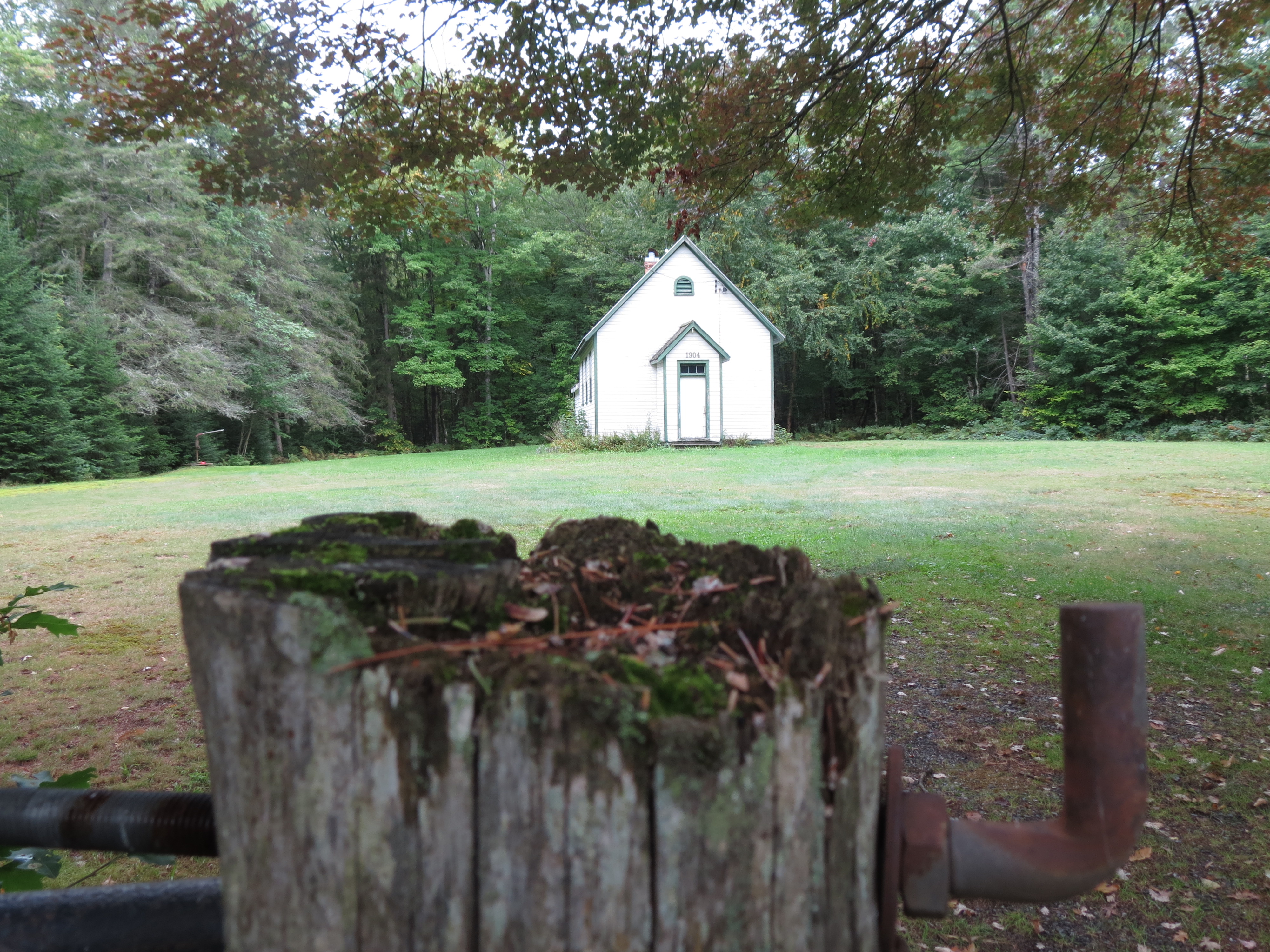
Whether you take Highway 11 or Highway 400 northbound, exit onto Highway 141 and point your vehicle towards Tally Ho Swords Road. Nestled along this winding road is the ghost hamlet of Swords, named for a family of local prominence. Watch for the 1904 schoolhouse on the west, now a community centre.
A little further on you come to the weathered one-time general store adjacent to the railbed of the defunct Ottawa, Arnprior and Parry Sound Railway (now the JR Booth multi-use recreational trail). This was the heart of the community. The rail station and Maple Lake Hotel stood across the road from the store, and there was once a string of cabins for men employed at the sawmill on nearby Maple Lake. If you have the time, a stroll east along the rail line leads to the impressive sight of towering abutments where the railway spanned a ravine.
The old schoolhouse in Swords, now a community center, and the former Swords General Store.
Ghost Town Road
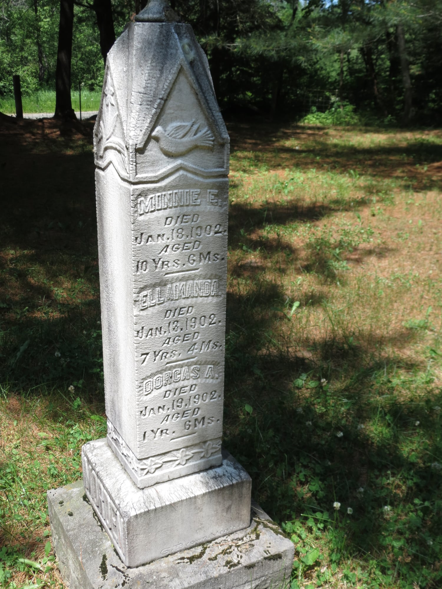
From Highway 518 continue north on the Nipissing Road, a colonization road that opened the vast region to 19th century settlement. Stretching from Lake Rosseau to Lake Nipissing, a dozen ghosted settlements rot along its length. Watch for the Dufferin Methodist Cemetery, which served the settlements of Dufferin Bridge and North Seguin, on the east. Shaded by towering pines, the cemetery is full of markers that speak to those who settled here and the hardships they endured. Among the heartbreaking timeworn headstones is one that belonged to the James and Janie Morden family, who lost six of seven children to a 1902 diphtheria outbreak. Trying to imagine the grief this couple endured in the open-wound days after laying their young ones to rest is almost unimaginable.
Tributes to hard lives of the area's settlers.
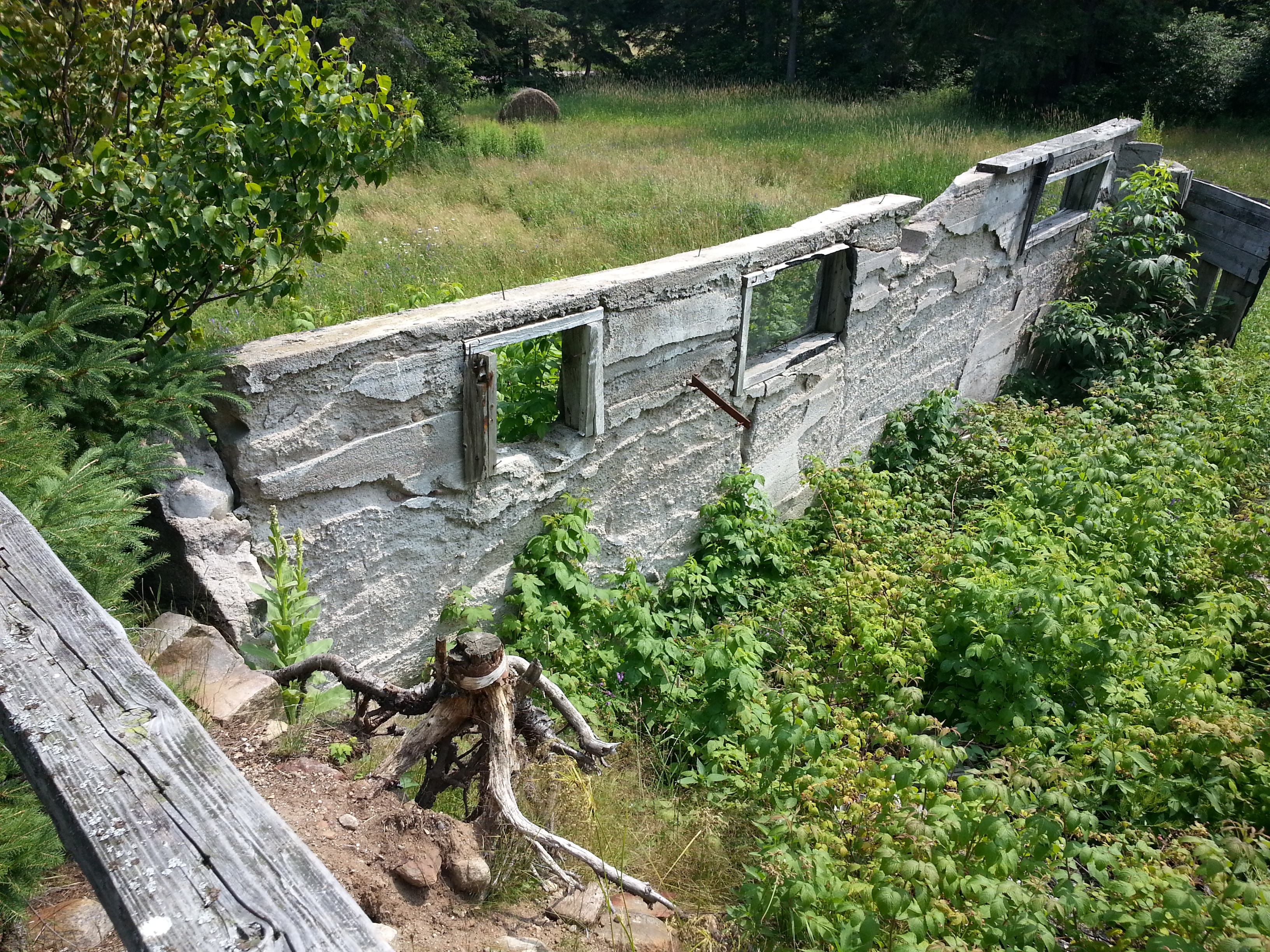
A little further north you will pass through the scattered remnants of the hardscrabble farming village of Spence. There is a one-time school and an Orange Hall, now both private residences, split rail fences, a cemetery, and the foundations of barns. Make a note for your return home to visit Muskoka Heritage Place in Huntsville as its recreated pioneer village includes the Spence Inn, a stagecoach hotel catering to weary travellers.
The Bells were one of the earliest families in Spence. Once one of the more enduring farms in the community, pieces of their homestead still remain today.
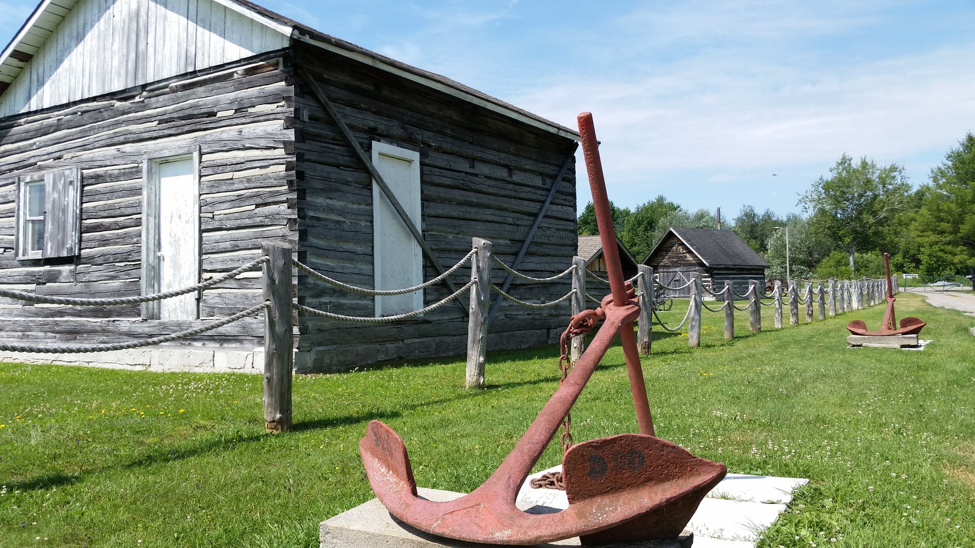
Your next destination is Sturgeon Falls and the Sturgeon River House Museum. Located in a recreated Hudson’s Bay Co. fort, the museum’s immersive exhibits offer insight into the history of the region and its grounds boast several historic buildings.
Located on the west bank of the Sturgeon River, the Sturgeon River House Museum preserves the cultural and natural heritage of the Municipality of West Nipissing.
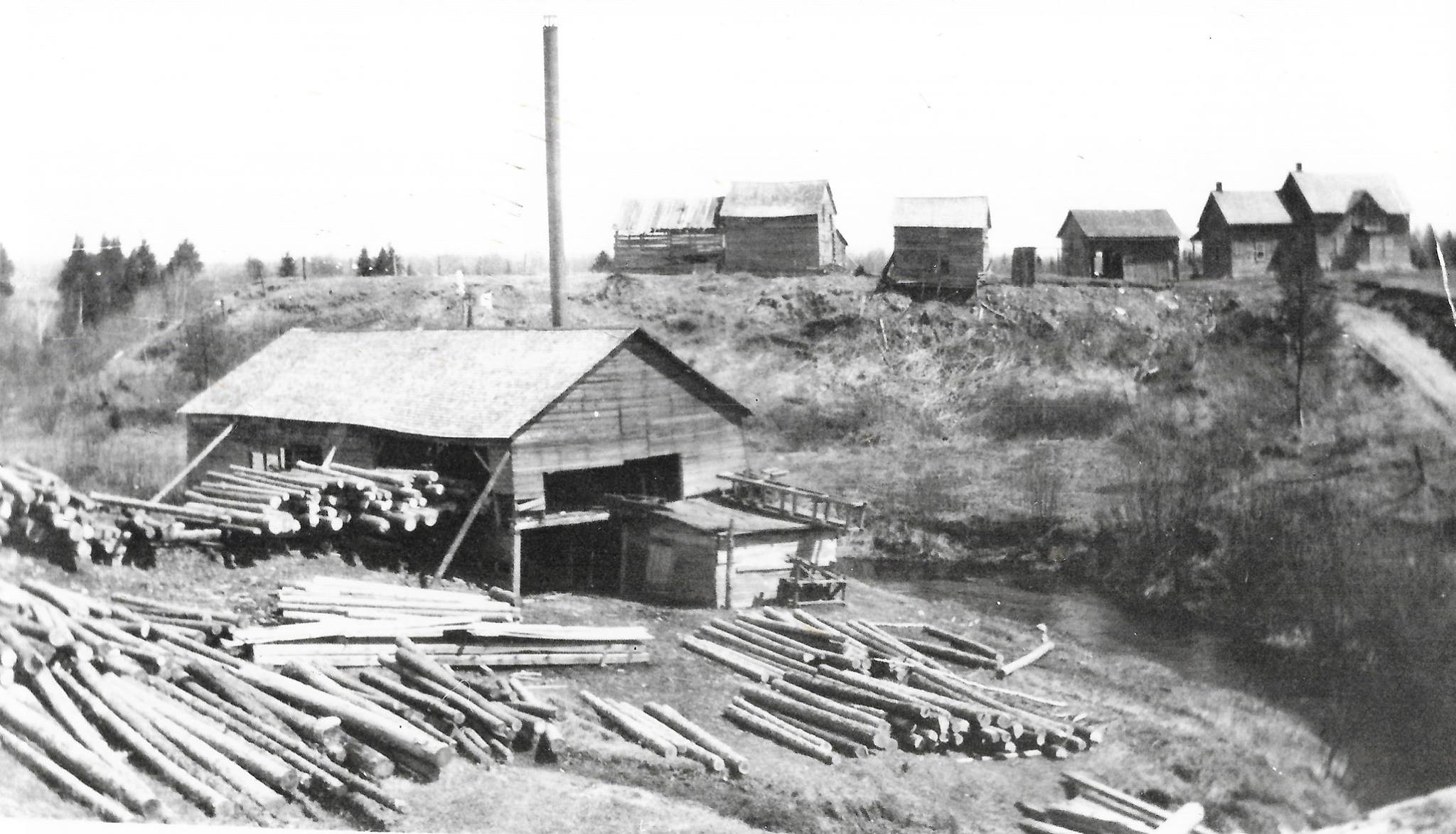
The community began with the vision of Father A.L. Desaulniers, who encouraged the settlement of a Francophone community in the relatively fertile soils north of Lake Nipissing. The community got a welcome boost with the arrival of the Canadian Northern Railway in 1913. The railway built a station and siding at Desaulniers, allowing farming goods to be shipped to distant markets and encouraging the construction of a trackside sawmill. Suddenly, virtually overnight, Desaulniers blossomed.
The Desaulniers sawmill, once a foundation of the now faded community.
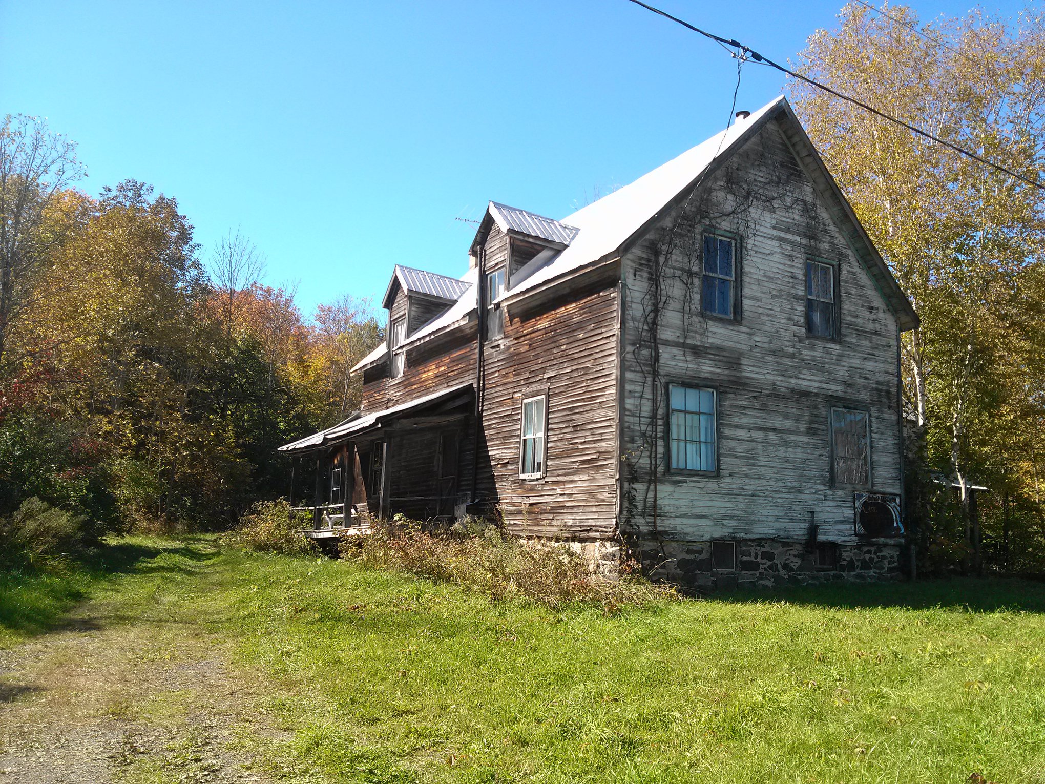
Desaulniers continued to grow. A boarding house sprung up beside the railway station, offering modest but very welcome overnight accommodation. There were two stores, a cheese factory, a church, a school, and railway facilities that grew to include a residence for the stationmaster, homes for section workers, and a water tower.
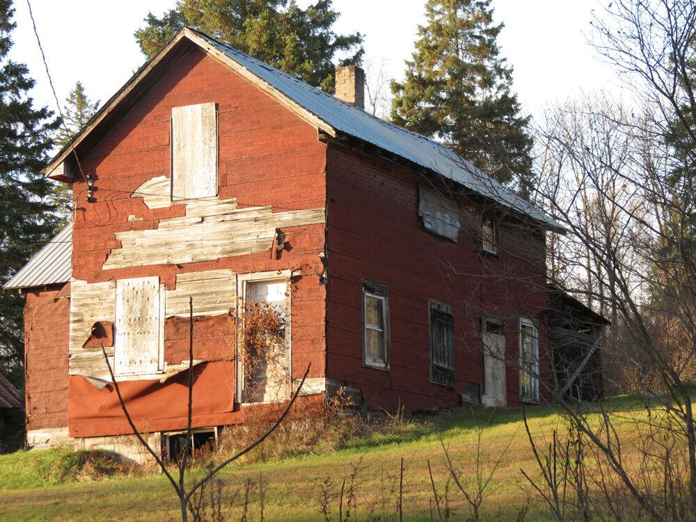
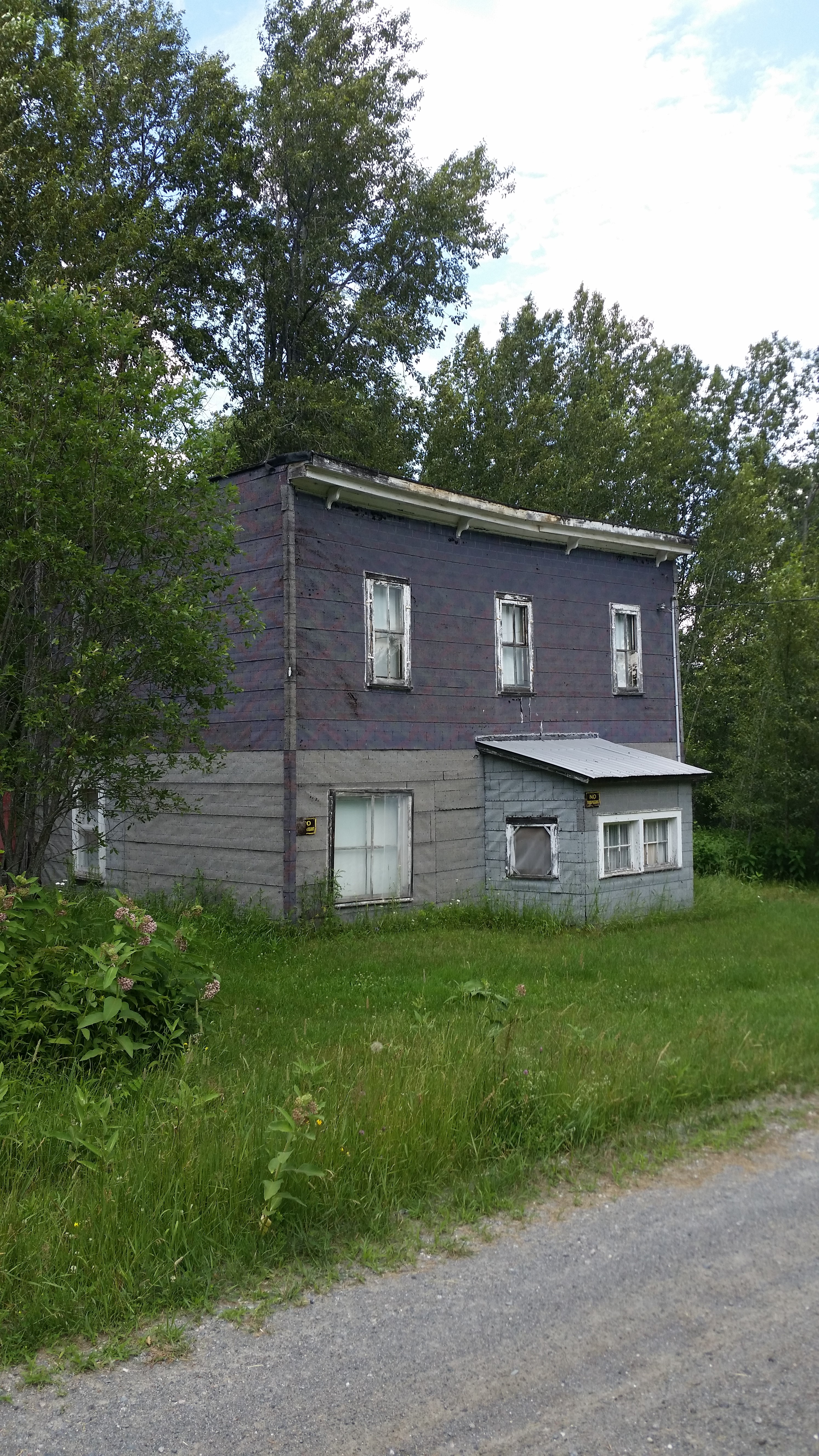
Fortunes sagged in the 1930s. The sawmill was long gone by then, businesses were moving to larger nearby communities, and the farms that were the foundation of the community never quite thrived as Father Desaulniers had promised. The village was floundering. Farm fields were soon reverting to pasture and town lots weeding over. The post office closed in 1960, and the store sign was turned to ‘closed’ not long after. Most of the buildings succumbed to the weight of ages, often slowly, reluctantly, as if unwilling to accept the village is no more.
The remnants of the Desaulniers Hotel and former Main Street, barely a shadow of what they once were.
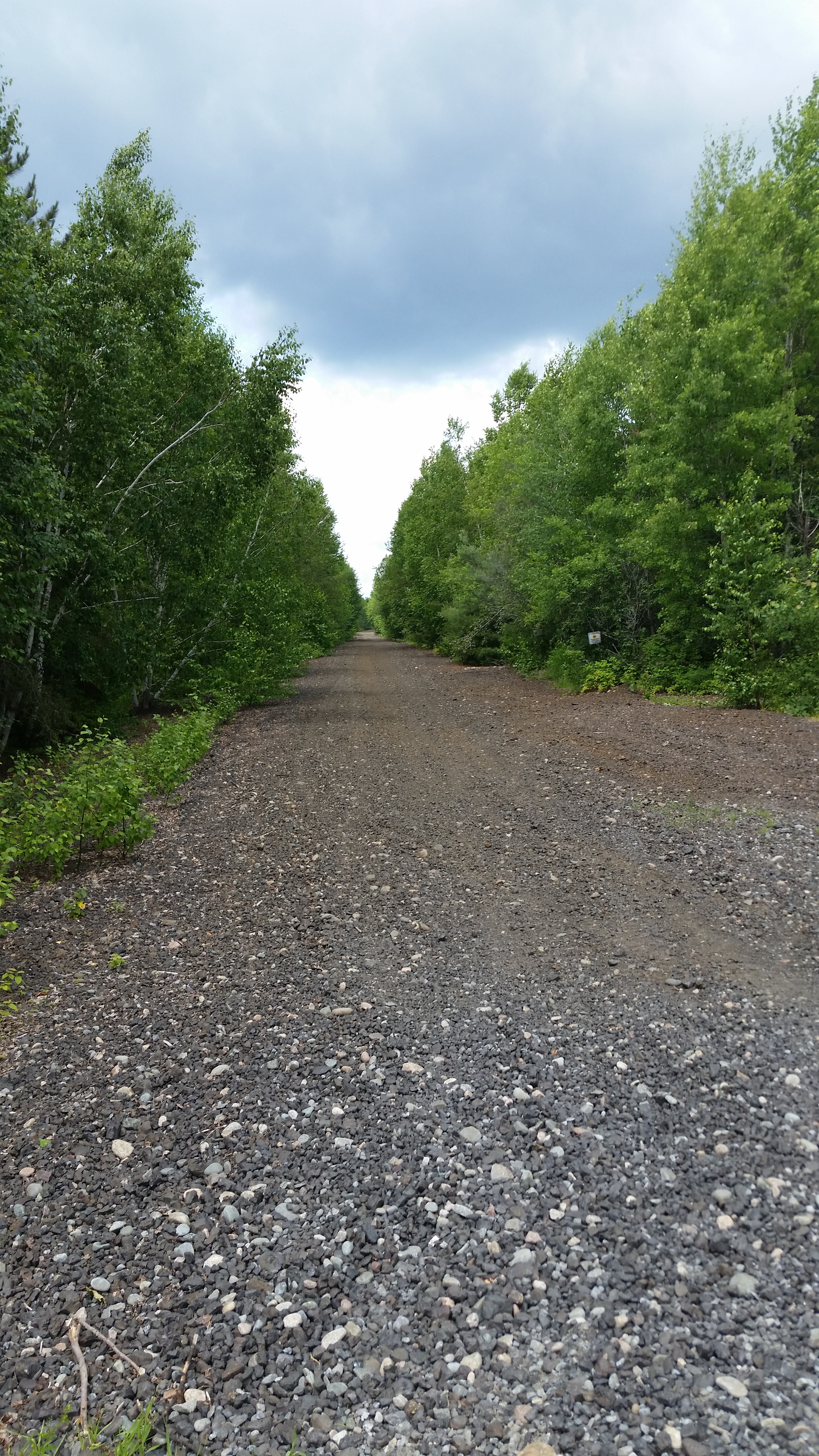
Desaulniers is virtually unrecognizable as a one-time community. What was once Main Street now looks like nothing more than a country laneway. A few period homes remain occupied. The weathered boarding house stands silent and almost mournful. Even the railway tracks have been lifted, the former rail bed now a multi-use recreational trail that extends off into the distance as if reaching to the distant past when Desaulniers was a thriving community.
Location: Milberta Road, just south of North Quarry Road, Kerns Township, NW of New Liskeard.
Much of Ontario’s north is dominated by the impenetrable rock of the Canadian Shield. But there’s an island of fertile soil just northwest of Lake Temiskaming, the Little Claybelt, which attracted land-hungry settlers in the late 19th century. Settlements sprung up. Most were flyspeck hamlets, but Kern Township’s Milberta was an exception, a sizable community – a true village.
The first settlers arrived in 1897. Life was hard; settlers described their existence as seven months of snow, two months of summer, and three months of black flies and mosquitoes. Nonetheless, a village began to slowly take shape. The community was named Milberta by Samuel Hogg, the first to settle the land — Mil comes from the fact he owned a sawmill, and Berta was in honour of his wife, Alberta.
By the first decade of the 20th century, visitors would find a thriving village that boasted Hogg's sawmill, two stores, a blacksmith shop, a hardware store, a butcher shop, a school, a hotel, and two churches. The main street had wooden sidewalks, a sign of a grown-up community.
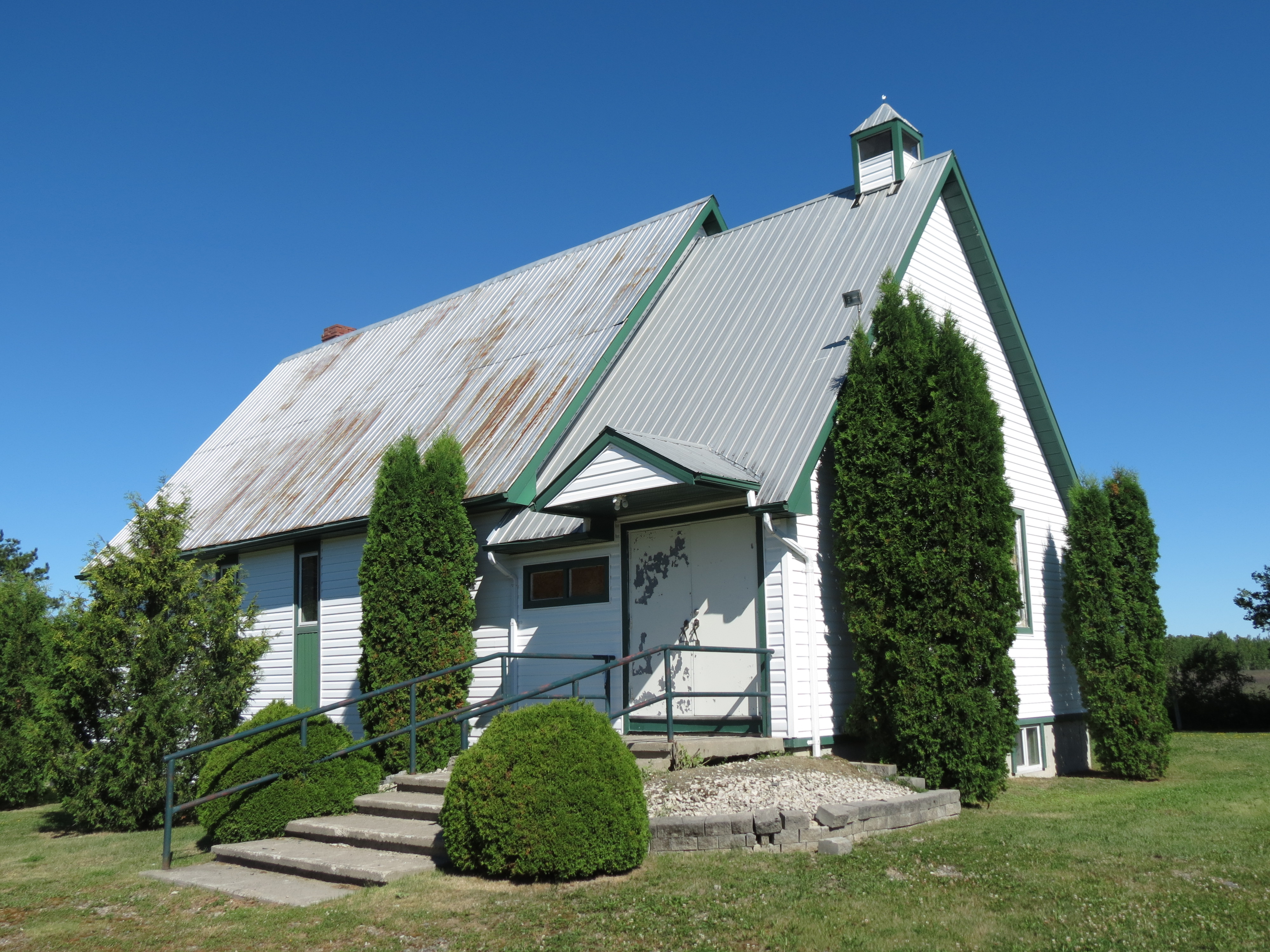
Much of Milberta was razed by the Great Fire of 1922, a forest fire that raged over 18 townships, consuming 1680sq km (650sq miles) of forest and farmland, claimed 43 people and left thousands homeless. It never truly recovered, though the village did endure, at least for a time.
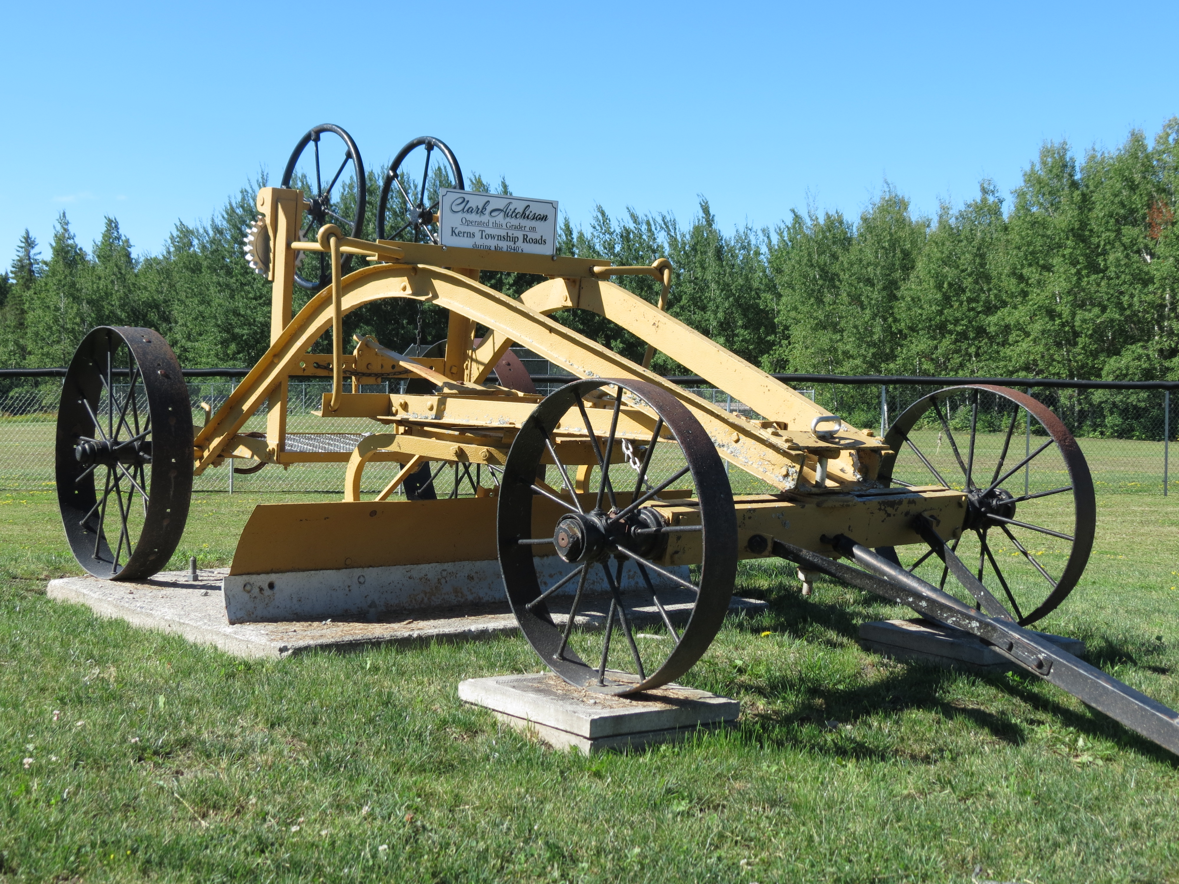
The sole existing building is the Milberta United Church, which survived the fire — congregants would have said it was blessed — and remained in use until very recently. Displayed on its grounds is a vintage road plough. Sadly, the church’s future is currently up in the air and there is a very real possibility that the last vestige of Milberta will soon be demolished.
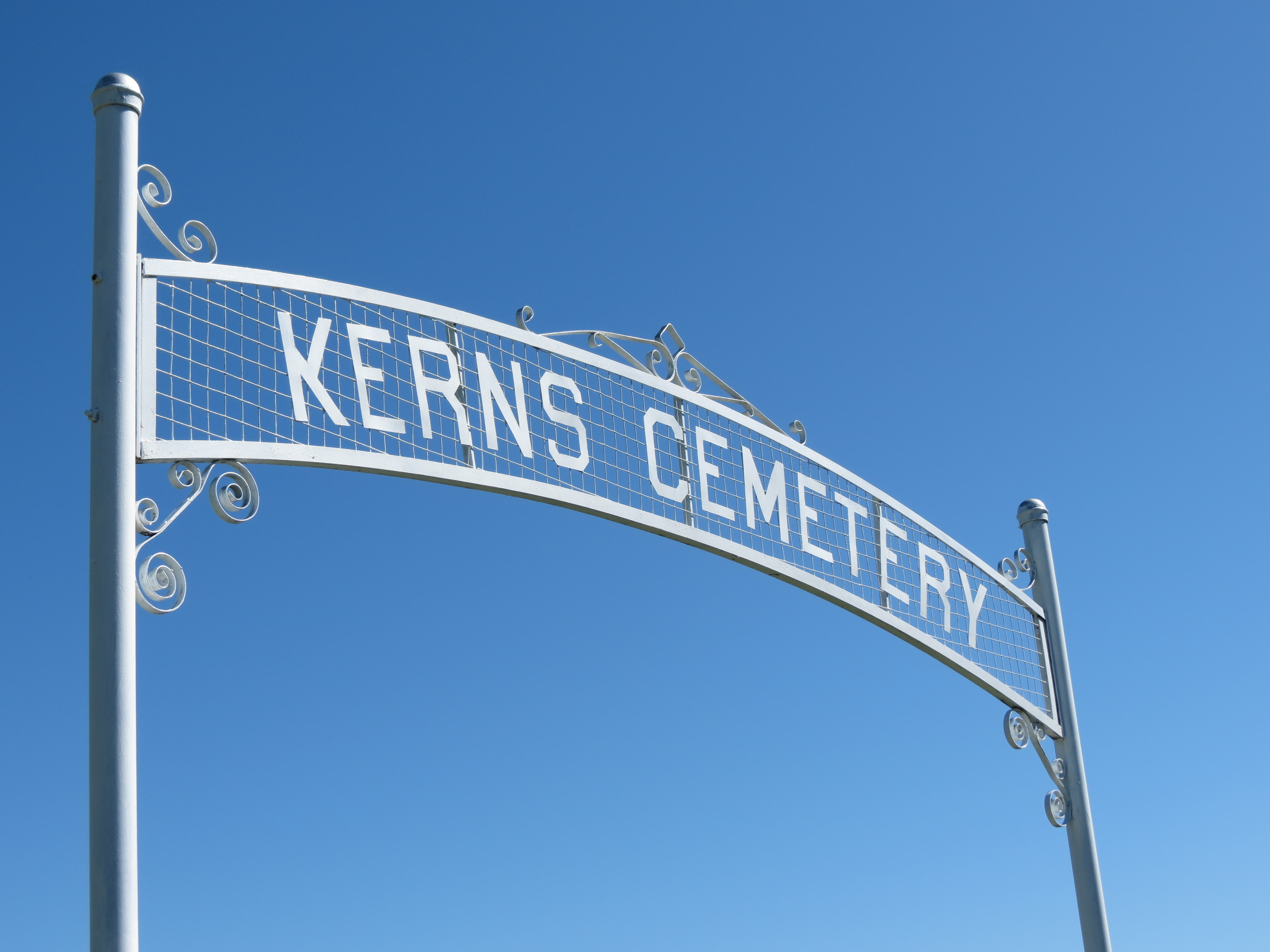
Kerns Cemetery lies to the south, east on Highland Road. It sits atop an escarpment, providing the interred, and those who come to pay their respects, with panoramic views.
The story of the settlement of the Little Claybelt, and hardships faced by early homesteaders, is told beautifully at the Little Claybelt Homesteaders Museum in New Liskeard.
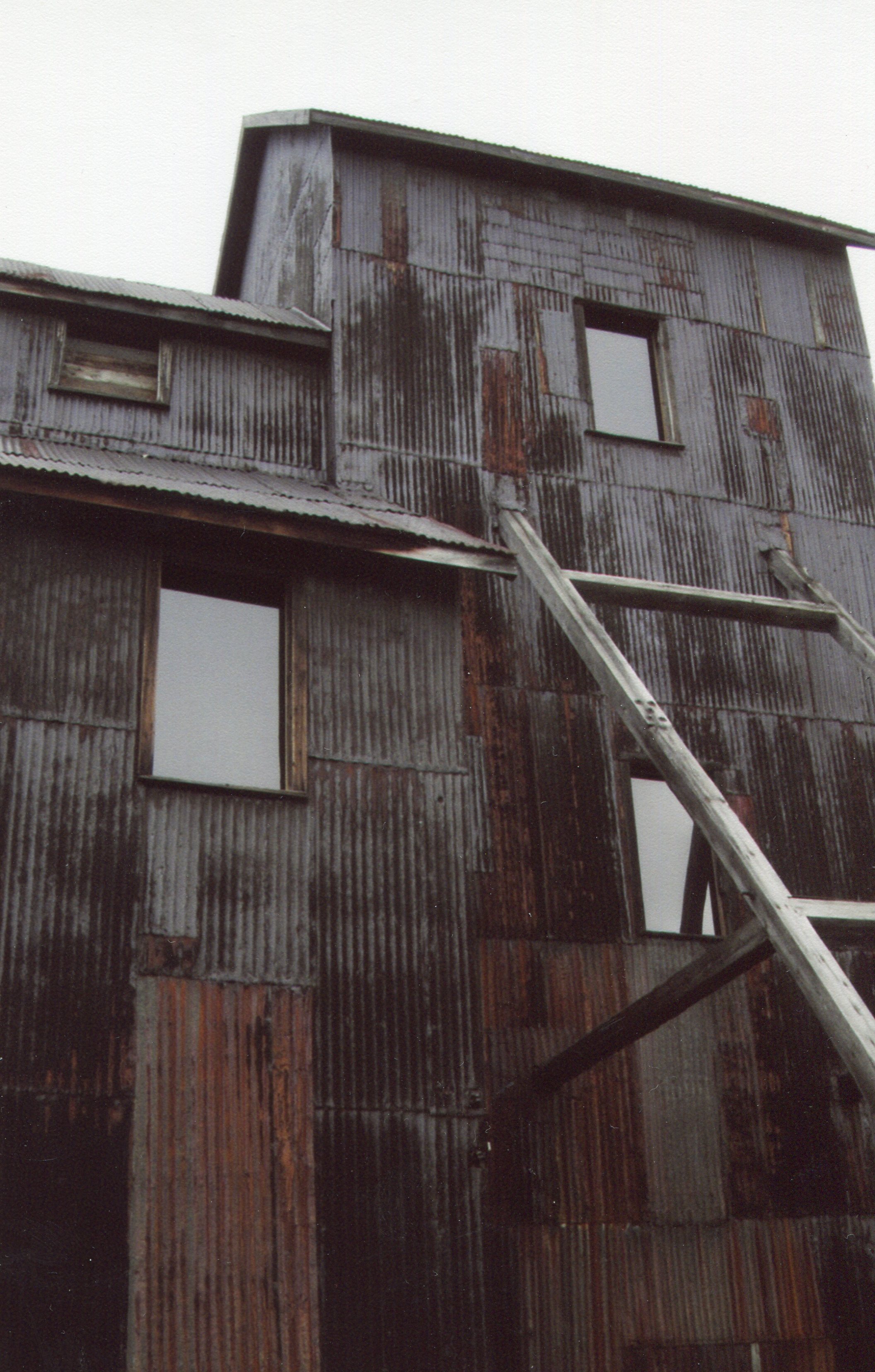
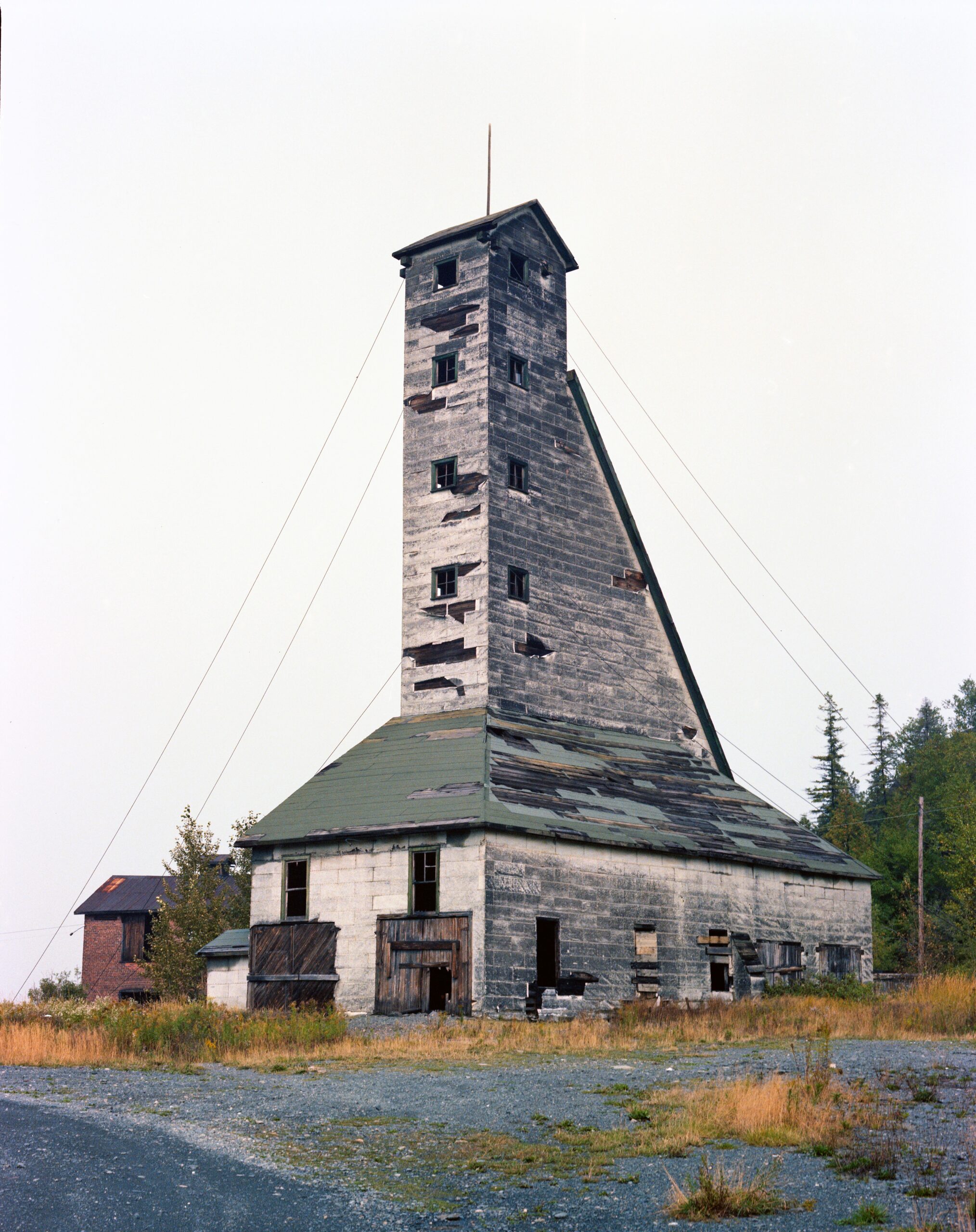
The decaying Right of Way and Colonial Mine headframes, part of the Heritage Silver Trail. Each have their share of local ghost stories and are iconic reminders of Ontario's past.
Andrew Hind is an author and a local history columnist. He has written on history and travel for a number of regional and international publications and lives in Bradford, Ontario.