Old Woman Bay
A Must Stop on Lake Superior
By Greg Sacco


Eighty-five km northwest of Sault Ste. Marie between Pancake Bay and Lake Superior Provincial Park, imagine a natural harbour by a flat grassing field, 26 km across an isthmus to Whitefish Point, the U.S. where history reaches deep. Local conflicts, a fishing community, a graveyard, fur trade, copper diggings, basalt caves, food gathering, voyageur canoes, a Hudson Bay Post, a wharf lined with 6 fishing or ferry services, tourist establishments, a World War ll allied shooting range, a fleet of rescue boats, a lighthouse keeper walking back and forth between the harbour and the Coppermine Point Lighthouse.
All part of the history of a continent where the Great Lakes provided the transportation system to settle North America. What remains at Old Mamainse Harbour is a ghost of the past.
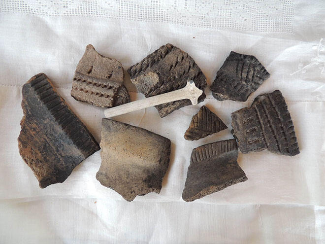
6,000 years ago, Indigenous people started mining copper in the Cape Mamainse area. Today, there is still local mining exploration at the New Mamainse Harbour 7 km north of the older harbour.
In the 1600s, Cape Mamainse and the Coppermine Point Lighthouse were already on maps, defining the Canadian entrance to Whitefish Bay or greater Lake Superior. Voyageurs stopped trading at the local trading post. Travellers took shelter from the conflicting cape winds in the harbour.
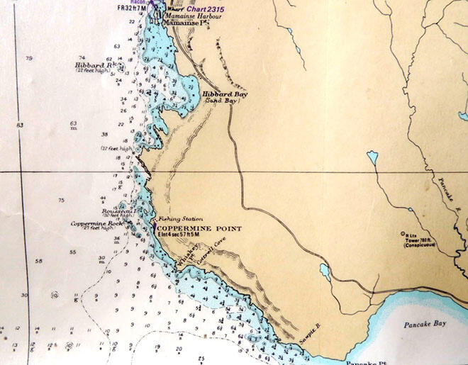
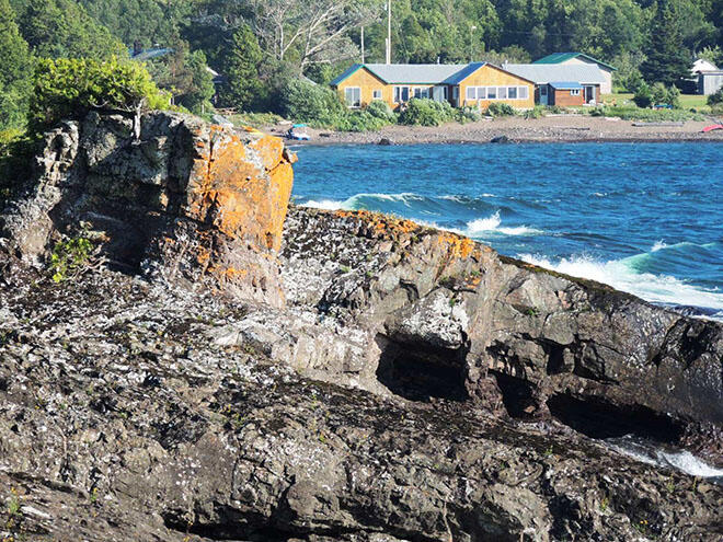
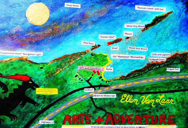
The name "Mamainse" has, at one time or another, been applied to various locations along a rather broad stretch of shoreline between the Pancake River and the Montreal River; more specifically, from Coppermine Point to Theano Point.
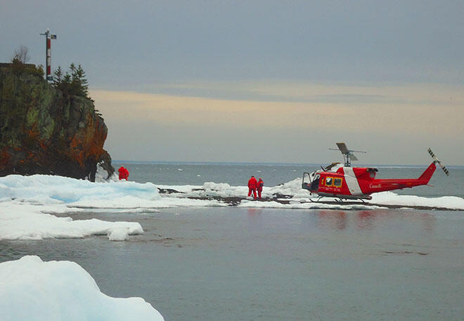
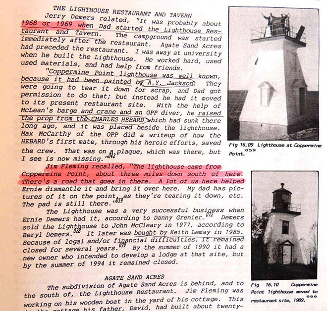
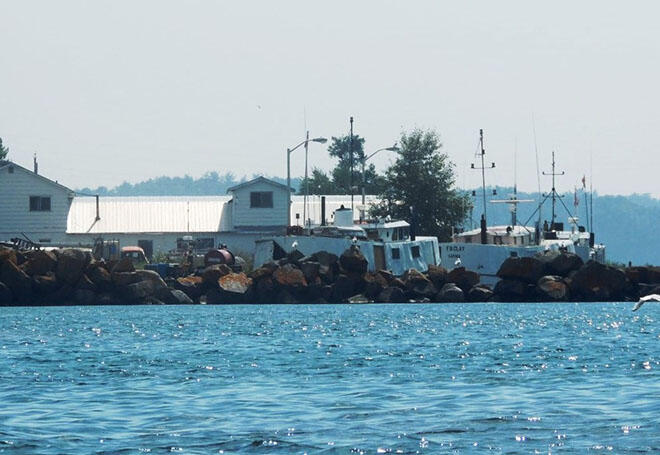
Coppermine Point and Sawpit Bay. Coppermine Point is still sometimes called "Old Mamainse" by oldtimers of the area. The lighthouse at Coppermine Point was a landmark for ships sailing in Lake Superior. That marked the northeast entrance to Whitefish Bay, as the lighthouse at Whitefish Point marked the southwest entrance. Earl Digby stated that the lighthouse at Coppermine Point was changed to automatic at about the time they arrived in the area in 1937. Evan Shanahan said, "There's a small island out at Coppermine Point. The old dock was built right out to the island. The old BATCHAWANA, about 200 feet long, could dock there. The big timbers of the dock are still there. You can see them from a boat."
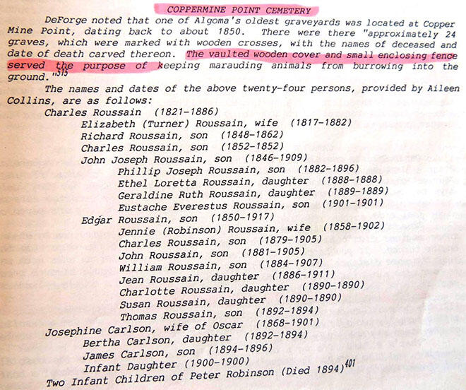
Bodley's restaurant...That was the only tourist place in the area when we were there in 1946. The old cemetery....They had it fenced off a while. Vance Hart related, "When Jack Bearden used to guide for Art Bodley I used to go up and fish with him frequently. Bodley had a little white picket fence around the cemetery there, whitewashed every year." (Steer, 1995)
Source: Superior's East Shore: Mamainse to Gargantua, Chapter 16, Mamainse Area
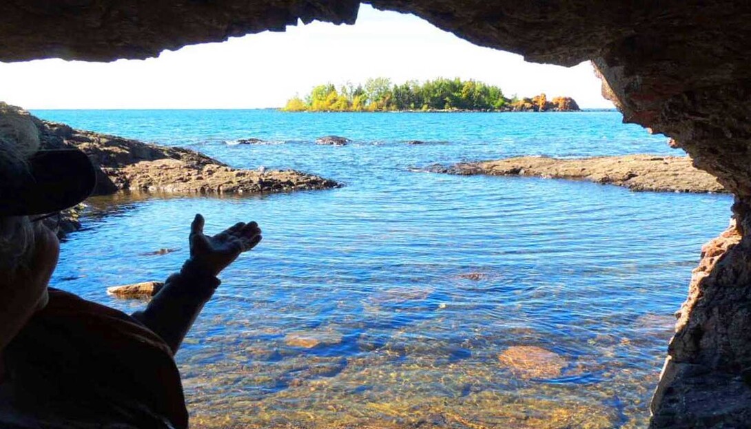
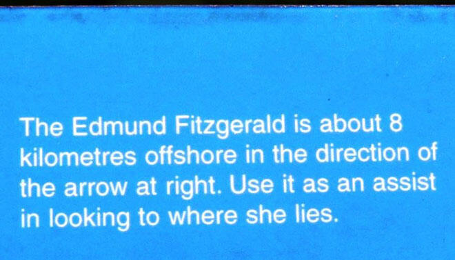
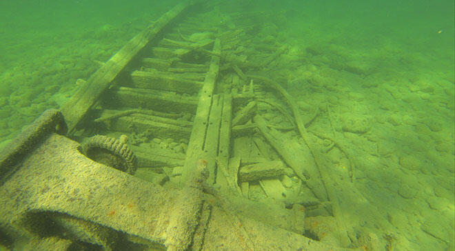
The Lookout Trail at Pancake Bay Provincial Park illustrates a glacial esker exposing the harbour land as glacial waters receded 5,000 years ago. Therefore there are many artifacts in the area. The park trail also provides information about the demise of the shipwreck, Edmund Fitzgerald, 8 km off the coast. The ship wreckage and lifeboats washed ashore on the Canadian side.

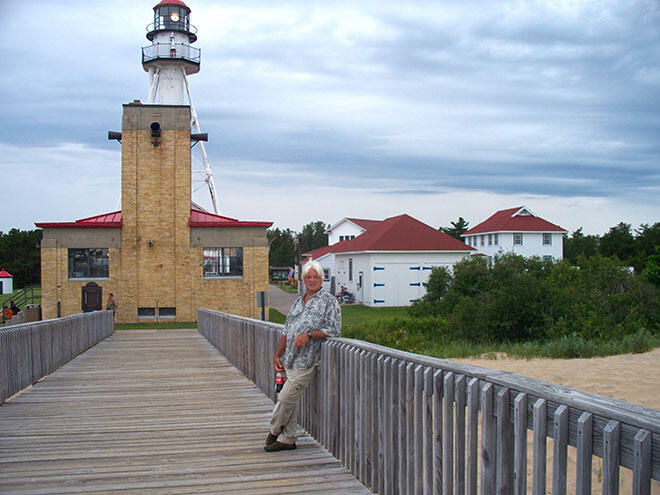
As the counterpart to Cape Mamainse, the U.S. Whitefish Point hosts a Shipwreck Museum that commemorates the wreck of the Edmund Fitzgerald. There is also a bird sanctuary and a lighthouse display, making it a very important tourist attraction. Yet, the same birds, history, navigation light, and shipwrecks also grace Cape Mamainse on the Canadian side.
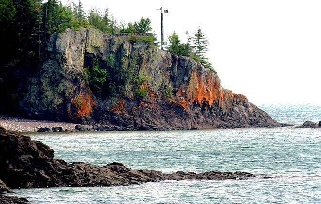
The Canadian side is so forgotten that it hardly has a name anymore. Locals and tourists are confused about where Mamainse Harbour and the lighthouse are located. Why is this? Well, the lighthouse structure was moved up to Hibbard Bay and the Fishery relocated to a new location, 3 km north of Old Mamainse. The old wharf is a ruin and the many shipwrecks are unmapped. The Hudson Bay Trading Post, graveyard, old mines, and townsite have been largely lost to the concerns of private land ownership and modern life.
Clip from the Don Steer book indicating that tour boats used to stop in at Old Mamainse Harbour harbour twice weekly:
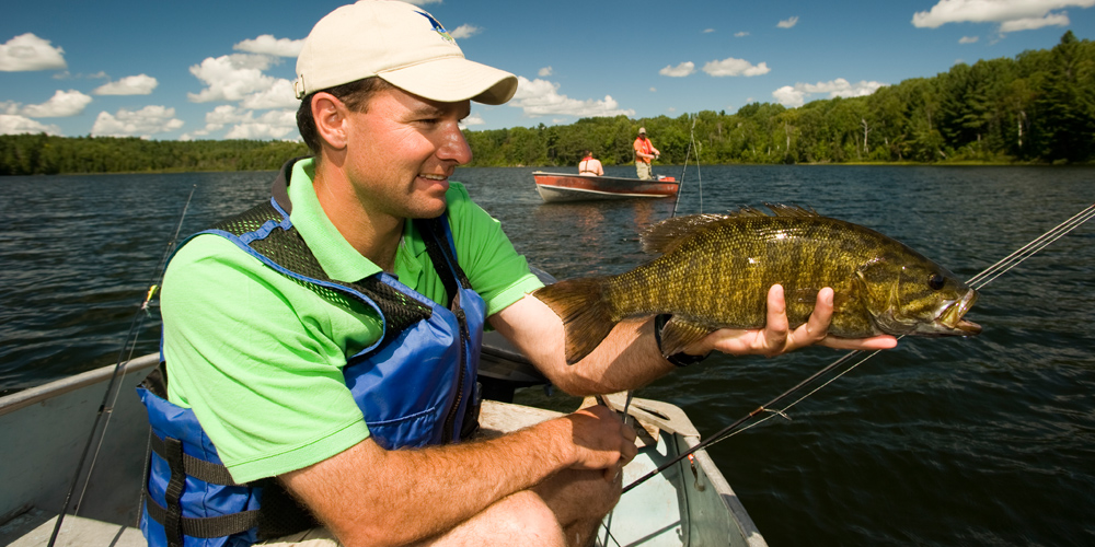
Early tourism. Of the people who traveled for pleasure to Lake Superior's east shore, recreational fishermen constituted by far the largest group. Hunters, sailing yachtsmen, and sightseeing tourists were also to be found, however.
In 1924 a traveler wrote in the Sault Star about a trip by water from the Sault to Point Mamainse. "The proposed new trunk road along the north shore of Lake Superior would, of course, take you to Point Mamainse and would be a delightful highway to travel on for those who wish to be close to nature, but for wonderful panoramic views nothing surpasses a trip by water, and the trip from the Sault to Point Mamainse in Roussain's launch will afford the traveller such a pleasure....The original Point Mamainse, now known as Copper Mine Point, is 17 miles across the (Michigan's) Whitefish Point.... A lighthouse, equipped with gas a year ago, is situated here.... Passing Copper Mine Point, the launch goes four miles further north to Mamainse Habour, the end of its journey. Roussains' launch makes two trips a week during the summer months. It is a six hours' run from the Sault to Mamainse, and if the weather is favourable is a most enjoyable voyage." (Steer, 1995)

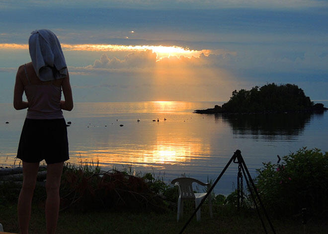
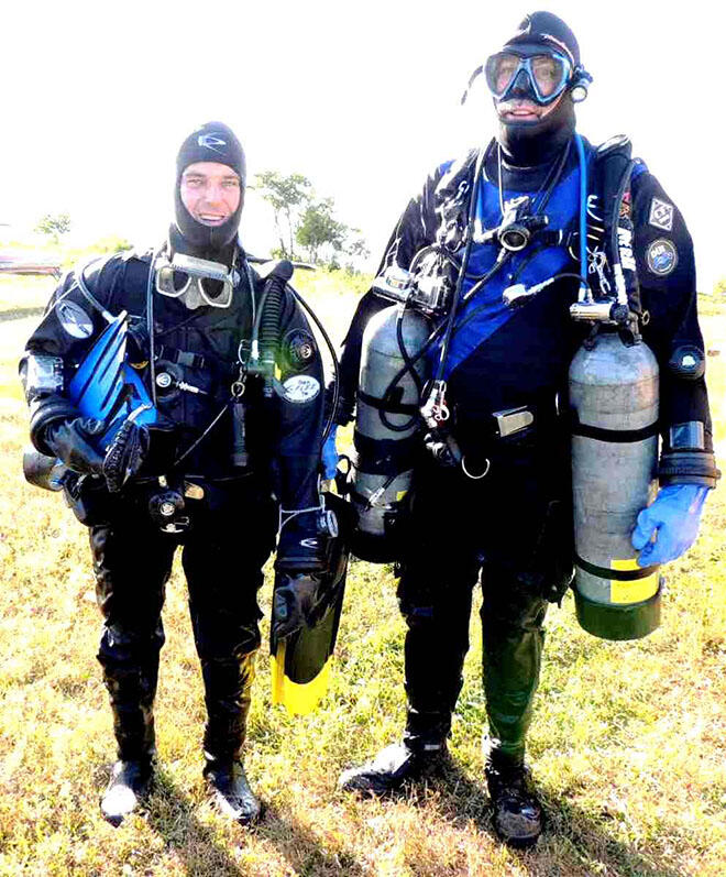
There is currently renewed interest in studying the archaeology, rocks, edible plants, shipwrecks, history and art of the area. Ideas abound including creating a history trail between Sault Ste. Marie and Gargantua. A small craft water trail is planned along the Lake Superior coast by the Lake Superior Watershed Conservancy. Artists have renewed interest in the area as the Group of Seven painted many of their iconic Canadian landscapes nearby. Divers are currently mapping the many shipwrecks. As one of the most beautiful areas in North America, the area boasts: water, rocks, mountains, coastal trails, wild foods, deep history, boating and parks.

Reference material:
Steer, D. (1995) Superior's East Shore: Mamainse to Gargantua, The Author
Great Lakes Heritage Coastline material Peter Burtch