
Ontario Bike Law
Know your rights and responsibilities.
By Ian Merringer


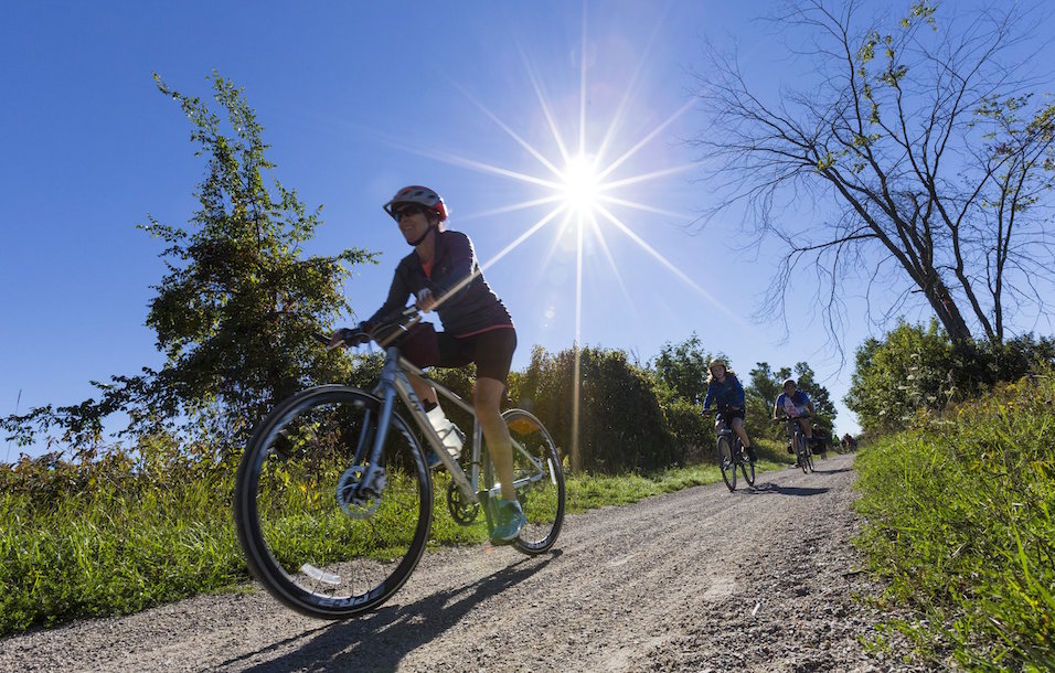
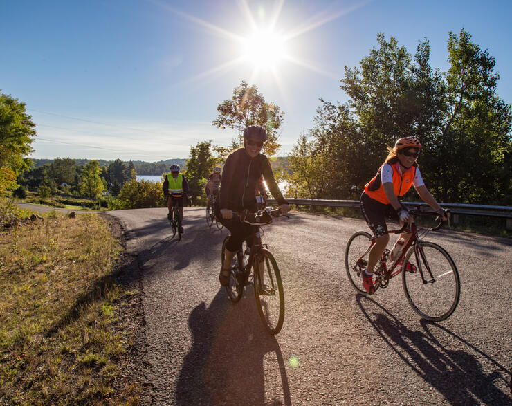
Do you want to know the secret to finding the best cycling routes in Ontario? Find out where the locals ride. And it's easier than ever with the fitness tracking app, Strava, available on iOS and Android. The app offers users a number of ways to discover what routes are popular with local cyclists in regions across the globe.
One way is to search for cycling clubs in an area you’re interested in. Hit the “Explore” tab, select “Clubs,” and then type in the location. This will populate a list of clubs in the area. Once you’ve found a club, you can explore members’ public profiles to see what routes they’ve ridden and towns they have explored, or you can toggle over to the “Recent Activity” tab and view the routes members have most recently completed.
The second option is to search by segments. Segments are portions of a route that have been marked by users for the purpose of comparing times, either with themselves or with other athletes. Once again, hit the “Explore” tab, select “Segment Search,” and then input the area you are interested in. This will populate a list of segments in the area. Select a segment to view a list of users who have completed said segment. From there, simply select the date a certain user rode the segment to view a map of the user’s full route.
The third—and best—option is to read this article. We’ve compiled the best Strava cycling routes in Ontario so you can ride in some of the prettiest locales and on the most interesting paths the province has to offer.
83.4 km | Elevation 721 m
https://www.strava.com/routes/2741013103736263622
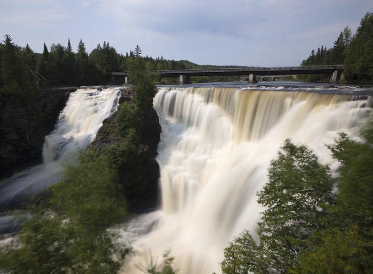
Kakabeka Falls is the highlight of this ride near Thunder Bay. Referred to as the Niagara of the North, the largest waterfall in the Lake Superior watershed stands at 40 m high and resides in Kakabeka Falls Provincial Park. The scenery on this ride is mostly farmland, which is unusual for this area since there isn’t much agriculture on the north shore of Lake Superior. The posted ride starts on Oliver Road, which runs east-west a few kilometres north of Hwy 11/17. We recommend riding this route counter-clockwise (route is shown as clockwise) .
If you want to grab some food before the ride, there is a Tim Hortons and a Subway restaurant at the intersection of Oliver and Golf Links Road. The first town enroute to the falls is Murillo. There is a small convenience store, Valley Foods, here if supplies are needed. As you come towards the end of Oliver Road and head into the small town of Kakabeka Falls, the road is extra-wide with lots of room for cyclists and vehicles. The town is somewhat limited, but has a variety of gas stations and a few restaurants. Continue on the park road past the gatehouse and over the bridge that crosses the river a little above the falls. There is a park building on the left with some picnic tables and bike racks. There is also a water filling tap located at the trailhead of the Mountain Portage Trail and washroom facilities. The rest of the loop is fairly remote with few options for rest stops, so make sure to fill up here.
Be sure to stop at AJ’s Trading Post on Hwy 61 as you head back towards Thunder Bay. This is a popular roadside eatery that has everything from deli sandwiches to homemade pizza. If you don’t want to ride the 83-km loop, you can opt to do a 60-km out-and-back ride to Kakabeka Falls.
Rollin’ Thunder
Fresh Air
Community Spokes
Petrie’s Cycle & Sports
AJ’s Trading Post
Bean Fiend Cafe
46.1 km | Elevation: 284 m
https://www.strava.com/routes/2741039202620586932
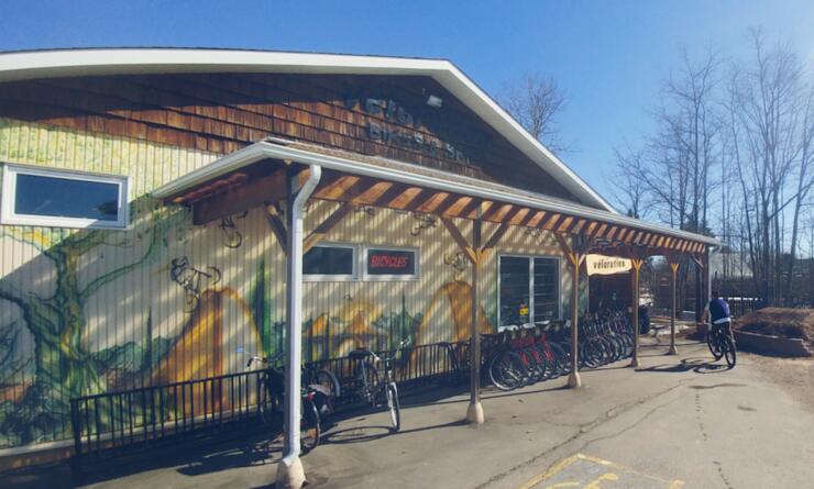
Referred to by locals as “The Lines,'' these popular roads have great scenery, good climbs and low-volume traffic. Spectacular waterfront views and forested areas make this route popular with local cyclists. The ride can start at any location on the map, but most locals start from Velorution bike shop, located at the intersection of Garden River Road and Second Line East (north of Queen Street East, not shown on the route as a starting point). You can grab a coffee, donuts and any bike essentials here before heading out.
The route is a combination of paved trails and roads with a wide paved shoulder. From downtown, ride towards the water and head west on Queen Street East before linking up with the Hub Trail system. This 25-km, multi-use trail connects all the key areas of the city and community. Clergue Park is a scenic photo op location along the waterfront on your way out of town. As you head north out of the waterfront area and west out of town towards Second Line, the roads quiet down.
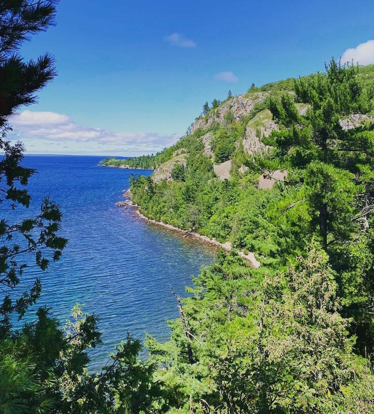
Once you are on Second Line heading west, you have the option at Town Line Road to keep going on Second out to Gros Cap Bluffs. This out-and-back adds some kilometres to the ride, but is well worth the effort. You’ll be able to stop and take in some beautiful views out over Lake Superior from this location. After you’ve taken some time for rest and reflection, make your way back to town via Third, Fourth and Fifth lines until you reach Landslide Road. There are some good climbs and popular Strava segments on the lines roads.
Head south back towards town on Landslide. OutSpoken Brewing is a popular post-ride stop and is located right beside Velorution. This local watering hole has great nachos and a selection of beers.
Vélorution
Algoma Bicycle
Duke of Windsor Sports
OutSpoken Brewing
Elliotts Ice Cream
49.5 km | Elevation: 393 m
https://www.strava.com/routes/2742805356166531934
The posted loop starts in Bonfield but could also start in Callander and be ridden in either direction. Bonfield is limited for restaurants, but has some beautiful waterside parks if a picnic lunch post-ride is on the agenda. The road between Callander and Bonfield is part of the famous Voyageur Cycling Route. There are plenty of options for additional loops or extensions beyond Callander to North Bay. Scenic, rolling roads follow the north shore of Lake Nosbonsing to Lake Nipissing—providing plenty of beautiful lakeside views on this spectacular route.
Callander has a great waterfront area with a large pier and a vast selection of restaurants considering the size of the town. 1886 Lake House Bistro in Callander is a bike-friendly restaurant with good vibes. There is also a new chip stand at the corner of highways 94 and 654, which, according to tourists, “is not your average fork’n chip stand” (the restaurant is called The Fork Chip Stand).
Cyclists can add more miles onto the loop by biking up to North Bay via Corbeil. The ride can also start in North Bay and be ridden in both directions. Kate Pace Way is also part of the Voyageur Cycling Route and is a paved trail along the shores of Lake Nipissing.
CycleWorks
Cheapskates
Wheelhouse
1886 Lake House Bistro
The Fork Chip Stand

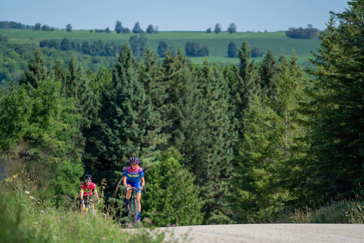
64.6 km | Elevation: 1,052 m
https://www.strava.com/routes/2740999734543481550
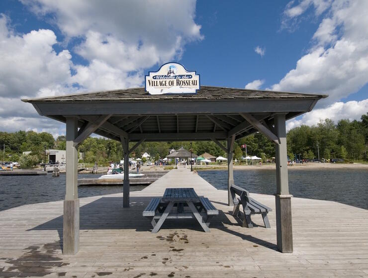
This is a classic Muskoka ride. This loop is perfect for cyclists looking for rolling terrain and challenging climbs with lots of rest stop opportunities. Endless lakes, lush forests, quaint lakeside towns and the rugged granite of the Canadian Shield granite make this an epic ride. Do not underestimate the distance—this ride will feel longer due to the punchy climbs. The loop can start at a variety of locations and be ridden in either direction. The loop linked here begins in the town of Rosseau. We recommend getting an early morning start as Peninsula Road and Hwy 118 can be busy at peak times of the day.
The roads in Muskoka are winding and hilly, so riding single-file is essential for this terrain. There are plenty of opportunities to stop at quaint general stores, waterfront parks and interesting cultural heritage sites along the way. Visit the famous Port Carling Wall—the world’s largest (at the time it was unveiled in 2005) historic photo mosaic mural, measuring 111 ft by 45 ft in size and comprising 9,028 photos. Then grab a sandwich at York & Mason to experience what it’s like to eat the best sandwiches ever.
Rosseau General Store is a popular spot, selling everything from hardware and tools to home-baked bread and pies—it’s also the site of the occasional celebrity sighting. There are washrooms and picnic tables at the Rosseau Waterfront Park just down the hill from the store. If you happen to be riding on a Friday, swing by the Rosseau Farmers Market where you’ll find food, live music and plenty of high-end vendors.
Port Sandfield is another interesting rest stop.The swing bridge into this hamlet is the divider between Lake Rosseau and Lake Joseph. Make a pitstop at Silver Stream Farms to pick up some fresh produce or baked goods, or sit on the docks at the Port Sandfield Marina and watch the boats go by.
Ecclestone Cycle
Muskoka Bicycle Pro Shop
The Bike Shop
Parry Sound Bikes
Trysport
Rosseau General Store
York & Mason Cafe
64.6 km | Elevation: 1,052 m
https://www.strava.com/routes/2743960904585316336
This ride is a local favourite and departs out of the old ship-building town of Collingwood, Ontario. Once you get out of town, there is a long climb up the Pretty River Valley that winds through Pretty River Valley Provincial Park and ends at the small community of Rob Roy. Pace yourself on this climb; it can take anywhere from 16 to 30 minutes to summit. Once at the top, the road flattens out as you approach the hamlet of Badjeros. There are more horses and buggies on this road than cars as you enter Mennonite Country. A good halfway rest stop is at Valentine’s Store & More in Badjeros. They have made great efforts to cater to cyclists with a large bike rack, washroom facilities and an outdoor gazebo area.
After leaving Badjeros and crossing Hwy 124, you’ll come to a spectacular long, windy descent into Maple Valley where you’ll find the artist community of Dunedin. The road winds through the valley between the Mad and Noisy rivers. Keep an eye out for Noisy River Provincial Park, a non-operating park with a series of hiking trails, on your right.
While the official route takes a left after you cross the Mad River, we recommend continuing east for 500 m to the quaint village of Creemore. There is a rich history in Creemore and many historical landmarks to visit. Old-fashioned shops, tree-lined streets, art galleries and stately historic homes make up the downtown area. Visit the famous Creemore Springs Brewery and ride by one of Ontario's smallest jails.
The ride back to Collingwood via Riverside Drive/Concession Road 6 is relatively easy with rolling hills that flatten out once you are past Hwy 91. The last 4 km is a well-maintained rail trail, known as the Clearview Collingwood Train Trail, that takes you back into Collingwood.
Kamikaze Bikes
Little Ed’s
Squire John’s
Valentine’s Store & More
It’s easy to plan your cycling adventure with the fitness tracking app, Strava. Download it and start exploring the best cycling routes in Ontario.