Crossing the Border into Northern Ontario by Car? Read this.
A complete guide to crossing with confidence
By Northern Ontario



Most road trips are centred around well-known, touristy highlights: the signature attractions for which places are known. But perhaps you want something a bit weird and wonderful. If you're willing to drive deeper into nowhere for an adventure sprinkled with the unusual, Northern Ontario has plenty to offer.
There are enough places that are charmingly uncanny across the north to fill a book. We’ve selected half a dozen of the best to fuel your imagination.
Pile into the car, buckle up your seatbelt and explore sites of delightful weirdness. Visit Northern Ontario’s…Stranger Places.
The moon is bright in the night sky, hanging like a lantern over the Northern Ontario forest. Something rustles the trees even though the night was still. Suddenly, an object glowing brighter than the moon appears over the swaying trees. Saucer-shaped, it hovers. Your body trembles. An ear-splitting crackle replaces music on the radio. The saucer hangs motionless above. And then, flying impossibly fast, it disappears into the night sky. The encounter lasts but a few moments but will be burned into memory like a brand.
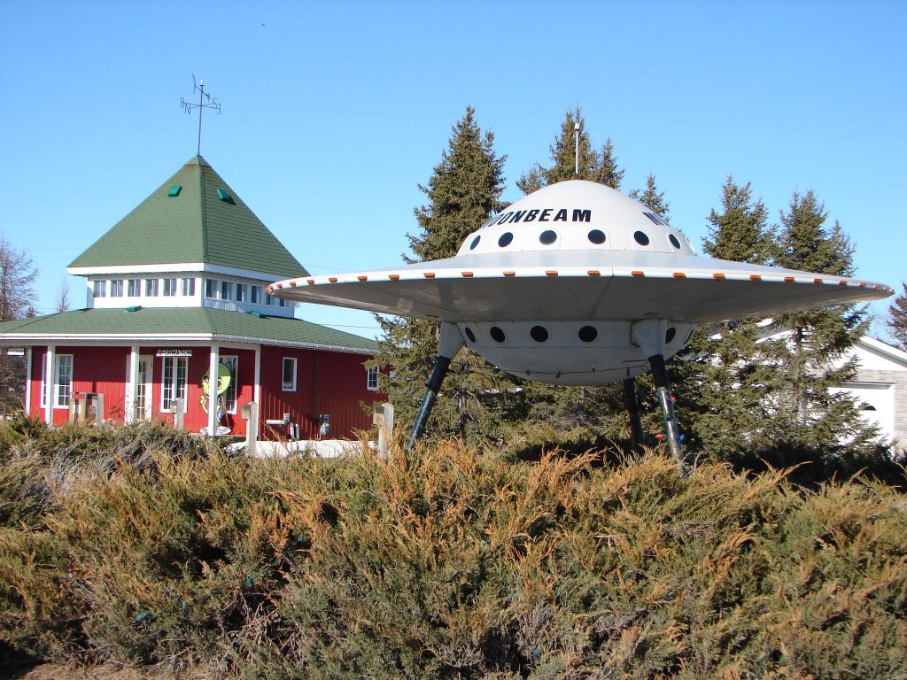
Encounters just like this occurred on numerous occasions around the town of Moonbeam throughout the 1960s and 1970s. Then, just as quickly as eyewitnesses claimed the saucer disappeared, the reports stopped—the saucers were gone, back to whatever orb in the cosmos they originated from.
To commemorate this rash of close encounters, encounters which put Moonbeam on the map for a couple of decades, the town erected a roadside replica flying saucer measuring 2.7 metres high and 5.5 metres in diameter. It quickly became a popular photo op for people driving along Highway 11. The Moonbeam Visitor Information Centre sells all manner of alien-themed merchandise, much of it depicting the town mascot Kilo, a cute Martian.
Incidentally, the name Moonbeam has no paranormal connotation. When people settled the region in the early 1900s, they called the northern lights flashing in the sky “moonbeams.” When a town was founded there in 1922, Moonbeam seemed a natural choice for the name.
For centuries, people from across North America have claimed to stumble upon massive hominid footprints pressed into the ground or even to catch fleeting glimpses of a hairy bipedal figure, manlike and yet not a man, striding through the wilderness. For just as long, people have debated whether Sasquatch exists.
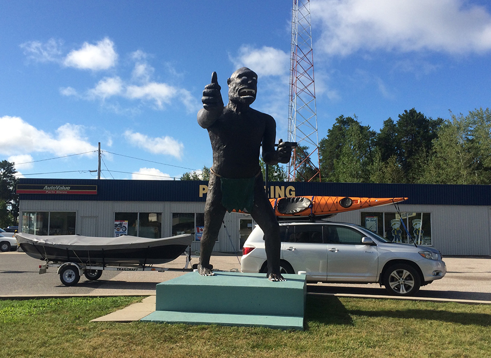
The people of Vermilion Bay know Bigfoot is no myth. They see it all the time along Highway 17, thumb out, trying to hitch a ride. This Bigfoot is, of course, a statue—a 20-foot-tall, 3-ton landmark that has become almost iconic to the small town.
Much like the Sasquatch of folklore, the statue is something of a mystery. It was moved to its present site in 1982 as a marketing gimmick by businesspeople before eventually being gifted to the community, but its origins are clouded in whispered rumour. It was said to be crafted by a local, but who that person was and why his identity has remained a secret is unknown.
What we do know is that the statue has become a popular tourist attraction. It's often dressed up in various outfits to add further levity; no one takes it too seriously.
As for the real Bigfoot, it may indeed be out there, lurking in the woods of northwestern Ontario, elusive and enigmatic.
At first glance, the Manitou Islands seem beautiful, but benign—a group of five small islands rising from the waters of Lake Nipissing, the largest only a few hectares in size. But according to legends dating back countless generations, there’s more to the Manitou Islands than first meets the eye. Much more.
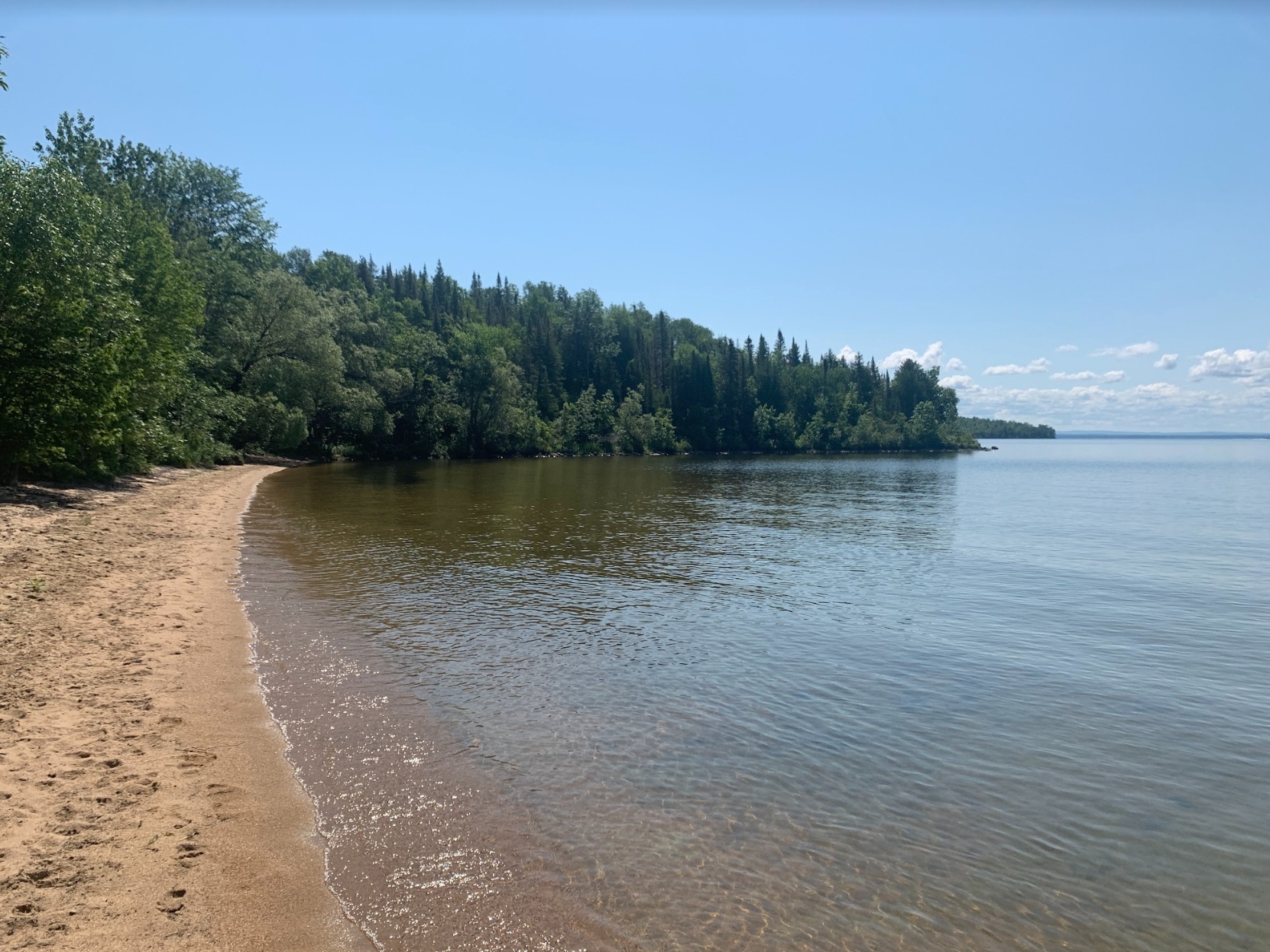
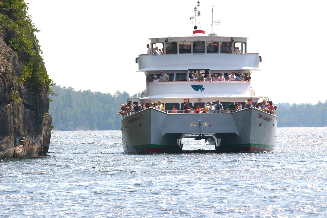
The Manitou Islands are a place of deep spiritual significance, and they're steeped in legend. Some call them haunted. Others call them cursed. Even the popular cruise ship Chief Commanda II maintains a respectful distance as it sails past.
The name Manitou comes from the Anishinaabemowin word manidoo, generally translated as 'spirit' or a sacred, mysterious power. Legends of the region tell of restless ghosts and islands no one could ever live on.
One story tells of how a young Nbisiing Anishinaabeg maiden fell in love with an Iroquois man, even though the Iroquois were the enemy of her people. The lovers carried on a secretive affair but eventually were found in each other’s arms. The Iroquois man was taken captive and sent to the Manitou Islands to be burned alive, with the girl a forced witness. Rather than live alone in misery, she instead chose to die with her beloved by throwing herself into the flames.
After that, the Nbisiing Anishinaabeg people gave the islands a wide berth, believing that the lovers wandered the shores as restless spirits. Some say the agony of the tortured souls twisted and corrupted the islands themselves. Many mysterious events have occurred on or around the islands over the years, including the appearance of apparitions and strange lights glowing in the water, so there may be some truth to the tale.
Some people even believe that there are subterranean caverns beneath the islands of Manitou Islands Provincial Park and that they are home to Lake Nipissing’s own lake monster.
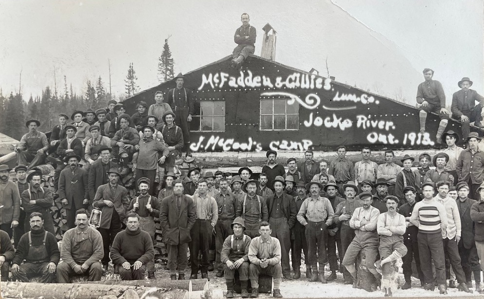
The Jocko River, located within Jocko Rivers Provincial Park in northeastern Ontario, is a tributary of the Ottawa River that courses through picturesque wilderness. The waterway, once a logging route, has become popular with outdoor enthusiasts: canoers paddle along its length, campers raise tents along its rugged shores, and hikers venture into the primal forests on either side of it.
There’s a darker side to the picture.
A story, probably told hundreds of times around late-night campfires, deals with the infernal spirit of a vile lumberjack by the name of Toussant, who refuses to rest easy in the fires of hell. His ghost wanders along the length of the Jocko River, terrorizing anyone unfortunate enough to cross his path.
Toussant was a black-hearted wretch who took to the woods after he had outstayed his welcome in more civilized areas. The wicked lumberjack cursed, stole, fought, conned, and even murdered his way through countless shanty camps and frontier towns. Toussant was such a wicked soul that he eventually gained the attention of the devil himself.
Toussant figured that his day of reckoning wouldn’t come until he was an old man lying on his deathbed. Instead, it came during a spring drive.
Rather than take his true form to claim his prize, the devil decided to appear as a huge, black wolf with eyes blazing red. Toussant spotted the wolf, and he instantly recognized its true nature. He tried to flee by racing from one log to the next. In his haste, he slipped and fell into the cold, springtime river and drowned. The devil had claimed his prize.
But Toussant’s reprehensible soul may have escaped hell after all, as campfire stories say his restless ghost wanders the banks of the river.
On the Quebec-Ontario border east of Kirkland Lake, Mount Cheminis (also known as Mont Chaudron) is one of the most distinctive features to be seen while driving through northeastern Ontario. It dominates the landscape, a lone knob-like mountain that looms over miles of forest like a silent sentinel.
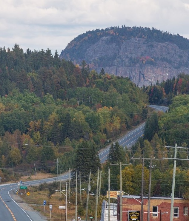
Formed in the last ice age (115,000 to 11,700 years ago), Mount Cheminis is known as a “monadnock” or “inselberg”—an isolated hill of hard caprock rising from the relatively flat surrounding landscape. It was formed when less resistant rock was eroded away by glaciation to form a plain, leaving the more resistant rock behind as an isolated mountain.
That’s our modern geological take on its origins. First Nations people who resided in the region had their own lore. Because of its distinctiveness, they viewed it as a place of immense spiritual significance. They conducted rituals and spirit quests atop the rock. Here, high above the landscape, they would have felt closer to their ancestors, to the spirits, to the land itself. Indeed, the name Cheminis is derived from the Indigenous word ‘Chamminis’, which translates into English as ‘the place of healing or healers.’
One of the strangest and most unique geographic locations in Northern Ontario was only discovered in 1951. Even then, we only became aware of its existence because of aerial photography. Until then, we were unaware of the massive crater, nearly four kilometres wide and hundreds of metres deep, carved into the densely forested landscape of northern Algonquin Park. Today it is known as the Brent Crater.
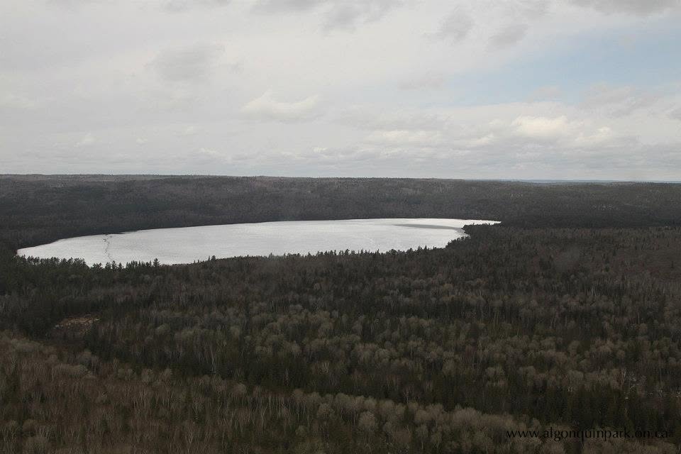
Scientists believe the crater was formed 400 to 450 million years ago by a massive meteor crashing into the Earth. The meteor would have been travelling at nearly 40,000 km per hour. When it impacted, it exploded with the energy equivalent of 250 megatons of TNT (more than 16,000 times that of the atomic bomb dropped on Hiroshima in 1945), creating shockwaves that would have levelled every tree in Algonquin Park and as far north as Quebec. If it occurred today, windows as far away as Ottawa would shatter from the concussive blast.
There are dissenters, however, which is where the mystery lies. Some scientists have postulated that the crater may be from an ancient, extinct volcano even though the preponderance of evidence says otherwise.
Either way, the Brent Crater is a fascinating place to visit. It's roughly an hour's drive southeast of Mattawa: head east on Highway 17, then follow Brent Road 32 kilometres south into Algonquin Park. There, a two-kilometre hiking trail features interpretive plaques detailing its geological features. The path descends the rim of the crater, proceeds to Tecumseh Lake and climbs back up the crater wall. An observation tower offers panoramic views that provide visitors a sense of its scale.