6 Best Weekend Bikepacking Trips in Ontario
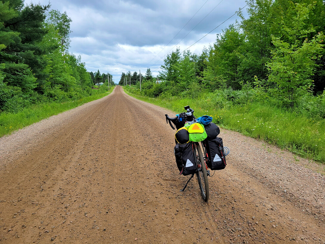
Bikepacking has become a popular weekend getaway option in Ontario. Touring by bicycle is a fun way to spend a few days outdoors, clear your mind, get some exercise, and enjoy the province’s sights and landscapes at a slower pace—and Ontario features some of Canada’s best bikepacking routes.
There are many different Ontario bikepacking route options to choose from, including rugged gravel roads and trails, to paved city pathways and quiet country roads. Whether you prefer packing your camping gear and sleeping under the stars, or staying at an upscale hotel or cozy bed and breakfast, there is something for everyone!
Here’s a run down of six awesome bikepacking routes in Ontario that are great for beginners and perfect for experienced riders looking for a quick weekend trip.
The Red Toque Tour
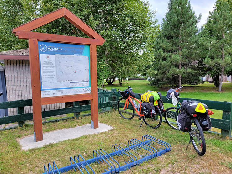
Follow in the footsteps of the Voyageurs by riding the Red Toque Tour, an 86-km linear route between the cities of North Bay and Mattawa. The Red Toque Tour is a part of the 645-km Voyageur Cycling Route which connects communities across Northeastern Ontario and the Ottawa Valley, following closely along the original fur traders and Indigenous Peoples’ waterway route.
Starting at Lee Park in North Bay you’ll ride south along a section of the Kate Pace Way paved multi-use trail and Trans Canada Trail until you reach Callander. Enjoy a rest at Centennial Park, and take in the view at the Lake Nipissing Lookout, before turning east and riding the back roads to Bonfield. Take a break at another Centennial Park located on scenic Lake Nosbonsing. Mr. D's Convenience Store in Bonfield is the last store on the route for over 45 km, so make sure to stock up on supplies before you leave town.
The route continues along paved roads through beautiful farmland, across creeks and rivers, and past forests of tall pine. Stop at the Eau Claire Gorge Conservation Area if you have the time and hike a short distance down the trail to view a spectacular waterfall. There is a section of gravel road just before Eau Claire and another section before you arrive in Mattawa, but besides that the rest of the route is paved.
Spend the night downtown at Le Voyageur Inn, or camp along the Mattawa River in Sid Turcotte Park. Le Voyageur serves authentic Thai cuisine; you can enjoy a poutine at the Riverview Snack Bar along the Ottawa River. A visit to Explorer’s Point is a must stop when in Mattawa; the stunningly beautiful confluence of the Ottawa and Mattawa rivers played a key role in Canada’s history.
After a peaceful night’s rest, jump on your bike and ride back to North Bay, enjoying the views along the route from a different perspective heading west.
Route info:
- Bike Fix Stands are located along the route in North Bay, Callander, Astorville, Bonfield, Eau Claire, and Mattawa.
- North Bay bike shops Wheelhouse, Cheapskates, Cycle Alley, and CycleWorks offer repairs, supplies, and rentals.
- For a unique dining experience after your trip visit The Boat restaurant at the North Bay waterfront.
- Enjoy a relaxing pre or post ride stay in North Bay at Homewood Suites by Hilton or Sunset Inn on the Park.
- Check out the Mattawa Museum, Chief Commanda II, North Bay Museum, or the Heritage Railway & Carousel Company while you’re in the area.
Manitoulin Island Loop
Manitoulin Island is becoming a popular part of the province for cyclists for good reason: the island features a gorgeous mix of pastoral, Great Lakes coastal and wilderness scenery, and there are many different bike routes across the island. Combining the Little Current to South Baymouth and Providence Bay and back to Little Current routes creates an excellent 190-km two-day cycling tour that covers a large part of the island.
Starting in Little Current, make your way down the east side of the island. Stop at the Strawberry Lookout to enjoy a view of the La Cloche Mountains in the distance. You’ll find some stores and restaurants in both the towns of Sheguiandah and Manitowaning, but not a lot between, so make sure to fuel up as you pass through.
Take some time to look around South Baymouth. There are a few gift shops, restaurants, a museum, the South Baymouth Range Front Lighthouse, and you might see the MS Chi-Cheemaun ferry picking up or dropping off passengers. From there you ride back up and east to Providence Bay.
Providence Bay is a lovely town on the edge of Lake Huron, famous for a large beach and sand dunes, so make sure to pack your swimsuit! Spend the night camping at the Providence Bay Tent & Trailer Park, or enjoy a stay at On The Bay Bed & Breakfast. Grab an ice cream lakeside at Huron Island Time and enjoy a delicious dinner at Lake Huron Fish & Chips.
On day two you’ll start heading north east back across the island. Make sure to stop at the town of Mindemoya for supplies and lunch as there are not a lot of other options after. Day two’s ride will take cyclists closely by two of Manitoulin Island’s largest lakes, Mindemoya Lake and Lake Manitou. There are a few picnic spots and boat launch areas where you can stop and enjoy the views.
Once you are back to Sheguiandah, it’s just a short ride north to Little Current and the end of the route.
Route info:
- Take a short side trip into Manitowaning to check out the SS Norisle, a Canadian steam-powered automobile ferry that used to travel between Tobermory and South-Baymouth.
- Breakaway Sport & Cycle in Little Current offers repairs and supplies.
- Enjoy a refreshing post trip beverage at the Manitoulin Brewing Company in Little Current.
- The Manitoulin Hotel & Conference Centre is an excellent spot to start and end your trip.
- You can shorten this route by 25 km if you choose not to ride the side trip down to South Baymouth.
Vive le Nord
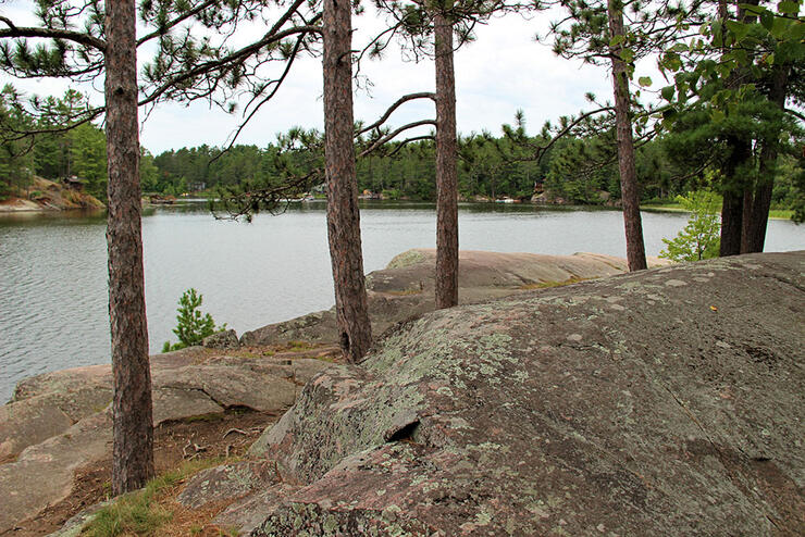
Vive le Nord is a 178-km-long loop located alongside the West Arm of Lake Nipissing, that celebrates the region’s Francophone history and culture. It follows mostly paved roads with a few short, hard-packed, gravel sections, along quiet country roads, through forests, and along a section of the Voyageur Cycling Route.
Starting in the community of Noëlville, ride north across an area covered in scenic wetlands, exposed Canadian shield, and two channels of the West Arm. The landscape begins to turn into farmland as you approach the town of St. Charles. Here you’ll find your first chance to refuel, with a couple stores to buy supplies at, as well as the Crazy Cow Café for a hit of caffeine.
Continuing north east you’ll pass by the Boreal Berry Farm and Winery, one of the largest ice cider producers in Canada. After crossing the Trans Canada Highway you’ll arrive in the community of Warren. The Rustic Cafe & Variety on Rutland Avenue is your last chance to grab a bite to eat for the next 37 km.
If you enjoy solitude, then you’ll love the next section along the route. You’ll find yourself in what may feel like the middle of nowhere, a quiet road surrounded by trees. Once you cross the Sturgeon River, you will follow it closely to the town of Field, which offers a riverside park to rest at, a couple chipstands, and the Riverview Market.
Continue south until you arrive in Sturgeons Falls where you will spend the night. The recently built Comfort Inn provides a comfortable night stay, or if you’d like to camp out, try the Sturgeon Falls KOA Holiday campground. There are dozens of options for dining while in town. Try the famous RIV Chip Stand, enjoy a cozy pub style atmosphere at McMacken's, or pick up some sweet baked goods at Chez Jean-Marc Bakery.
The second day of the route is a lot shorter and starts off with cyclists heading west across farmland once again for the first part. Pick up some snacks at Chez Courchesne General Store or have lunch at Lavigne Tavern before reaching the West Arm. The next section of the route passes between Mashkinonje Provincial Park. This is an excellent spot to stop for a break and enjoy a short 2.9 km hike along the Loudon Peatland Trail, featuring a provincially significant peatland with its fen border and central bog. From here you’ll make your way south-west back to Noëlville.
Route info:
- Bike Fix Stands are located at Minnehaha Bay Municipal Marina in Sturgeon Falls, in Noëlville, and Lavigne.
- Bike accessories and parts can be purchased at the Sturgeon Falls Canadian Tire.
- Stop at the Sturgeon Falls Lookout Park to enjoy a view of the Sturgeon River and historic railway bridge.
- Stay at the Green Bay Lodge on the French River, or at the Noelville Family Resort, before or after your trip.
- The Noelville Restaurant, Café Caravan, and The Voyageur Chipstand in Noëlville are great options to grab a delicious pre or post ride meal.
Espanola to Chutes Provincial Park
Cyclists who are new to bikepacking camping trips will really enjoy the short 30-km long linear bike route from Espanola to Chutes Provincial Park. This easy Ontario bikepacking route on the Great Lakes Waterfront Trail is perfect for beginners, with basic terrain and flat paved roadway. It's a great place to try riding your bike with the extra weight of camping gear for the first time.
Pack up your tent and sleeping bag and hit the road starting in Espanola. For most of the journey you’ll follow along the quiet Lee Valley Road. There are no services along this route, so make sure to be prepared.
After a lovely countryside ride, you’ll cross the Spanish River and find yourself in Massey, where just a short ride across town will bring you to Chutes Provincial Park. This small park has a lot to offer with beautiful treed campsites, a waterfall at the edge of the campground, a sandy beach to cool off at, and the Twin Bridges Trail along the Aux Sables River.
Chutes is located just at the edge of town so it’s easy to jump on your bike and ride back into Massey for supplies or dinner. Dine at The Dragonfly Ristorante, Back Home Bistro, or The Little Brew Café, or grab a pizza at Poirier's Confectionery & Pizza. Poirier's Clover Farm and Martins Country Market offer a variety of fresh foods and grocery items if you’d rather purchase your own ingredients and cook a meal at your campsite.
Want to spend more time at the park? Book two nights at Chutes and enjoy a rest day exploring the park before riding back to Espanola.
More experienced bikepackers who are looking for a longer route can start their trip in the City of Sudbury. From there they can ride side roads down to Espanola, adding roughly 80 km to the total distance of the linear route. Important to note, there is a 6.5 km section to ride along the Trans Canada Highway through this route, but there are paved shoulders.
Route info:
- Visit the Massey Area Museum to learn all about the history of the area.
- Bike accessories and parts can be purchased at the Espanola Canadian Tire.
- Stop by the Heritage Park in Espanola where you’ll find a view of the Spanish River Dam, along with informational signs and historical plaques that tell the story of Espanola, including a WWII prisoner of war camp that was located in the pulp and paper mill.
New Liskeard to Elk Lake
The most northern route on this list is New Liskeard to Elk Lake. This 65.9-km linear route is #7 on the South Temiskaming Bicycle Routes list, and features long stretches of flat paved roadway that makes its way through farmland and forested areas.
Starting at the Waterfront Pool and Fitness Centre in New Liskeard you’ll head northwest out of town. Only a few kilometers into the journey you’ll come across the road to Historic Pete’s Dam Park. Pete’s Dam is a 4 km hiking or mountain bike trail that winds around a section of the Wabi River to a pretty waterfall. From there continue on west. You’ll pass the Triangle Hill Hiking Trail, which climbs to the top of a cliff overlooking the surrounding farmland. Both Pete’s Dam and Triangle Hill are great little spots to stop along your ride if you have the time on your way to or from Elk Lake.
The Kenabeek General Store is the only store located along this route and it makes a perfect half way point to stop and stock up on snacks and beverages. They also serve real milkshakes and hand-dipped ice cream.
As you get closer to Elk Lake, you’ll start to see views of the mighty Montreal River, which flows through the middle of the quiet community. Although Elk Lake is small, there are many options for accommodations. You can camp at Elk Lake Tent & Trailer Park, or Lakeside Leisure Farm. The Moosehorn Motel and Campground has rooms, cottages, and campsites, and the Elk Lake Lodge and Eco Centre offer lodge and chalet amenities.
Dine at the Elk Lake Lodge’s fully licensed restaurant and bar, or fuel up on poutine at Josee’s Fries and More chip stand at the J&S Variety Store.
After a peaceful night’s rest in Elk Lake, stop by the Elk Lake Heritage Museum to learn the history of the area, before making your way back to New Liskeard.
Route info:
- Well maintained washrooms can be found located at the bend in Barber Township, at the intersection of Highway 65 and Barber Cane Township Road.
- Take a walk along the 2-km-long Waterfront Boardwalk Trail while in New Liskeard and enjoy extensive views of Lake Temiskaming.
- Enjoy a stay pre- or post-trip at the Waterfront Inn located at the New Liskeard waterfront, or stay in a room, cabin, or go camping at the Edgewater Motel just a few kilometers outside of town.
- Visit the Little Claybelt Homesteaders Museum while in New Liskeard and take a selfie with the big cow statue.
- Bike accessories and parts can be purchased at the New Liskeard Canadian Tire.
Simcoe County Loop Trail
One of the most popular bike routes in all of Ontario is the 160-km-long Simcoe County Loop. It travels between the cities of Barrie and Orillia, and the town of Midland, passes through many other small communities along the way, and reaches three major bodies of water—Georgian Bay, Lake Simcoe, and Lake Couchiching.
The loop follows along mostly off-road, multi-use rail trails, with some short paved road sections. The trails are mostly crushed limestone, with a few rough spots depending on the weather and time of year. Overall the route is fairly flat. This all makes for a safe bikepacking route for beginners who want to stay off roadways as much as possible. It can easily be divided up into a two or three day trip, starting at one of the three main communities along the loop and spending nights at the other two.
Cycle Simcoe has created a very informative online map that cyclists can use to plan their trip around the Simcoe County Loop. The map includes directions, accommodations, campgrounds, bike repair shops, restaurants, washrooms, and points of interest. The map can be viewed online or a paper copy can be ordered for free.
Most of those completing the Simcoe County Loop will do a two day trip beginning in Barrie, making their way through Orillia around to the Midland area where they will spend the night, then completing the loop back down to Barrie the next day.
A must stop along the route is the Emvale Water Kiosk, located near the town of Emvale. You can fill up your water bottles with pure spring water that is tested regularly.
If you tag @cyclesimcoe in a social media post during your Simcoe County Loop Trail adventure, and follow up with an email to Cycle Simcoe, you will have a chance to win a t-shirt for completing the route!
Route info:
- Some great locations to stop along the route include the Spirit Catcher statue in Barrie, grab a selfie at the Love Barrie sign, cool off at Couchiching Beach Park in Orillia or at the Penetanguishene Rotary Champlain Wendat Park beach.
- The loop passes closely by Sainte-Marie among the Hurons and the Wye Marsh Wildlife Centre, which are amazing historic and educational places to visit if you have some time to stop for a break during your ride.
- There are outdoor bike repair stations located at major trailheads along the loop.
Bike shops can be found in Barrie, Orillia, and Midland that offer repairs, supplies, and rentals. Shops located closest to the loop include: Trek Bicycle Store Barrie, Velocity Bike Werx and The Crank & Sprocket Bicycle Co. in Orillia, and Midland Ski and Bike.
Recommended Articles
LOOKING FOR KICKASS MOUNTAIN BIKE TRAILS?
Best Fall Bike Rides
50-km Bike Routes
Bike Routes & Trails in Ontario

Best Ontario Cycling Events
19 Easy Weekend Getaways from Detroit
North Bay Bike Attractions

Pedal-Powered Camps for Kids
Best Of: Bike Towns

Fat Biking Hot Spots in Ontario
Are You Up for the Challenge?
The Voyageur Cycling Route is Calling
Timmins Bike Adventures
Pedal On
Sublime Riding
See the Best of the Soo by Bike

Cycling Vacations Ontario
Ontario's Best Bakery Bike Tours

9 incredible bike rides
