Dizzying Heights at Devil's Rock: Hike one of the coolest spots in Northeastern Ontario
Editor's Note: This summer, we asked you to tell us what your favourite hiking trails in Northeastern Ontario are as part of our BIG Top Five Contest. Each month, we will be publishing a story about each of the top five hiking trails in Northeastern Ontario as voted by you!
This month we are featuring the hike that earned the number two spot —Devil's Rock, located in Temiskaming Shores.
They say that for travellers the journey is the destination, and this probably holds true for many hikers as well. But in the case of Devil’s Rock on the western shore of Lake Temiskaming, the destination most definitely is the reason why people come here. The view that rewards you at the end of this trail is one of Northeastern Ontario’s best-kept secrets, and one that will quite literally take your breath away – and replace it with a feeling of awe and deep respect for Mother Nature.
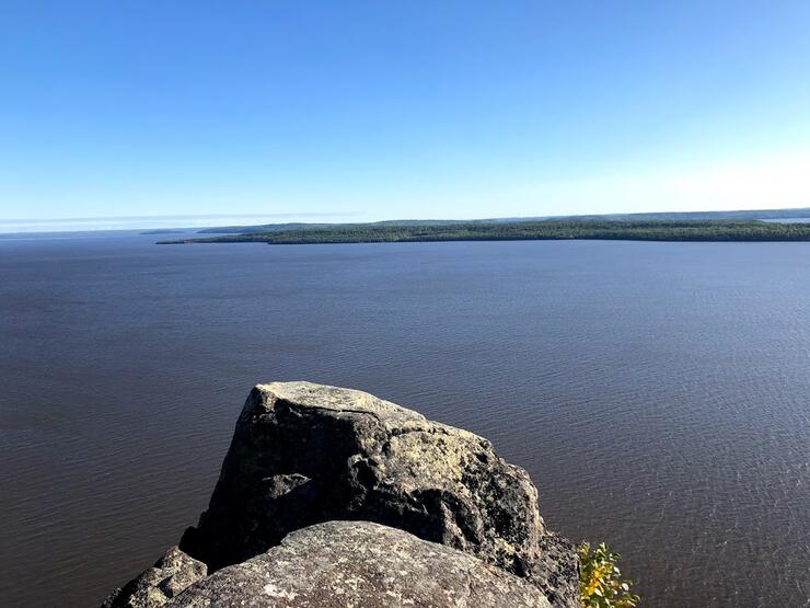
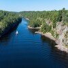
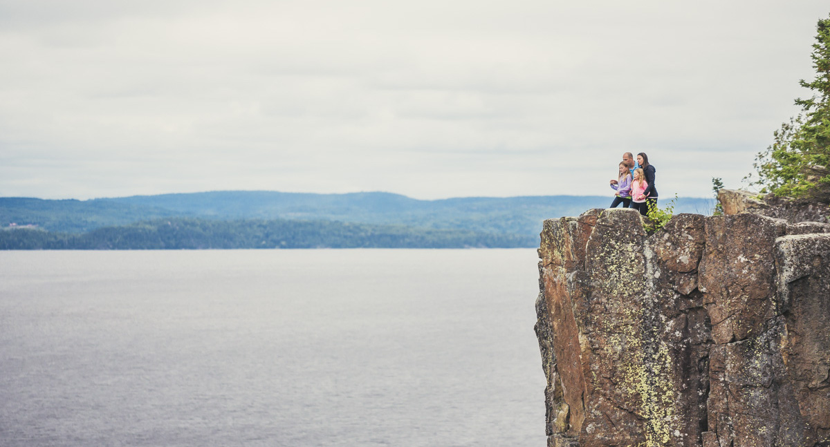
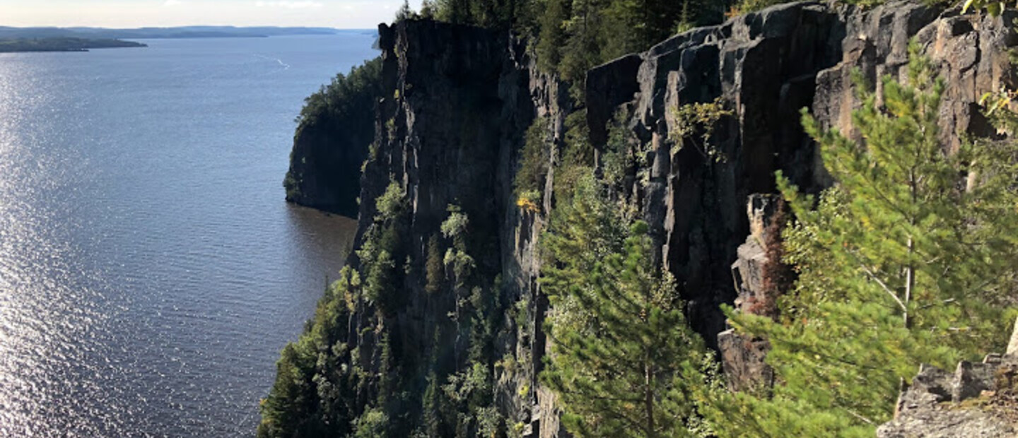
It’s always exciting when you are hiking and you start to notice sky appearing between the trunks of the trees ahead on the trail, signalling that you are approaching an overlook. But the relatively easy incline of the shorter trail that I took to arrive at Devil’s Rock didn’t prepare me for the view that I found at the end: the trail ended at a rock ledge that opened up to nothing but sky, and as I approached the edge, I got my first glimpse of Lake Temiskaming spread out below me – 300 feet below me, in fact, with nothing but air between the edge of the cliff and the water.
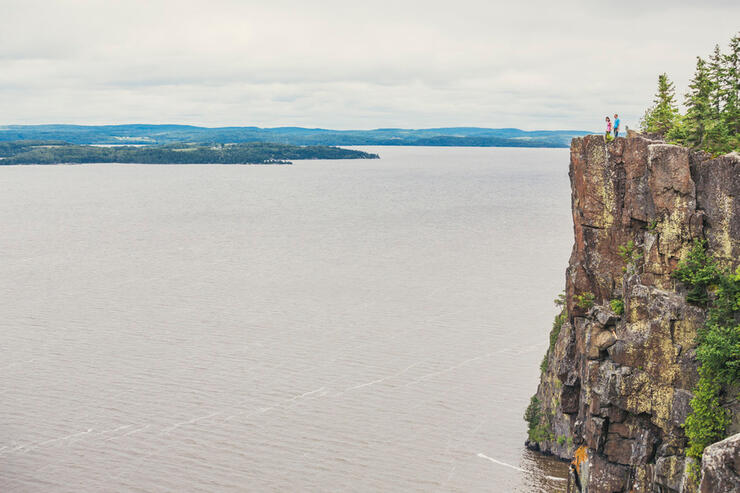
But it was when I turned my head, and got my first glimpse of the sheer cliffs on either side of me that the full impact of this place hit me and literally made my heart pump a little faster.
The chiselled cliff walls plunging straight down to the water’s edge would be enough to give even the most seasoned hiker a knot in the pit of their stomach (never mind a casual hiker like myself), and I became very aware of the very few feet between my feet and the edge. This is no place for joking around or trying to get that elusive photo angle because with only the odd fence keeping me back from the most treacherous of areas, it was up to me and my good sense to keep a safe distance from the edge.
This dangerous beauty is the allure of Devil’s Rock, in fact. It’s not just the spectacular panorama of the lake spreading out in front of you, Quebec visible on the far shore, or even the miles and miles of visibility that this rocky perch provides, but it's the fact that here, nature commands your respect.
Access
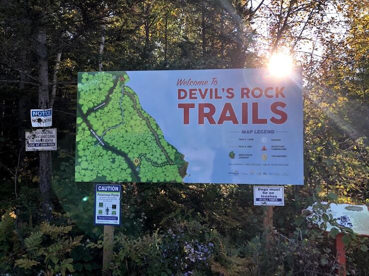
There are two trails to Devil’s Rock. One begins at Bucke’s Campground, about 3.5 km south on Hwy 567 from the 11B Junction. The hike is a steady uphill climb from lake level, and the trail is quite rocky so you’ll need to pick your footing carefully as the trail winds its way between lichen-covered trees. There are occasional red ribbons on the trees to mark the way, but at the top, it gets a little harder to follow. The important thing to know is that the cliffs are to your left, and signs let you know when you are getting close to the top.
The second trail is 1.5 km south of Bucke’s campground and has only a small sign and parking lot off the east side of the road to identify the trailhead. This route is more of a walk than a hike, the path itself is much wider, with a much easier incline than the Bucke Trail. The trail is well defined, and a marker even tells you when you are at the halfway point.
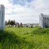
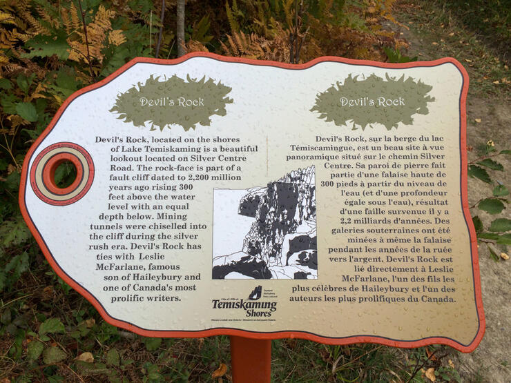
Both trails arrive at the same Devil’s Rock overlook (where there’s a white cross as a sober reminder of the danger posed by its 300-ft drop.)
Difficulty
Hwy 567 Trail: 1 (easy incline, wider path but still a little rocky)
(If there are hikers of varying skill levels in the same group, less experienced hikers could drop off more advanced hikers at the Bucke Campground access point, and then drive to the easier trail 1.5 km farther south. Both groups could meet at the lookout, and return together to the Hwy 567 parking lot.)
Trail Difficulty Legend
(Evaluated by an occasional hiker, 50+, reasonably fit with no mobility issues and who is able to walk 3-5 kilometres and climb 5-10 flights of stairs with no difficulty)
LEVEL 1: Easy. Trails are easy to follow, with good footing and gradual slopes, although surface would not be suitable for strollers. (May even have handrails, stairs or other assists in certain places.) Comfortable, closed footwear recommended.
LEVEL 2: Moderate. Trails have the occasional incline, with roots and/or rocks to step over. Running shoes with good tread and support, or hiking footwear recommended.
LEVEL 3: Moderate with some challenging areas. Trails may be rocky, requiring careful footing, with some steep inclines, or the trail could involve sustained uphill hiking for longer sections. Hiking footwear recommended.
LEVEL 4: Challenging. Requires agility and a good level of cardiovascular fitness as there may be steep sections, climbing over and around large boulders, roots, etc. May involve water crossings on rocks or logs with rough or narrow surfaces where balance is required. Hiking boots/footwear required.
LEVEL 5: Expert. (Basically a sustained Level 4 throughout most of the trail, with occasional sections that are easier) Hiking boots required.
Amenities
The visitor centre at Bucke’s Campground sells some snacks and water, and has restroom facilities available, if open. Access to the trail from Hwy 567 has no facilities.
Where to Stay
One of Temiskaming Shores’ newest hotels is the Holiday Inn Express and Suites in New Liskeard, just off Hwy 11 at the north end of town. Here we enjoyed a little bit of luxury in a King Suite that had a bedroom and sitting area, each with its own TV and separated by frosted glass French doors. In addition to free WiFi, the hotel provides a great complimentary hot breakfast in a large, modern eating area, and even has a pool.
Recommended Articles
The Seven's Best Hikes, Biking Trails and Lakes

7 Best Spots to Check Out in The Seven

Budget Bliss: Explore Northeastern Ontario Without Breaking the Bank

Bring Your Fam!

Time to Unwind: 6 Spa Havens to Discover In The Seven
5 Amazing Places to SUP in Northeastern Ontario

5 Amazing Bike Rides to Discover

Northern Lights in Northeastern Ontario

Northeastern Ontario's Best Pride Festivals

Fish for one of the World's Rarest Species of Trout

An Insider's Guide to Manitoulin Island

6 Small-Town Gems to Explore in Northeastern Ontario

11 Best Things to Do in Kapuskasing, Ontario

