By Backroads Bill Steer
A professor at Canadore College and Nipissing University, as well as the founder of Canadian Ecology Centre in Mattawa.
April 12, 2023
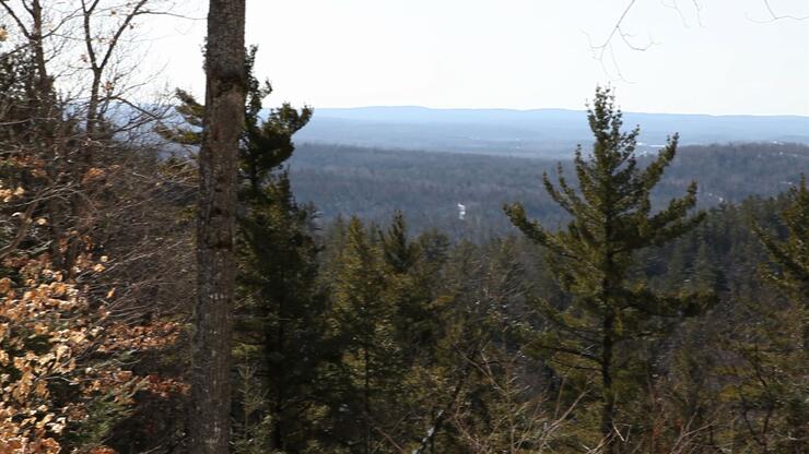
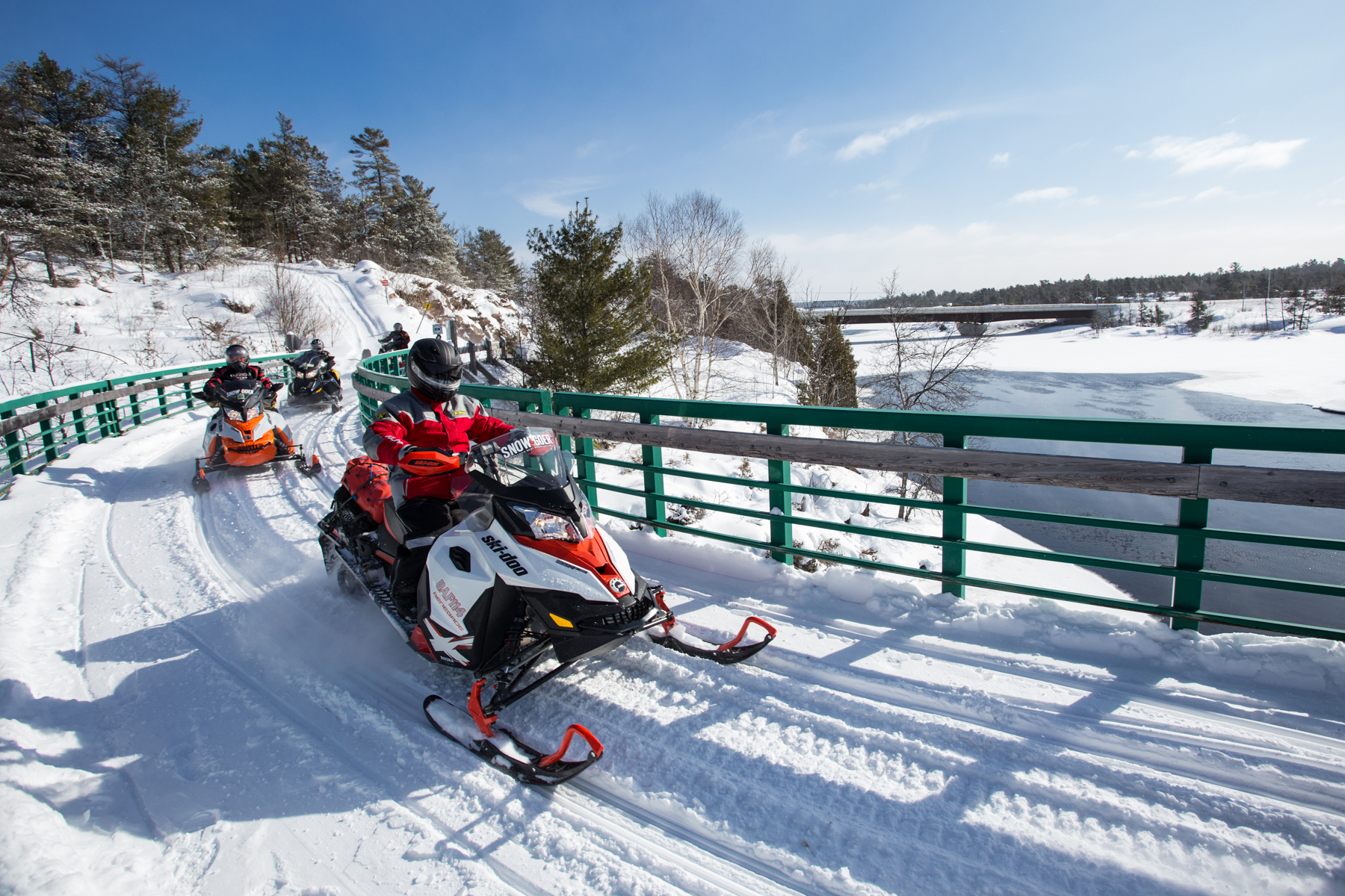
When you are riding the snowmobile trails, to these three expansive lookouts, you are discovering more than just a Northeastern Ontario legend. There are reasons for it beyond the good days you are having within the Mattawa-Bonfield area.
One of the most difficult eras in history to comprehend, are the millions and billions of years that preceded the arrival of humankind on Earth.
As you ride the Ontario Federation of Snowmobile Club trails throughout Northeastern Ontario, enjoying the outdoors and natural resources, the first remark made is often related to the scenery that confronts you. It is a common denominator throughout the entire tourism region.Knowing how the hills, lakes, beaches, and rock outcroppings were formed is important in understanding how the original inhabitants and the European settlers travelled, and chose suitable pockets of land near waterways. The destinations you will visit is just a snippet of what went on a long time ago. It is the dynamic works at work and the long time ago which is difficult to comprehend.
For example the fact that the water of Lake Nipissing flows towards Georgian Bay via the French River, and the Trout Lake watershed drains towards the Ottawa River, is a geological story in itself. The problem is trying to visualize the tremendous forces that continually shape our landscape. If you have ever visited a glacier or walked along the shoreline in the spring when the ice is melting, exposing the sandbars, then you may be able to understand how the physical features of the North Bay - Bonfield - Mattawa area came to be.
Earth's Calendar
The most accepted theory claims that the earth was formed from a primordial dust cloud some 4,500 million years ago that's hard to imagine when a year ago seems like a long time. And don't forget, the gradual weathering process and the catastrophic events, such as volcanic eruptions and earthquakes that helped shape the earth as we know it today.
Geological time is beyond our comprehension, many millions of years mean little to us. Consider the often used analogy of one single year representing the earth's entire history. With the 1st of January as the beginning of the planet and midnight of December 31st as the present, the oldest rocks, some located on Greenland, Canada and South Africa were formed sometime in March.
Life in its most microscopic form appeared in May with identifiable sea life occurring in November, dinosaurs roamed during the second and third week of December, before they became extinct.
Humankind's ape like ancestors evolved on the evening of December 31st. The last of the great ice ages began to recede about 90 seconds before midnight. The Roman Empire, including the time of BC, occupied 10 15 seconds before midnight, while the Vikings and the great explorers of the 1400's arrived in North America about three seconds before midnight. The time since the arrival of the CPR in the early 1880's contributes only a minute fraction of the final second!
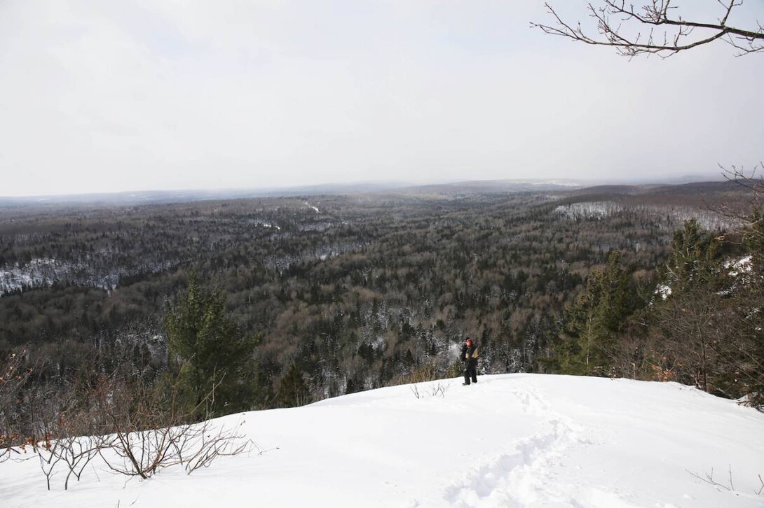
Boulter Lookout
Look Around
The rocks that comprise most of Northeastern Ontario are part of the Canadian Shield created during the Precambrian age, and are older than 570 million years. These volcanic rocks are of economic importance to the north's mining industry. Mining that occurred in Mattawan Township (Purdy Mica Mine), and on Newman Island (the search for uranium) owe their existence to this geological period. Find the Purdy Mica Mine on the www.nnta.ca website, it is worth a visit and take your flashlight!
At the same time, the low lying area between the Airport Hill escarpment near North Bay and the Almaguin Highlands approaching South River to the south was formed because of a crack or fault which parted to form the French Mattawa river system. The Highway 11 corridor gives you many glimpses of the underlying bedrock, especially the distinctive pink and grey granite of the Precambrian age. Look as you drive through the rockcuts on Thibeault Hill, (Hwy 11 N) and those just south of Powassan (Hwy. 11 S).
Skip back in geological time to the start of a succession of ice ages that began about 80,000 years ago. The impact of the most recent ice age remains in evidence today. As the climate of the earth cooled, the Arctic ice advanced southward. Imagine, this huge sheet of ice advancing and retreating, the tremendous weight of ice compressing the earth several hundred meters.
During the last retreat, approximately 10,000 years ago, the melted ice flooded the sunken landscape. During this time, the early Lakes Huron and Michigan actually drained eastward through the fault that is now the Mattawa River.
As the ice continued to retreat, various outlets became exposed, forming many of the rivers that bisect the landscape. The South, Sturgeon, Veuve, North, Temagami, Jocko and Wasi Rivers all owe their early beginnings to this time period.
At the time of the retreat the entire area was littered with a mixture of material called glacial till. Dig below the active layer of grass and decaying debris and you will find most of the underlying soil is red to grey in colour, mixed with sand, gravel, and boulders.
Try to appreciate that this ongoing, process caused by the glaciers, shaped the moraine various types of concentrated debris into a variety of landforms. These appear as eskers - long ridges of sand and gravel - most evident on the rolling terrain of farms or where small sand and gravel pits are being excavated. This moraine is most prevalent in the Rutherglen Bonfield area indicating once active flowing glacial streams. Glacial lake clays permitted the building of a former brick factory at the south end of Powassan. Drumlins - a streamlined hill or ridge - can be seen east of Powassan in the Grand Desert area. The pronounced tails of these ridges actually indicate the direction of the ice flow. That's one of the lookouts (Boulter)!
Many farms were abandoned, unsuitable for mixed farming practices because the soil was underlain by sand and gravel. These plains, although flat, were the deposits of the outflow of glacial rivers under the ice. These fields often became the first plots that were reforested by the Ontario Department of Lands and Forests (now the Ministry of Natural Resources).
Areas exposed by the draining of Lake Nipissing, lying below the raised beach of the lake in its former glacial state, are the largest and most productive for mixed farming in the West Nipissing area. The terrain is the flattest in the area, with alluvial deposits comprised of finely powdered sandy silts and clays that made up the former lake bed. It was the destination for the large influx of French settlers in the last two decades of the 19th century.
The higher areas, such as these three lookouts, area are actually raised beaches, and at one time, represented the margins of submerged land that lay under approximately two hundred metres of water. These are identified by terraces, sand and boulder beaches that are often hundreds of meters higher than the low lying area of the developed residential areas of North Bay.
This raised beach material differs from the fine beach sand found on many area lakes – particularly nearby Lake Nipissing. Wave action has reworked the gravel deposited thousands of years ago. As the ice sheets continued to retreat, the next important event to shape the area's two major watersheds started to evolve.
Approximately 11,000 years ago, the Mattawa River continued to drain the glacial Great Lakes. Lake Nipissing and Trout Lake were one in the same. As the land began to rebound from the receding weight of the ice sheets, the French River outlet was opened up. You will ride to two more lookouts here!
A series of steps, caused by the uplifting of the exposed land mass, created an elevation difference of less than one meter between the height of land between Trout Lake and Lake Nipissing. This created two separate watersheds, and directions, for the drainage of the remaining lakes and rivers. Often you will see swamps and bogs, the result of poorly drained areas being filled in with organic material. Abandoned channels from glacial times are now the low lying areas that can be observed along Highway 17 East and the CPR railway. Both take a meandering route around natural obstacles on the way to North Bay.
The uneven landscape surface, characteristic of the North Bay and area region is typical of the glaciated Canadian Shield. The exposed bedrock, ridges and depressions, lakes and rivers are the result of thousands of years of geological history. The location of railways, roads and communities are a direct result of the sculpting of the landscape. As you travel throughout the area consider the forces that shaped the land over a time that is almost incomprehensible to us. Enjoy the vistas! There is more to discover throughout Northeastern Ontario.
The Ontario Federation of Snowmobile Clubs Near North Trail system can be found at www.nnta.ca ; go to the interactive trail map tab. For more information on this ride click through the included buttons for the GPX, GPS, Google Earth and other JPEG maps.
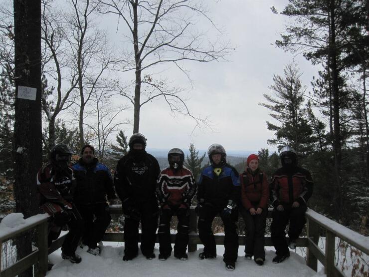
Here is a snowmobile primer for the trails in the Mattawa area.
If you want to access any one of the three vistas go to the Near North Trail Association website at www.nnta.ca. There are a number of loops to consider for your day's ride. There are signs on the trails to the lookouts, keep a close lookout!
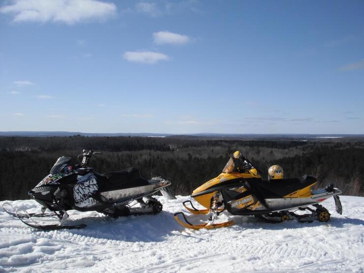
• For the Boulter lookout, south of Bonfield consider the 'A' trail and BF 204 and BF 205.
• For the Bird's Eye lookout north of Mattawa take A112A
• For the Redbridge lookout, east of North Bay, northeast of Bonfield and north of Mattawa consider trails A112A or A2 to BF 201...to NB308...your destination is NB
Showing 'Edited Body' is no longer supported.
About Backroads Bill Steer
has a passion for Northern Ontario and the great outdoors.
He is the founder of the Canadian Ecology Centre and remains as the General Manager/Head Master of one of Canada’s leading environmental education centres. It is based on the CEC’s M.A.D.E. principle – Make A Difference Environmentally. He also developed the national geomatics certification program.
He is Back Roads Bill on the CBC. He holds degrees and diplomas from Laurentian University, Nipissing University, McMaster University and Durham College.


