Gateway to The Arctic
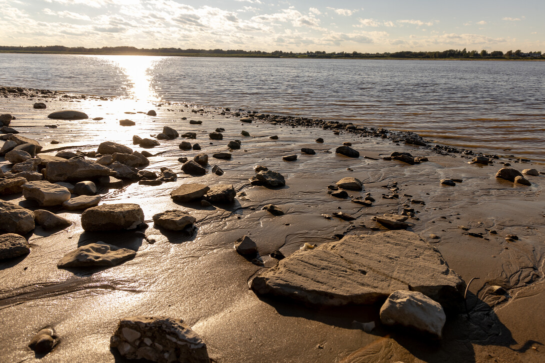
The rain plummeted down onto the wooden slats of the Moosonee docks as my guide Ryan Sutherland and I prepared a tarp to keep us dry in the boat. Today, we were heading out to the world’s largest seasonally ice-covered inland ocean where the mighty Moose River empties into the salty waters of James Bay.
James Bay is the southern end of the Arctic Ocean and the southernmost point of sea ice in the world each winter. Split between Ontario, Québec, and Nunavut, this unique area is brimming with life. Surrounded by the Hudson Bay Lowlands, one of the world’s most significant wetlands (and home to peat bogs, essential in storing carbon and mitigating climate change), the area provides home for unique vegetation as well as large swaths of migratory birds. Close to both inland North America and the Arctic, James Bay is home to several migratory bird sanctuaries which provide protection for the numerous species who stop in the bay on their way to and from the Arctic.
Although James Bay has low salinity levels due to the considerable volume of freshwater that empties into it from surrounding rivers, it’s still home to marine life. Seals and Beluga whales frequent these waters. Due to the relative ease of travelling to Moosonee as opposed to other communities on the bay, it’s considered to be one of the best access points. Eager for what we would potentially see in the bay, I hopped into the boat with Ryan.
Looking north toward the bay we could see pockets of rainfall blocking the view of the landscape. Upriver to the south looked relatively clear. Luckily, that’s where we were heading first. The night before we had set a gill net (a large net anchored to the river bed used to passively catch fish) in a southern channel of the Moose River. We took off towards the net, hoping that we would be rewarded with some fish for the day.
The skies suddenly opened up, pelting us with heavy rain. With no hard-top on Ryan’s boat to keep us dry we dove under the tarp to wait out the rain. Minute after minute passed until we felt the localized rainfall become lighter and lighter. Eventually silence surrounded the boat. We emerged from underneath the tarp and made our way toward the net. Pulling the rope out of the water to release the anchors, we were curious to see what might be waiting for us.
Tangled in the net were two fish, a Whitefish that Ryan decided to keep, and a small Lake Sturgeon. Designated as a species at risk in Ontario, the Southern Hudson Bay - James Bay population of Lake Sturgeon is classified under special concern. A delicacy to Cree people who have the right to keep them when caught, non-Indigenous people are not allowed to fish for Sturgeon. If they catch one, they must release it immediately.
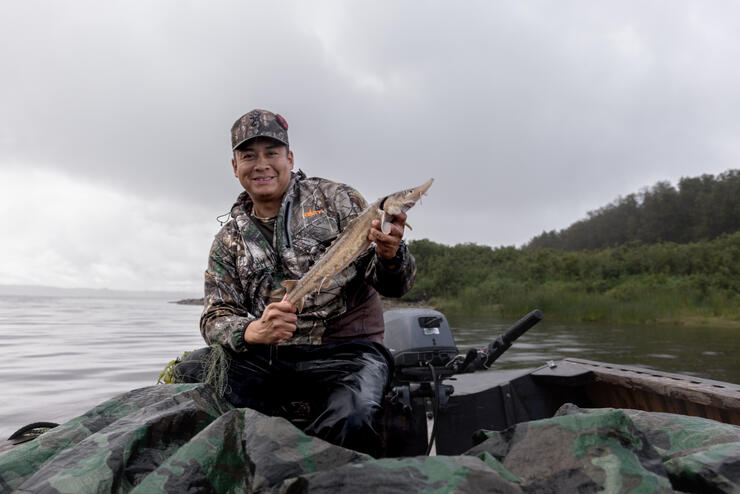
Moose Cree First Nation and the Wildlife Conservation Society are currently working on a project, Learning From Lake Sturgeon. The project aims to improve stewardship of Sturgeon and the rivers through a mix of scientific research and Indigenous perspectives in the Moose Cree homelands. Before my arrival, Ryan took a group from the WCS out onto the river to conduct research.
Tossing the Sturgeon back into the river, Ryan and I began our journey northeast toward the bay. The thick clouds that drenched us in water earlier that morning seemed to be scattering. Still anticipating some rain and rough weather, we kept the tarp accessible as we motored north.
We passed sandbar after sandbar, coasts of sand, rock, mud, spruce and tamarack, and the river gradually began to widen until it was no more. Looking forward all we could see was the open ocean, endless kilometres of shallow, salty water leading to the Arctic.
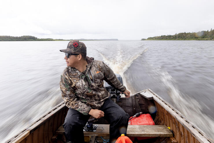
I felt as though I could smell the salt water, which was unlikely considering the low salinity of James Bay. It was likely my mind playing a trick on me knowing that I had just entered the only open ocean accessible from Ontario’s coastline. Still, there was no denying that we had reached the ocean.

The sun peeked through the clouds opening up a small pocket of sunlight granting us visibility to the endless sea to the north. While we were content floating in the ocean, we wouldn’t be able to stay long. The tide was going out, and depending where we were on the water, there was a chance that we could get stuck on the tidal flats of the bay and have to wait until the tide came back in to return to the docks.
Making our way back towards the Moose River we checked out the northwest coastline where the river joins the bay. There, on Ship Sands Island, is the Moose River Migratory Bird Sanctuary. Established to protect the large flocks of diverse birds that use the site as a pit stop during their fall migration, it’s a must-see for birders.
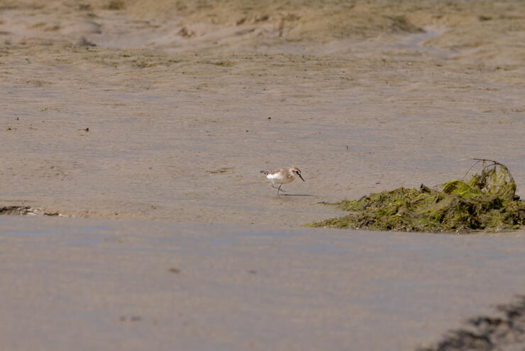
While it was too early in the season to see the mesmerizing show put on by flocks of geese and the millions of other birds that stop at the sanctuary, we slowed down from afar to watch the small birds that were present on the tidal flats.
Depending on the time of year, these flats are home to resting and feeding shore birds, large numbers of water birds including green-winged teal ducks, and geese such as the snow goose.
We sat there watching the birds walk along the mud, find food, and then fly in small groups in what looked like rehearsed theatrical patterns. It was breathtakingly beautiful to see them soar over the waters of the bay.
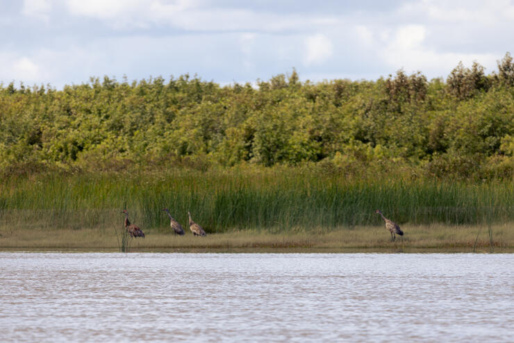
Leaving the bird sanctuary behind, we continued upriver towards Moosonee, first stopping at the Horseshoe Islands. Home to several other species of birds, we were on the lookout. To our right we watched a flock of Sandhill Cranes in the grass. When they spotted us, they took flight, unfurling their large wings and dangling their feet as they ascended upon the sky. In the water we saw several species of duck including Diving Ducks and what appeared to be either a Green-Winged Teal duck.
The tides were still going out. New vegetation was emerging in the river indicating the low water levels. While the weather was still in our favour, it seemed like a logical time to wrap up our exploration of the bay and surrounding area. We had been successful in not only seeing the ocean, but were fortunate to see multiple different species of birds. Content with that, it was time to move on to the next item on my agenda: camping in Tidewater Provincial Park. With the clouds disappearing I was even more excited to set up camp for the night. Clear skies meant that my chances of seeing beautiful stars and potentially even the Northern Lights was growing.
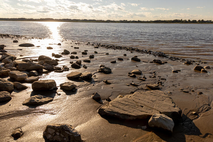
Tidewater Provincial Park is one of the most unique parks in Ontario. Not only is it the northernmost operating park in the province, but it’s the only operating park where you have the potential to see marine wildlife. Run in partnership between the Ministry of the Environment Conservation and Parks and Moose Cree First Nation, it’s the perfect spot to camp within proximity to Moosonee.
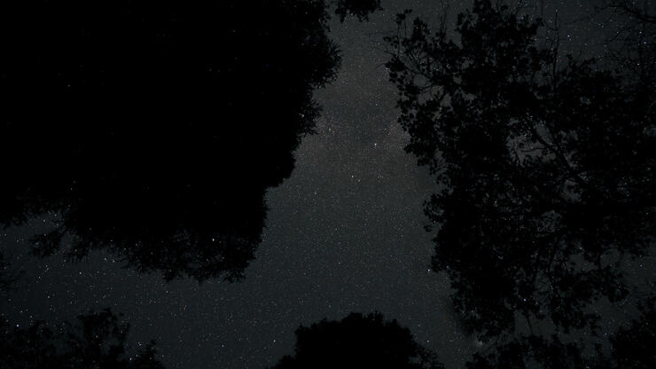
Ryan dropped me off on Charles Island (the northernmost island in Tidewater Provincial Park) where I set up my camp for the night. After cooking up a nice dinner I sat out on the rocks watching the sun set over the town of Moosonee located just across the river. As the hours passed, a brilliant array of stars presented themselves across the sky.
Looking up, lost in the beauty of the night sky, I recalled the natural wonders I was fortunate enough to see during the day. From the salty waters of James Bay to the wildlife that call this area home, the homelands of the Moose Cree people rewarded me with exceptional landscapes, wildlife viewing, and unparalleled experience. As I looked out towards the stars a feeling of overwhelming gratitude and appreciation to be here swept over me. Gentle rolling waves scattered across the sandy banks until they were nothing.
Recommended Articles
The Seven's Best Hikes, Biking Trails and Lakes

7 Best Spots to Check Out in The Seven

Budget Bliss: Explore Northeastern Ontario Without Breaking the Bank

Bring Your Fam!

Time to Unwind: 6 Spa Havens to Discover In The Seven
5 Amazing Places to SUP in Northeastern Ontario

5 Amazing Bike Rides to Discover

Northern Lights in Northeastern Ontario

Northeastern Ontario's Best Pride Festivals

Fish for one of the World's Rarest Species of Trout

An Insider's Guide to Manitoulin Island

6 Small-Town Gems to Explore in Northeastern Ontario

11 Best Things to Do in Kapuskasing, Ontario


