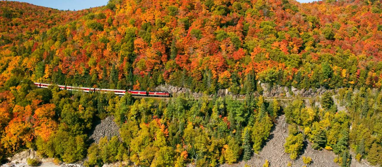

The Ultimate Road Trip Guide to Chasing Waterfalls in Northeastern Ontario
Nine stops, nine waterfalls — from Duchesnay Falls to New Post Falls
By Hollie Demore


All history, the saying goes, is contemporary history and the paradox of New Post Falls is a great example of how we can learn from the no-so-distant past.
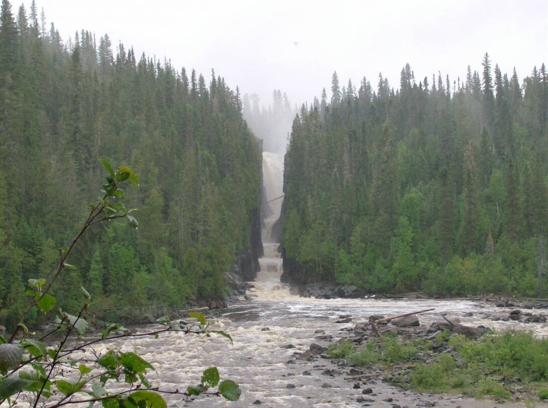
New Post Falls, a few kilometres north of Cochrane in Northeastern Ontario offers visitors a breathtaking vista, a towering gorge, and the sights and sounds of the roaring water as it plunges into a pool far below. Because of the narrow gorge, the falls give off a great deal of mist, making a visit here feel almost surreal and otherworldly.
But lately, one of the most scenic and accessible but unknown waterfalls in Ontario has undergone some changes. Thanks to the completion of a new construction project, the flow of the falls have returned to what it once was.
Construction for the New Post Creek dam was completed in 2017 but the project goes back much further than that. In April 2006, a Memorandum of Understanding was signed between Ontario Power Generation Inc. (OPG) and the Cree, Taykwa Tagamou Nation (TNN- pronounced tay-kwa tag-a-moe) to jointly explore hydroelectric development opportunities within the Abitibi River drainage basin, north of Highway 11. As a result of this initiative, a potential waterpower generation location was identified on New Post Creek, a tributary of the Abitibi River. The finished produces approximately 25 megawatts of renewable hydroelectric power, which is enough electricity for 20,000 homes. While not a large project, it provided a substantial amount of construction employment in the region and economic benefits for TTN. The project is four kilometres upstream from the falls–but the effect of the project on the falls, as predicted, was substantial.
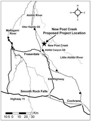
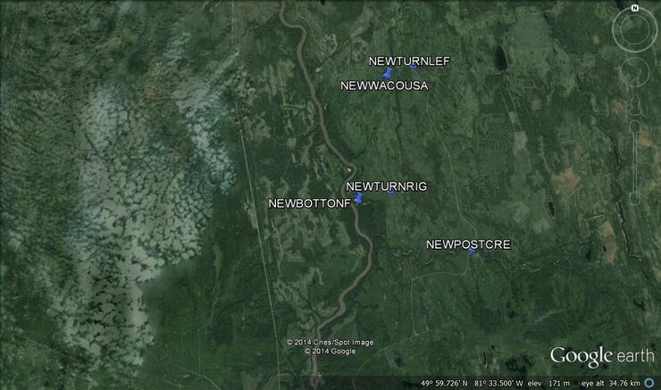
The location of the new dam project
Wayne Ross is President of Coral Rapids Power, the First Nations proponent for the development. He explained the previous state of New Post Falls before the project was completed.
Now water from New Post Creek is diverted by penstock (pipe) or an open flow channel to the new generating station on the Abitibi River.
“The Elders and community members of TTN have an interest in returning the waterfalls, on New Post Creek, to something approximating the waterfalls before the Little Abitibi River was diverted in 1963, and prior to the creation of the Waterway Provincial Park in which it is located,” he says.
In the early 1900s the Hudson Bay Company (HBC) established a trading post on the Abitibi River near New Post Creek.
Approaching the falls the view is a dramatic narrow gorge.
“Our elders describe the historic flow as ‘a trickle with barely any water,’" he explains. "It has also been a concern of our community that a provincial park was created on the Little Abitibi River and encompassed the falls, about which the TTN community was never consulted.” To carry out the development, the deregulation of a small portion of Little Abitibi Provincial Park was necessary to align with requirements of the Provincial Parks and Conservation Reserves Act, 2006. Replacement lands adjacent to the park boundary have been identified resulting in a larger park and enhanced ecological integrity.
A reduction of water flowing over New Post Creek waterfalls due to the New Post Creek Project would result in flows more typical of natural conditions as recalled by TTN Elders. “My Grandfather said they were able to walk into the gorge,” he remembers. At that time, there was hardly any water coming over the falls–and with the new dam completed, so it is again. The new generating station is named the Peter Sutherland Senior Generating Station, after Wayne’s grandfather, who was born close to the post, in 1915.
New Post Falls is easily accessed. Take Highway 11 North from Cochrane towards the northwest and nearby Smooth Rock Falls.
Take Highway 634 north, 74.3 kilometres to Fraserdale and then continue for four kilometres to the Abitibi Canyon Generating Station.
Stop and have a look before you drive over the dam. There are a couple of monuments there and a dynamic view. The four-sided bronze plaque found here displays Rudyard Kipling’s poem ‘Sons of Martha.’ At certain times of the year the volume of water is comparable to Niagara Falls albeit with a more horizontal plane than vertical drop. It is impressive: the rock walls are 46 m (150’) above the riverbed. There is a boat launch here enabling you to travel by water to New Post Falls. The Abitibi Canyon community of 300 residents ceased to exist in 1980. (Beyond the New Post turnoff, continuing north, you would eventually come to Otter Rapids Generating Station, the first of four stations to be completed, post WWII, in the rugged James Bay watershed.)
Drive on another 15 kilometres. You will pass over New Post Creek bridge and it's a great place to take a look at the upstream rapids. Drive another 12 kilometres, you will turn off of the main road leading to Otter Rapids. This is the key change of direction, almost a switchback, west or left. N50° 03’ 57.4” W81° 29’ 17.9” or WGS 84 17 U E465053 N5546077.
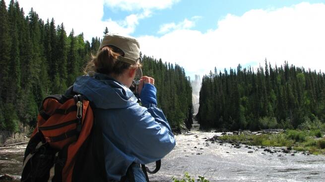
It is another eight kilometres: west to southwest then a sharp west turn (right). It is now less than two kilometres, here you will park: there are well trodden trails to the bottom and to the brink of the falls.
New Post Falls will always be there, in some form or another, but now is the right time to go and have a look. The falls you see may soon be returned to the way they were in their original state–before they were altered by industry.
Click here for KMZ and GPX files.
For a complete package of digital map information, contact the author.