
New Restrictions on What You Can Bring into Canada
Keep up to date with the changes.
By Erin Rody


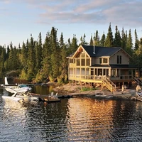
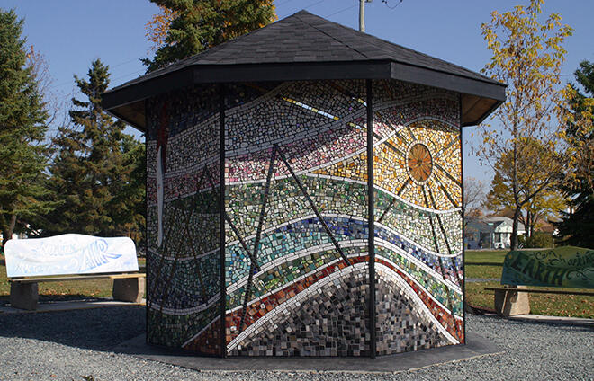
Northwest Ontario starts at the Manitoba/Ontario border and travels east to just past Marathon on the Trans Canada Highway. This vast expanse of land is home to many lakes, forests, wildlife, and many friendly locals. If you took the population of Thunder Bay out of the picture, there would almost be as many people as lakes in Northwest Ontario! Sunset Country and Superior Country are the two travel regions.
Here is an alphabetical listing of the cities and towns in Northwest Ontario. Use the list to help plan a vacation or if you're seeking to relocate, you'll find lots of information on the community websites. Many of the communities are also on Facebook.
Armstrong is a small community at the end of Highway 527. Many people heading to Wabakimi Provincial Park or to a northern Ontario fly-in camp use the town as a base point. It is also northwest of Lake Nipigon, Ontario's largest inland lake.
For more information: Armstrong website or the Armstrong Resource Development Corporation: wabakimi.on.ca/wabakimi/index.htm
Atikokan is known as the "Canoeing Capital of Canada" and is the closest community to the famous Quetico Park. It is located just off of Highway 11 halfway between Fort Frances and Thunder Bay. The varied history of Atikokan includes fur traders in the 1700s to gold, copper, and iron-ore mining to the forest industry.
For more information: Tourism Atikokan: They are on the web at visitatikokan.com and on Facebook. Township of Atikokan: atikokan.ca or on Facebook.
Dryden is a full-service community that it conveniently located along the Trans-Canada Highway halfway between Winnipeg and Thunder Bay. While the city has a large retail and service sector, it is also on the shores of Wabigoon Lake and has the rugged wilderness right next door. Cross the Wabigoon River over the Roy Wilson Suspension Bridge which can be accessed from Johnston Park.
For more information: City of Dryden: dryden.ca or Discover Dryden's Facebook page.
The Township of Dorion is located in the heart of Ontario's "Canyon Country" at the top of Lake Superior just 70 km east of Thunder Bay. Dorion is home to the largest suspension bridge in Canada and to the famous Ouimet Canyon Provincial Park.
For more information: Township of Dorion: doriontownship.ca
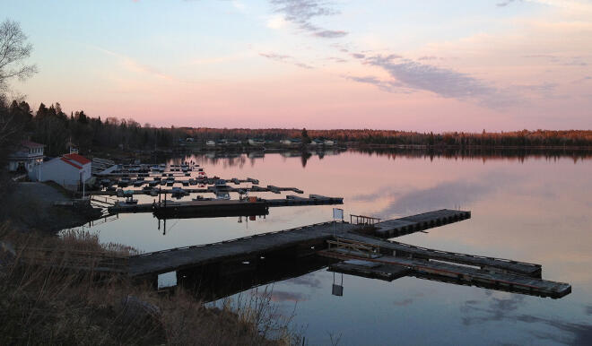
Located on the shores of the famous Lac Seul and the English River, Ear Falls offers residents and visitors an outdoor playground that is enjoyed year-round. They offer world-class fishing and hunting right at their doorstep. The town is located about 100 km north of Vermilion Bay on Highway 105.
For more information: Town of Ear Falls: ear-falls.com
Emo is located on the shores of the Rainy River, roughly 30 minutes west of the Fort Frances/International Falls International border and 40 minutes east of the Rainy River/Baudette International border on Highway 11/17. Because of Emo's geographic location, it serves as the main service center for the agricultural needs of the Rainy River District, and as an important service center for the tourist industry.
For more information: Township of Emo: emo.ca
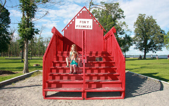
Fort Frances, or the "Fort" as it is commonly known, is the largest town in the Rainy River District and is the oldest settled community west of Lake Superior. Situated on the shores of Rainy Lake and the Rainy River, Fort Frances is a full-service community of approximately 8,000. Fort Frances is located across the international bridge from its sister city, International Falls, Minnesota making it the gateway to Northwestern Ontario.
For more information: Destination Fort Frances or the Town of Fort Frances at fort-frances.com, Fort Frances Chamber of Commerce: fortfranceschamber.com, or their Facebook page.
Kenora is located on the beautiful Lake of the Woods and is the first city heading east into Ontario from Manitoba. With roughly 15,500 residents, it's the second-largest city in Northwest Ontario. Kenora has branded it as the "Premier Boating destination in North America" and you just have to look outside to know why. The downtown is located along the shores of Lake of the Woods and there are many other lakes and rivers nearby. When you are not shopping or dining in one of the many restaurants, head out on the lake and go fishing, paddleboarding, kayaking, or boating. Visit one of the many beaches in Kenora.
For more information: City of Kenora: Visit Kenora or Tourism Kenora's Facebook page.
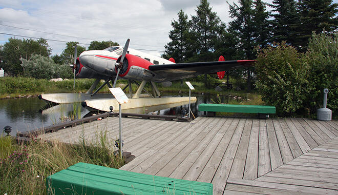
Ignace is a small town of about 1200 located on the shores of Agimak Lake. It is on the Trans-Canada Highway about 2.5 hours west of Thunder Bay. There's a variety of year-round outdoor adventures in and around Ignace with fishing, hunting, and canoeing the most popular. Agimak Lake is the gateway to the Turtle River-White Otter Lake Provincial Park and the Trans-Canada Trail water route. Visit the White Otter Castle by canoe or floatplane in the summer or by snowmobile in the winter.
For more information: Township of Ignace: ignace.ca or on Facebook.
Manitouwadge is located just over 50 km north of the Trans-Canada Highway at the north end of Highway 614. Like many towns in Northwest Ontario, there are plenty of outdoor activities to do in the surrounding wilderness. Be sure to view scenic Lake Manitouwadge from Lion's Beach or the downtown waterfront. You can go hiking, backpacking, kayaking, rafting, climbing, cycling, golfing, or skiing in the winter.
For more information: The Corporation of the Township of Manitouwadge: manitouwadge.ca
The Town of Marathon is located along the famous Lake Superior Circle Tour Route just off Highway 17, the Trans-Canada Highway. In addition to the traditional pastimes of hunting and fishing, there are opportunities for kayaking, canoeing, hiking, golf, biking, skiing, snowmobiling, wildlife and bird watching, camping, and more. There are many other reasons to visit Marathon: Pebble Beach, Lake Superior viewed from Hawk's Ridge, and Neys Provincial Park.
For more information: The Town of Marathon: marathon.ca
Minaki is a small hamlet located about 45 minutes north of Kenora at the north end of Highway 596. It is the gateway to the Winnipeg River System which includes Gun, Sand, Pistol, and Roughrock. All are teeming with bass, muskie, northern pike, and walleye.
For more information: Minaki
Morson is a small community on the south end of Lake of the Woods, Ontario. Morson is a vacation destination for anglers, naturalists, bird watchers, golfers boaters, campers, and photographers. The Morson Bass International is held here each August. The community is located 35 miles north of the Canada/United States border on Highway 621 from the Baudette, MN and Rainy River, ON border crossing.
For more information: Morson Tourism Association: lakeofthewoodstourism.ca
The Corporation of the Municipality of Neebing is situated between the City of Thunder Bay and the U.S. border. Highways 61, 608, 597, 595, and Highway 593 cross the municipality. Access Pigeon River Provincial Park, Little Bay Conservation area, Sunken Ship sites, and Thompson Island Provincial Nature Reserve. Thunder Bay International Airport is a short 20-minute drive north of Neebing.
For more information: The Corporation of the Municipality of Neebing: neebing.org
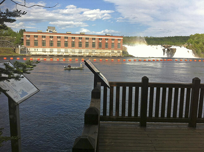
Nipigon sits on the edge of the Nipigon River just west of Highway 17 and Highway 11 intersection on the north end of Lake Superior. Nipigon is surrounded by dramatic shorelines, lakes, and rugged landscapes. The Nipigon Marina is the most northerly freshwater port in North America. The world's largest brook trout was caught in the Nipigon River in July of 1915. Dr. Cook brought in the world record trout weighing in at 14 lbs. 8 oz. (6.58 kg), 31 ½" long, and 18" around the middle.
For more information: The Township of Nipigon: nipigon.net or on Facebook.
Perrault Falls is located on Highway 105 between Vermilion Bay and Ear Falls. It is a small community mostly comprised of resorts and lodges. The Perrault Falls Adventure Area is made up of 600,000 acres of land, 130 Lakes, and 25 Lodges ready for you to explore.
For more information: Perrault Falls website or the Perrault Falls Adventure Area.
The Township of Pickle Lake is located at the end of Highway 599. It's about a three-hour drive north of Ignace and is known as "Ontario's Last Frontier." Pickle Lake is at the end of the paved road, however, you can continue travelling north on a gravel road for another several hours without any services. The Municipality runs four campgrounds on various lakes.
For more information: The Township of Pickle Lake: picklelake.ca
Known for its farmland, rivers, and rolling hills, Oliver Paipoonge contains several communities within its boundaries including Kakabeka Falls, Murillo, Rosslyn, Slate River Valley, and Stanley. Visit Kakabeka Falls, known as the "Niagara of the North." It's on the Kaministiqaui River, and the waterfall plunges 40 meters over sheer cliffs and some of the oldest fossils anywhere.
For more information: The Municipality of Oliver Paipoonge: oliverpaipoonge.ca
The Town of Rainy River is a gateway to Northwestern Ontario via Baudette, Minnesota over a toll-free international bridge. The locals and visitors love to fish the Rainy River and Lake of the Woods which is a mere 14 miles away. Birders will also love the area with its lakes and waterways and the mix of northern, southern, and prairie natural environments.
For more information: The Town of Rainy River: rainyriver.ca or on Facebook.
Located at the end of Highway 105, the Municipality of Red Lake is made up of six distinct communities, Red Lake, Balmertown, Cochenour, Madsen, McKenzie Island, and Starratt-Olsen. It is a full-service northern community and is the gateway to Woodland Caribou Park. There are many lakes, beaches, parks, and a beautiful 18-hole golf course, as well as lodges and fly-in outpost camps to choose from.
For more information: The Municipality of Red Lake: redlake.ca or hwy105.ca
Red Rock is a picturesque community nestled on the shores of the north end of Lake Superior. Fishing and the outdoors are a big part of life in Red Rock. The fish include walleye, northern pike, muskie, lake and brook trout, small and largemouth bass, perch, crappie, Sturgeon, and Whitefish. The Red Rock area is also great for hunting moose, deer, and grouse.
For more information: The Township of Red Rock: redrocktownship.com or on Facebook.
The Township of Schreiber is in a valley surrounded by rugged hills and is on one of the most northerly points of Lake Superior. Since 1885, the community's past has been deeply entrenched in the railroad. You can relive the past at the Schreiber Rail Array Museum. Outdoor enthusiasts can swim at Schreiber or Whitesand beaches, hike the Casque Isles Trails or go camping at Rainbow Falls Provincial Park.
For more information: The Town of Schreiber: schreiber.ca or on Facebook.
The Municipality of Shuniah is located just east of Thunder Bay and is considered to be the "Gateway to the Sleeping Giant". It's a bedroom community to Thunder Bay and includes 40 km of Lake Superior's shoreline. The Amethyst Mine Panorama, which has the largest deposit of amethyst in North America is located in Shuniah.
For more information: The Municipality of Shuniah: shuniah.org
Sioux Lookout, dubbed "Hub of the North," is located on Highway 72 north of Wabigoon on the Trans-Canada Highway. The community can be found on an old water route between Lake Superior and Lake Winnipeg. The route runs via the English River, Minnitaki Lake, Abram Lake, Frog Rapids, Pelican Lake, and Lac Seul. This scenic town boasts a culturally diverse population of over 5,300 residents and provides essential services to 30,000 people in 29 remote First Nation communities.
For more information: The Municipality of Sioux Lookout: siouxlookout.ca or the Chamber of Commerce: siouxlookout.com or on Facebook.
Sioux Narrows-Nestor Falls is located on Highway 71 along the eastern shores of Lake of the Woods. While many people have cottages here and love the resort town feel, Sioux Narrows-Nestor Falls also has over 60 customer service facilities offering a wide range of retail, hospitality, personal, financial, and many others. There's also beautiful Sioux Narrows Provincial Park and the White Moose Golf Course to keep you busy.
For more information: The Township of Sioux Narrows-Nestor Falls: snnf.ca or on Facebook.
Terrace Bay is a picturesque community situated on Trans-Canada Highway 17. The area is surrounded by the rugged beauty of the North of Superior wilderness and serves as the Eastern gateway to the Lake Superior National Marine Conservation Area. Two beautiful areas to see are Slate Islands Provincial Park and the 100-foot Aguasabon Falls & Gorge.
For more information: The Township of Terrace Bay: terracebay.ca or on Facebook.
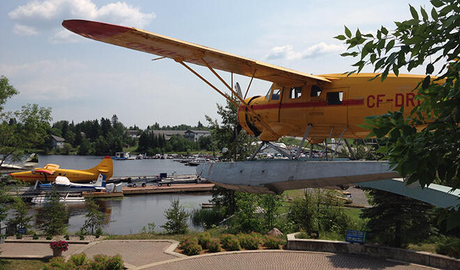
Thunder Bay is by far the largest city in Northwest Ontario and is located on the shores of the world's largest freshwater lake, Lake Superior. It is next to a well-known Provincial Park best known to the rest of the world as the Sleeping Giant. Thunder Bay is a great place for business, education, and training, conferencing, medical, sports, living, and of course, visiting.
The city is located at the head of the Highway 61/Interstate 35 corridor and is only 45 minutes from Minnesota. The Thunder Bay International Airport is serviced by Porter, Air Canada, United, Westjet, Wasaya, and Bearskin Airlines. There are many natural attractions surrounding Thunder Bay as well as many outdoor adventures like kayaking, canoeing, windsurfing, golfing, sailing, snowmobiling, and skiing. Make sure you visit the Fort William Historical Park, the world's largest reconstructed fur trade post.
For more information: The City of Thunder Bay: VisitThunderBay.com or on Facebook.
The Municipality of Machin is made up of three communities (Eagle River, Minnitaki, and Vermilion Bay) on Eagle Lake along the Trans Canada Highway. Some of the main attractions in the area are Blue Lake Provincial Park, Egli's Sheep Farm, and Fort Vermilion. Head to the waterfront on Eagle Lake where you'll find the Centennial Pavilion, a park with benches, a picnic area, and restrooms, and the Pine Tree Pathways, a trail leading from the waterfront through Vermilion Bay leading to a 2km trail north of Fort Vermilion.
For more information: The Municipality of Machin visitmachin.com
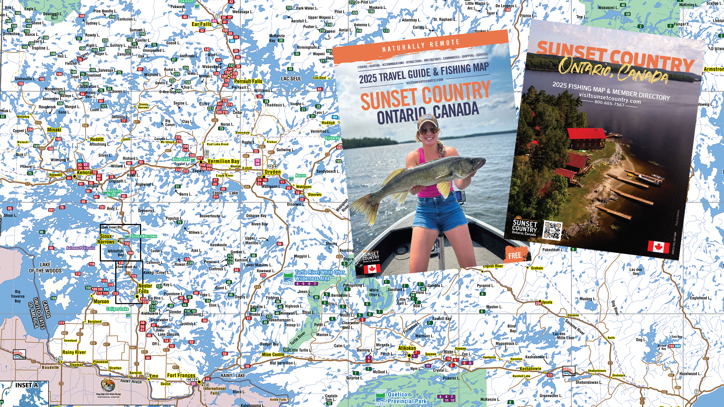
Need more information? Contact the Sunset Country Travel Association for their Free Travel Guide and Map or Superior Country for a Travel Guide.