The temperature begins to drop; skates hit the ice, school's back in session, and autumn sets the region on fire. As the season picks up, the colours become something exquisite, and when winter begins to extinguish the blazing orange for just for a moment until the first snowfall, it’s quite sad.
One thing that I love most about Autumn is the picture it paints during this time of year throughout Superior Country. Some may disagree and argue summer nights on the beach or mornings during the spring hunt are their favourite, but I want to show you what the wonderful exploration of Superior Country is like in the magic of fall.
My exploration took place through a series of a hikes and adventures. I wanted to summarize and highlight some of the best ones to capture the essence of the season.
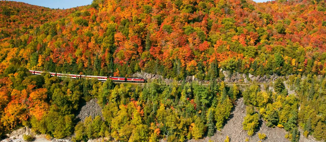
The Nipigon River Recreation Trail is a popular trail between the Townships of Red Rock and Nipigon, Ontario. The 10-km hiking trail connects the two communities, with three lookouts to stop at along the way that have the most breathtaking views.
Location: The trail heads are located at the Nipigon marina and the other along Highway 628 (Red Rock Road) approximately 6.7 km from the turn off Highway 17 and on the left-hand side of the road. There is plenty of parking available at both trail heads, and although people hike the trail in smaller portions at a time, if you want to complete the whole trail at once it is recommended to begin in Red Rock and end in Nipigon.
Description: The trail is open throughout all seasons, but it is highly recommended to hike it during the fall season in September or October. The trail has all the proper signage and is maintained throughout the year. It is estimated to take anywhere from three to five hours. I would classify this trail as a difficult one as it is lengthy, with rocky terrain and a lot of steep inclines. When I completed the trail with a friend this fall, we left from the Red Rock trailhead at about 11:30 am and reached the Nipigon Trail Head at approximately 1:30 pm.
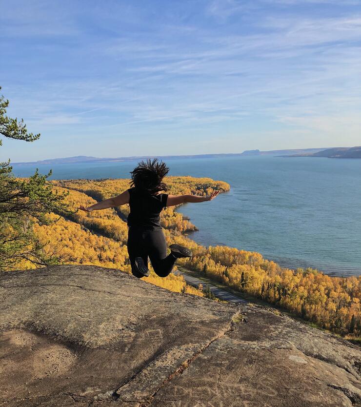
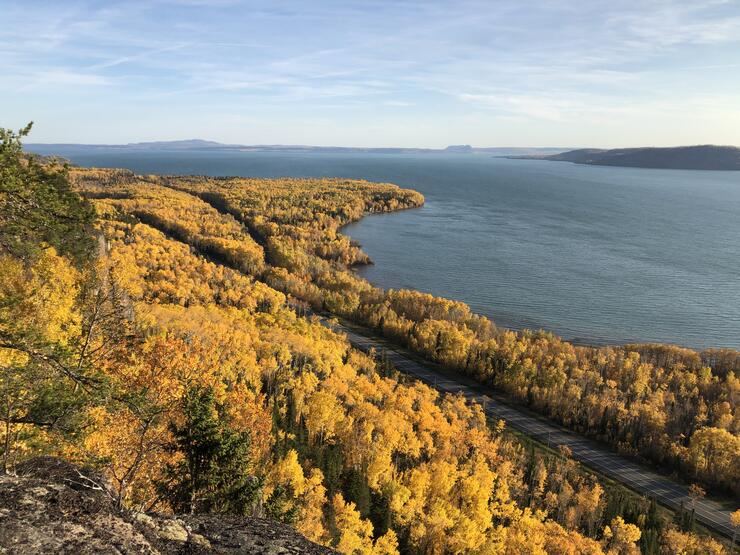
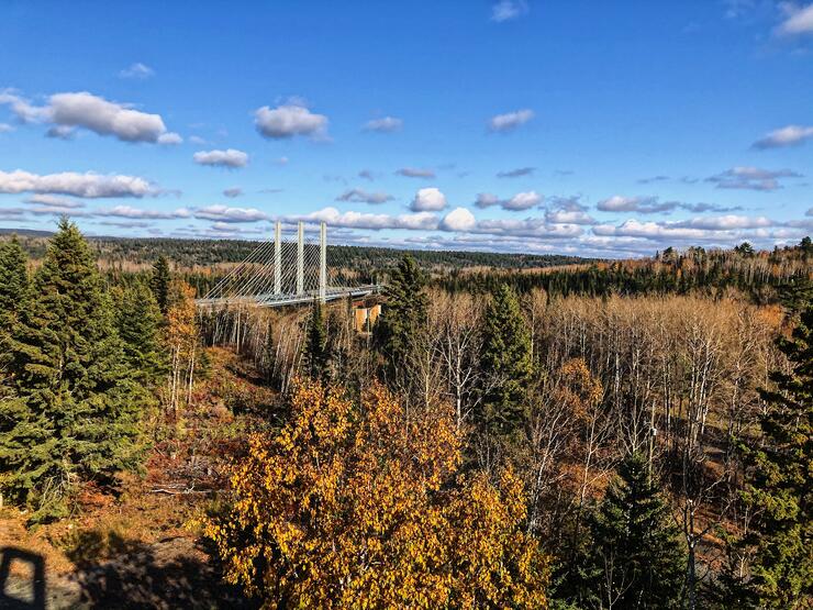
Highlight: The highlight of this trail is reaching one of the three lookouts, Eagles Ridge. Nothing beats this view of the North Shore, especially with the Nipigon River right in front of you, the lush blazing orange forest surrounding the river, and the Nipigon River Bridge off in the distance.
I have hiked this trail in all seasons, and the view simply does not compare at any other time of the year than during the fall season.
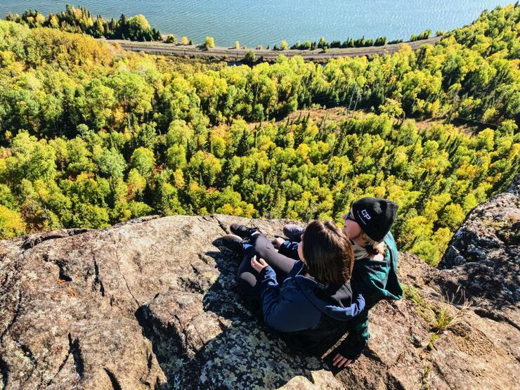
Location: The Kama Kliffs trail is located approximately 24.6 km from the Township of Nipigon heading east towards Terrace Bay Ontario along Highway 17. When travelling from Nipigon, the trailhead will be along the side of the highway on the left-hand side, and almost directly across is Kama Bay road where you can find great space to park.
Description: I would describe this hike as a difficult one because it has multiple spots with loose rocky terrain and very steep hills to climb. There is also a spot where you must cross a small creek without a solid path. However, the result of hiking this trail is extremely worth a bit of challenge!
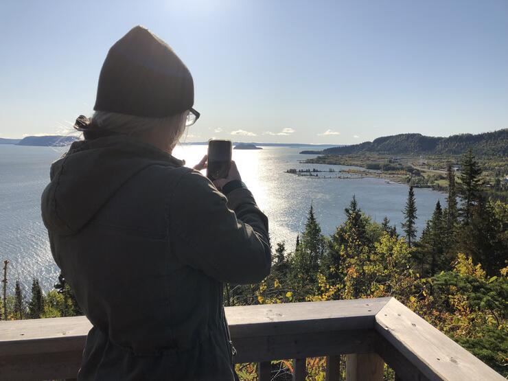
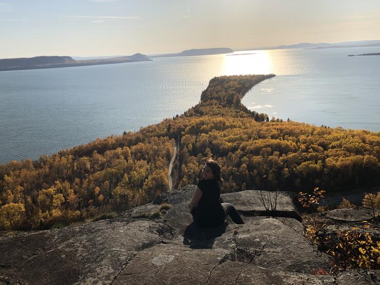
Highlight: The panoramic views of Kama Bay and further out to Lake Superior are stunning. We sat at the top of the Kliffs for over an hour and truly marvelled in the beauty that sat in front of us.
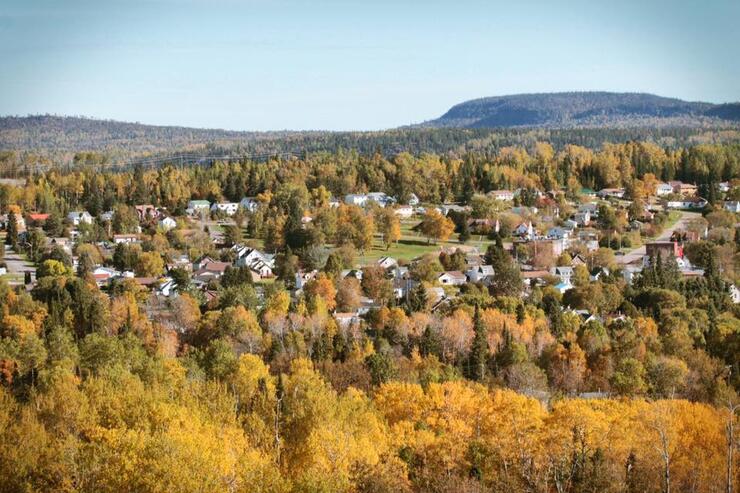
The Bald Spot is what you could say a "local hangout" for the Township of Nipigon, as this one is a very short hike and has the ultimate view of the entire community including the beautiful Nipigon River Bridge. However, it can be just as great for travellers passing through who want a beautiful view and a better understanding of the Township of Nipigon.
Location: Trailhead is located on Greenmantle Drive, 100 m north of the Wadsworth Dr. intersection. (Shortly after the pavement turns to gravel.)
Description: This is the perfect trail for those in the area for only a short amount of time, as it probably takes a maximum of 15 minutes to reach the top, has great signage, and is easy to follow. The whole trail is about 2.8 km return and has a slow gradual incline as you hike you to the top. I would describe this as an easy hike and good for all ages and pets.
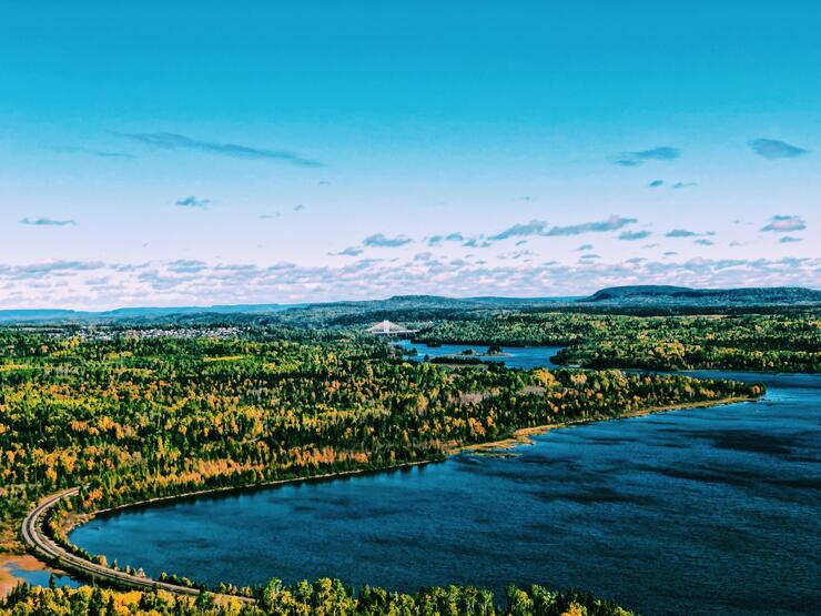
Highlight: The highlight of this trail is the lookout with the best view of the entire township of Nipigon including the Nipigon River Bridge. As a child, my favourite thing to was to sit at the top and spot my own house, along with those of other friends and family, within the view.
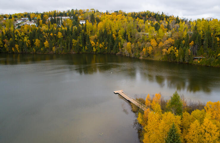
The portage trail is a recent addition to Nipigon and the surrounding area's plethora of hiking options. The great thing about this trail is that it's perfect for tourists! The trail is close to town, has appropriate signage, and lots of gorgeous views.
Location: The trail begins on Railway Street leading up to Nipigon's newest attraction the Bridgeview Lookout Tower. We recommend beginning your hike from the tower, as there is plenty of parking and it is easy to find.
Description: This is an easy hike, as it's all flat and packed gravel to walk on with signage and extremely easy to follow. Begin the trail by going up the tower to get stunning 360-degree views you will see Nipigon, the Nipigon River Bridge, and Lake Helen. The trail is a loop, following the path from the lookout tower under the Nipigon River Bridge, where you have the option to walk up to viewing platforms for a gorgeous view of the Nipigon River. From there, you continue under the bridge and follow the old railway line that hugs the river towards the Nipigon Marina.
Once you are approaching the marina, the Turtle Point Boardwalk will be on your right. To finish the trail entirely, continue along the old rail line past Turtle Point, cross “Black Bridge,” and eventually you will reach a set of steps on your right. Climb the steps and turn right, which will bring you to downtown Nipigon. There are there are great spots to have lunch, shop, and explore or walk back up to your starting point on Railway Street/The Bridgeview Lookout Tower.
This is a hike that has been featured before in other articles for Superior Country, and you can head over to Magical Mazukama to get a more in-depth look at the trail, but this is such an amazing trail to also experience in the fall season that it simply had to be included.
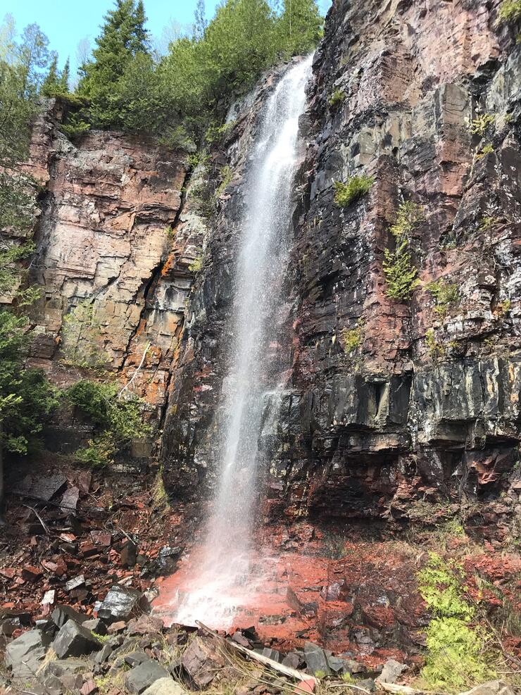
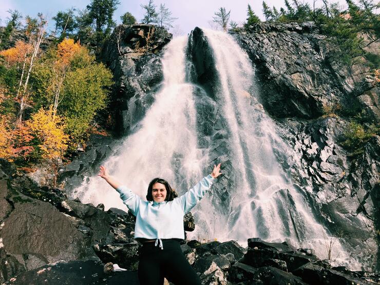
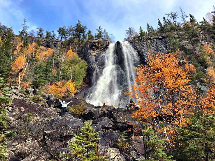
Location: This trail is located on Highway 17, approximately 20 km east of Nipigon. You drive down the highway, and once you’ve passed “Ozone Creek” there will be a gravel road (Camp 81 Rd.) on the left-hand side at the bottom of a large hill, which you will need to turn onto. Once you’ve turned onto the road, the trailhead is only about 200 m away. There is a large space where you can park your vehicles and get organized before taking on the trail.
Description: This a moderate hike due to portions of the trail requiring you to climb with a rope and you must cross a stream with rough terrain. The hike to the waterfalls is only a portion of the trail, as it is an entire loop that can be hiked but the portion only until the falls is approximately 30 minutes at a steady pace and about 1.5km.
Highlight: The highlight of this trail is the 25-metre-high falls that you reach at the end of this portion of the hike. It is stunning to view and very fun to stand underneath for the perfect photo op.
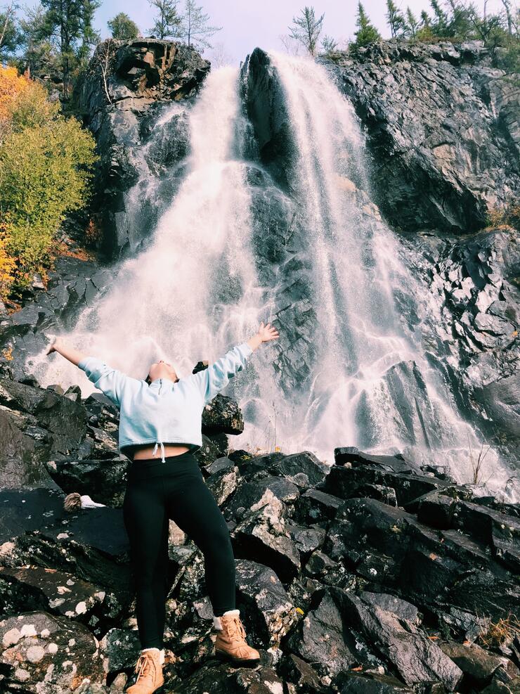
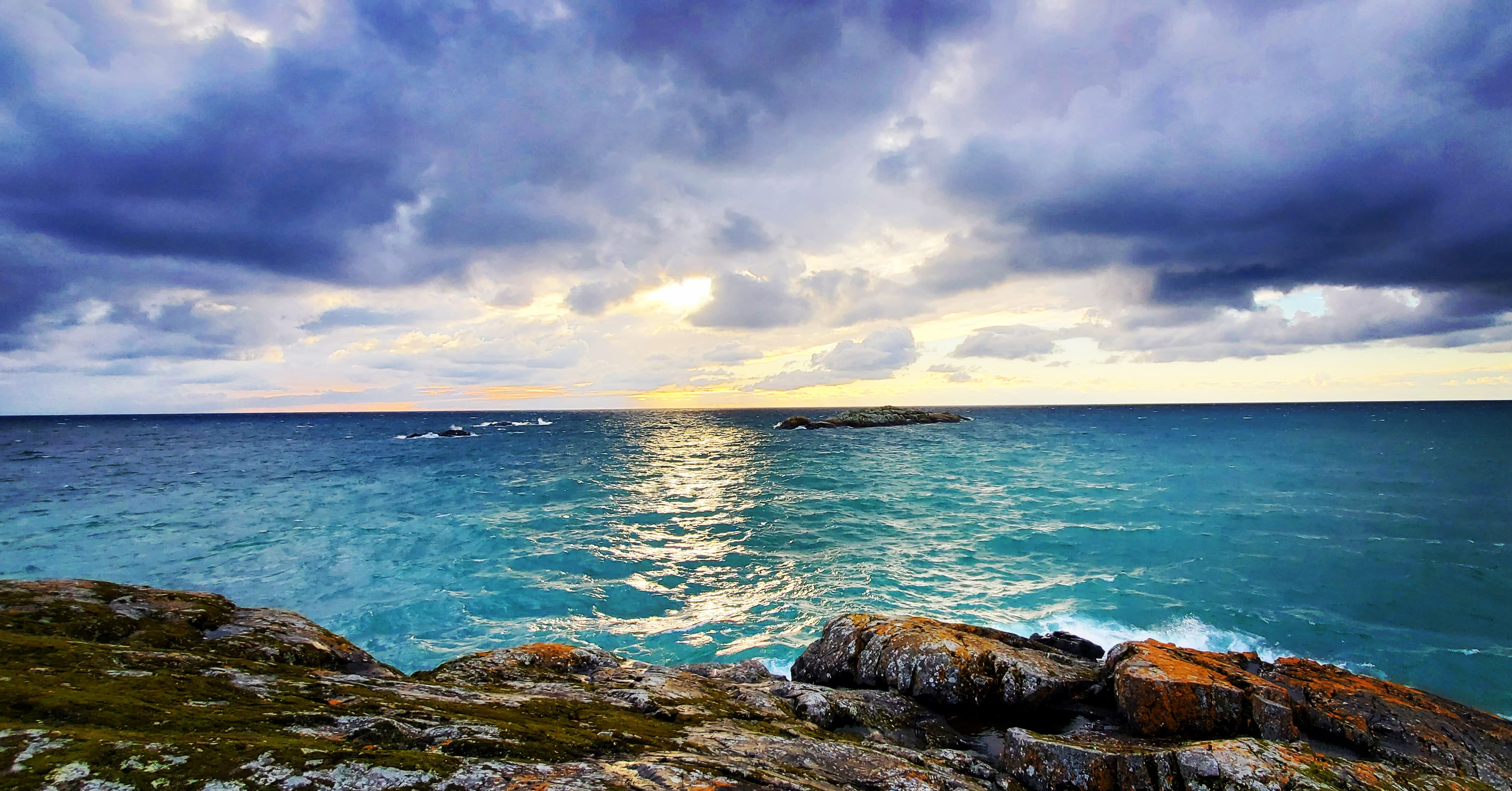
Location: When turning onto Highway 11 from Highway 11/17, if you travel 43 km down the highway, the falls will appear on the right-hand side with a small area to pull off and park. The waterfalls can be seen from the highway and is easy to spot. The Cascade Falls are located within the Greenstone region in Superior Country, and you can find a lot of other great things to do while passing through.
Description: This is not a designated hiking trail, and can be simply just viewed from the road, still giving the visitor stunning views; however, if you want to approach at your own risk, there is a small dirt path leading up the rocky terrain that leads up to the falls.
Highlight: The highlight of this point of interest is simply just viewing the large falls from either roadside or climbing higher to sit right underneath the falls on the rocky terrain.
Superior Country is stunning all year round, whether it's in the summer sunshine or winter wonderland. My exploration of Superior Country during the fall season is my favourite thus far, and the stunning views I'll remember forever. I hope that when planning your next trip, you consider Superior Country during this time of year and enjoy or find the highlights listed above helpful.
Casey is a writer and photographer born and raised in Northern Ontario's Superior Country region. She has enjoyed travelling the world but her passion for home has always brought her back. Her love for the great outdoors has her exploring on her free time through hiking, fishing, hunting etc.