Let’s be honest, “geology” doesn’t always scream road trip excitement. For some, it conjures up dusty textbooks and words that are hard to pronounce. But in Northern Ontario, geology isn’t something you read and theorize about. It’s something you stand on, climb over, paddle past, and photograph at sunset. It’s dramatic, strange, and, in many cases, surprisingly beautiful.
Ontario’s gemstone, amethyst, gets all the attention around here. It is beautiful, to be sure. But beyond that striking, purple treasure is a landscape full of lesser-known wonders: swirling rock formations, mysterious holes carved by ancient waters, and islands shaped by fire and ice. If you’re planning a road trip through Northern Ontario, these six hidden geological and geomorphological gems are worth pulling over for. Even if you’re “not into rocks”, these places might just change your mind.
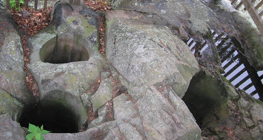
Nature’s Ancient Whirlpool Art: Keewatin Rockholes Near Kenora
We’ll start our geological adventure west of Thunder Bay near the Lake of the Woods area, in Keewatin, which is part of the City of Kenora. Just off Highway 17 and a short walk from Keewatin Beach, you’ll come across something that looks almost alien. The Keewatin Rockholes aren’t your typical roadside attraction; they’re a collection of four perfectly rounded holes drilled into solid bedrock. But here’s the kicker: no machines were involved.
These holes, which are commonly referred to as “potholes”, range in size from 30 inches to several feet in diameter and were carved during the last ice age, approximately 18,000 years ago, by swirling meltwater from retreating glaciers. Imagine torrents of water spinning rocks in tight circles, slowly grinding smooth holes, about four to seven feet deep, into the stone. It’s like nature took a giant drill to the landscape, and then just left it there for us to discover.
What makes this spot especially fun is how interactive it feels. Kids love it. Adults end up asking, “Wait… how did this happen again?” The best part is that it’s not overly crowded or heavily commercialized—it still feels like a bit of a secret. Amenities at the site include a picnic shelter and a viewing platform from which to admire the formations.
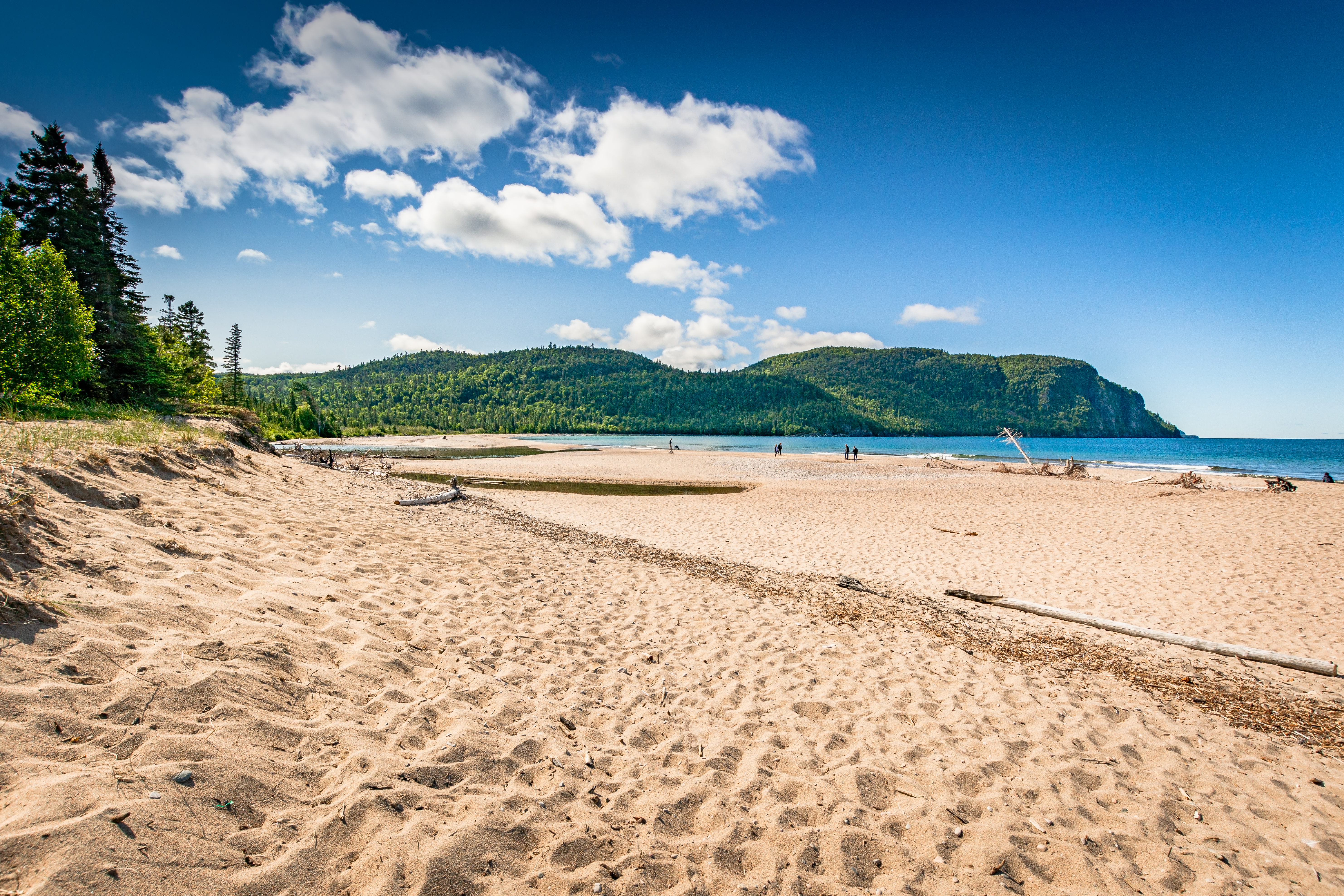
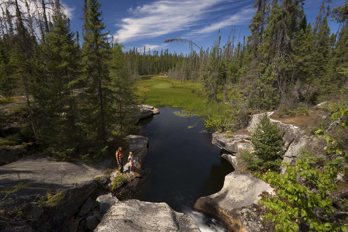
Shifting Sands in a Sea of Granite: Sable Islands Provincial Park
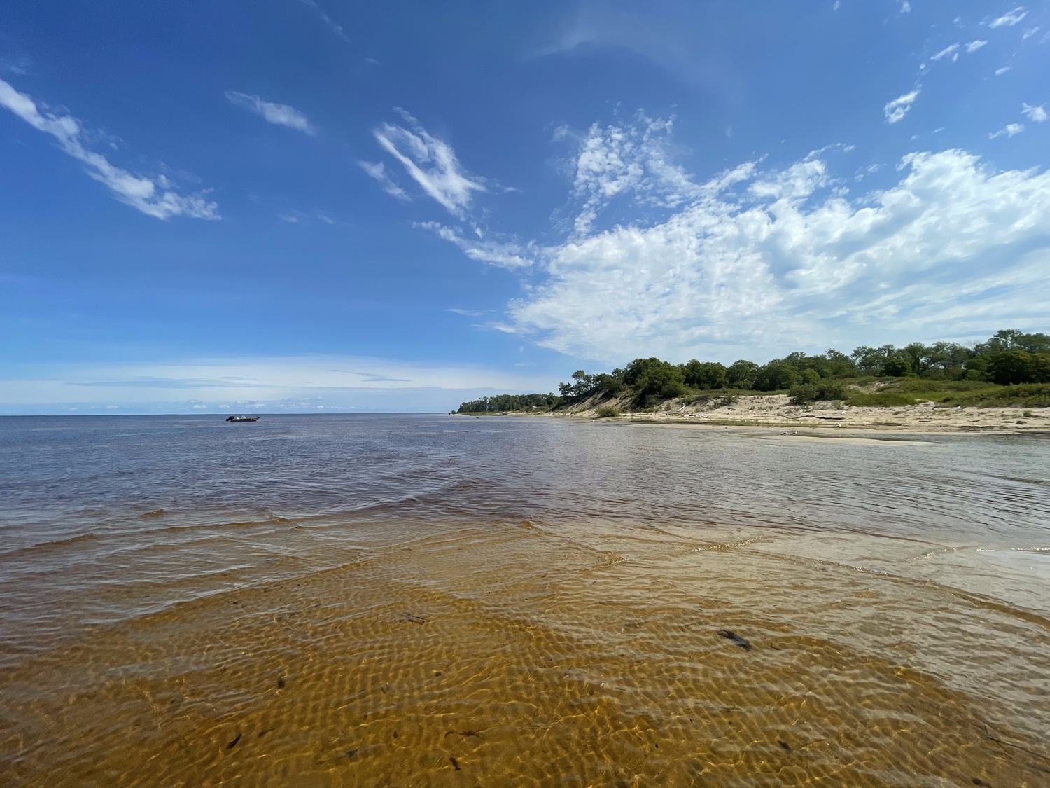
Head just over 200 km south of Kenora, and you’ll find Sable Islands Provincial Park, located on the south shore of Lake of the Woods near the Minnesota border. On these islands lies a landscape that feels almost out of place in the Canadian Shield. Instead of endless rock, you’ll find sand, rolling dunes, quiet beaches, and ever-changing shorelines.
The Sable Islands are a fascinating geomorphological puzzle. In a region dominated by ancient granite, these sandy islands were shaped by currents, wind, and wave action over centuries. They shift and evolve, so no two visits are ever quite the same.
If you’re paddling through the area or exploring by boat, the contrast is striking. One minute you’re navigating rugged rock outcrops, the next you’re stepping onto soft sand that wouldn’t feel out of place much farther south. Even if geology isn’t your thing, this place delivers on pure atmosphere: calm, wide-open skies, and the kind of quiet that makes you forget your phone exists. Except to take photos, of course.
Another interesting fact: This site is currently the only known location in Ontario where the nationally endangered Piping Plover breeds. It also marks the easternmost breeding point in Canada for the northern Great Plains population of this species of bird, with the nearest significant group found roughly 300 km to the northwest at Lake Manitoba.
The islands are accessible by water only, and there are no visitor facilities on the islands.
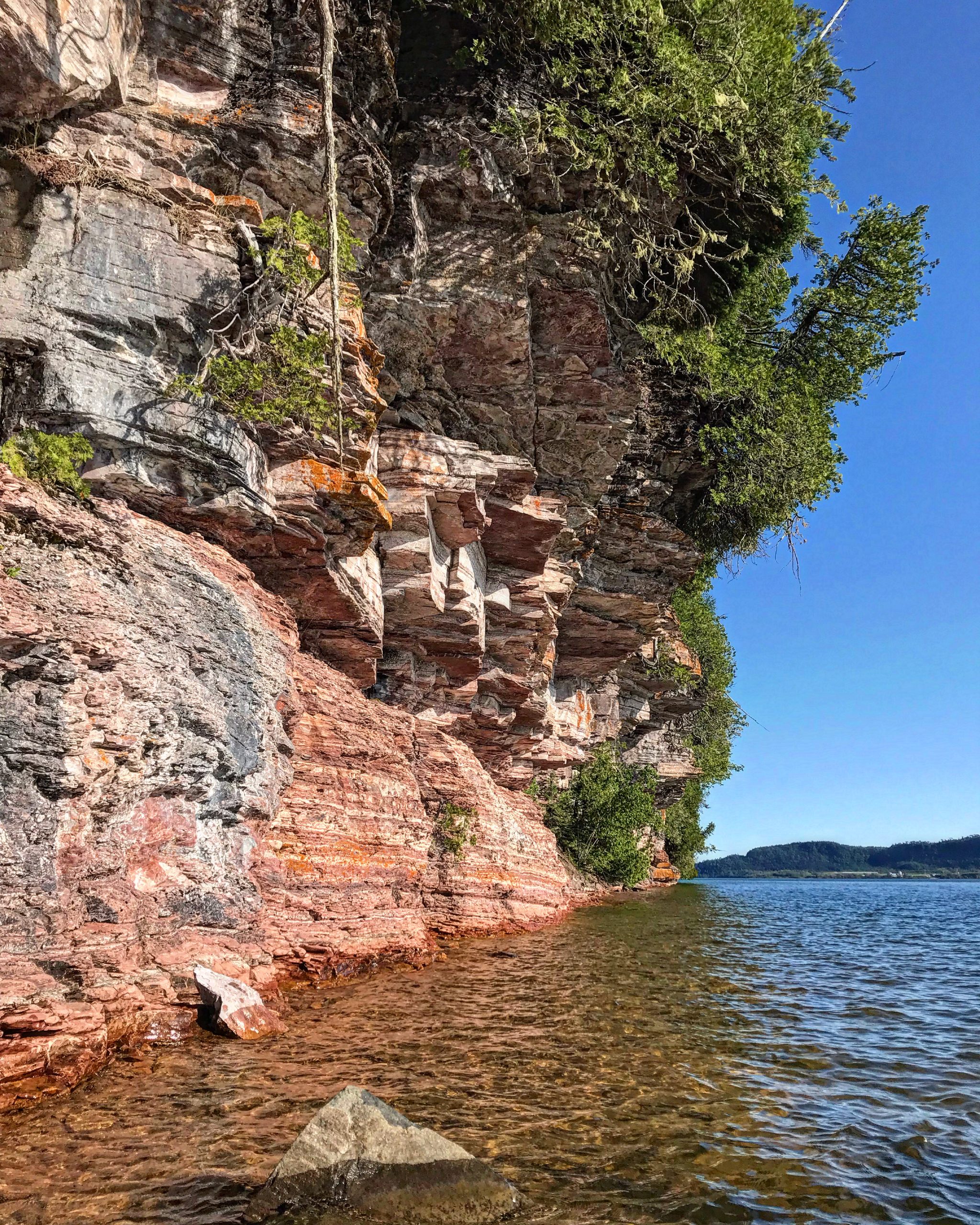
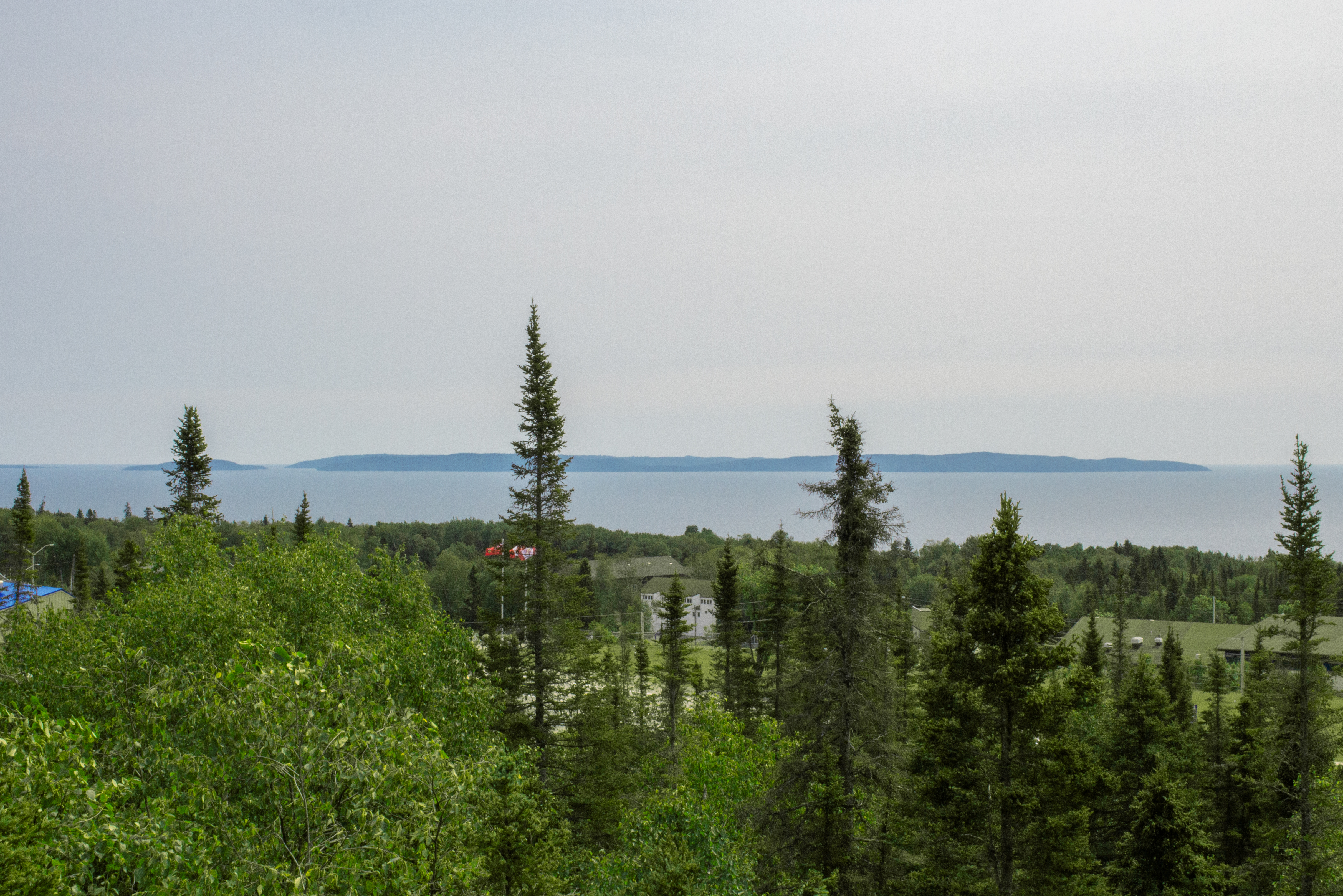
A Fiery Landmark on Lake Superior’s North Shore: Red Rock Cliffs
About one hour east of Thunder Bay is a quaint little community that is named for its renowned geological feature. Red Rock is famous for its dramatic cliffs and mesas characterized by deep, rusty hues. Known as “cuestas”, these iron-rich formations are especially beautiful at dusk and dawn when the setting or rising sun makes them appear to glow.
But these aren’t just pretty cliffs. They’re snapshots of ancient environments, formed from layers of sediment that were deposited, compressed, and transformed over vast stretches of time. The distinctive colour comes from iron-bearing hematite within the volcanic-origin, columnar jointed rock. The red cliffs are capped by hard, black diabase rock, forming plateaus. This diabase was created by molten material pushing between sediment layers, often forming dramatic vertical columns as it cooled and shrank.
The most impressive cliff of red rock can be seen by driving east on Highway 11/17, just after the turnoff to enter Red Rock. The cliff is surrounded by private property, so if you’d like to take pictures, you’ll have to pull over when it’s safe and get some quick shots. Before or after you check out this cuesta, make sure you head into town and visit the Red Rock Marina Interpretive Centre. Here, you’ll find out more about these fiery geological formations, but you’ll also learn about the flora, fauna, and history of the area. A bonus: you can admire the yawning cliffs that surround Nipigon Bay and the town proper.
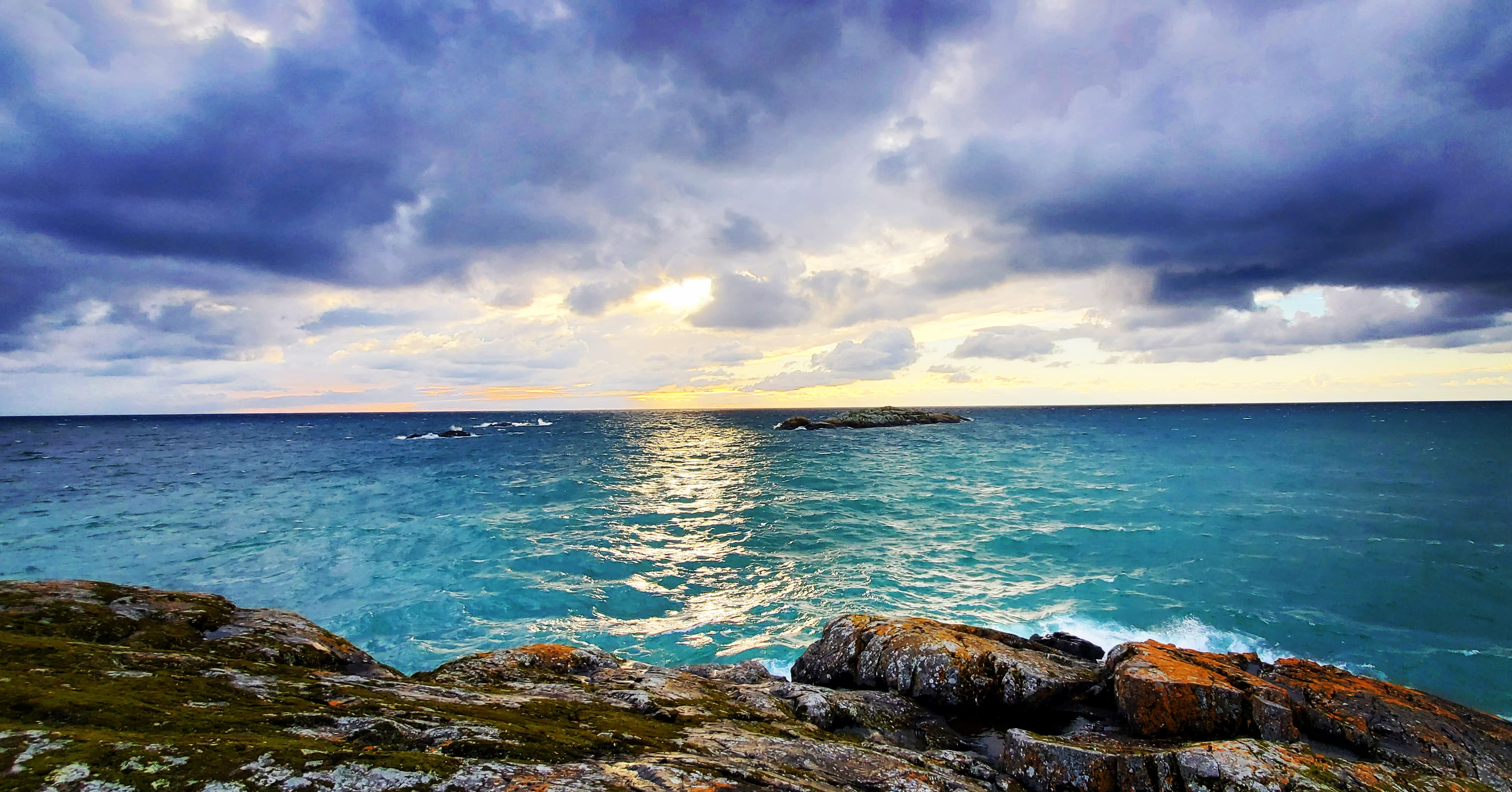
Echoes of a Volcanic Past: Slate Islands Provincial Park
Drive another 90 minutes east, and you’ll find Slate Islands Provincial Park. About 12 km off the coast of Terrace Bay and located within the boundaries of the Lake Superior National Marine Conservation Area (LSNMCA), this park is remarkable. Not just for its rugged beauty, but for the extraordinary geological story it reveals.
The Slate Islands are the eroded remnants of an ancient meteorite impact structure, formed roughly 450 million years ago when a massive object struck the Earth in what is now Lake Superior. The force of this collision fractured and uplifted the underlying bedrock, creating a circular pattern that can still be traced in the arrangement of the islands today. As a result, the rocks here display unusual features rarely seen elsewhere in Ontario, including shattered and brecciated formations, or fragments of older rock that have been broken apart and fused back together under immense pressure. In some areas, visitors can also find evidence of “shock metamorphism,” where minerals were altered by the intense energy of the impact, offering a rare glimpse into processes usually associated with planetary-scale events.
What makes the Slate Islands especially unique is how clearly this ancient impact history is preserved and visible at the surface. Unlike many other impact sites that are buried or heavily eroded, the islands’ rocky shorelines, cliffs, and outcrops allow visitors to directly observe the results of this dramatic event. The interplay between the geological past and the present landscape is striking. Wave-washed basalt ridges, smooth glacially polished surfaces, and fractured rock faces all contribute to a terrain that feels both wild and scientifically significant.
The park is open to the public, but access is limited to boaters and experienced kayakers. There are no regular shuttles from the mainland, and no visitor services are available. The islands can be seen from the Terrace Bay Beach, where budding geologists can learn more by checking out the Slate Islands Interpretive panel or speaking with Parks Canada staff at the beach pavilion.
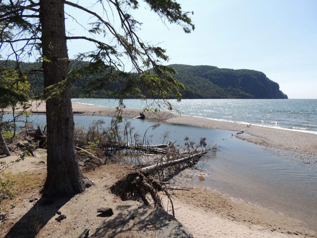
A Face in the Cliffs: Old Woman Bay in Lake Superior Provincial Park
About three hours further east, not far past Wawa, is Lake Superior Provincial Park. The geology here is breathtaking, shaped by ancient volcanic activity, billion-year-old continental rifts, and glacial erosion. This is also where you’ll find Old Woman Bay, characterized by diabase dikes and dramatic faults. Its name refers to the striking 200-foot granite cliff that resembles the profile of an elderly woman gazing out over the lake. But beyond this optical illusion, the cliffs themselves are a geological masterpiece.
These towering formations are part of the ancient Canadian Shield. The layers, colours, and textures tell a story that stretches back further than most of us can even comprehend. Then there’s the setting: a sweeping sandy beach, powerful waves, and cliffs that seem to rise straight out of the water. It’s dramatic in every sense of the word.
Lake Superior Provincial Park features several amenities, including serviced camping sites, picnic areas and washrooms. It is also extremely popular for swimming.
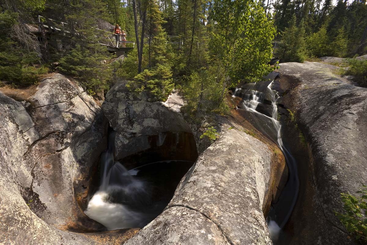
Carved by Ice and Time: Potholes Provincial Park in Algoma Country
If you aren’t going to be travelling west of Thunder Bay and are intrigued by “potholes”, there’s no need to miss out seeing them up close and personal. Go off the beaten path slightly, north of Lake Superior Provincial Park, and you’ll find Potholes Provincial Park. This lesser-known stop offers one of the most fascinating geological displays in Algoma Country.
The park’s namesake “potholes” are just like the ones you’ll find in Keewatin. Smooth, cylindrical depressions carved directly into solid bedrock, formed thousands of years ago by swirling meltwater at the end of the last Ice Age. As glaciers retreated, fast-moving currents carried stones and sediment that drilled into the rock, slowly grinding out these perfectly rounded holes. At the park, you can still see and even peer into these formations, some of which are surprisingly deep and wide. It’s a hands-on way to connect with the powerful natural forces that shaped this landscape.
What makes the site especially interesting is how accessible these formations are. Instead of reading about glacial erosion in a textbook, you can walk right up to it, trace the edges of the potholes, and imagine the rushing water that once filled them. The surrounding bedrock, part of the ancient Canadian Shield, adds to the experience with its weathered textures.
Features at the park include a 350 metre self-guided hiking trail and boardwalk, and interpretive panels that detail the history of these awesome formations. That said, the park’s simplicity is a feature in itself. It’s quiet, uncrowded, and all about the landscape itself.
Stone Cold Impressive: See Geological Wonders in Northern Ontario
You don’t need to be a geologist to enjoy and appreciate these places. In fact, that’s kind of the point. Northern Ontario’s landscapes aren’t just about rocks; they’re about stories. Epic stories of giant glaciers carving the land, violent volcanoes shaping the earth, and erosive water transforming it all, even now as we observe.
So, the next time you’re cruising through Northern Ontario, don’t just focus on the bigger, crowded destinations. Pull over at the strange spots. Walk the short trails. Follow your curiosity. You might just discover that rocks aren’t boring at all. When you take the time to learn about everything they’ve been through, you can’t help but walk away feeling a sense of both awe and admiration.