Is It Safe to Travel to Northern Ontario Right Now? What Visitors Need to Know About the 2026 Wildfires
By Northern Ontario


There are a lot, and I mean a lot, of notable facts about the Trans-Canada Highway. We narrowed it down to ten amazing facts about the TCH, but there is so much more to learn. Discover more about Canada's most famous highway by visiting its Canadian Encyclopedia entry, checking out TransCanadaHighway.com or watching this video. But first, a bit of history!
On July 30, 1962, former Prime Minister John F. Diefenbaker officially opened the Trans-Canada Highway. At the time of the grand opening, Canada's Highway 1 was the world's longest non-interrupted highway. The opening of the 8,000 km highway meant that motorists could cruise the country uninterrupted from St. John's Newfoundland to Victoria, British Columbia (with a few ferry rides thrown in).
After World War II, Canada was growing exponentially; in fact, the population doubled two decades after the war. A lot of major construction projects took place during this time including the St. Lawrence Seaway. The automobile industry was thriving, and the country was working to build and pave roads to connect major cities. In 1949, the Trans-Canada Highway Act was passed by Parliament, shortly after Newfoundland joined Canada, with construction beginning in 1950. This was because up until the highway was built, the only way to travel across Canada was by train.
Now that you've got the basics—here are 10 facts about the Trans-Canada Highway.
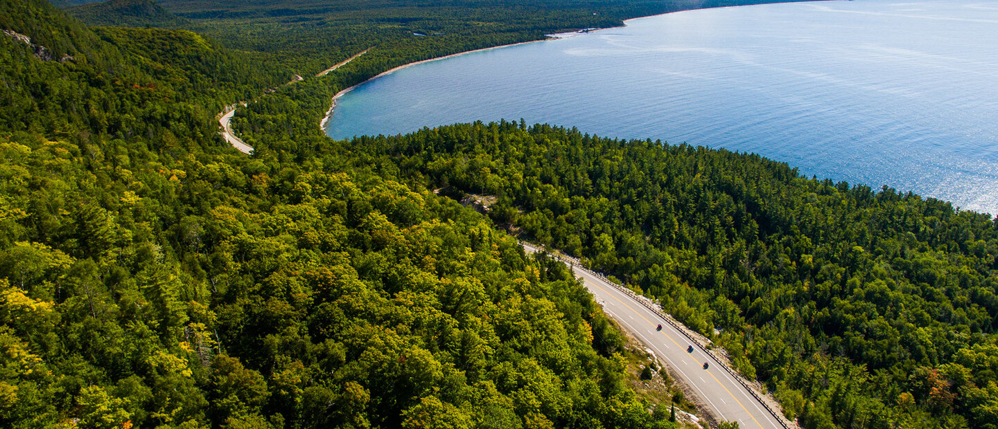
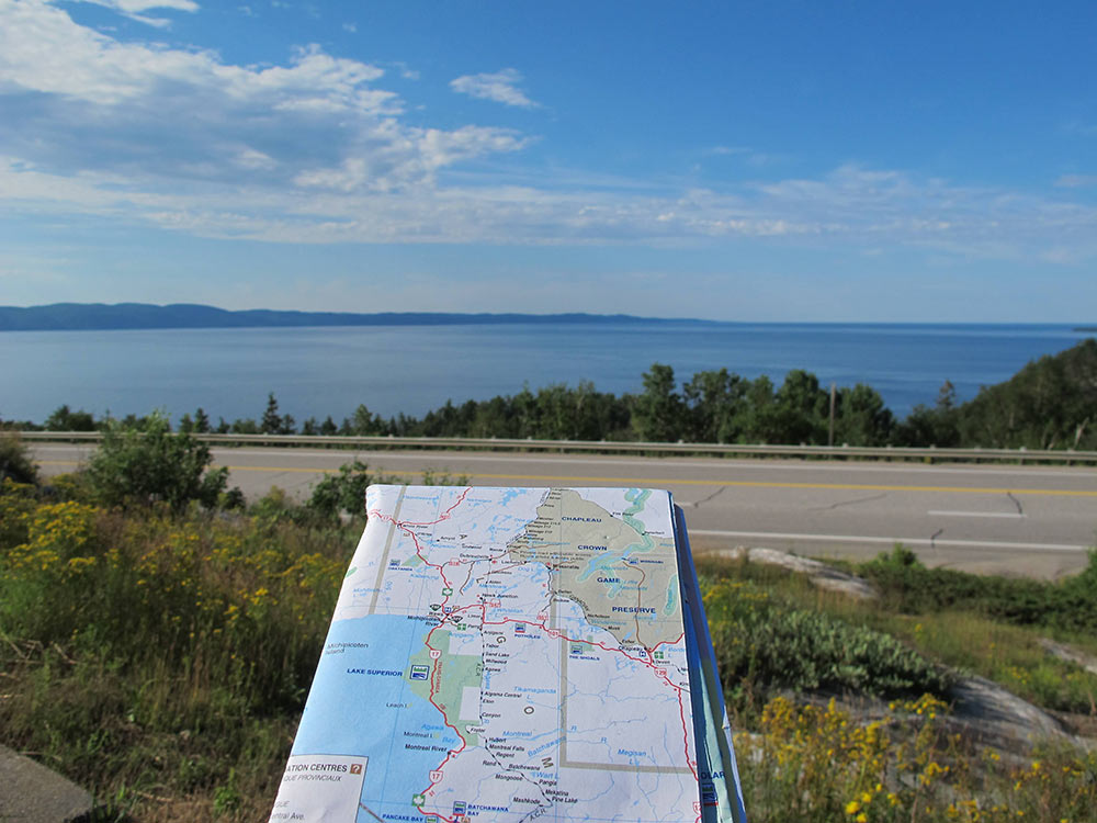
The Trans-Canada Highway is 8,000 km long coast to coast. In Ontario, the province's section of the TransCanada Highway is 1,964 km / 1,220 mi long making it Ontario's longest highway from the border of Manitoba to Arnprior. Today, several different routes cross Canada—and over 500 highway routes in Ontario.
While the highway links the nation, the federal government is only responsible for sections of the highway that run through national parks. This means provinces make decisions on design, construction, safety standards, signage, and financing of highways. The Ontario portion of the highway is known as Highway 17.
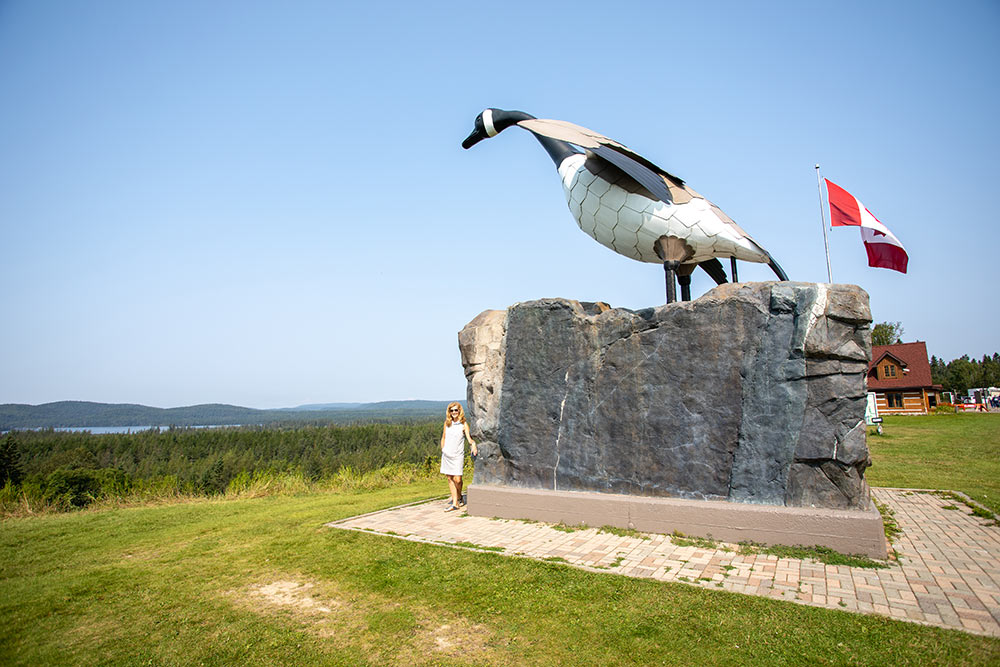
The official opening ceremony for the Lake Superior Circle Tour and the Trans-Canada Highway was on September 17, 1960, near the town of Wawa, Ontario. Wawa is the home of the famous Wawa Goose Monument, one of the most photographed monuments in North America. The completion of Trans-Canada Highway 17 was a catalyst for building the goose.
The challenge of protecting Rogers Pass in British Columbia was addressed by constructing snowsheds to shield the Trans-Canada Highway from avalanches. However, other remote areas required more direct and forceful solutions. The Gap—the section between Agawa Bay (north of Sault Ste. Marie) and Wawa—was one of the most rugged, inaccessible areas in the country. The Gap was a 265 km long stretch of Canadian Shield and dense forest. To bridge this gap, engineers had to blast 2,087,234 cubic metres (2,730,000 cubic yards) of rock, remove 5,982,641 cubic metres (7,825,000 cubic yards) of earth, and clear 6.97 square kilometres (1,720 acres) of forest.
To learn more about The Gap and view some historic photos click here
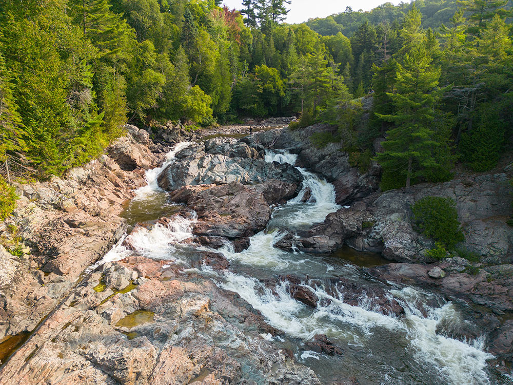
The halfway point of the TransCanada Highway is located at Chippewa Falls in Algoma Country. The plaque is on a stone monument at the parkette near the waterfall. Visitors can see a full view of the waterfall from a walking bridge next to Hwy 17. Or, with caution, take some of the trails that follow alongside the waterfall.
Like U.S. Route 66, the Trans-Canada Highway runs right through many towns and cities, with homes and businesses built next to the highway. However, over the years, many bypasses and upgrades have been made to the original route—leaving many towns out of luck when it comes to the tourism and traffic they used to rely on. Many of these original sections are now under the responsibility of regional and local jurisdictions or decommissioned, lying abandoned in the forest. Notable bypasses in Northern Ontario include Thunder Bay, Nipigon, Sault Ste. Marie, Espanola, Sudbury, and North Bay.
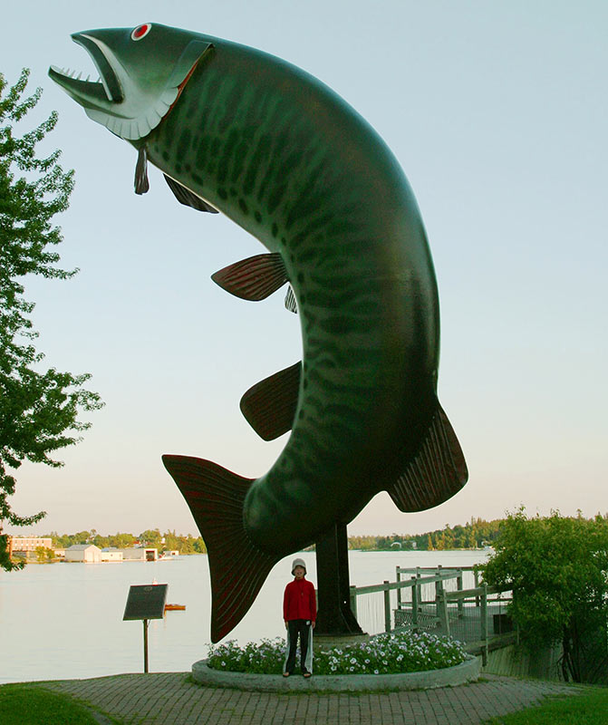
Instead, take Highway 17 into Kenora, located on Lake of the Woods in Ontario's Sunset Country. Snap a photo with Husky the Muskie, a 40-foot-tall outdoor sculpture depicting a muskellunge in McLeod Park. Husky has appeared in a few road trip movies like One Week (2008) starring Joshua Jackson.
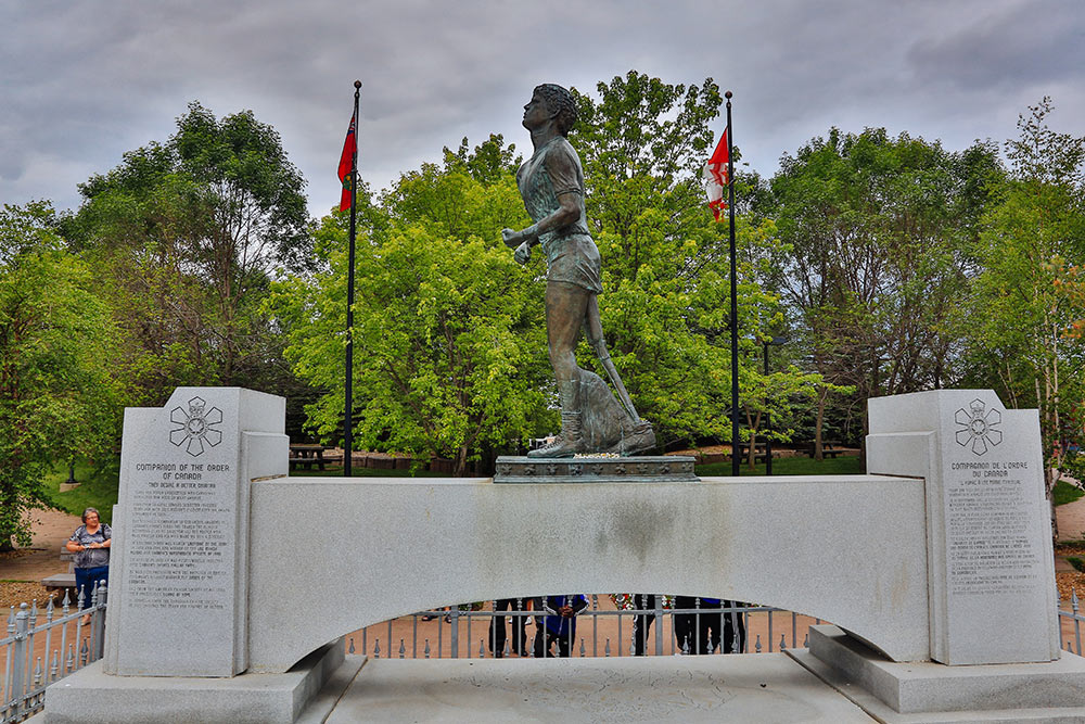
This next one is not to be missed. The Terry Fox Memorial and Lookout is located along Highway 17, just on the outskirts of Thunder Bay in Superior Country. The monument and national plaque commemorate Terry Fox, who was a cancer research activist known for his Marathon of Hope in 1980. Terry embarked on a cross-Canada run to increase cancer awareness. His run was cut short in Ontario just outside of Thunder Bay.
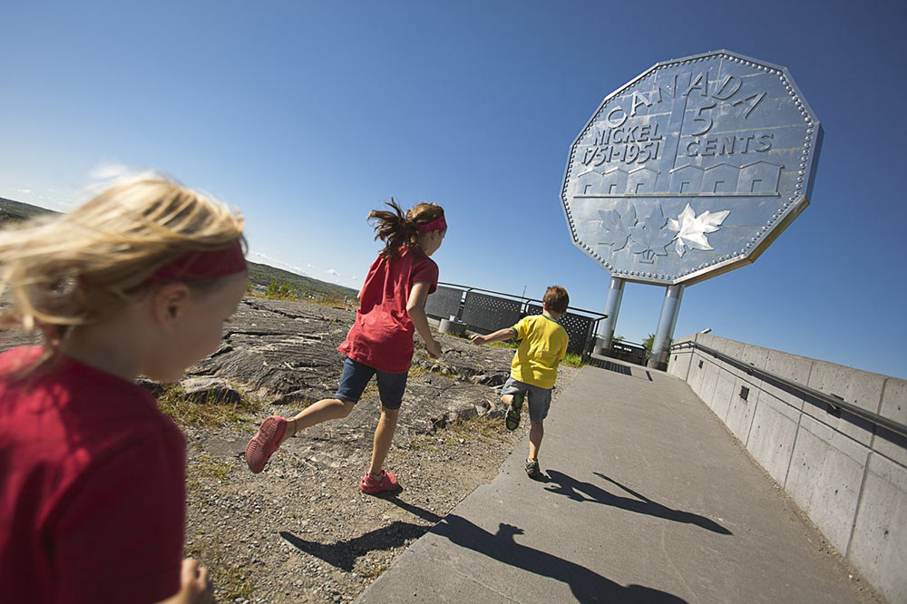
No stop on Highway 17 is complete without a visit to the Big Nickel, the biggest coin in the world! Sudbury, in Northeastern Ontario, is home to this famous monument standing 30 feet tall and weighing nearly 13,000 kg! It's made of stainless steel and is a replica of a 1951 Canadian nickel. To learn more, check out these top 10 facts about Sudbury's Big Nickel.
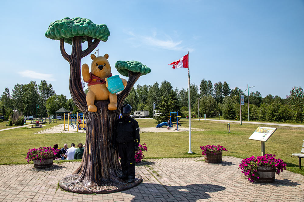
The town of White River, located on the Trans-Canada Highway, is home to Winnie the Pooh Park. White River is the hometown of the real Winnie, a black bear who inspired A.A. Milne’s beloved bear, Winnie-the-Pooh. You can reach the park just off Highway 17 as you pull into town. Additionally, check out the White River Heritage Museum, the Historic White River Train Station, local murals and the Tourist Information Centre.
Building the Trans-Canada Highway to connect Canada coast to coast was an amazing feat. It cost over $1 billion to build TCH by the time it was completed in 1962. Calculating for inflation, this type of project today would cost over $10 billion. That’s a big suitcase full of money. The TCH crosses 10 provinces, is connected by land and water over mountains, through forests and across the prairies, along the majestic waters and crosses 6 time zones!
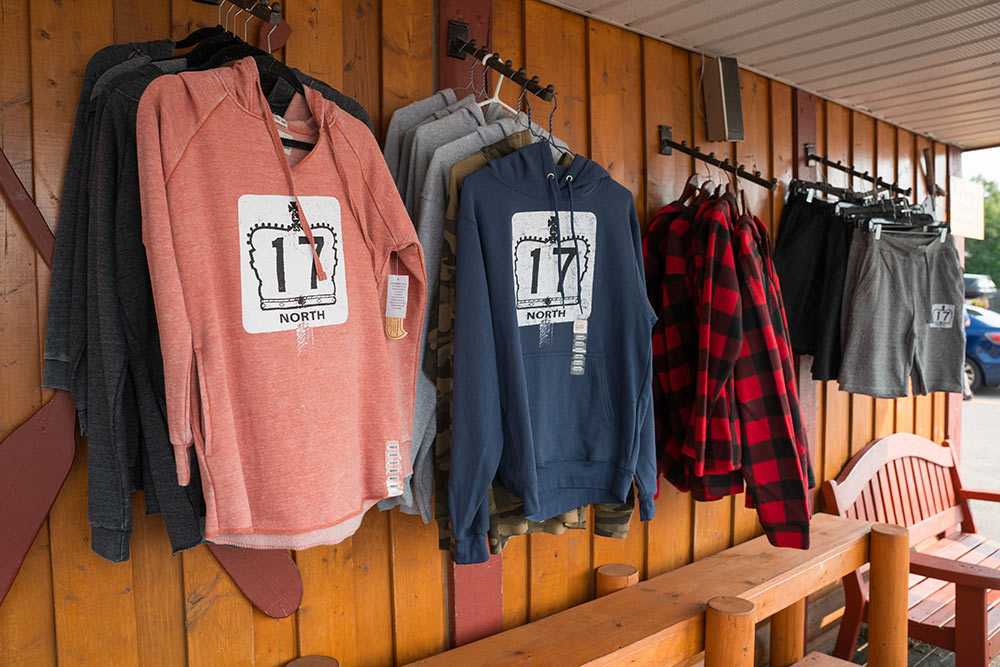
Commemorate your journey along the TCH from Sault Ste. Marie to Batchawana Bay, along the breathtaking coast of Lake Superior—a stretch of the TCH also known as Highway 17 North. Get your Highway 17 North gear from River Rock Gifts. Located at The Voyageurs’ Lodge overlooking Batchawana Bay, purchase tees and hoodies, ball caps and toques, mugs and signs depicting the classic highway sign. And get yourself an apple fritter, too!