Timeless Middle Falls
The day we drive to Middle Falls (on the Canada-USA border south of Thunder Bay), the sky is a perfect shade of summer blue, dotted with clouds cheerfully white and agreeably fluffy.
Highway 61 cuts an undulating path through the rocky landscape and the view changes almost constantly, as the sun picks out individual trees on the variable green mountainsides and highlights severe cliff faces of orange and white and gray. The land here, heading south towards the border through the Municipality of Neebing, is rugged and wild.
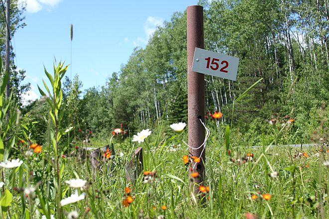
We turn right on to Highway 593 just before 61 makes its final sweep towards the border crossing. Not too far along, there's a suggestion of a parking area on the left, marked at the road by a lonely fire number 152. We are almost past it when we see it, but with a quick turn we coast in the drive, and our wheels crunch over a small patch of gravel encroached on by scrub grass and wildflowers. The river rushes past, just beyond a small stand of trees, and in the distance we hear the roar of falling water.
It feels very much like a forgotten corner of the world and indeed, when we consult the map perched on a pole beneath a tree, the red star pinpointing our position claims we are standing at just about the most western point of Pigeon River Provincial Park on a small blip of land tucked away behind a bend of the river.
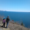
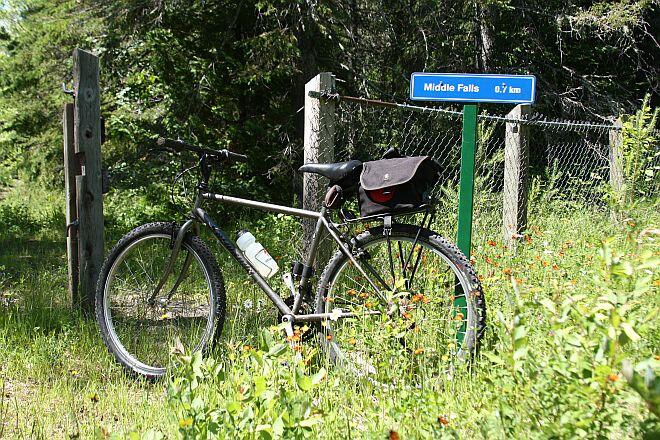
A little blue sign beside an oddly placed chain link fence tells us we are 0.7 km from Middle Falls – that’s if we choose to head upstream along the Pigeon River. If we set off in the other direction, there are two trails according to the map: the Old Logging Trail, which eventually cuts a path to the High Falls trail near the border, and the Lookout Trail, a 1.6-km hike over steep terrain leading to a view that goes on for miles.
With the sound of the falls beckoning, we jump on our mountain bikes and head down a muddy, rutted road that parallels the river, past crumbling remnants from when this place used to be a bustling tourist park. It has the feel of a ghost town.
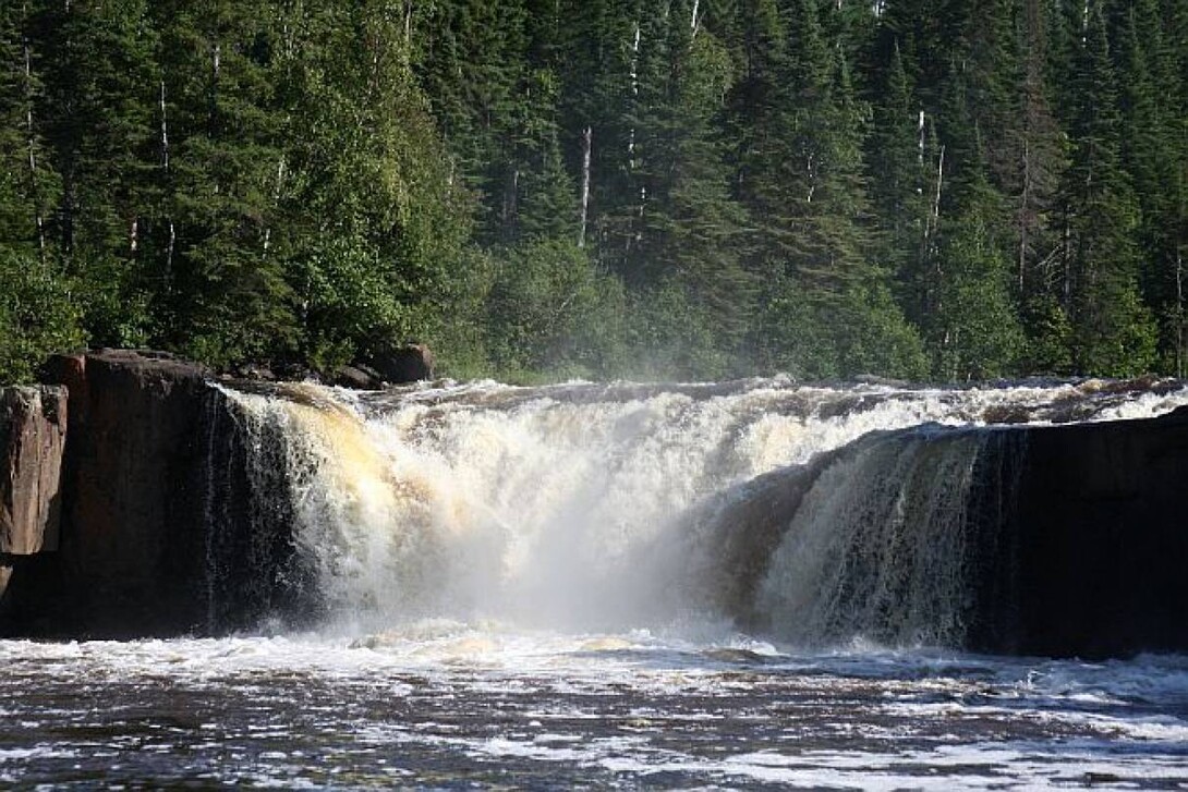
But Middle Falls commands this little corner of the Pigeon River. When we first glimpse it through the trees, we stop by a picnic table and watch the white water tumble over black rock 20 feet down to the churning river below. Then, we cycle out the road to where it becomes a steepish rocky trail to the river’s edge, and stand within the very periphery of the waterfall’s spray, letting the roar of it fill our ears.
We explore further, biking up a steep grade to the highway and following the road a short way to a gravelly shoulder, which is clearly a vehicle pull-off area. From there, a dirt footpath disappears into the tree line, leading back towards the river where we stand beside towering Tamaracks on a rocky precipice, 10 feet above where the falls drop over their edge, water endlessly crashing into white noise. We are so close, we can almost see the water hesitating before it plunges over. Before us is a long sweeping view of the river as it disappears around a bend and dashes away toward Lake Superior.
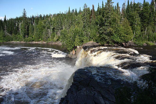
The trip to Middle Falls is worth this view alone, but there is another trail from the gravel shoulder just a little bit upstream. We emerge on to a great table of red-tinged rock. It reaches out into the middle of the river and forms part of a channel, through which the previously placid Pigeon River funnels into a tumultuous cascade of rapids.
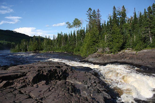
We sit on the warm stone, experience the timelessness of this place and watch the water rush past, feel the odd splash as it crashes against the rock and then swirls away through a flat area before plummeting over the ledge of the falls, sending up white plumes of spray into the perfect summer-blue sky.
Recommended Articles

Epic Lake Superior Adventures Near Thunder Bay
Experience Your Perfect Summer in Thunder Bay

Eco-Friendly Travel in Thunder Bay

Wellness Retreats in Thunder Bay

LGBTQIA+ Friendly Businesses in Thunder Bay

Uncovering Thunder Bay's Hidden Gems
Top 10 Interesting Facts About Thunder Bay

Work Hard, Reward Yourself: Discover Thunder Bay’s Best Winter Experiences

Thunder Bay Winter Fun Guide 2025

12 Best Places to Stay in Thunder Bay

5 Fantastic Ways to Explore the Water in Thunder Bay

5 Reasons to Bring a Conference or Meeting to Thunder Bay, Ontario

21 Ways to Enjoy Thunder Bay

The Remembrance Poppy and its Thunder Bay Roots

Why You Should Always Travel With Fishing Gear in Thunder Bay

This new cruise ship sails into Thunder Bay

Chill Out in Thunder Bay: Why Cold Plunges Are Hot Right Now

Walk This Way: Self-Guided Art and History Tours in Thunder Bay


