Two Days of Italian Cuisine and Culture
An August Long Weekend Tradition
By Chelsea Cameron-Fikis


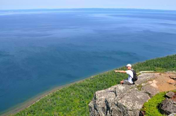
Peering over the edge, I looked straight down at Lake Superior from the top of the Sleeping Giant.
"Careful where you step," said Greg Stroud, my hiking partner for the day from Parks Canada, "because each step could be your last."
There was no sign, no guardrail—just an unobstructed view of the world's biggest lake from one of Ontario's highest points.
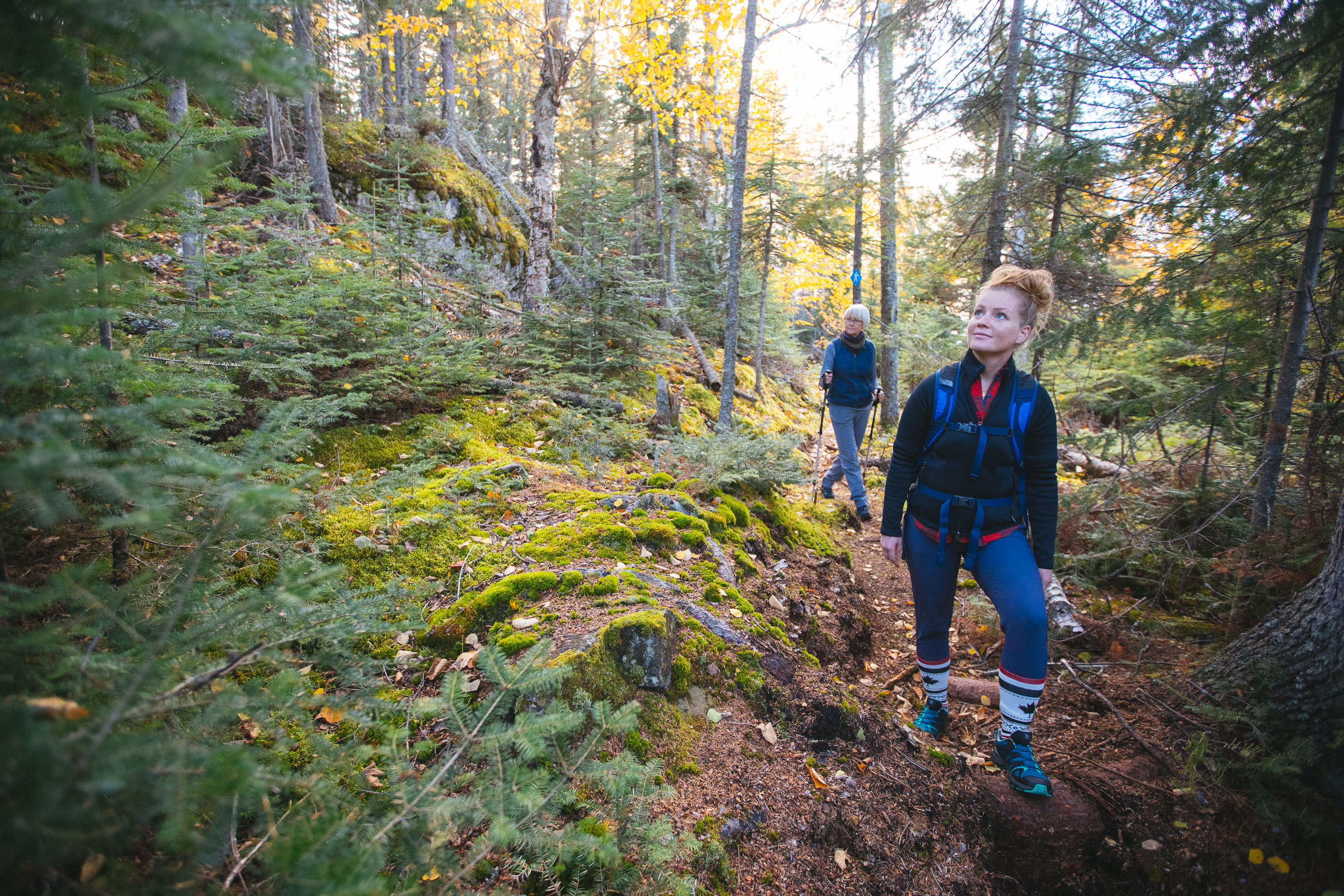
Hiking the Top of the Giant Trail in Sleeping Giant Provincial Park, Ontario, Canada, is no easy feat. The goal was to reach the Lake Superior lookout that hovers 950 feet above, which means hikers have to climb every step of the elevation gain.
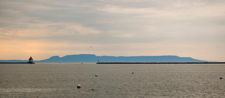
Looking from the waterfront in Thunder Bay, the formation of volcanic rock mesas that juts out into Lake Superior looks like a stone figure sleeping peacefully on his back. According to Ojibway legend, the Sleeping Giant is "Nanabijou" — The Spirit of Deep Sea Water — who was turned to stone when the white man was given the location of a nearby silver mine at Silver Islet.
The Sibley Peninsula divides Thunder Bay to the west from Black Bay to the east and is a prominent figure in the landscape. With its abundance of trails, Sleeping Giant Provincial Park is one of the best destinations for hiking in Northwest Ontario. Though the provincial park has a variety of hiking routes including a coastal trail and an abundance of easy trails for varying abilities, the Top of the Giant is among the more popular routes.
After looking at the Sleeping Giant for a few days from across the bay I was determined to hike to the top. The trail winds its way through a boreal forest that is dense with foliage and surrounded by birdsong. More than 100 birds migrate to the park each year including Ovenbirds, Magnolia Warblers, Black-capped Chickadees, Swainson's Thrush, and Winter Wrens.
The Top of the Giant Trail departs from the South Kabeyun Trailhead on Highway 587 near the Silver Islet Township. From the trailhead, take the Kayebun Trail 6.0 km (3.72 miles) to the Talus Lake junction. Take the Talus Lake Trail for 1.8 km to the Top of the Giant Trail junction.
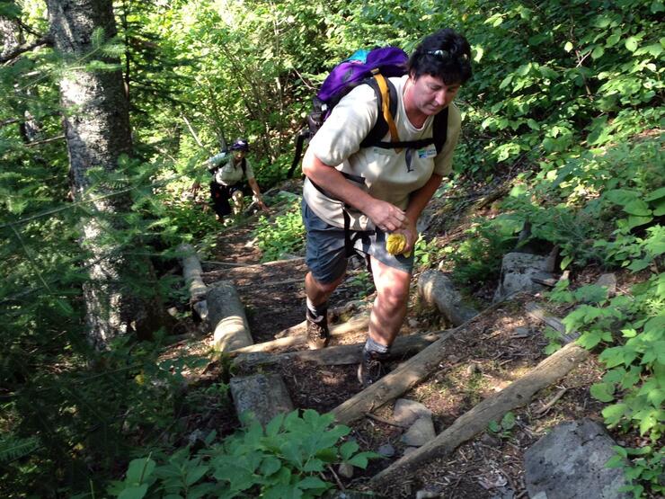
This is where the climbing begins. You'll head straight up the mountain for 2.7 km until you reach the "Top of the Giant," which sits 750 feet above Lake Superior. There you will find a "top of the giant" sign, a cold creek and a bench for resting, but you're still not to the best viewing point yet.
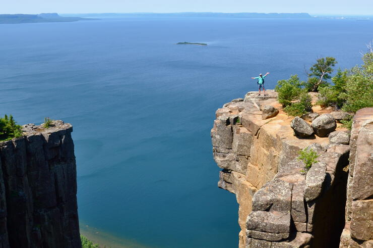
To get to the Lake Superior lookout it's another 2.0 km of gradual climbing, but the extra hiking is well worth the trek. The top of Sleeping Giant is one of the highest points in Ontario and the view is spectacular. Once you reach the end of the trail, you'll look out over Thunder Bay and Lake Superior.
To shorten the distance of your hike, you can bike, kayak or sail to Tee Harbour, which takes 10 km off your total round trip.
Trail: Top of the Giant
Location: Sleeping Giant Provincial Park
Distance: 21.8 km (13.54 miles) round trip
Elevation Gain: 950 feet
Level: Difficult