The Complete 2026 List of ATV Events in Ontario
Poker Runs, Mud Bogs, Charity Rides, Rallies and more!
By Mike Jacobs


Roads. We take them for granted—just another piece of our modern infrastructure. We've always known them to be there. They take us from A to B as we travel through our daily routines. Off to work. To school. A visit with friends. Always there under our tires and feet. We grumble when a road has potholes, and fuss when we're stuck on one in traffic. We see the land only through the paths of black asphalt and crushed stone that are cut through the forests and open fields, twisting and weaving an interconnected web that touches every home and any destination we wish to travel.
But have you ever taken a moment to think about the history of the road you're traveling upon? That's the question that keeps rolling through my mind every time I find myself traveling down an old country road.
I'm talking about the roads that roll with the natural terrain and bend around the foothills of the mountains. Who was the first person to travel on this road? Did the road originate from a long established walking corridor that connected early pioneer settlements, or was it surveyed and cut for a specific purpose? Of all the possible routes available, why was the present path selected? Simple questions, I agree, but when I'm driving my ATV down a road, taking in the scenery and the smells of the land, these questions I cannot help but wonder.
This is a story about the Old Hastings Road—the road of broken dreams.
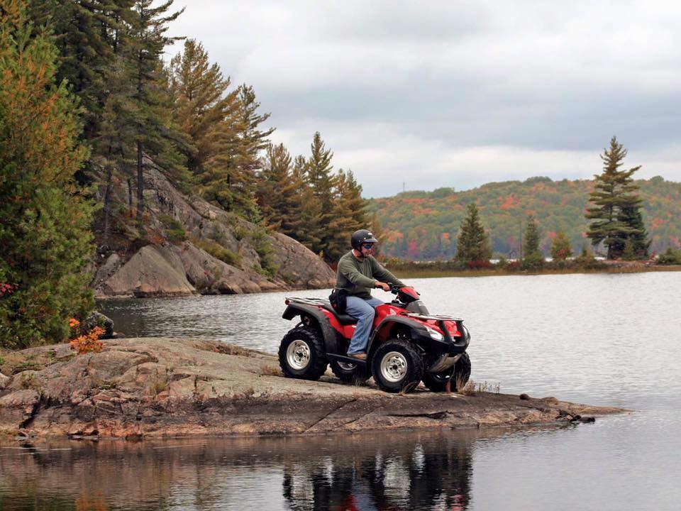
Every year I load the ATVs onto the trailer and head to Bancroft for a weekend of relaxed ATVing and exploration. Unlike some of the other ATV trips that are more geared towards rough backwoods trails, this trip is all about going slow, taking lots of breaks, looking around, going into old shops, and discovering bits and pieces of our pioneer past.
I originally stumbled onto the Old Hastings Road after reading about the ghost town of Glanmire in Ron Brown's book Ghost Towns of Ontario. After looking up the location of Glanmire, I noticed that I could access the Old Hastings Road right off the Hastings Heritage ATV trail, part of the EOTA trail system.
So back in 2014, my wife and I drove our ATVs from the Marmora KOA Lodge, jumped on the Old Hastings Road at Millbridge, and had a wonderful afternoon exploring the cement bridge and cemetery. Since then, I've wanted to learn the history of the road and the stories of the early settlers.

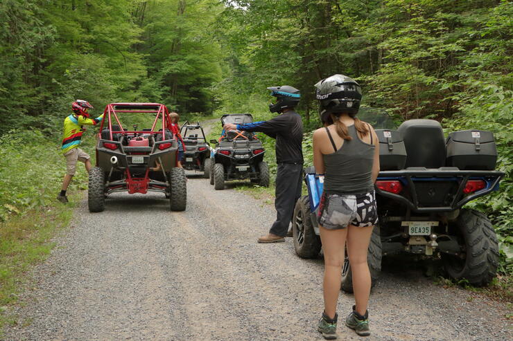
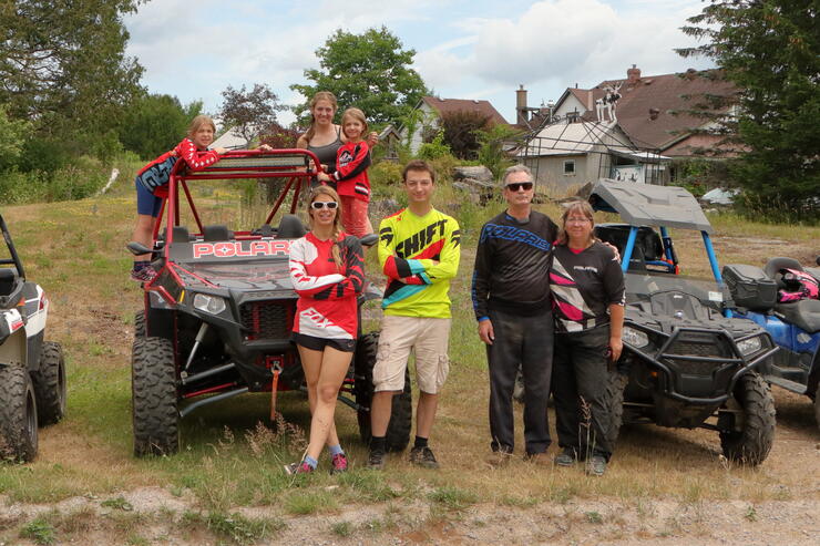
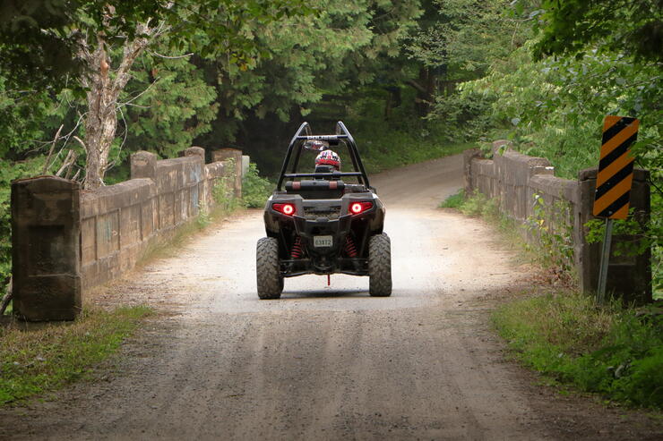
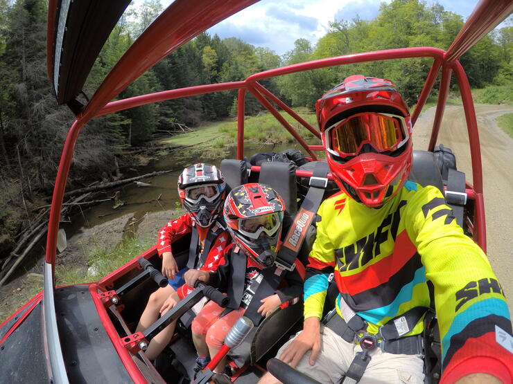
Fast-forward to 2018. What was once a multi-day trip via horse and buggy, on a road that would be considered impassable by today's standards, is now a leisurely hour's ATV ride. This year, we had a group of seven people on four machines kicking up dust down the old trial. But our family vacation didn't start on the ATVs this year. Instead, we arrived a day early at the Bancroft Inn & Suites so we could explore the sites of Bancroft.
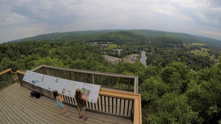
First up on our list was the Eagles Nest Park lookout. For those who have driven through Bancroft before, the lookout is basically at the top of the giant cliff bedside the Tim Horton's. As a child, I can remember driving past that location and always wanted to scale the cliff—who knew you could just drive to the top? The walking trails from the parking lot to the lookout require moderate effort, but the view at the top makes it all worth the climb!
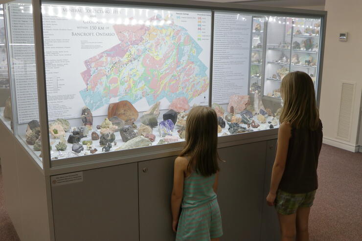
Next up on our list was the Bancroft Gem and Mineral Museum. If rock collecting is a hobby of yours, this is a must-see attraction! Bancroft and the surrounding area boast a unique geology that has yielded many different types of precious materials over the years. A map in one of the displays pinpoints the location of where the rocks were extracted—makes me want to grab a miner's pick and start digging for myself! The museum has a realistic display of what a mining shaft looks like underground. So realistic, in fact, that the little ones might be a bit frightened!
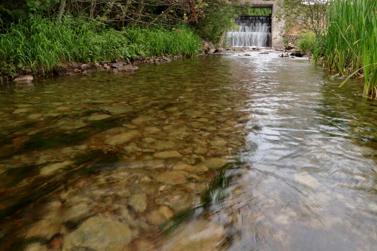
It was very hot day and we wanted to cool off, so we grabbed our swimwear and headed to the L'Amable Dam public beach, just a quick drive outside of the town. L'Amable is a ghost of its former self. What was once a thriving little town is now nothing more than a few old homes and an abandoned cemetery. The beach at the dam is alive and well, though, full with the sounds of water splashing and children laughing as they jump off the end of the dock.
You can easily walk to the base of the small dam and stand under the waterfall as the thundering water rolls over the top and crashes down at your feet. Crayfish are everywhere in the little creak downstream of the falls, and if you're brave enough (or if your kids keep bugging you until you cave), you'll have no problem finding one to catch! Watch out, though—they might nibble on your toes!
The day wouldn't be finished without experiencing the local cuisine. We wandered into the Bancroft Brew Pub, located in one of the older buildings in the downtown core. The home cooked meals were spot-on, and the outdoor patio was inviting and relaxing. Exhausted from our full day of activities, we headed back to the hotel and settled in for the night.

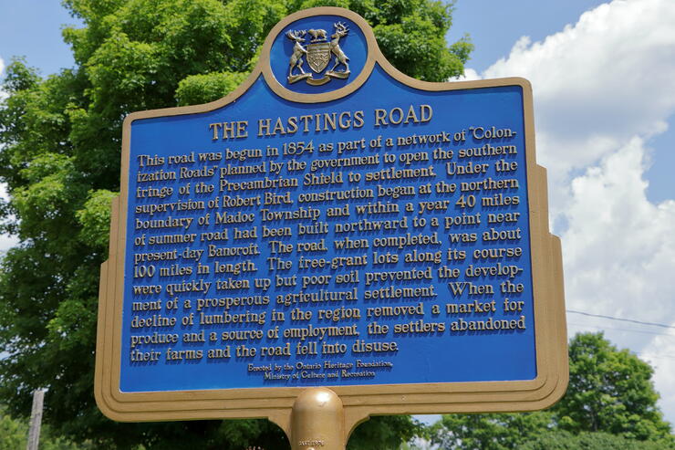
On July 18, 1851, Publius Elmore set out into the forest to survey a road. Employed by the government of the day, it would take Elmore and his team until December 30th, 1854 to complete the task. The Old Hastings Road was part of the government's Colonization Road scheme "... to open the waste lands of the Crown... for settlement." The government wanted to increase immigration and by the 1840s, farmland was in short order. On top of the land shortage, logging companies wanted to push further into the bush to harvest the tall pines.
It was a perfect plan: build a road, settlers would farm the land and produce crops, the loggers would gain access to the forest, the settlers would sell their produce to the logging companies, and everyone would be happy! Sadly though, some roads end in broken dreams.
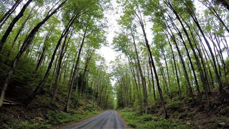
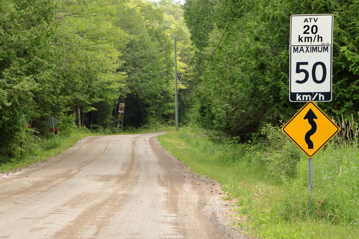
What is left of the Old Hastings Road begins just south of Bancroft off Highway 62 and continues south for 45 km, where it once again joins back up with the 62. We loaded our gear into our ATVs and headed out in search of the ghost towns that line the now-forgotten road of the past.
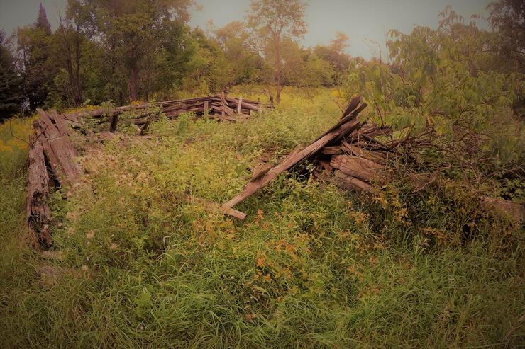
Our first stop was at the Umfraville cemetery, the only remaining landmark of this early village. Umfraville is located just off the Old Hastings Road down Umfraville road, and the turnoff for the cemetery is marked with an arrow pointing up a narrow dirt road. At one point, Umfraville boasted a flour and sawmill, a general store, a church, and a school. Now all that remains is the road, the cemetery, and some stone fences hidden in the bush.
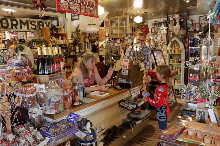
The 20 or so residents who still reside in Ormsby might be a bit upset with the designation of "ghost town," but it really is a ghost of its former self. We were treated to four intact and well-maintained early pioneer buildings. Ormsby is located at the intersection of the Old Hastings Road, Highway 620, and the Hastings Heritage ATV trail (a former rail line).
We first stopped at The Old Schoolhouse, an early single-room pioneer school house that has been beautifully converted into a tea room and restaurant. We picked up a nice warm beverage and chatted with the owner as he showed us his collection of old antiques. Next we wandered over to The Old Hastings Gallery, which is an old general store that has been converted into a very interesting gift shop. Across the street you will find two churches. One appears to still be used for church service, while the other seems to be under renovation.
We had to stop and turn around because we drove right past what little remains of Thanet. It was once a busy village with three hotels, a church, and a school; now all that remains is a small cemetery beside the road with a little white sign. All other structures have completely vanished and returned to the earth.
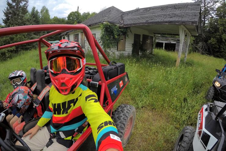
Just a few kilometres south of Thanet at the intersection of the Old Hastings road and Steenburg Lake road, you'll come across the only remaining structure in Murphy Corners: an old service station (possibly a general store). In the 1860s you would have been treated to a sawmill, a church, and a school house. The old service station is tightly boarded up so you can't even peek inside the building. The overhanging carport at the front of the building is a great spot to stop for a rest and enjoy a snack.
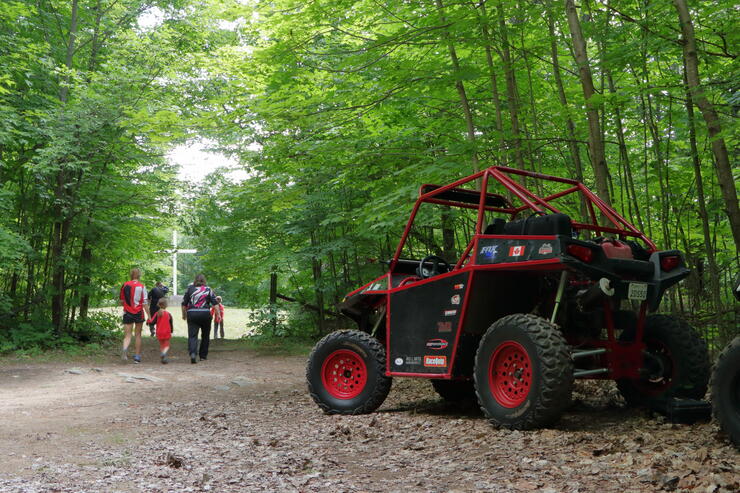
Glanmire is by far my favourite ghost town on the Old Hastings Road. The haunting images of the church steps in the cemetery leading to nowhere is what originally attracted me to journey down this road. Rounding the corner, you come to a sandy clearing where the cemetery lies silently today. The cement steps once lead into St. Margaret's church, but when the building fell into disuse it was torn down.
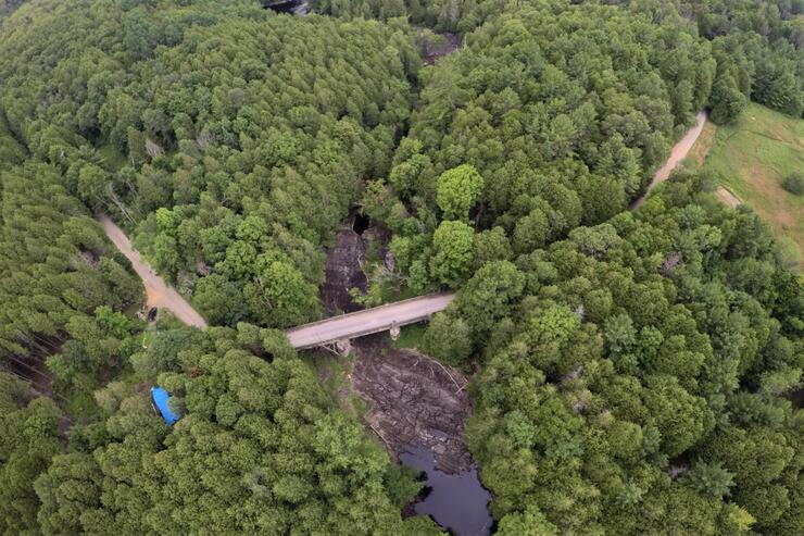
A very large cement bridge spans Beaver Creek and makes for some fantastic pictures and videos. Some round holes drilled into the rocks on the bank of the creek, and spikes driven into the rock, lead me to believe that there was once a mill that used the fast-flowing water from the small waterfall just east of the bridge.
The creek itself has a very interesting feature. In the drier days of summer when the water level is low, you can see the creek disappear into the ground through some underground caves on the west side of the bridge, and then reappear on the east side! Bring a picnic blanket for a unique lunch, but watch out for the poison ivy on the trail that leads from the road under the bridge. If you travel just a short distance downstream of the bridge, there are smaller waterfalls and swimming holes that are breathtaking and spectacular for a refreshing swim.
The last two remaining ghost towns on the Old Hastings Road are Millbridge, and just a short distance to the west, Millbridge Station. Like Ormsby, Millbridge has not completely vanished off the map. Situated just a short distance from Highway 62, the town has a mix of new buildings sprinkled with the remains of its pioneer days, including the old cemetery. Just a short distance south of Millbridge, the Old Hastings Road intersects with Highway 62 and then ends.
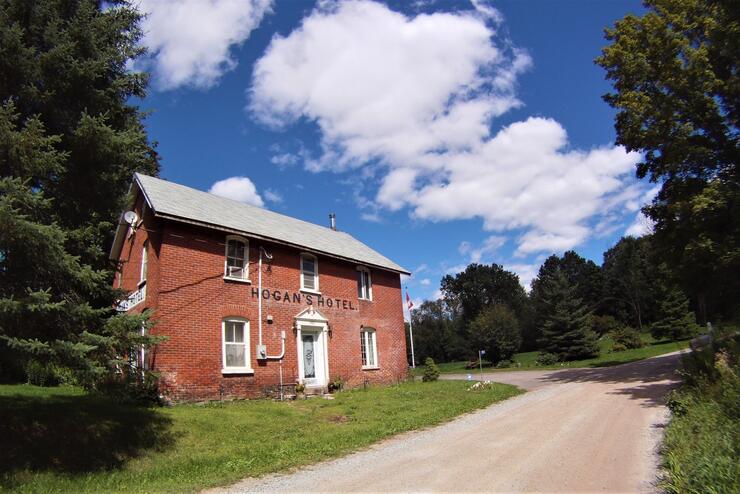
Millbridge Station developed just west of Millbridge, where Stoney Settlement Road intersected with the rail line. Today, the Hogan's Hotel still stands, and even has the original hotel name painted on the red brick building.
At this point, the Old Hastings road merges back into Highway 62. To continue south to Marmora, we jumped onto the Hastings Heritage ATV trail and continued our journey in search of ghost towns.
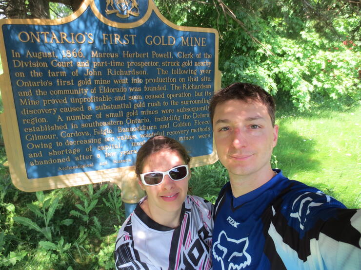
Eldorado sprang onto the map when gold was discovered in the area, leading to Ontario's very first gold rush! Miners, speculators, and anyone with a pick and a pan flooded into the area, giving birth to what is now the hamlet of Eldorado. When the gold dried up the place went bust and the settlers moved on. Little is left of its mining past—the mine is long gone, the train station has been torn down, and all that remains is an older-looking building on the main street that was most likely a general store. Hidden under the limbs of a tree is a plaque commemorating the town's mining past and its historical importance.
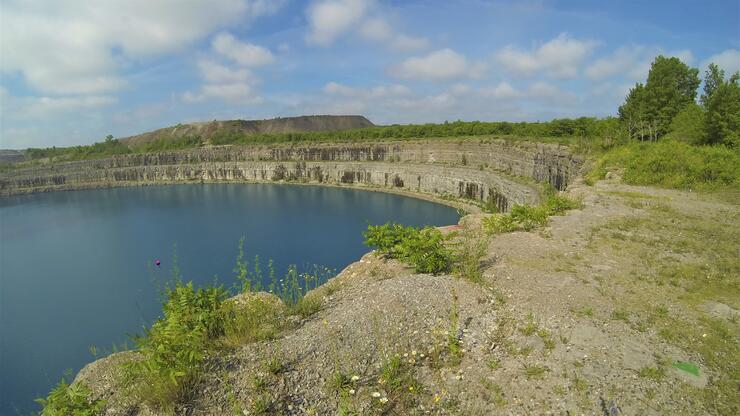
By no measure can Marmora be considered a ghost town. However, just outside of Marmora lies the now abandon Mighty Marmoraton Mine, an open-pit iron mine that spans 1,700 feet across and 700 feet deep. After extracting 1.3 million tons of iron ore, the mine shut its doors in 1979. Since then, the pit has mostly filled up with water. A lookout has been created so tourists can safely walk up to the edge of the pit and observe the massive crater that was dug into the earth.
When I think about the Old Hastings Road, I always wonder what could have possibly happened to drive people to completely abandon their homes, farms, and entire community. How could the situation deteriorate so badly that leaving everything was the only option? In 1925, just 60 years after the first settlers began to arrive, Charles Aylsworth Jr., an Ontario land surveyor, wrote the following:
The answer to why the Old Hastings Road was built is simple. The road was part of the Colonization Road Scheme, that was supposed to open up vast tracts of land for settlement and encourage settlers from overseas to travel to Canada, with the promise of 100 acres of free land, providing a portion of the land was farmed and a small home was built on the property. The Old Hastings Road was supposed to be a sign of opportunity, to start a new life, to own a plot land, to carve out a prosperous future, build a family, create a community.
Looking at what remains of the early towns and villages, it's clear why the road is referred to as the "Road of Broken Dreams." If not for the cemeteries, the traveller of today would never know that our early pioneers had once toiled on the land. The homes are gone, the churches are gone, the general stores are gone, and all that remains is the twisting road through the harsh, rocky, swampy, and unforgiving land.
I highly recommend the following books to continue your journey down the Old Hastings Road: