A Fine Pine is Like a Fine Wine
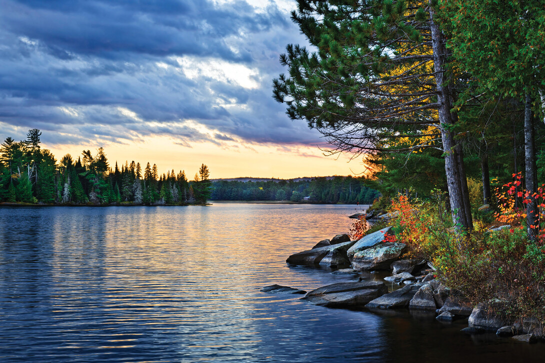
With thousands of red and white wines in the world, it can be difficult to choose the perfect ones. The same is true of the trees that form the backdrop of your vacation in Northeastern Ontario! To make deciding easier, we've created a list of vintage reds and whites . . . pine trees, that is, to explore on your next hike in the BIG wilderness of the North.
White – Old Growth – Temagami
There are some who believe that big trees, particularly white pines, eminate vibrations when when you come into contact with them. You begin to resonate with the tree’s energy and you become more centered and grounded.
Regardless of what your personal beliefs are, the Eastern White Pine is Ontario’s arboreal symbol. The tree, identified botanically as Pinus strobus Linnaeus and commonly known as white pine, became an official emblem, along with the trillium, in 1990. Artists like the Group of Seven have immortalized its stately appearance on the Canadian Shield landscape. Stands of white pine are close at hand to view and to understand. Mature trees can easily be 200 to 250 years old. Some white pines live beyond 400 years.
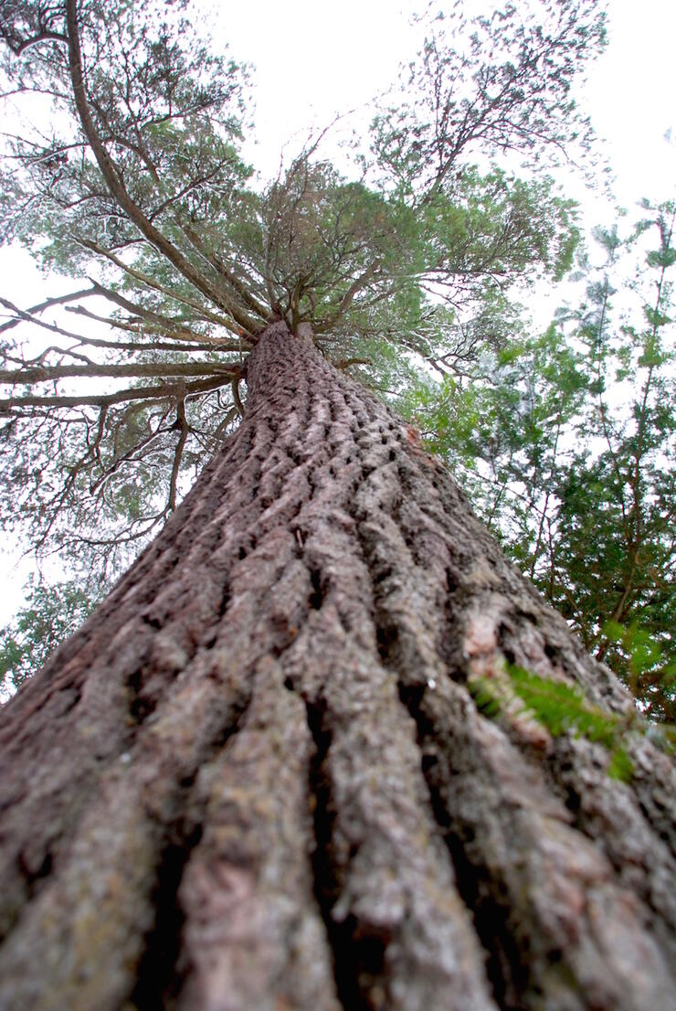
Big trees make you look up. It is difficult today to imagine what the original white pine trees were like, or to visualize their seemingly infinite reach upwards towards the sky. If you drive a little north of North Bay towards Marten River and Temagami, you can see the past and the present.
Peter Quinby has spent a great deal of time with the trees. This scientist was the Director of Conservation Science and Research Ecologist with the Temagami Wilderness Society in the early 1990’s and currently works as a senior environmental scientist. He says, “Since the 1990’s it has been known that old-growth white pine forest is an endangered ecosystem. It has been estimated that just prior to European colonization, there were approximately six million hectares of old-growth white pine forest throughout its natural range, which includes most of eastern United States and much of southeastern Canada. It is now estimated that only approximately 24,000 hectares of this endangered ecosystem remain throughout its range. Even if this estimate is doubled to 48,000 hectares, there is only less than 1% of the old-growth white pine forest remaining.” Good reasons to have a good long look at these big trees—see below for where to find them.
Red Pine and Wolf Lake
Locals know the area surrounding Wolf Lake as “little Killarney” for its spectacular scenery of quartzite rock and majestic red pine trees.
Red pine (Pinus resinosa) is a coniferous evergreen tree characterized by tall, straight growth in a variety of habitats. The crown is conical, the bark is thick and gray-brown at the base of the tree, but thin, flaky and bright orange-red in the upper crown; the tree's name derives from this distinctive character. The leaves are needle-like, dark green, in bundles of two, (12–18 cm; or 4.7–7.1”); the cones are oval and symmetrical.
“Some of these are quite large trees,” says Peter Quinby in his book ‘Ontario's Old-Growth Forests,’ “such as those found on or near the campsite on the west shore of the lake, which are 250 to 300 years old and have survived at least four fires." If red pines could sing, their anthem would be The Doors' "Light My Fire." Fire takes life out of the forest to give red pines life in it. When fire burns off the duff on the ground, the seeds can reach the soil and sink their roots. The fire pulls back the canopy to the joy of these shade-intolerant species.
Yet, according to Quinby, many red pine are deceivingly small. "On dry rocky ridges with little soil, the oldest red pines can be 200 years old while measuring 20 centimetres in diameter and only seven metres in height!" For reference your canoe is over five metres long!
Wolf Lake is thought to be the world’s largest old-growth red pine forest in the world, containing trees between 140 and 300 years old. Canoeists often paddle through, captivated by the rugged ridges, crystal-clear water and quartzite scarps, oblivious to the ecological treasure surrounding them.
Access the Red and White
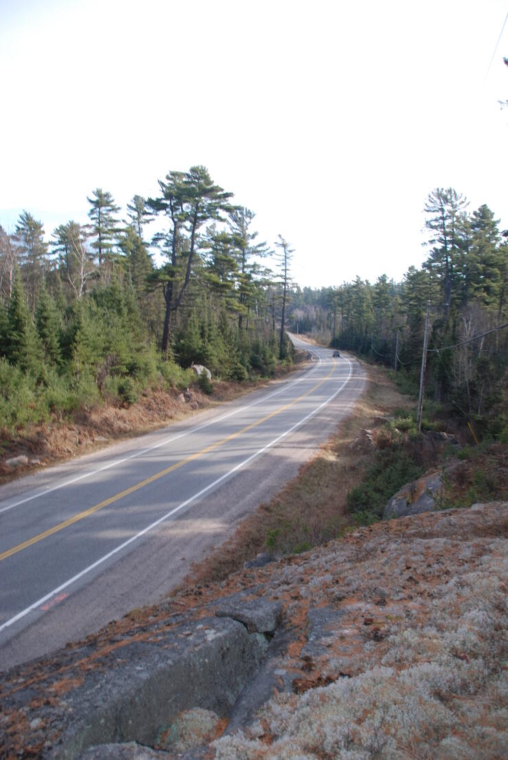
Where to find the vintage white? If you are in the Marten River-Temagami area there are three places to consider a visit in any season.
The White Bear Forest, including the historic fire tower on Caribou Mountain in Temagami, makes for a great day. Access is from the historic train station (O’Connor Drive) to the tower. Trek east to the White Bear trail. Within 15 minutes (there is a short, steep descent) you will come to the first giant. You can loop back or return. The Pad Lake and Peregrine trails will take you deeper into the protected White Bear Forest. The tree is located at WGS 84 17 T E 0593049 N 5212665 or N47° 03’ 39.4” W79° 46’ 28.9”. The trail system offers a number of loops.
Come back for a winter visit and try snowshoeing the “Transition Trail” in Marten River Provincial Park where you’ll be amongst the white pine; one remnant pine is more than 350 years of age. The Transition Trail offers a moderate trek that is 5 km long and will take approximately two hours to complete. The trailhead is about 1 km from the highway.
Make Temagami Island a “must see” in any season. Get to the island from the Temagami Access Road south of Temagami (WGS 84 17 T E 573459 N 5202121 or N46° 58’ 06.8” W80° 02’ 03.6”). Access to this trailhead is 1 km west northwest from the end of the access road. Six trails lead to sky-high old-growth pines in a multiple age-class forest.
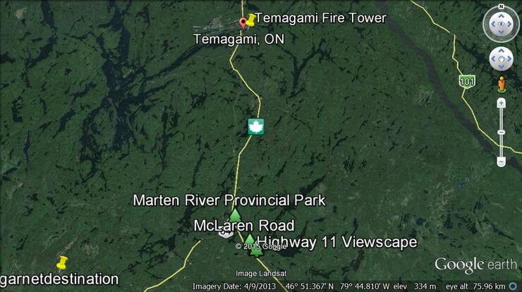
Approaching Marten River, Highway 11 is lined with old growth white pine trees. Drive 1.8 km north of the Rock Pine Restaurant or 3 km south of the Marten River Provincial Park entrance. This is one of the best highway landscape views of white pine in the province.
Then stretch your legs and get close to some real beauties on the McLaren Road, west side of Highway 11, 300 m south of the Rock Pine Restaurant (WGS 84 17 T 594400 5171938 or N46° 41.660’ W79° 45.920’). It is part of the 423-ha McLaren Forest Conservation Reserve.
If red pine is your choice then move towards the City of Greater Sudbury where there are two bonus locations—Wolf Lake Mountain and the Blue Lagoon.
A great two- or three-day canoe loop to scout on your map is the Matamagasi, (start) Silvester, Wolf, Dewdney, Chiniguchi, Laura, Evelyn, Irish, Bonesteel, and Wesell lakes, to McCarthy Bay (northeast arm of Matagmasi Lake) back to your starting point.
For a day trip and direct access to the Blue Lagoon, a unique destination, the best access is at the narrows between Matamagasi Lake and Lake Wanapitei (N46° 45’ 16.7” W80° 37’17.4” or WGS 84 17 T E 528908 N 5177969). Paddle northwards and take the northwest arm to the end of the bay. There is one portage and another short paddle going upstream on the Chiniguchi River. You will soon arrive at the Chiniguchi Falls, a worthwhile sight. Walk the portage upstream to the north end and Silvester Lake. Immediately ford the narrow passage (you may need your canoe). Once you have crossed to the east side, walk about 100 m to the Blue Lagoon, hidden from the portage where you were!
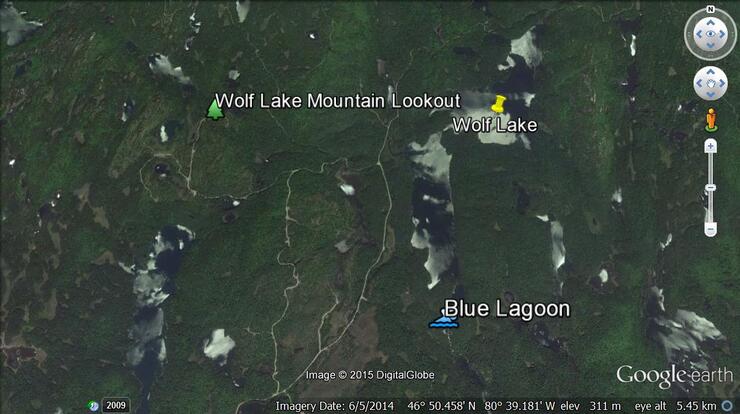
Like the exceptional taste of red wine nouveau, there is the secret back road access for the Blue Lagoon and Wolf Lake. You can mountain bike or go by ATV. Paper or digital topographic maps will help (1:50 000 – 041I15 - MILNET). You can drive and take a very short hike into the Blue Lagoon via the Kukagami Lake Road, north from Highway 17, just east of Sudbury (Wahnapitae). Follow the signs to the Sportsman’s Lodge. Drive northwards approximately 11 km and cross what was the railway line. Continue to follow the signs to Sportsman’s Lodge for another 11 km. You will come to a major intersection and turn left or northwards (do not follow the signs to the Sportsman’s Lodge and Kukagami Lake.) Turn on to Matamagasi Lake Road and then Bushy Bay Road. You will be travelling approximately 10 km to the Lake Wanapitei/Matamagasi Lake Narrows. This is where you could launch a canoe.
Drive on . . . you will travel on past the narrows between lakes Wanapitei and Matamagasi. You will drive past many entrances to camps and cottages. It remains a good gravel road. This is where your GPS comes in handy as you will drive approximately 12 km more on a primary forest access road to a road on the right (east) that turns southeast (N46° 49’ 59.2” W80° 39’ 14.2” or 17 T E526390 N5186676). You will travel less than 1 km and look for the trail on the left or northeast side. It is about a 300 m walk northeast into the lower end of the Blue Lagoon (N46° 49’ 56.5” W80° 38’ 38.8” or 17 T E527141 N5186597). You can walk around on the east side.
Drive further on and you can access Silvester Lake right off of the main road (WGS 84 17 T 526605 5188325 or N46° 50’ 52.6” W80° 39’ 03.8”)—a really good access point to consider. There is a small creek and a paddle of a couple of hundred metres to Silvester Lake and a paddle downstream to Paradise Lagoon or north into Wolf Lake; there is a five-star campsite between the two lakes at the narrows.
Drink in the vistas, enjoy the red pines of Wolf Lake, the blue water, and a swim at the lagoon.
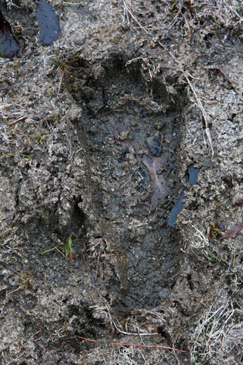
There are reliable wine choices to be made when ordering in a restaurant. When you want an easy-drinking, inexpensive red, perfect with roast chicken, you order Beaujolais. If you stick with the red and white pine trees to satisfy your hunger for outdoor experiences, you will become a Northeastern Ontario connoisseur. Watch out for the Sasquatch!
Access
Recommended Articles
The Seven's Best Hikes, Biking Trails and Lakes

7 Best Spots to Check Out in The Seven

Budget Bliss: Explore Northeastern Ontario Without Breaking the Bank

Bring Your Fam!

Time to Unwind: 6 Spa Havens to Discover In The Seven
5 Amazing Places to SUP in Northeastern Ontario

5 Amazing Bike Rides to Discover

Northern Lights in Northeastern Ontario

Northeastern Ontario's Best Pride Festivals

Fish for one of the World's Rarest Species of Trout

An Insider's Guide to Manitoulin Island

6 Small-Town Gems to Explore in Northeastern Ontario

11 Best Things to Do in Kapuskasing, Ontario

