The Steel River
Ontario’s ultimate loop canoe route.
By Conor Mihell


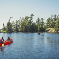
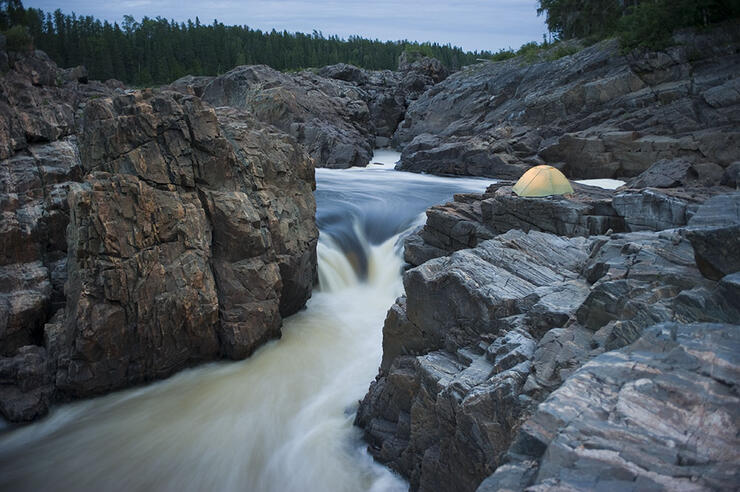
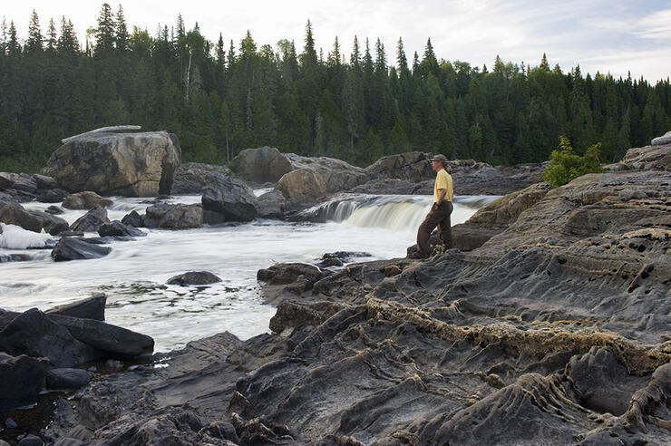
The Missinaibi River is a canoeist’s dreamscape. It free-flows for over 500 kilometres, from Missinaibi Lake, near the height of land toward Lake Superior, to where it becomes the Moose River before mixing with the salty waters of James Bay. Along the way are countless class II-III rapids, expansive marshland, and scenic cascades—including Thunder House Falls, a powerful chute that cuts through a dramatic canyon.
Upper and Lower River Sections
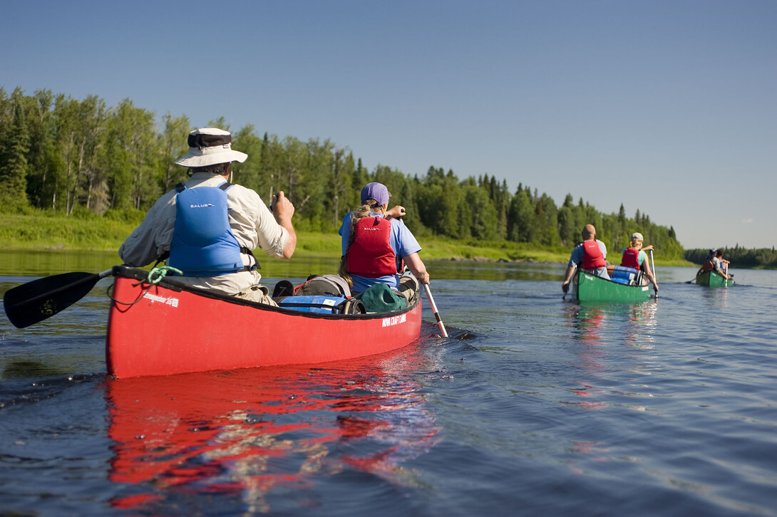
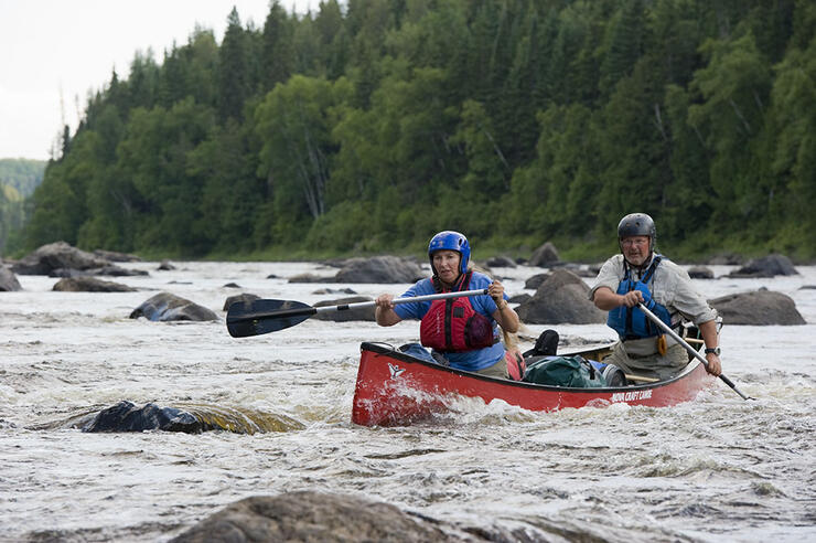
The ultimate trip would be to paddle the river’s entire length, taking roughly 20 days. However, most canoeists only have time to paddle 10-12 days on either the upper section (236 km), from the town of Missanabie to Mattice on Highway 11, or the lower section (316 km), from Mattice to Moosonee. It’s an ongoing debate as to which is best. Many canoeists choose to paddle the lower section for a view of the incredibly scenic Thunderhouse Falls, and to be able to bless the bow of their canoe in the salty waters of James Bay, but much of the route travels through the James Bay Lowlands, so the terrain is not as scenic as the Canadian Shield. For that reason, others prefer to paddle the upper section for its more technically challenging rapids, and to witness the more than 100 Indigenous pictographs at the Fairy Point site on Missinaibi Lake. Missinaibi is a Cree word for "pictured waters,” referring to the Fairy Point site. The paintings are one of the most extensive collections of pictographs in Northern Ontario. They depict a number of figures, including caribou, herons, soul boats used by shamans in search of lost souls, and even the Mishipzhiw—the Great Lynx, purported to have the ability to conjure up storms and high winds.
The best starting point for the upper stretch is at the public boat launch in the town of Missanabie. You can also begin at either the Barclay Bay Campground on Missinaibi Lake or at the Peterbell train bridge. To reach the Barclay Bay Campground, however, you must drive north of Chapleau on an 88-kilometre gravel road, and it can be difficult to organize a shuttle from the campground. Accessing the river at Peterbell by train can also be a bother. It’s an abandoned town, so not a scheduled stop, and requires a special service request arrangement with VIA Rail. Rare is the ticketing agent that has ever heard of it. Whichever way you get on the river, the take-out is at the public boat launch in the town of Mattice.
The lower stretch of the river is accessed via the public boat launch in the town of Mattice and ends in the remote town of Moosonee, where you load your canoes into a boxcar on the Polar Bear Express train (there are no roads to Moosonee) and head to Cochrane, where a shuttle driver can take you back to Mattice (185 kilometres west).
It’s possible to do a shorter 5-6 day route on the upper reaches of the Little Missinaibi River. You begin in the town of Missanabie and take the VIA Rail Budd Car that will take you and your gear to a rail stop called Shumka, south of Bolkow Lake. The route takes you through some of the prettiest lakes (Ribes, Abbey, Elbow) in the immense Chapleau Game Preserve, and down some class I-II rapids on the Little Missinaibi River (if you are doing the route in reverse, you can skip rapids by detouring to Trump Lake). The route then heads west and north around Fairy Point on Missinaibi Lake, and then back to the town of Missanabie via Crooked and Dog lakes.
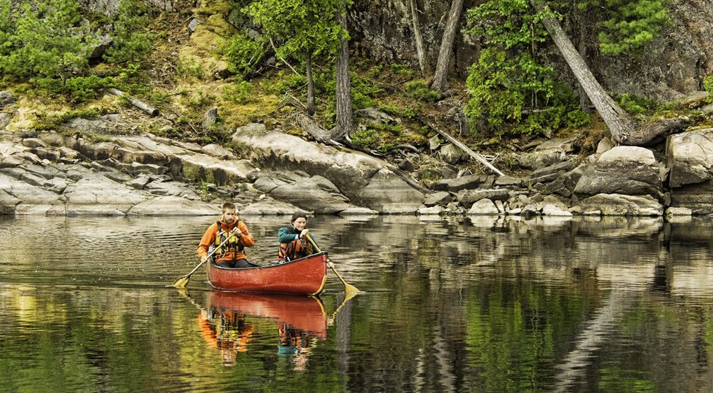
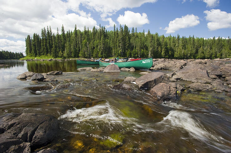
An incredible trip can be had on Missinaibi Lake itself. Access it from Barclay Bay Campground (part of Missinaibi Provincial Park) and spend your entire time exploring the shoreline of this huge body of water. Missinaibi Lake stretches more than 40 kilometres in length, with the additional 20-kilometre Baltic Bay opening to the north. A canoeist can spend an entire week exploring the lake. Visit Reva Island off South Bay to view the 350-year-old stands of white and red pine; fish for walleye at the base of Whitefish Falls; paddle upriver on the Little Missinaibi to explore the kettle formations decorated with unusual pictographs; or venture into the more isolated Baltic Bay to hike inland to the old Borasso lumber camp. Fairy Point should not be missed. These sheer granite cliffs are adorned with more than a hundred Indigenous pictographs. Just be watchful of the weather on the section of the lake. In minutes wind can conjure metre-high waves and send them crashing against the rugged cliffs. Many canoeists have overturned, and even lost their lives, at the base of the steep rock wall at Fairy Point. Even larger fishing boats and their occupants have ended up at the distant bottom. In the late 1980s, in fact, a one-person submarine searching for the body of a drowned fisherman at the base of the rock cliff discovered a series of seemingly bottomless caves and crevices.
Outfitters: Missinaibi Outfitters, located in the town of Mattice, offers canoe and gear rentals. 705-364-7312.
Shuttles: Missinaibi Outfitters offers Missinaibi River shuttles to and from all possible access points. 705-364-7312.
Guided Trips: Paddling the Missinaibi River requires at least moderate whitewater skills and moderate to advanced wilderness tripping skills. You might want to consider a guide. Missinaibi Headwaters Outfitters is a good choice. They’ve been a leader in Ontario’s guiding industry for 30 years. 705-789-6479.
Permits: Permits are required to paddle the Missinaibi River, since it is an operating provincial park. They can be obtained online from the Ontario Parks reservation system or through Missinaibi Outfitters in Mattice. 705-364-7312.
Maps: HapWilson’s guidebook, Missinaibi: Journey to the Northern Sky, published by Firefly Books, remains an excellent reference. ChrisMar Adventure Maps also has a series of detailed maps for the Missinaibi route
The Topographic Maps needed for the entire river are: 42C/8, 42B/5, 42B/6, 42B/11, 42B/14, 42G/3, 42G/6, and 42G/11W.
Water Levels: Missinaibi River water levels vary but the waterway can be run throughout the season - mainly from June to September.
Weather: Missinaibi weather can be unpredictable. You’re in the north, headed to James Bay. Expect extreme changes, from heat waves to hail storms, even in mid-summer.
Missinaibi Lake’s Barclay Bay Provincial Park Campground is home to large, well-treed campsites. Take note, however, that there are only basic amenities and the campground is located at the end of an 88 kilometre dirt road, north of Chapleau.
The Missinaibi River flows through the Chapleau Crown Game Preserve, which encompasses 700,000 hectares. It’s the largest crown game preserve in the world. Day outings can be had from the town of Chapleau and Barclay Bay Campground on Missinaibi Lake
The Chapleau Heritage Museum is an opportunity for a unique pit-stop to celebrate the local history of Northern Ontario. It’s full of interesting antiques but the biggest attraction is the 275-tonne Iron Horse steam engine. The museum also features a sawmill, a CP Rail caboose, the footprints of Prime Minister Lester B. Pearson, and a memorial to Louis Hémon, the French writer who died, by suicide or by accident, on the train tracks here in 1913.
If you make it to the end of the river, before leaving the town of Moosonee make sure to book a beluga whale and seal watching boat tour.
The Moose River Bird Sanctuary is located at the mouth of the Moose River where it meets James Bay, including Ship Sands Island. This 15 square-kilometre tidal flats is a protected wetland complex and is a haven for various bird species—it's one of the most significant migratory paths for waterfowl in the world.