
Where to Eat, Dine, and Play on the Sault Ste. Marie Waterfront
Your guide to discovering the diverse shorelines of a historic Northern Ontario waterway.
By Conor Mihell


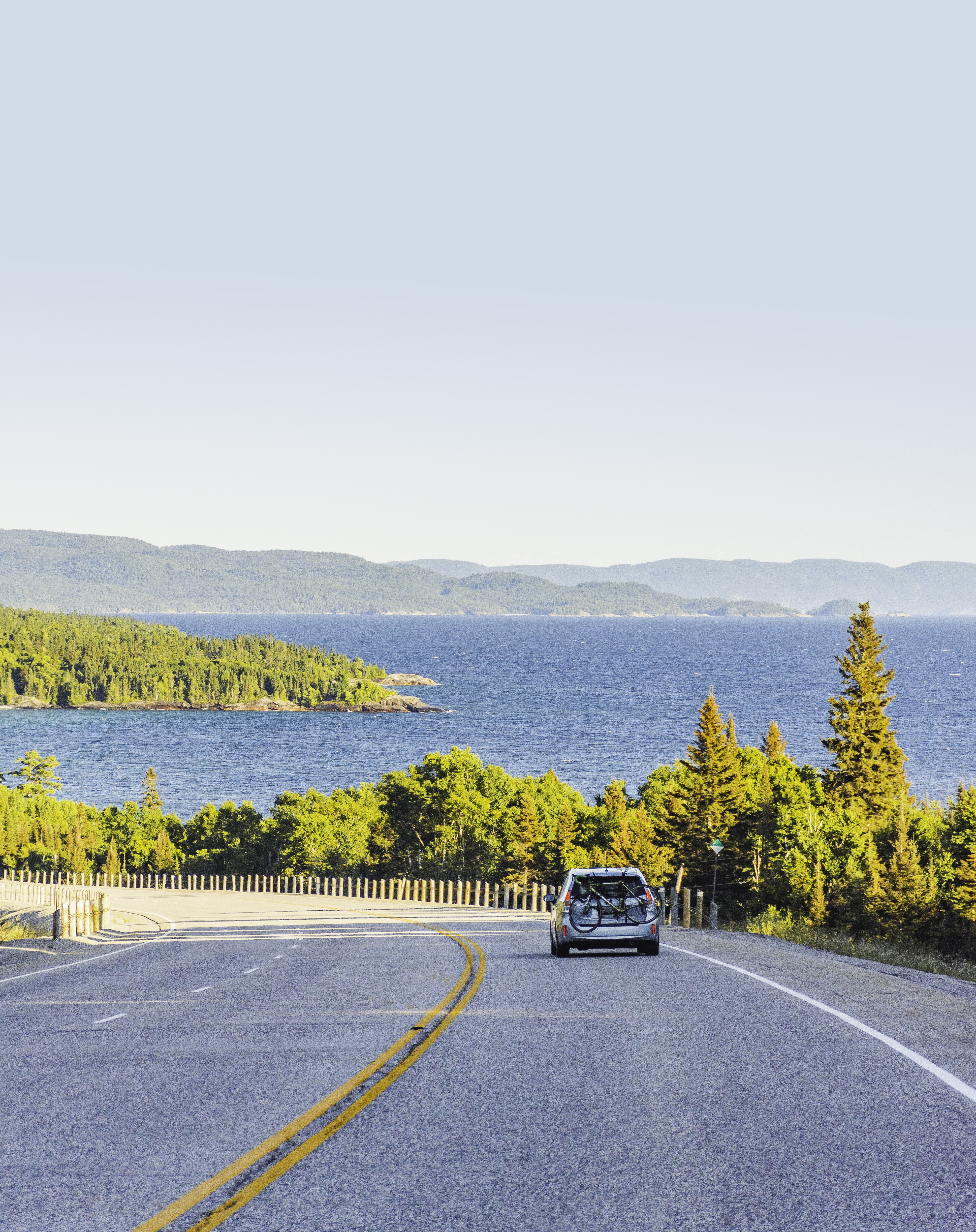

Once you’ve experienced the magnificent views of tumbling waterfalls, glacier-smoothed cliffs and ocean-like horizons of Lake Superior along the Trans-Canada Highway north of Sault Ste. Marie, Ontario, you can’t help but dream of doing it again. The 230-km stretch of Highway 17 from the Soo to Wawa easily ranks amongst Canada’s most scenic drives.
Best of all, Lake Superior’s mercurial moods make each drive different: one day it’s glassy calm and the next there’s pounding surf, just as the big skies over the inland sea afford endless combinations of cloud and sun. Along the way, you'll find adventures for every type of traveller—hikes and scenic lookouts, Group of Seven interpretive panels, sandy beaches, delicious apple fritters, and many secret coves waiting to be discovered.
Here’s our complete guide to driving the coast.
The Coastal Drive is a 230-km stretch of scenic highway along Lake Superior between the city of Sault Ste. Marie and the township of Wawa. It’s possible to do the drive as an out-and-back day trip although if you have the time, we recommend a weekend (or more) for exploration—this is a bucket list experience to be savoured as much as possible. The main attraction here is the stunning scenery but you'll also find plenty of amenities along the way, such as campsites, lodges, rest stops, gas stations, and dining options.
That said, let's begin with your first stop on the Coastal Drive!
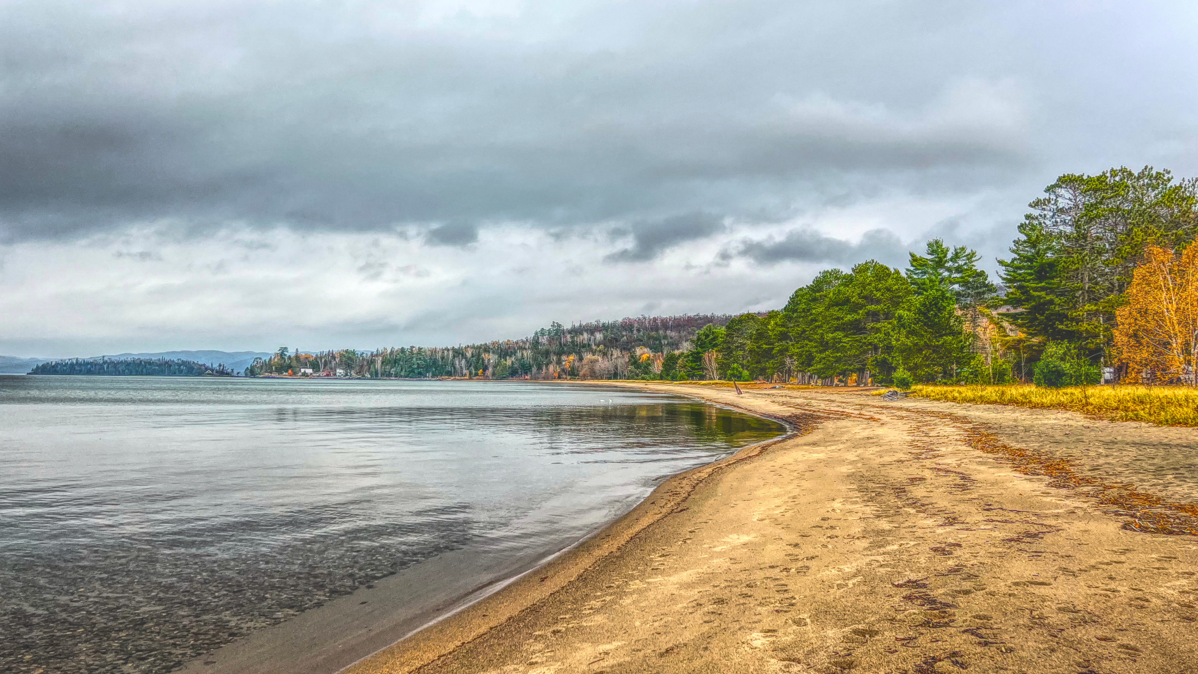
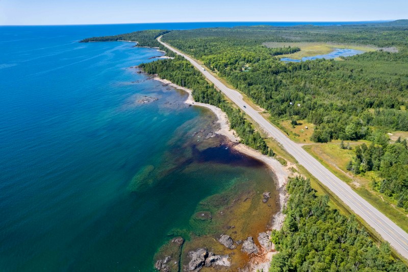
About 30 minutes north of Sault Ste. Marie and a short detour off of Highway 17 is Harmony Beach, an especially popular spot amongst locals for its sugary sand, comfortable water temperatures and gradual drop off.
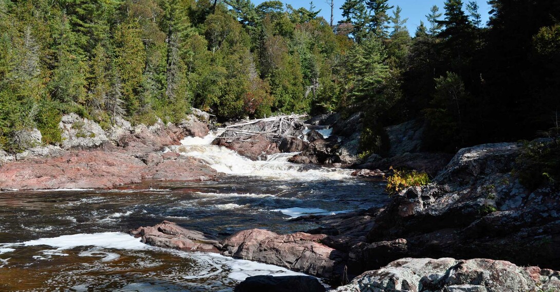
Just a short drive north of the city is your first (and most historic) rest stop. Stretch your legs at Chippewa Falls (and the mid-way point of the Trans-Canada Highway) and see the same set of rapids that inspired A.Y Jackson’s 1955 sketch “Stream Bed, Lake Superior Country.” Take in the Group of Seven interpretive panel to learn more about how this scenic spot inspired one of the country’s most famous artists.
A bit further north from Chippewa Falls, you’ll find Batchawana Bay—a sprawling inlet of Lake Superior that’s rimmed by golden sand beaches.
Finally, Batchawana Bay Provincial Park features several kilometres of impeccable beach and the opportunity to play in gentle surf when the winds blow from offshore. Right across from the beach, the Voyageur’s Lodge and Cookhouse is famous for its delicious apple fritters, homemade takeout, cozy rooms and friendly service.
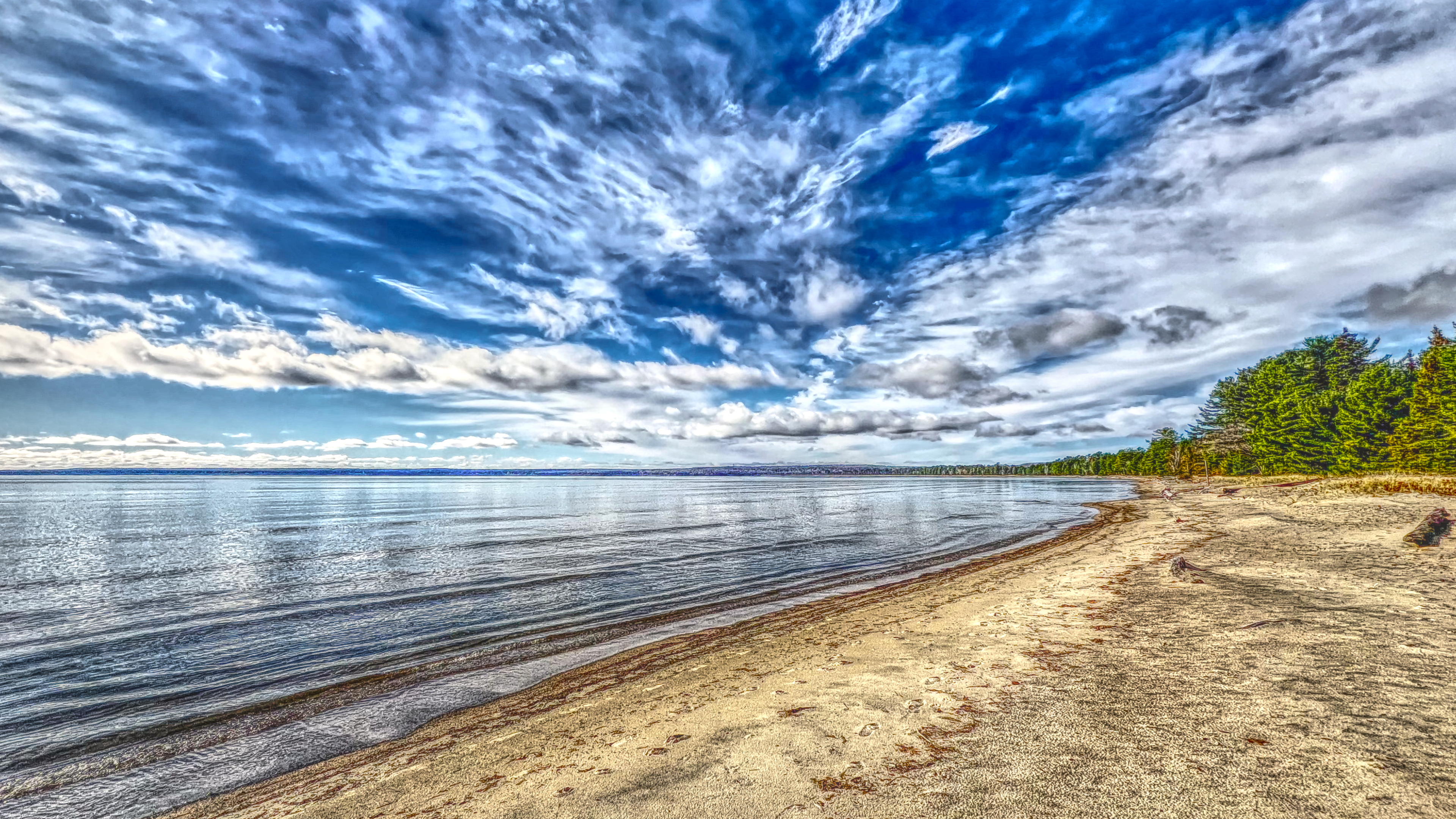
There’s no question that Pancake Bay is one of Ontario’s best beaches—and it’s located less than an hour’s drive north of Sault Ste. Marie. With its white sand and azure waters, it’s easy to mistake the shores of Pancake Bay Provincial Park for the Caribbean. The 3-km beach is the park’s main attraction, and it served as a campsite for crews paddling voyageur canoes during the Canadian fur trade, along the ancient watery predecessor to the Trans-Canada Highway. The park offers over 300 campsites and a few hiking trails, including the 5-km trek to the Edmund Fitzgerald lookout. In addition to the beach and lookout, Agawa Fish & Chips and Agawa Crafts & the Canadian Carver are Pancake Bay landmarks. Stop in for a feast of fresh caught lake trout and whitefish, ice cream and uniquely northern gifts, art and memorabilia.
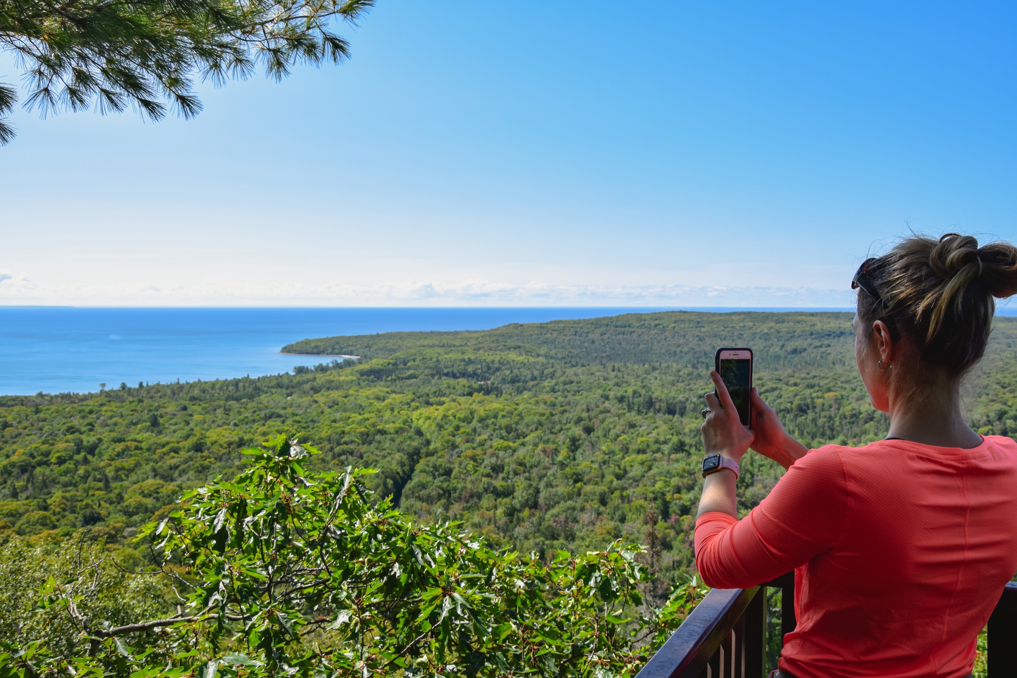
One of the most popular hikes along the coastal drive is the Lookout Trail which takes you to the scenic Edmund Fitzgerald Lookout. From here, visitors can take in the final resting place of the sunken ore carrier Edmund Fitzgerald, made famous by Gordon Lightfoot’s classic “The Wreck of the Edmund Fitzgerald.” With viewing platforms and an information panel, this is a historic viewpoint well worth the hike.
Get your camera ready. While it’s hard to pick a favourite stretch of the amazing coastal road, this is often top of the list for locals—and for good reason. Heading north from Pancake Bay, visitors will enjoy one of the most scenic 20-minute drives in all of Canada. Free from the sheltered shores of Whitefish Bay this stretch offers full oceanic views of the big lake. Sawpit Bay is where you’ll catch the first glimpse but there are many views of the endless lake from this point onwards.
A roadside lookout at Alona Bay is a great spot to pause and soak in the grandeur of Lake Superior. You’ll find several pullouts between Pancake Bay and Montreal River Harbour—make time to stop and be mesmerized by the pattern of waves breaking on rocky shores and a distinct feeling of northern wilderness—just be sure to be mindful of private property. The Twilight Resort rents cabins with spectacular views at the mouth of the Montreal River, where you’ll become immersed in the same ancient mountains that inspired several famous paintings by the Group of Seven artists, including JEH MacDonald and Lawren Harris.
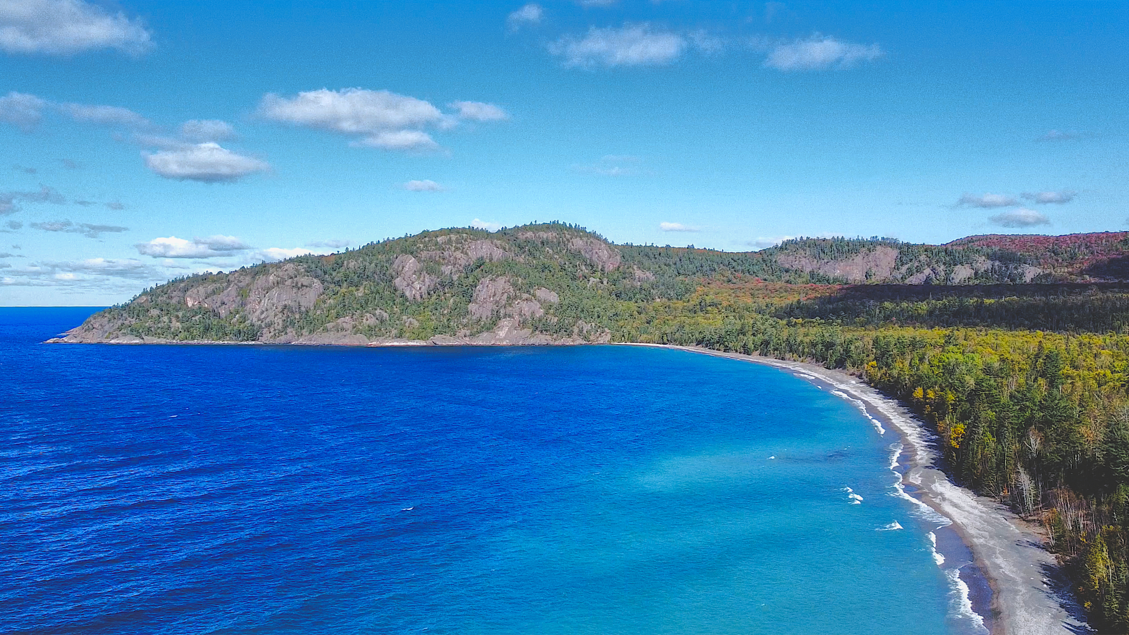
The Lake Superior coastline makes curves at Agawa Bay, forming a natural gateway to Lake Superior Provincial Park and one of Ontario’s best campgrounds. Be sure to make a reservation well in advance to score a coveted beachside campsite. The Agawa Bay Visitor Centre offers a great introduction to the park’s unique ecosystems, landforms and outdoor activities. Before leaving the bay behind, stop at the Agawa Bay Lookout, a small pullout on the right for a panoramic view of the lake.
Lake Superior was created by a massive cleft in the crust of North America, known as the Mid-Continental Rift. The lake’s diverse geology is highlighted by a multitude of rock types, shaped and polished by several Ice Ages and eons of wear and tear by the elements—and there’s no better place to experience this than in Lake Superior Provincial Park. Experts from Natural Resources Canada, the Ontario Geological Survey and Laurentian University have produced a handy guide to help you understand the features along the way.
One of the park’s most notable attractions is the Agawa Rock Pictographs—an important cultural site for the Ojibwe Peoples. The pictographs are accessible via a short hike from mid-May to mid-September (when lake conditions are calm). The trail passes through a natural rock canyon; sure-footed visitors can carefully tread along the smooth-rock shoreline to view and pay respect to this ancient canvas. Do not touch or photograph the pictographs at this sacred place.
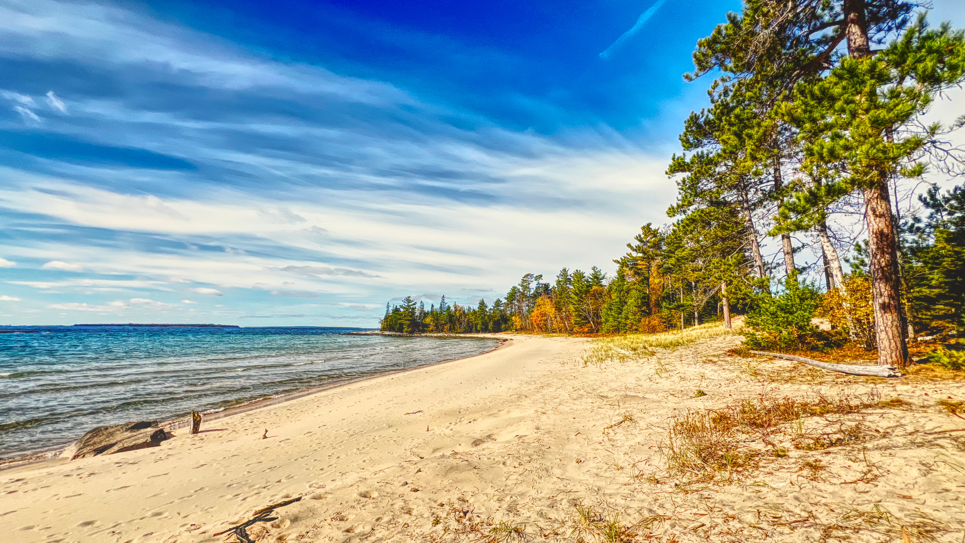
There are lots of hiking trails in Lake Superior Provincial Park giving you opportunities to stretch your legs, snap some pictures and hopefully see some wildlife. Waterfall chasers love the 3-km out-and-back Pinguisibi Trail at Sand River. (Pinguisibi means Sand River in Ojibwe). The trail follows the edge of the waterway and encompasses rushing rapids and waterfalls along the way. Further north, the 8-km Orphan Lake trail takes you from forest to high lookouts and the Lake Superior shore.
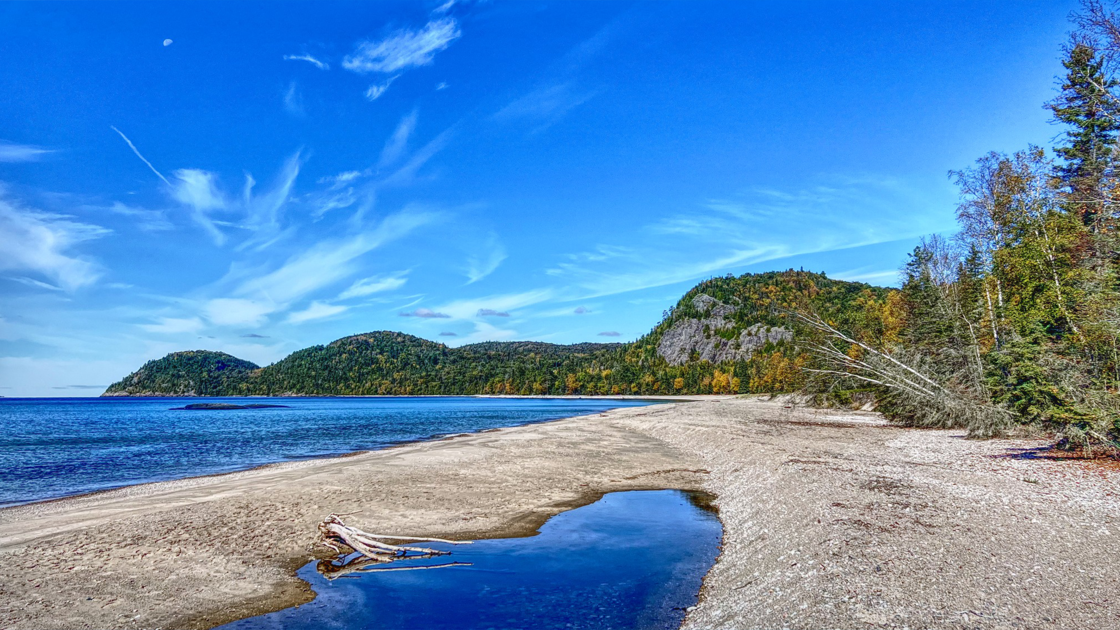
There are opportunities for beach lovers and rockhounds alike at Lake Superior Provincial Park’s Katherine Cove. Here, two impeccable beaches are separated by a polished finger of granite, which makes a great place to bask in the sun and warm up after a dip in the crystal clear waters. Beachcombing the shoreline immediately south of Katherine Cove reveals an isolated boulder that’s larger than a minivan. Known as a “glacial erratic”, it’s a leftover from the floodwaters that surged at the end of the last Ice Age.
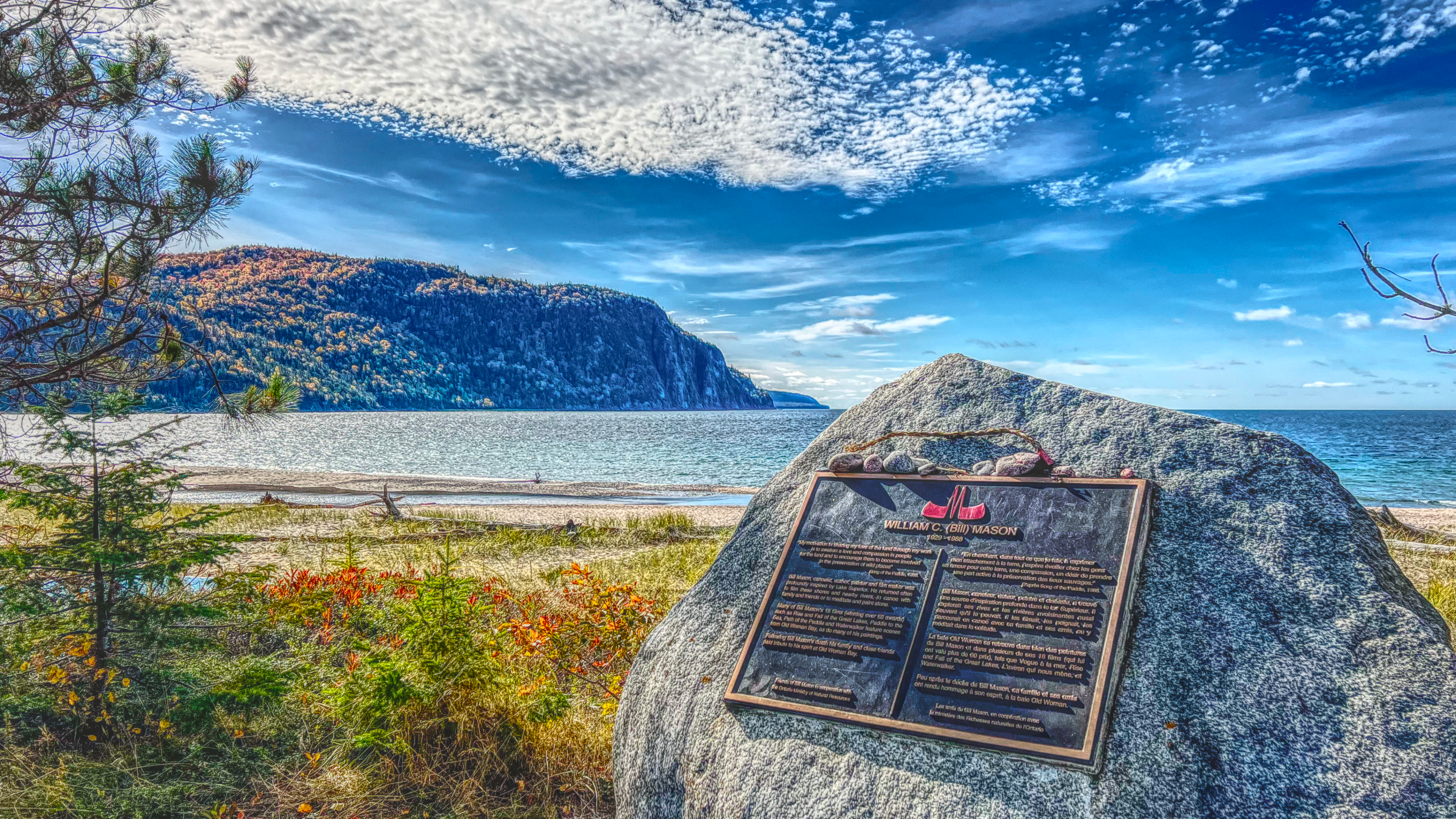
At the northern tip of Lake Superior Provincial Park is the expansive Old Woman Bay, named for the rock formation that resembles, well, an old woman’s face. With washrooms, picnic tables, and a 3-km stretch of beach, this is a great spot to stop and stretch your legs. For hikers, you’ll find the trailhead here for the 5-km Nokomis Trail—offering views of the towering cliffs at Old Woman Bay.
At the end of this scenic drive visitors will find the historic town of Wawa, Ontario. Whether you choose to stay overnight, continue the drive along the North Shore of Lake Superior, or head back to Sault Ste. Marie for dinner and some nightlife, be sure to get a photo with the famous Wawa Goose.
The drive back to the Soo can feel like an entirely different road trip. Depending on the weather and the time of day you set out, this route offers travellers new opportunities to explore. Leave time to discover scenic overlooks, beaches, and coves you may have missed as you cruise south toward the Soo. You can stay a night at the Voyageurs' Lodge & Cookhouse. Hungry travellers can enjoy a fish fry dinner at McCauley’s Havilland Bay Restaurant or head into the city for a delicious dinner and night in a hotel.
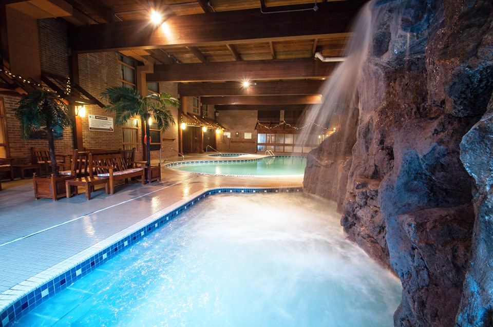
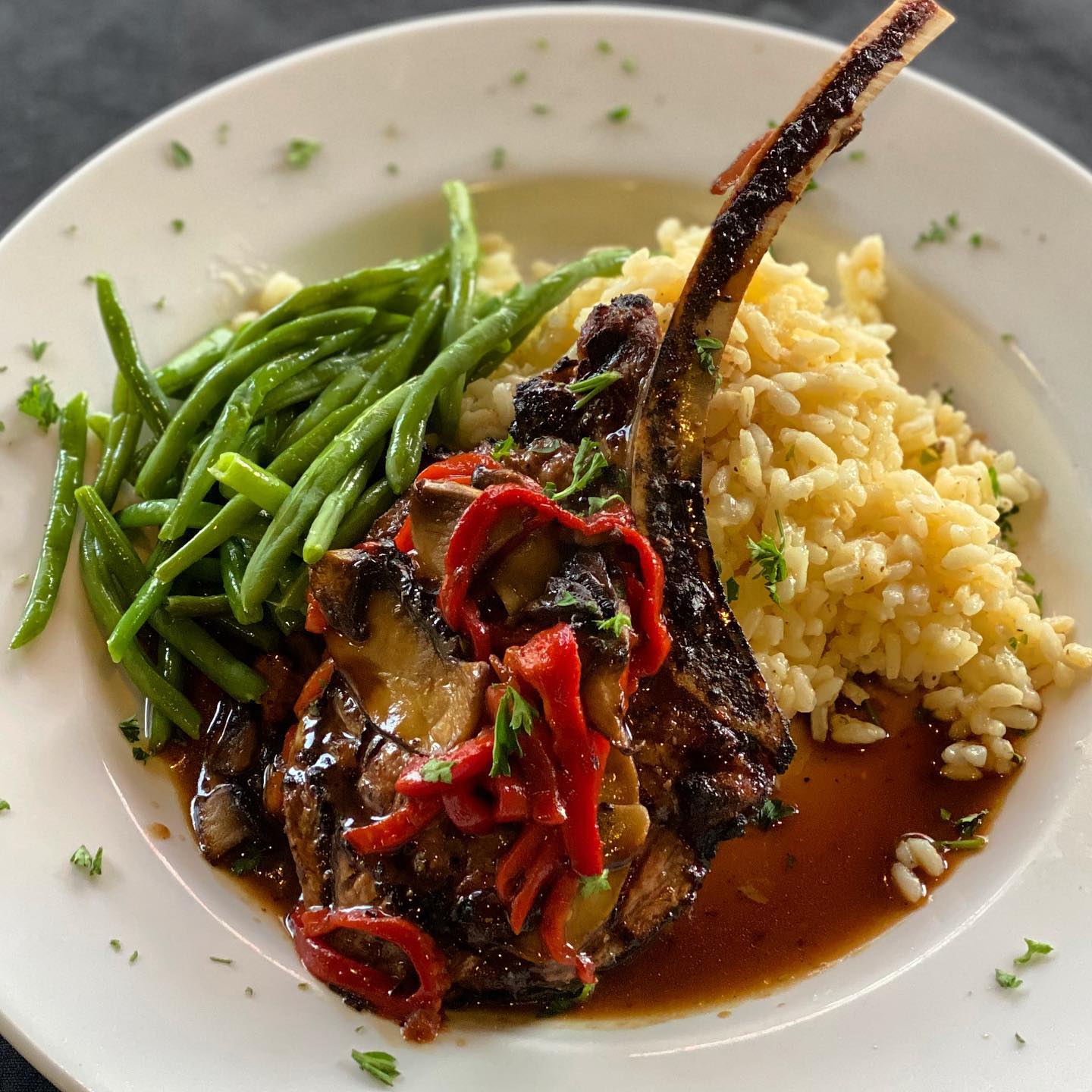
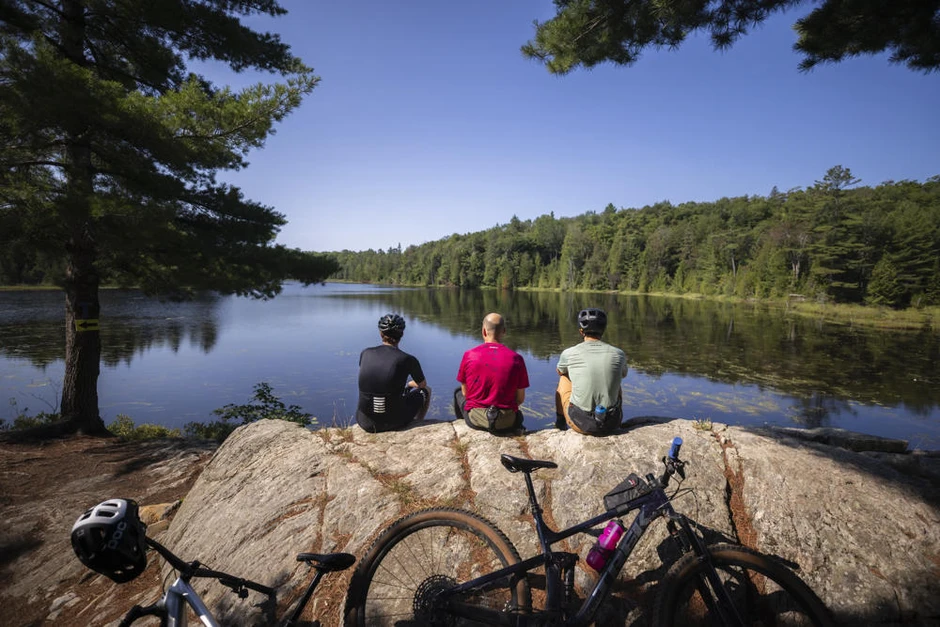
The city of Sault Ste. Marie is the perfect basecamp for exploring this touring route. The city offers amazing options for accommodations, restaurants, and attractions either before or after your drive. Located in the north end of Sault Ste. Marie, the Water Tower Inn is the ideal gateway to the coastal drive, with fantastic swimming pools and hot tubs for a relaxing soak after a busy day. The hotel provides easy access to many local outdoor attractions, including the Hub Trail and outstanding mountain bike trails in the Hiawatha Highlands. Just down the road, Giovanni’s Restaurant serves authentic Italian food and Gino’s Fired Up Kitchen offers the city’s largest patio. There are also several budget-friendly motels on Great Northern Road, including the Ambassador, with spacious rooms. Glenview Cottages also rents private cabins.
Be sure to head downtown to check out Northern Superior Tap Room, located adjacent to the Canadian Bushplane Heritage Centre, near the city’s waterfront. Take a tour of the historic Sault Locks on the Miss Marie Lock Boat Tour and the Sault Ste. Marie Canal National Historic Site—the St. Marys River is the only waterway draining Lake Superior (its water flows into Lake Huron). This historic highway sets an impressive backdrop for the Art Gallery of Algoma, where you’ll discover a diverse collection of contemporary and classic Canadian art.
Local guides Forest The Canoe, Thrive Tours, Walk Among the Trees and Restore Yoga and Wellness take care of the planning and deliver a wide range of unique adventures, including interpretive hikes and paddles, authentic Indigenous experiences, and outdoor yoga and wellness retreats.
Check out Tourism Sault Ste. Marie for more information and to help plan your coastal drive along Lake Superior today!