
Highway 17 Treasures through Superior Country
A locals' guide to a righteous road trip in Northern Ontario
By Josie Cormier


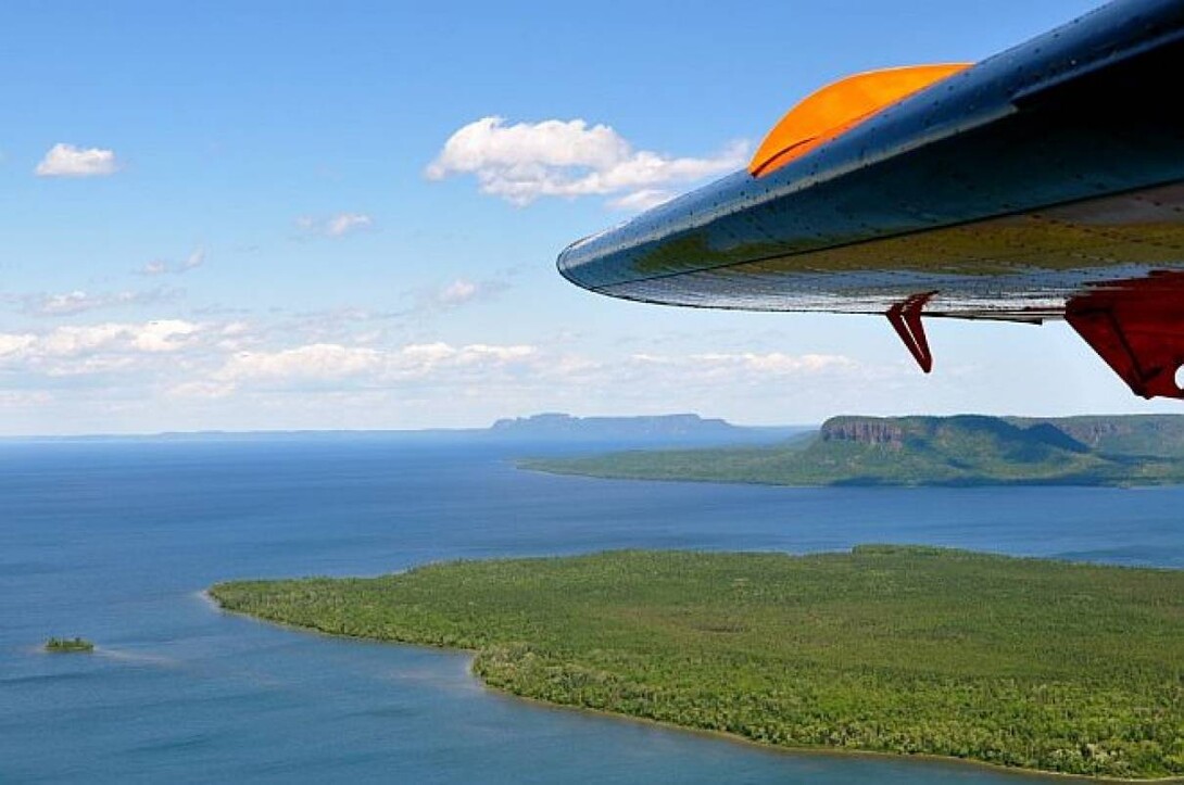

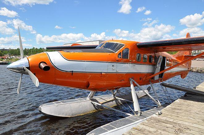
From the front seat of a Turbine Otter converted World War I seaplane, it was quickly apparent how big Lake Superior truly is. The body of water is the largest freshwater lake in the world and even from my vantage point a few thousand feet above, I couldn't see land on the eastern horizon. To my left was pilot Guy Cannon, and to my right was an endless view of the world's biggest lake.
It was the start of a seven-day vacation in Thunder Bay and I was on an aerial tour with Wilderness North. The company's fleet of float planes routinely takes guests to remote fishing lodges on Lake Superior, but we were on a one-hour scenic flight. A bird's-eye view of Lake Superior is an epic vantage point and an experience not to be missed. It was my first time riding shotgun in an airplane, so I pushed the window down and hung my head out. Here's everything you can expect to see on a tour of the lake.
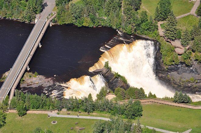
The nine-passenger seaplane was originally built in the 1950s, but later rebuilt with a turbine in the 1980s. Normally, Cannon says he flies over areas that cars can't get to, but since recent rainstorms had filled the lakes and streams, the Kaministiquia River was high. It drops 40 meters at Kakabeka Falls creating a spectacular waterfall and was worth the inland detour. Circling back towards the lake, we flew low over the boreal forest and along the river's inlet into the big lake.
Back over the water, we headed south toward the Welcome Islands, Flatland Island and Pie Island. Boats sailed on the sparkling water below. The northern region of Lake Superior is home to the future Lake Superior Marine Conservation Area which will be the largest freshwater conservation area in the world once established, and from my viewpoint, it was easy to see why this place was special.
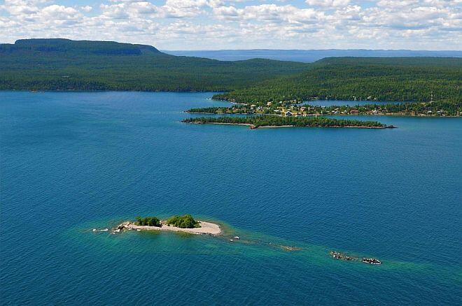
The turquoise body of water looks more like the South Pacific than a lake from the air. It's clean and clear, and home to an abundance of wildlife including a few Ontario species at risk. Rocky islands and sandy islets are scattered throughout the lake and along the north shore. We looped around the north shore and circled over the Silver Islet, which was once the location of the world's largest silver mine. From the air, we stared down at the now-defunct mining shafts.
Next we flew over Trowbridge Island, which is home to a fully-operational solar-powered lighthouse, and then we were heading west again towards Thunder Bay and flying low over the Sleeping Giant. The Ontario Provincial Park is home to local lore and named for the giant rock monolith that resembles a giant sleeping on his back when viewed from Thunder Bay. But from the air, the giant is simply a stack of volcanic rock mesas that jut out into the world's biggest lake.
Aerial toursstart at $99 per person and can be customized by route and time in the air. For more information, visit wildernessnorth.com.