
Ontario Motorcycle Events
Let's Ride!
By Mike Jacobs


Someone told me that I would be blown away by Algoma Country, and they were right.
For me, this trip was a homecoming. All last winter, and for the first time, we did what many Ontarians do: migrate to Florida. My wife Margot, along with our dog and road companion Sadie, drove our minivan, which pulled along our home, a 17’ travel trailer. I journeyed separately on my Honda CB500X, meeting up for lunch and/or at our destination. Our stays were a week to a month long, with the occasional night in a Walmart parking lot. Unfortunately, the riding opportunities in the Sunshine State were not all that exciting for me with their flat, straight roads. I enjoyed the palm tree scenery, the beautiful bird life, and the alligators kept things interesting, but it just didn’t fulfill my appetite for riding.
When I returned to Ontario, a friend of mine posted they wanted to ride the Grand Algoma Tour and that they were looking for travel mates. This seemed the perfect way to reconnect with my riding roots: I was in!
Check out my itinerary for one of the best places to ride in Ontario—The Grand Algoma Tour.
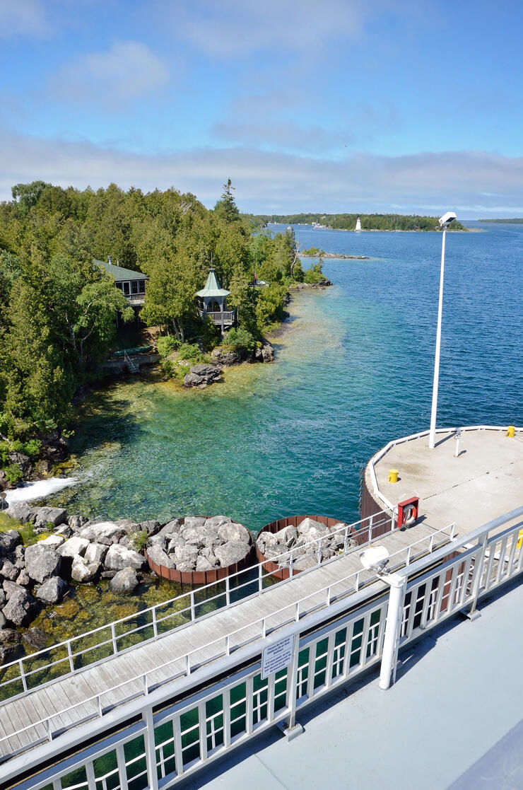
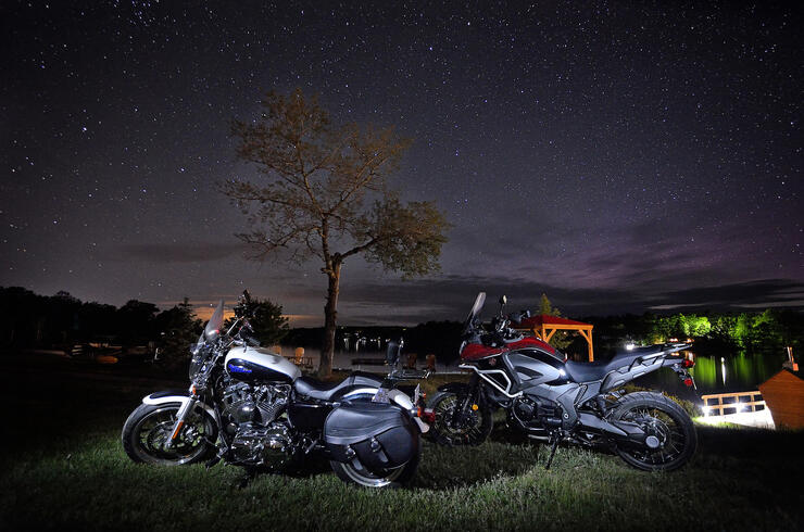
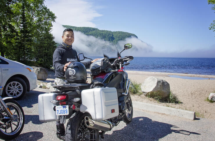
Fast forward a month later, I picked up a Honda VFR1200X and we met in Tobermory to catch the 11:20 am Chi-Cheemaun ferry to Manitoulin Island.

Fill up your tank in Little Current as you leave Manitoulin Island because you won’t have a chance for another 50 km until Espanola.
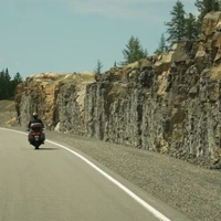
The ride from Little Current to Espanola takes your breath away as the road gently curves and huge exposed rock faces slowly come into view as your round the corner.
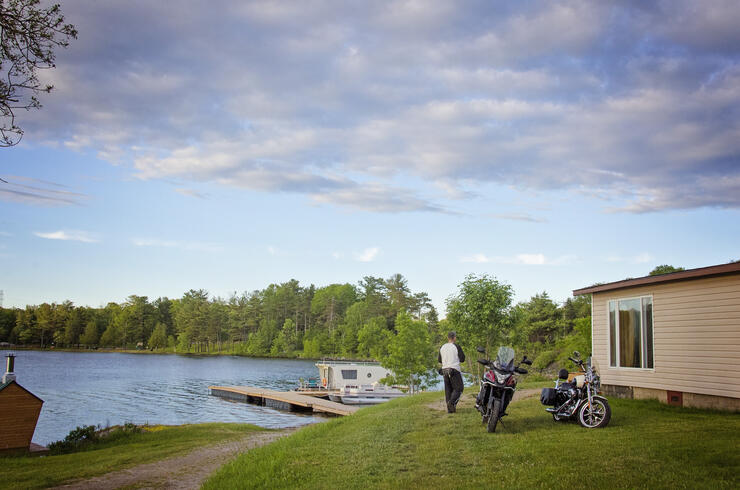
We ended our first day at the beautiful Lake Lauzon Resort where we were able to park our bikes beside our lakeside cabin. The resort served us a hot, delicious, and friendly dinner.
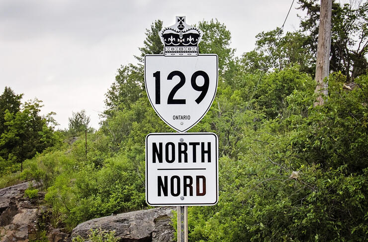
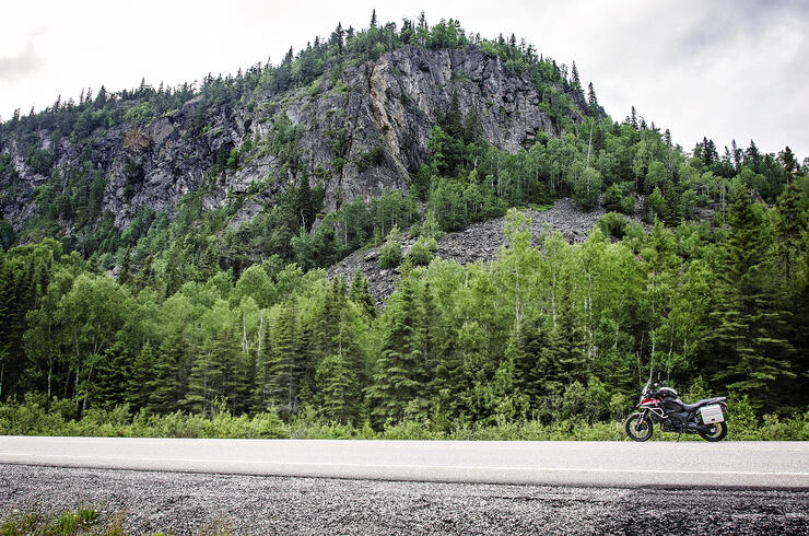
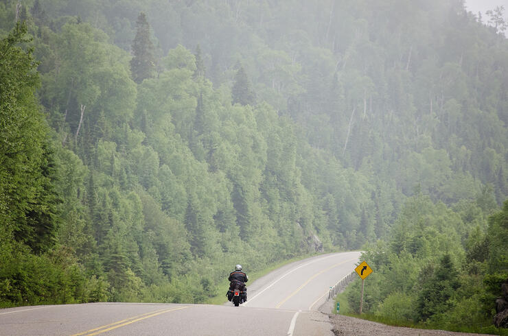
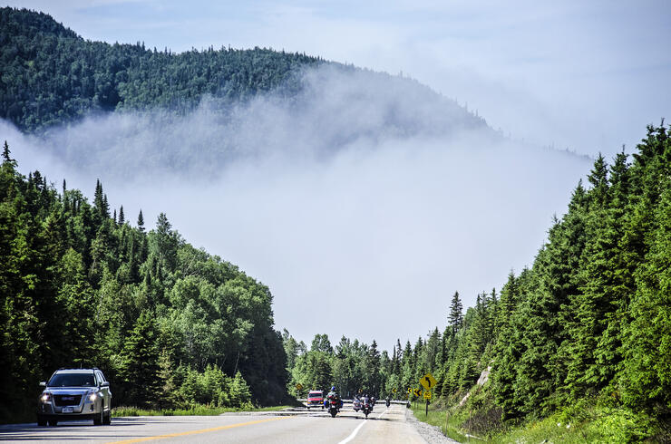
Certainly, the most fun road on the trip is the bottom stretch of the famed Highway 129 a combination of technical twisties, hills, wild natural landscapes, and very little traffic. Sounds perfect, right?

Fill up at the Little Rapids General Store before hitting Highway 129. While here, try their 10-year-old cheese! It's a thing.
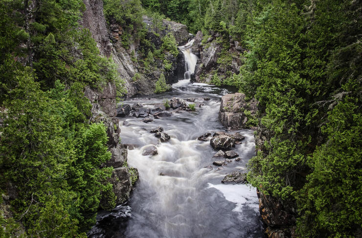
The short 2-kilometre hike to Aubrey Falls was a welcome stretch of the legs. You can view the falls from the bridge, or venture a little further on for a better angle. The little brown sign for “Aubrey Falls” is easy to miss and is about 20 min north of the Aubrey Falls Trading Post, where you can have lunch and fuel up.

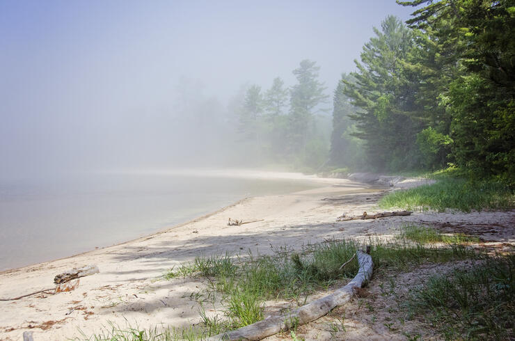
The view approaching Wawa Lake on Highway 101 was inspirational for both its beauty and for finding civilization after a full day’s ride in the remote wilderness along Highways 129 and 101. Unfortunately, I wasn’t able to capture it due to heavy fog.
The Wawa Motor Inn welcomed our weary bones. There was a sauna we could relax in, a large restaurant dining room and a bar. With a gas station across the street at Young’s General Store and bike parking with a door to our room, it was the perfect stop for this leg of our road trip.
The following morning we stopped in at Young’s General Store for a bit of tourist shopping and a photo op at the Wawa Goose before heading south to Sault Ste. Marie (pronounced “Soo Saint Marie,” or just “The Soo”).

Fill up your tank, hug a moose, and try some pickle fudge at Young’s General Store ! I bought moccasins and a hoodie here, but there’s something for everyone in this quirky little store. Also, check out this video about the store.
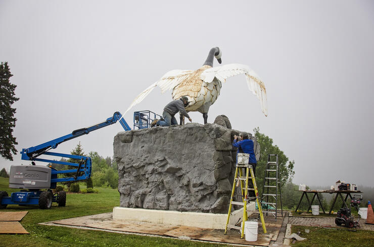
The world famous Wawa Goose, one of the most photographed landmarks in North America. Wawa means “Wild Goose or Land of the Big Goose” in Ojibway. Learn more Fun Facts about the Wawa Goose here. She was getting a major uplift during my trip.
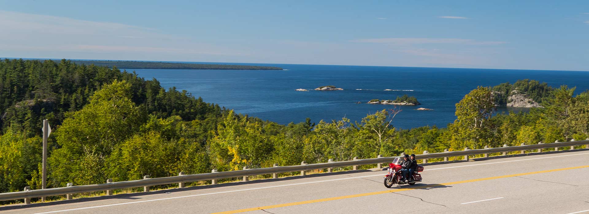
South of Wawa on Highway 17 or the Trans-Canada Highway, are spectacular views of the eastern shore of the largest body of freshwater in the world: Lake Superior. In my mind, these views rival the beauty of the Cabot Trail. There’s nothing like riding toward the massive blue waters with rugged cliffs on one side. Be sure to take advantage of the stops and lookouts such as Old Woman Bay and Katherine Cove along the way.
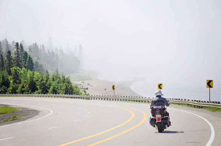
Don’t blame me for the name! Old Woman Bay will be your first view of Lake Superior, the deepest and coldest of the great lakes. You can find more information and more photos of Old Woman Bay here.

Big Loonie in Echo Bay just west of Sault Ste. Marie.
We overnighted at the iconic Red Top Motor Inn. Parking was again right outside the door and dinner and breakfast were so satisfying.
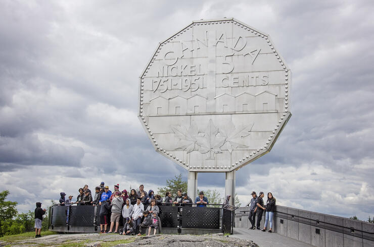
For our final day, we made a beeline back to Toronto. We indulged in a photo op of the Big Nickel in Sudbury.
One of the attractive aspects of riding in Northern Ontario is its remoteness—you can enjoy the views without a hoard of tourists getting in the way. There are few gas stations outside well-established towns such as Wawa, Chapleau, Iron Bridge, Blind River and Sudbury. There’s no need to bring extra gas, just know the range of your tank. My recommendation is to gas up when you can.
Having completed the Algoma Loop, I have some words of wisdom to share:
There’s something special about riding the Algoma loop: the rush of adrenaline as you take on the twisties of Highway 129; the remote areas that make you feel like you’re the only one in the world; the raw wild beauty of the Canadian Shield, forests and rivers; the big sky and beautiful sunsets; the vistas as your ride alongside Lake Superior.
As always, it’s the people that make road trips more memorable. The locals seemed to accept us as long-lost friends making sure our stay in the area was enjoyable, sharing tips or a little bit about the history. Being on the Trans-Canada Highway, we met a lot of travellers, many of whom were on epic road trips of their own (such as the retired couple on a Goldwing that had been on the road for a month, or the gentleman who was riding his bicycle from Washington state). I felt humbled yet grateful to have intersected with their lives, and to be enjoying this country and province I call home.
Special thanks to Lake Lauzon Resort, Wawa Motor Inn, Red Top Inn, and Honda Motorcycles Canada .