Great Ontario Bike Roads - The Google Map
Easy Rides - Ontario's Motorcycle Roads
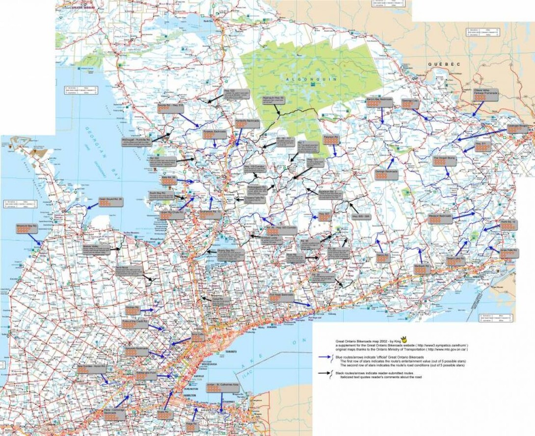
Many riders are familiar with the Great Ontario Bikeroads Big Map, but it's tough to plan a trip off this squinty JPG. So we've translated these roads to a zoomable and clickable Google Map. Read on for details!
For riders new to Ontario, the most common question is "Where can I ride?" We spend a lot of time pouring over all of the possible answers to this complicated question - are you a cruiser rider looking for the long distances and big scenery, or a sport rider looking for the most technical twisties. For riders who are just getting a sense of where Ontario's best rides are, there is a perfect map that quickly and easily outlines the major riding roads in Ontario, often with plenty of cool things to see and do along the way too. You can check out the map below or click here for the full-blown Google version.
This map was created by riders throughout the province, so you can be sure every road has been tried and tested. You can customize your route, see what is close to you, and cross them off your list one by one.
View Ontario's Bike Roads - The Big Map in a larger map
Click here to see Ontario's Top 30 Roads and here to see the Top 10 Motorcycle Routes.
Ontario has dozens of motorcycle events as well. If you're heading to Port Dover, the Bikers Reunion, Ride for Sight, or any of a dozen other great rides, try and work in a few of the roads on your way there, or your way back.
Recommended Articles

Bucket List Motorcycling in Ontario, Canada 2026

Ontario's Best Twisties: Five Roads to Get Your Lean On

The Big Belly Tour—A Complete List of Ontario's BBQ Joints

It's Bike Night in Ontario 2024

Ontario's Top Twisties

Have You Ridden Canada's OG Highway? Here's Why Every Rider Needs to Hit Up Historic Highway 2

23 Amazing Photos That Prove PD13 Is Still The Best Motorcycle Event Ever

Motorcycle Swap Meets in Ontario—The Complete List for 2025

And a Vespa shall lead them all...


