
Ontario Motorcycle Events
Let's Ride!
By Mike Jacobs


What’s the old saying? Where there’s a will, there’s a way? Well, when it comes to riding the roads of Ontario, let’s just say "Where there’s water, there’s a parkway."
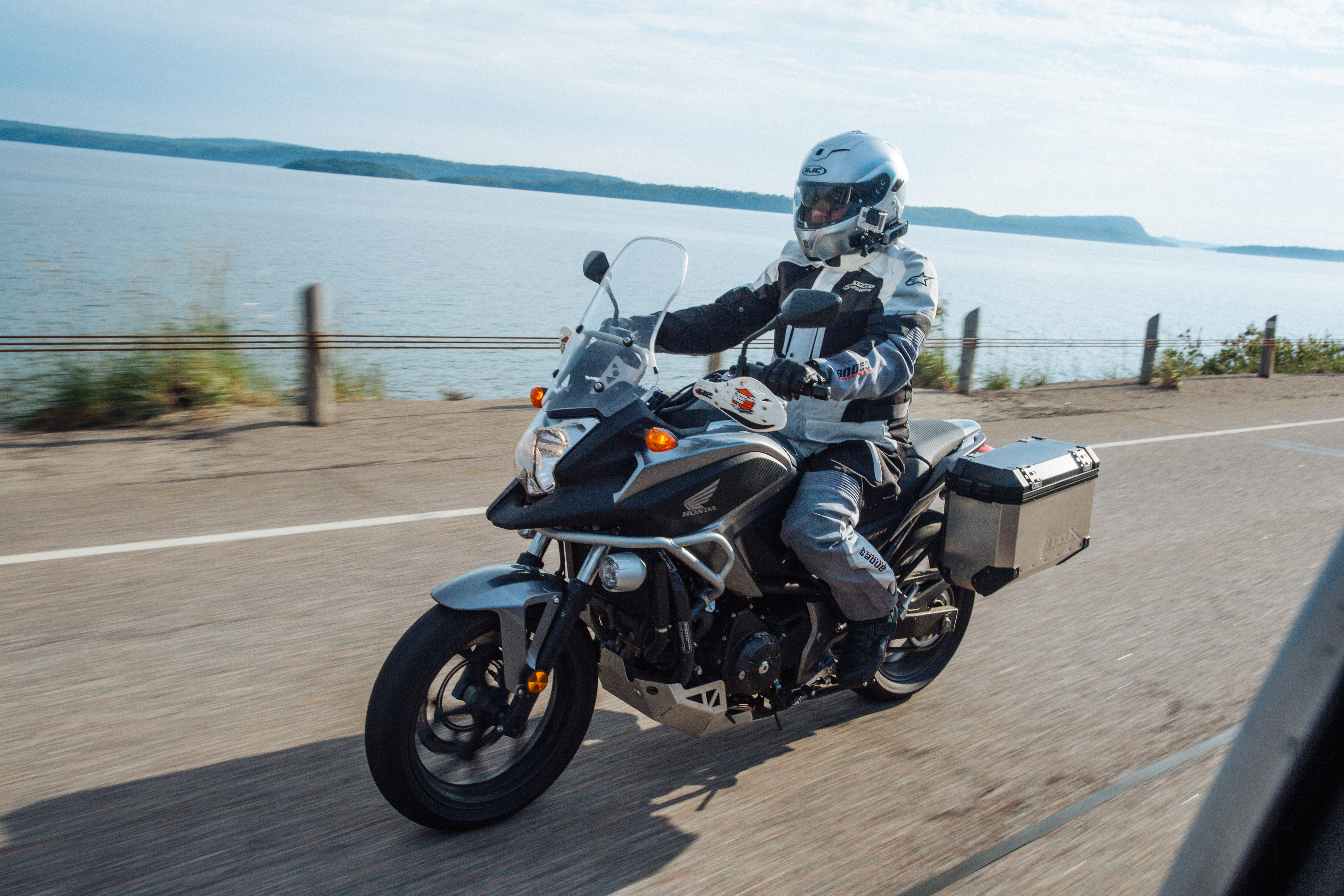
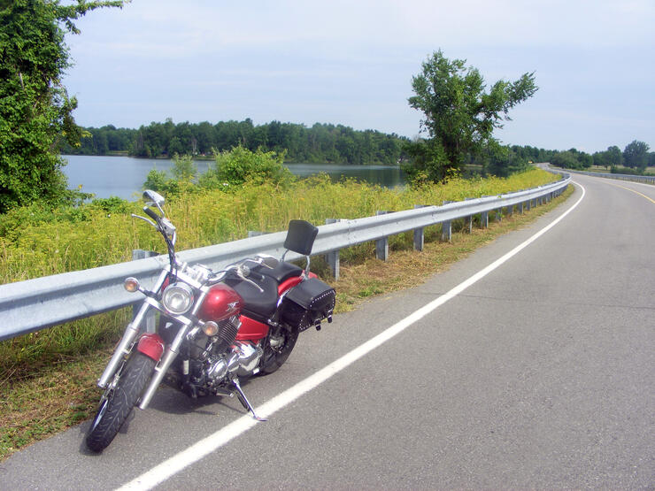
Growing up on the banks of the St. Lawrence River, I spent a lot of time exploring my village of Long Sault and the surrounding area while pedalling around on my bicycle. Little did I know that I would return to explore the area 30 years after leaving it; this time, rediscovering the roads and playground of my youth from the saddle of my trusted friend, confidante, and riding partner—a bright red Yamaha VStar 650 Custom named Ruby.
In this first of three pieces about great motorcycle routes in Ontario that also happen to be parkways, we’ll begin our journey where I began my own journey of sorts over 30 years ago.
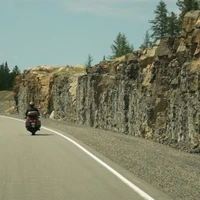
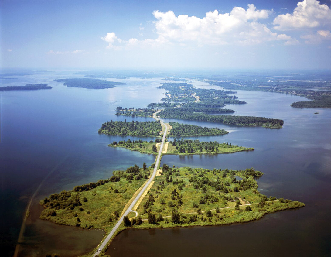
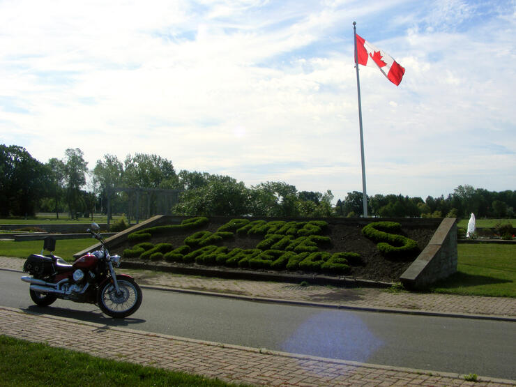
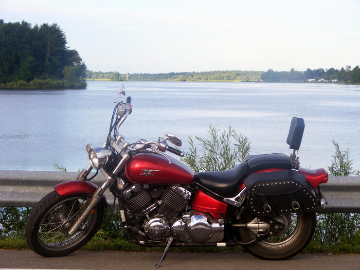
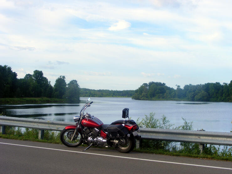
Recognized by What A Ride’s own Mike Jacobs as one of the Top 30 Motorcycle Roads in Ontario, the Long Sault Parkway is pure cruising territory. Formed when they flooded the St. Lawrence, this fresh pavement looks out over the river throughout the whole ride.
When I was a kid, I learned the history of the area because the teachers at school said it was important. Now as an adult (or at least, pretending to be one), I wanted to revisit those stories and lessons, relearn the history, and better appreciate this highly-regarded route if I was going to enjoy it from the back of a motorcycle.
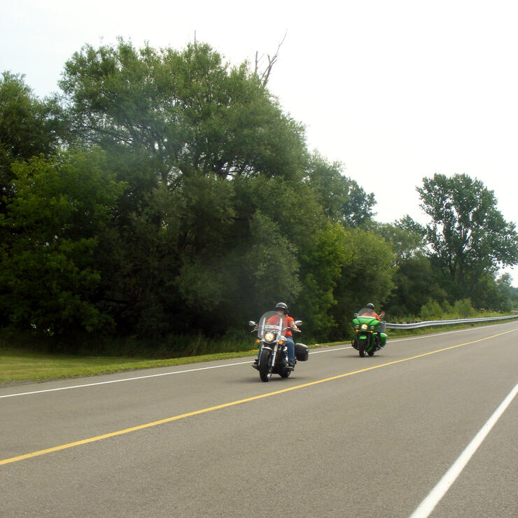
Whether riding the Parkway in the early morning as the sun comes up over the water, during the day when you pass almost as many motorcycles as you do cars, or in the evening as you wind down from a day of riding, the Long Sault Parkway is one of the best combinations of road, ride, and recreation in the province.
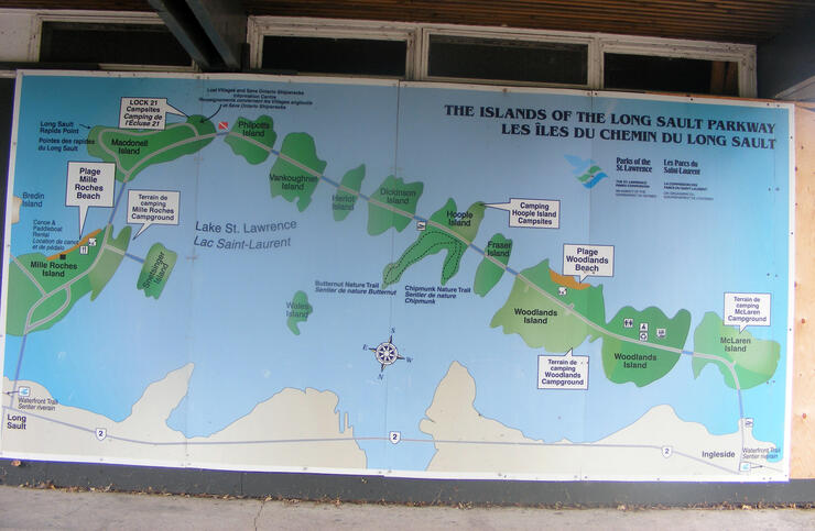
The road itself is smooth and even, full of long stretches and gentle curves. The scenery is exhilarating and calming at the same time. The route provides plenty of places to stop, take pictures, explore, rest, or just plain stand in awe at the surroundings.
Full of campgrounds, rest stops, picnic areas, and beaches, the Long Sault Parkway is a motorcyclist’s paradise, able to serve as a home base (campgrounds) while exploring the eastern part of the province, a day trip destination (with an extended stop during the day to rest, picnic, enjoy the beach and more), or simply take in the view as you ride through on your way to the next stop on your travels.
One of the things I remember the most about riding the Parkway when I was a kid was looking out into the water and seeing a small section of paved road rise up, then disappear beneath the waves on the other side of one of the many little pieces of land that dotted the landscape.
Ride through the parkway from end to end the first time you’re there, simply to enjoy the scenery, and then make a point of riding through it several more times, stopping along the way (safely, of course) to go off the main road and do a little exploring, you’ll be amazed at what lies around the bend on some of the smaller roads that pepper each of the nine islands.

I took the Long Sault Parkway for granted when I was a kid; I think we all tend to overlook what’s in our own back yard at that age. I thoroughly enjoyed the many times I rode it on Ruby over the three days I was in the area during my very first long-distance solo road trip. You really can go home again…
The Lost Villages were nine communities in the province of Ontario, in the former townships of Cornwall and Osnabruck near Cornwall, which were permanently submerged by the creation of the Saint Lawrence Seaway in 1958.
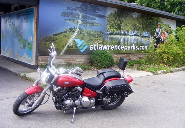
One of the best and most accurate sources of information about the area is a website home to a unique organization called The Lost Villages Historical Society. On their site, you’ll find a treasure trove of information about the historical events surrounding the creation of the Long Sault Parkway, area attractions and accommodations, plus a variety of helpful tourism links to provide you with plenty of information about what to check out when you’re touring this part of the province.
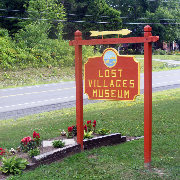
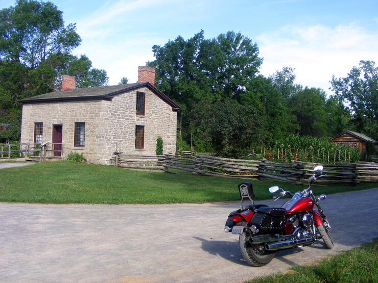
Located on Highway 2 just a short ride from the (Long Sault end) entrance to the Long Sault Parkway, The Lost Villages Museum is a great place to park your bike, grab a bit of shade, and get up close and personal with the history of the area.
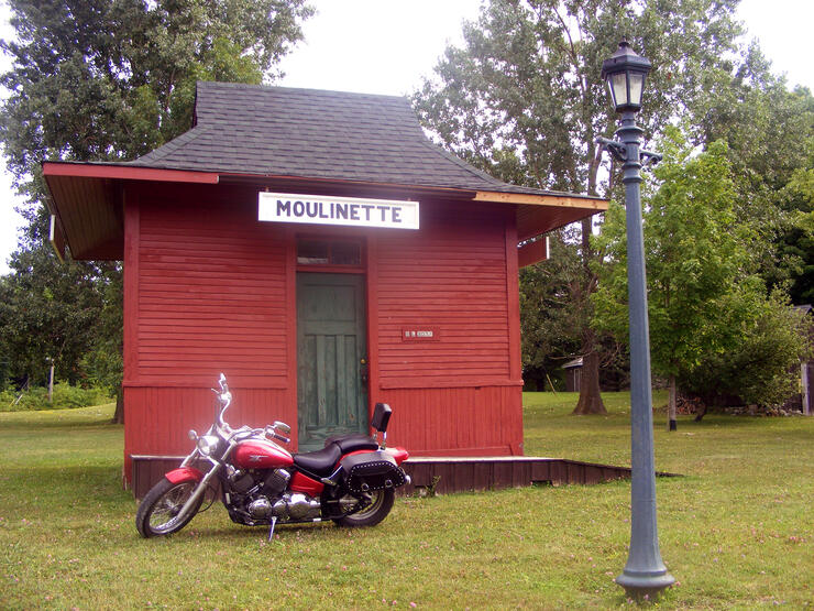
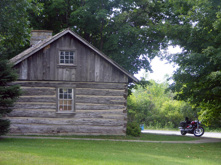
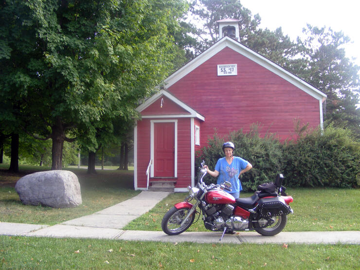
Actual buildings that were moved from towns and villages that were flooded when the Seaway and the Parkway were created, The Lost Villages Museum site consists of 10 heritage buildings, moved and restored to Ault Park from The Lost Villages and surrounding townships by the members of The Lost Villages Historical Society. Both the interiors and exteriors of the buildings have been restored, and they have been assembled in a village-like setting.
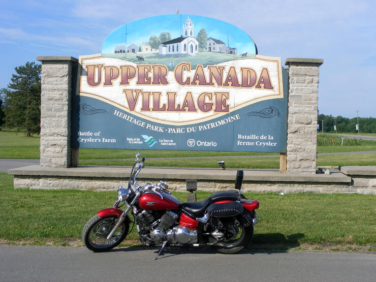
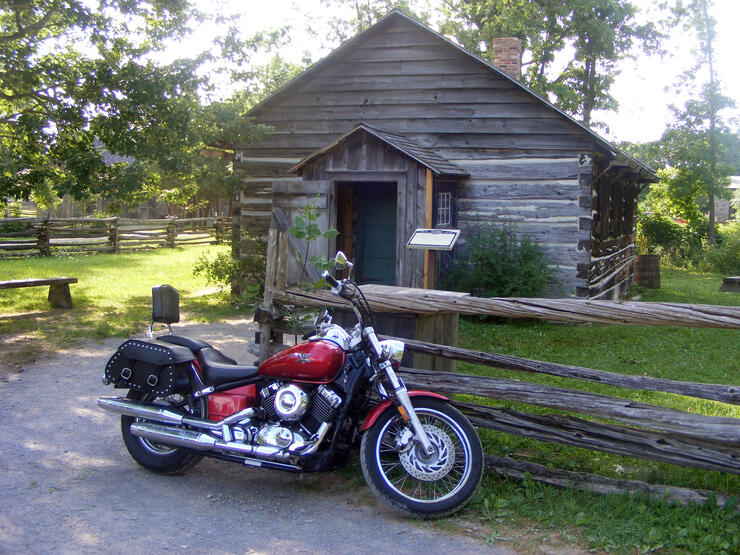
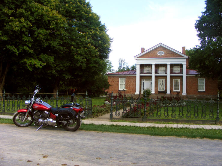
Upper Canada Village is a heritage park near Morrisburg, Ontario, which depicts a 19th-century village in Upper Canada. Construction began in 1958 as part of the St. Lawrence Seaway project, which required the permanent flooding of ten communities in the area, known as The Lost Villages. Upper Canada Village was a part of the project's heritage preservation plan. Many of the buildings in Upper Canada Village were transported directly from the villages to be flooded. The park, owned and operated by the St. Lawrence Parks Commission, was opened to the public in 1961.
Featured at the site are over 40 historical buildings, including several working mills (wool mill, grist-mill and sawmill) and trades buildings (blacksmith, tinsmith, cabinetmaker, cooper, bakery, cheese-maker). Farming is demonstrated through the growing, harvesting, of processing of heritage vegetables and livestock, and aspects of late 19th-century domestic arts, social life, music, religion, and politics are also discussed, interpreted, and demonstrated at by staff dressed in clothing of the period.
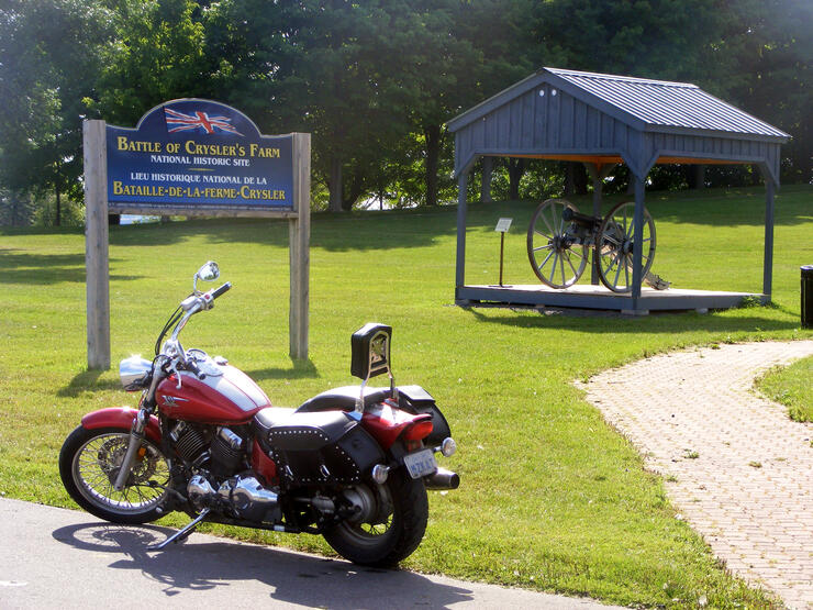
The park also incorporates a memorial to the Battle of Crysler's Farm, a War of 1812 battle which also took place on land submerged by the Seaway project.
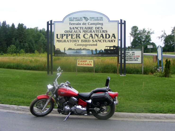
According to the St. Lawrence Parks Commission’s website, at the Upper Canada Migratory Bird Sanctuary you can “turn your camping experience into a learning adventure that’s fun for both avid birders and families alike at one of North America’s only campgrounds located in the heart of a bird sanctuary.”
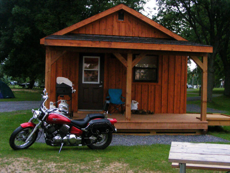
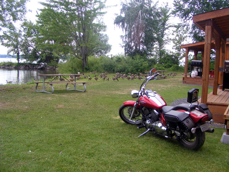
Established in 1961, the nature reserve features 69 campsites and five group campgrounds, including the recent addition of ten 50 amp serviced campsites, several camping cabins, the "Robin’s Roost Treehouse" (which sleeps up to six people and offers a private beach, master loft, full kitchen, bathroom and more), a Visitor Interpretive Centre with displays and themed merchandise, 8 km of self-guided hiking trails and, of course, abundant wildlife with over 150 different bird species. The Sanctuary’s Morrison Island offers some of the best carp fishing in the world with anglers coming in on chartered excursions from around the globe.
I spent two nights in one of the campground’s Camper Cabins and loved it! The view was spectacular and peaceful (right on the bank of the St. Lawrence River), the Sanctuary is a unique environment in and of itself, and it presented a wonderful alternative to one of the three campgrounds located along the Long Sault Parkway (McLaren Campground, Milles Roches Campground, and Woodlands Campground).
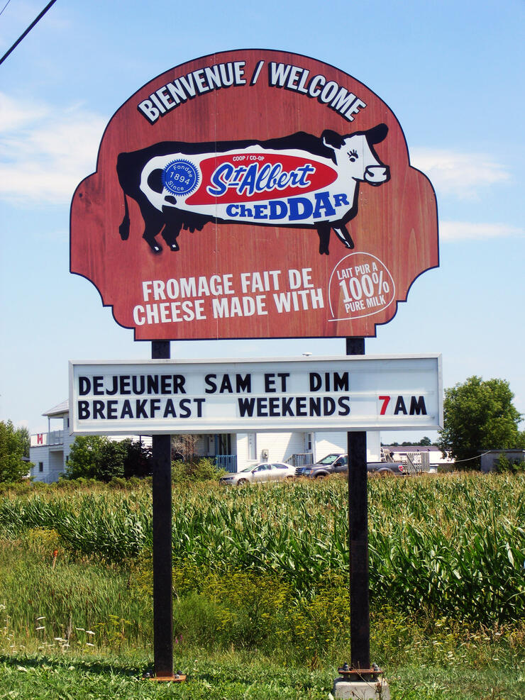
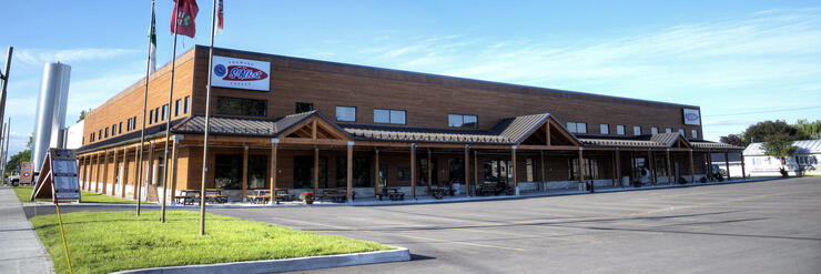
Every year, hundreds of thousands of visitors stop by the St-Albert shop to buy their cheeses and local products. One of the most vivid memories from my childhood is of my father (an OPP officer stationed out of District 11 headquarters based in Long Sault) bringing us small bags of cheese curds from the store in St. Albert’s. The curds were so fresh that the bottom of the bags were always filled with whey and we would run the cheese across our teeth to hear it "squeak." The taste of fresh cheese curds is one of my go-to treats whenever I am in eastern Ontario, so I couldn’t pass up on the opportunity to visit St-Albert’s and check out their expanded store and production facility (opened in 2014 following a rebuilding after a devastating fire the year beforehand).
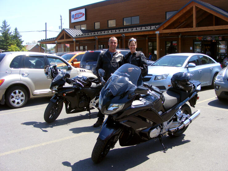
There are many routes up to St-Albert and their flagship location, complete with a restaurant, boutique, visitor centre and museum. From the Bird Sanctuary, the route I took went from Highway 2 (at the Sanctuary entrance at Highway 2 and Aultsville Road) east to County Road 14 (just past Ingleside), turning left and travelling all the way up to the end. County Road 14 offers long, sweeping curves and travels through beautiful farmland and rolling hills. Following a left onto County Road 12 (heading north through Finch—where you make a quick left onto County Road 43 W for a few minutes, then get back onto 12—and Crysler), you make your way to Regional Road 7 and follow the signs for St-Albert / Casselman (click here for the map).
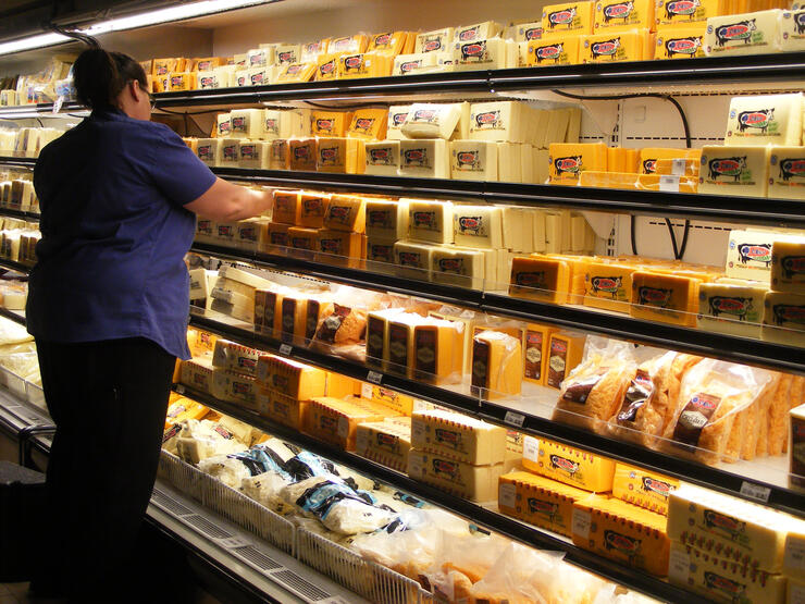
A popular stop for motorcyclists travelling throughout the region, the parking lot at the co-op was peppered with single riders, couples travelling together, and small groups of bikers. I had a great time talking to everyone (putting some of my rusty French into practice), sharing stories, checking out bikes, and making connections. And ohhhhhh, the cheese curds! I think "nom nom nom" is the same in both official languages!
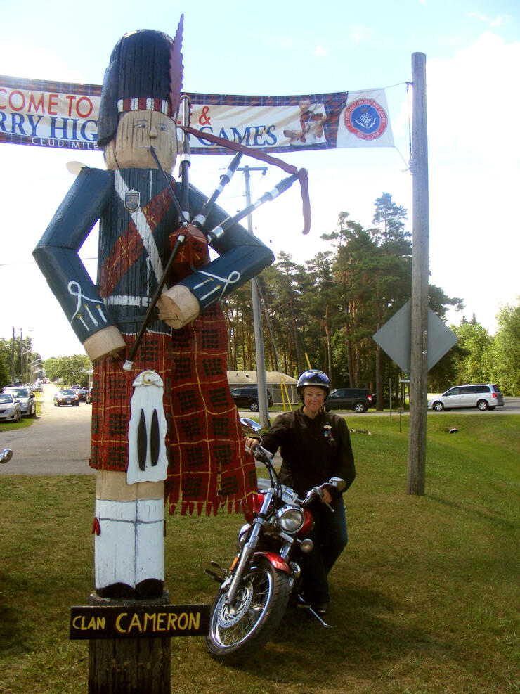
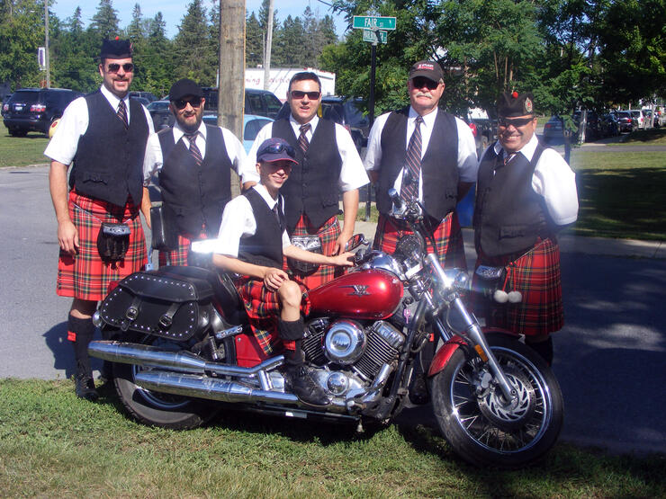
A summertime visit home wouldn’t have been complete without a trip to the Glengarry Highland Games in Maxville. An eastern Ontario tradition (and significant annual event for a young KAT who happened to participate in competitive highland dancing competitions for years), this two-day Scottish festival is held during the first weekend of August every summer.
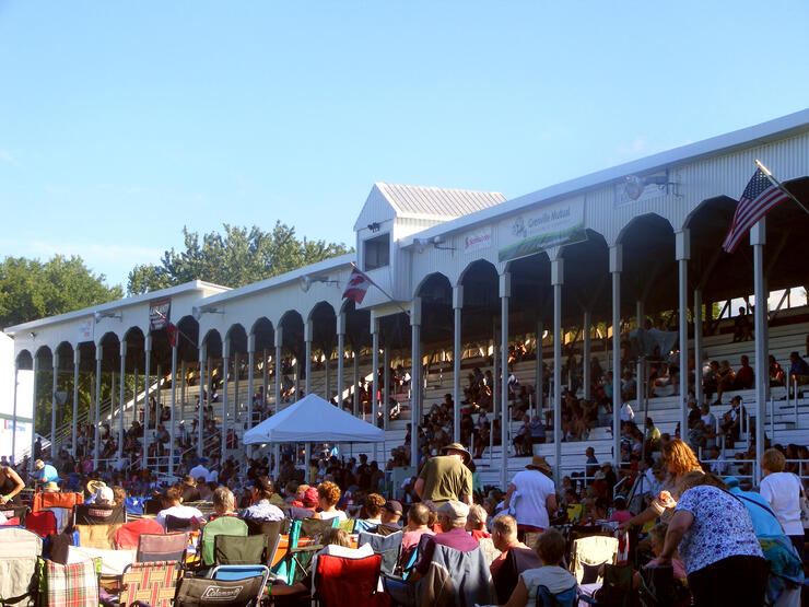
Since the first Games were held in 1948, the people of Glengarry have extended close to a million welcomes to visitors who come to see what is estimated to be one of the largest Highland Games in the world. Thousands of people find themselves drawn each year to Maxville to witness an outstanding display of music, dance, sports, fiddling, pageantry, and tradition.
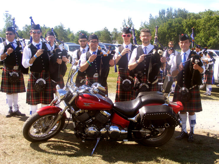
In the course of the day, more than 50 pipe bands are put through their paces to decide the North American Pipe Band Championships™, more than 200 dancers defy gravity in the Highland Dance competition, and giants hurl telephone pole-sized cabers and 50-pound iron hammers around the infield. It is a memorable and incredible event.
There are children’s events, Clan displays, fiddling, competitions (including heavyweights, highland dancing, Highland Regiments tug of war, Piobaireachd Society Gold Medal Competition, piping & drumming), a Tartan Ball, a kilt run, whiskey tasting, and the highlight of the event—the massed bands and massed highland dancers (plus full entertainment lineup) of the awe-inspiring Tattoo, and so much more!
KAT (aka KimberleeAnna Taplay) is a member of the ‘What A Ride!’ correspondent team, and is happily enjoying her explorations of Ontario as a newly-minted "M" rider. To share your adventures in riding, pass along a photo, or make a suggestion for a story you’d like to see from KAT, send her a quick message at kattales@rogers.com