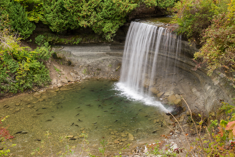
The Ultimate Road Trip Guide to Chasing Waterfalls in Northeastern Ontario
Nine stops, nine waterfalls — from Duchesnay Falls to New Post Falls
By Hollie Demore


Ontario's Manitoulin Island is blessed with incredible natural beauty mainly because of the rocks. It's rocks are oddities. We can learn much from these anomalies.
Follow this through. It is the 172nd largest island in the world and is the 31st largest in Canada. Known as the “Spirit Island”, it has within it 108 freshwater lakes, some of which have their own islands; in turn several of these "islands within islands" have their own ponds. Lake Manitou is the largest lake in a freshwater island in the world and Treasure Island in Lake Mindemoya is the largest island in a lake on an island in a lake in the world. These facts alone give the island an atypical introduction.
It is about 130 km long and 50 km wide and it's intriguing landscape resulted from the action of ancient rivers and glaciers that altered the soft bedrock. These actions are what make the island distinctive. It is an extension of the Bruce Peninsula and the Niagara Escarpment.
When compared to the granite of the Canadian Shield found in most of Northern Ontario, it is the white, quartz and limestone rock and the alvars that make the island the exception. Five hundred million years ago Palaeozoic limestone was deposited in shallow, tropical seas. At the time, over top of the bumpy landscape of the Canadian Shield. Slowly the island was buried by these limestone sediments made from millions of sea shell pieces. The accumulation of the invertebrates’ hard parts after their deaths generated the sediment; all of this hardened into the limestone features.
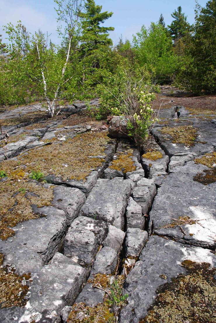
Alvars (a Swedish word), are globally rare, naturally open habitats with either a thin covering of soil or no soil over a base of carbonate rock, such as limestone and dolostone; it is one reason why Manitoulin is unique. The rock is easily dissolved by water in it's many forms through a process of karstification or karst landforms. Most of the features on the island likely formed in the last 15,000 years following the last glaciation period.
The alvar vegetation community developed on many of the island’s bedrock barrens. It is a rare and sensitive ecosystem that is not found outside the Great Lakes basin. Juniper bushes and herbaceous plants such as grasses and sedges are typical of the alvar plant community. This delicate ecosystem manages to eke out a living under extreme and fluctuating conditions of temperature, moisture and poor soils.
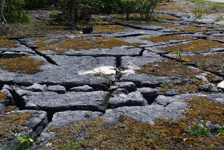
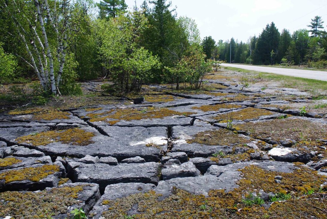
When you visit you will see a great deal of almost flat-lying, smooth pavement, linked to the movements of the glaciers. Soils are thin or almost non-existent. Because of the softness, the pavement's cracks form and become increasingly dissected. The fractures create blocks of various sizes called “clints.” The spaces between them are called “grikes.” These collect soil and plants take root. The sparsely vegetated bedrock barrens that develop are in fact, the alvars.
Back Roads Bill contacted one of the three authors of ‘Manitoulin Rocks!’ Peter Russell is the Curator for the Earth Sciences Museum at the University of Waterloo. Their aim was to present a “simplified account” of geological history and to present interesting and unusual facts.
He said, “The grikes average about 13 cm or so across. As the fractures widen through dissolution, the ground water flows to the water table. The importance of recognizing such passageways in bedrock cannot be overstated, because they bear on locating landfills, sewage treatment and management of livestock manure.”
He explained the tragic events at Walkerton, situated on the Bruce Peninsula. “In May of 2000, water moving quickly through the fractured bedrock, combined with subsequent lack of chlorination caused an outbreak of E.coli (Escherichia coli) bacteria in the town’s water supply.” The result was more than 2300 cases of gastrointestinal disease and eventually seven deaths. It was attributed to farm runoff into an adjacent well that had been known for years to be vulnerable to contamination and to two employees of the Walkerton Public Utilities Commission who could have admitted (falsifying reports) to the contaminated water sooner.
The question to Mr. Russell was, “Is there a location that represents both the alvar community and the karst process?”
“There is some beautifully exposed pavement on both sides of the road with excellent development of clint and grike karst,” said Mr. Russell. “It is one of my favourite places to visit, especially in October when the maple trees turn red and yellow. The trees are short bonsai-like due to the lack of soil.”
Zoom out on the Google Map below to see exactly where this is:
This location is found at N45° 43’ 38.8” W82° 14’ 43.4” or WGS 84 17 T E403094 N5064519. It is found north of Providence Bay off of Highway 551 (SW corner of Mindemoya Lake). Highways 551 and 542 merge in Mindemoya, the village. Turn north on to Monument Rd. (west of Mindemoya) and drive north, 1.5 km; this is quiet country back road, good for parking. It is a wonderful site to see the fractures and a multitude of sensitive ferns, stunted Junipers and exposed dolostone pavement with no topsoil.
There is so much to see on Manitoulin Island including finding trace fossils at Gore Bay and the Cup and Saucer Trail, close to Little Current. The 123-page, comprehensive guide, with coloured photos, is one of the best of its kind as a stop-to-stop field guide of the island, with GPS coordinates and good directions, (a tip of the hat to the authors, I would give it a “camp badge,” this is how information for visitors should be presented!) You can order it through the Earth Sciences Museum, University of Waterloo (earthmuseum@uwaterloo.ca or 519-888-4567 ext.32469).
Most people know a crack when they see one, but that doesn't mean they understand or have thought much about cracks like the clints and grikes of Manitoulin Island. Understanding the Walkerton tragedy through visiting the Manitoulin alvars may prove to be more than just interesting.