Think You're an Avid Hiker?
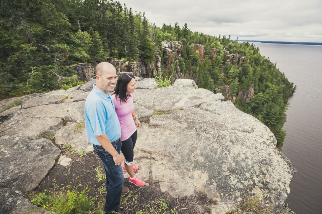
Hiking is a lot like life. And the surprises that life can bring are a lot like what you will find on your next BIG hiking experience in Northeastern Ontario. Wondering where to go? For starters, think about your accommodations. Whether you are doing an overnight trek, a day trip, a linear trail or a loop, trip planning requires a beginning and an end near a community that’s waiting with a welcome mat of information and services. And there are plenty of communities and service providers along the way.
Northeastern Ontario is home to some BIG hiking adventures that are as diverse as the terrain, and offer the reward of some amazing vistas at the end of your trek. Take a look back on the trail you’ve experienced, and you’ll already be thinking about your next trip.
Mattawa
Mattawa, situated along the Trans-Canada Highway (17 East), is an area that is full of great hiking opportunities for all four seasons, including Eau Claire Gorge. You can access this trail by turning off at Highway 630.
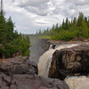
The most spectacular scenic feature is the gorge itself, where the Amable du Fond flows between steep rock walls in a dramatic series of rapids and, of course, the breathtaking waterfall. Below the gorge the river widens and winds its way through a cluster of islands. The trail finds its way through an old growth red pine stand.
French River
If you have always wanted to be a voyageur and travel in the footsteps of our Canadian legends, the French River is a good place to stretch your legs if travelling along Highway 69. Start at the French River Visitor Centre and then walk the 2-km linear trail downstream along the French or west to the infamous Recollet Falls.
Going cross-country on Highway 64 near Lavigne/Verner is Mashkinonje Provincial Park, a great choice for a long, adventurous hike. It is an area where our ecological perceptions are changing. At one time everything was a “swamp.” We are now learning that wetlands are important but we still don’t know much about them. We all have seen a pond or swamp of some description. They take many forms including marshes, estuaries, mudflats, mires, ponds, fens, pocosins, swamps, deltas, coral reefs, billabongs, lagoons, shallow seas, bogs, lakes, and floodplains; some are even man-made. A great recommendation is to take the Loudon Peatland Trail – find the kiosk just off the east side of the highway.
Cochrane – Smooth Rock Falls
If you want a moderate hiking challenge to see one of the Region’s best waterfalls – you’ll want to hike to New Post Falls! It’s a great hike to turn into an overnight camping trip.
Cochrane and Smooth Rock Falls is the land of black spruce and the boreal forest. This is one of many journeys to a destination where you will enjoy a breathtaking vista, a towering gorge and revel in the sounds of the roaring water as it plunges into a pool many tens of metres below. Because of the narrow gorge it always has a great deal of mist.
Moonbeam
The Moonbeam trail system is a great choice for one of the best multi-faceted and multiple-use trail systems in the Region. The town with the flying saucer is just east of Kapuskasing and lies in the heart of the Great Clay Belt and within Canada’s boreal forest.
There are almost 40 km of trails with a variety of surfaces suited to different types of trail users. The system is well marked and the connectivity is exemplary. Of special interest are the two trails that utilize the Edward Bonner Nursery, one of Ontario's largest tree plantations; it is a one-of-a-kind research forest in the boreal region of Northeastern Ontario. The trail system also connects with Rene Brunelle Provincial Park. A great hike and bike opportunity!
Killarney
Killarney is world renowned for its hiking. It includes the 80-km, looped La Cloche-Silhouette Trail that takes you along the ridges of the LaCloche Mountain Range. This is a challenging trail best suited for experienced hikers.
Its notoriety is because of the Group of Seven. Three of the group painted extensively in the park and brought the area to prominence. Once you visit, you quickly understand their passion.
Explore the 100 km of stunning white quartzite hills in Killarney Provincial Park. Killarney now boasts of 10 hiking trails that encompass scenic beauty, marine heritage, and native history. Come and enjoy the pristine shorelines with stunning views of Georgian Bay. Enjoy day hikes along gentle granite slopes or tackle one of Ontario's highest elevations – Silver Peak. Silver Peak has one of the most dynamic views in the province.
If you can’t afford the time try the “Crack” trail. It is a great way to access and experience the beauty of the “white rock” within a short hiking distance.
Kirkland Lake
If you want to track the evidence of a glacier, then Kirkland Lake's trail system will bring you back in time.
Straddling the height of land (continental divide) between Arctic and Atlantic watersheds, Esker Lake Provincial Park preserves the legacy of glaciers that retreated 10,000 years ago – dozens of kettle lakes, part of the geologically famous 250-kilometre Munroe esker with undulating hills and sand dunes.
The park has four different hiking trails but you want to gravitate towards the Trapper’s Trail. It has three loops to match your fitness level – 9 km, 14 km, and 20 km – and takes from four hours to two days, if you are up for the challenge. This long hiking and backpacking trail begins at the north end of Panagapka Lake and continues north towards Thrasher Lake. The trapper’s cabin on the trail was built by an Ojibway woman who trapped in the area until 1970.
Manitoulin Island/North Shore
Manitoulin Island and the North Shore are blessed with incredible natural beauty mainly because of the rocks. Its rocks are oddities, limestone left over from the great inland sea. What a difference when compared to the granite of the Canadian Shield found in most of the Region. The background here is the white quartz and limestone rock.
Just about everyone has heard of the ‘Cup and Saucer’ trail. This is the Manitoulin extension of the Niagara Escarpment, with 70-metre high cliffs. There are more than 12 km of trails with a number of loops to choose from.
But give the M'Chigeeng Trail a try. Recently doubled in length, M'Chigeeng includes two trails; one along the bottom of the bluff, and the other climbing to the very top. The Bear Caves and Fossil Rock Point are two spots of special interest. The top of the bluff offers outstanding views of the North Channel. The Anishinaabe regard this as a special place for spiritual cleansing. The trail starts behind the ballpark, off Highway 551, just south of Highway 540.
Moosonee/Moose Factory
Looking for a special experience? If you’re lucky, you may glimpse a seal or the milky white back of a beluga whale from a vantage point on this trail.
Riverside Trail is a 2-km interpretive trail within Tidewater Provincial Park operated by the Moose Cree First Nation. Views of Moose Factory Island and Moosonee can be seen from Charles Island along the trail through the forest.
Water access is the way to locate this gem, located in the northernmost part of Ontario near the salt waters of James Bay and Hudson Bay.
The park consists of five islands in the Moose River estuary close to Moose Factory and Moosonee. From Moosonee, there are water taxis to take visitors to the park islands. You can also kayak the coast or canoe the Missinaibi River or Abitibi Rivers.
Temiskaming Shores
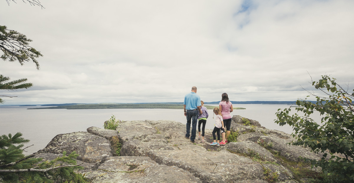
A visit to the historic tri-towns would not be complete without a stop to the Devil’s Rock, one of the best and biggest vistas in the Region. The high cliffs overlooking Lake Temiskaming were the inspiration for the Hardy Boys series of books. It is a very short walk in/out and a must-see panoramic view!
North Bay – Sturgeon Falls
Driving along Highway 17 from North Bay through West Nipissing you have two opportunities to experience a waterfall and then a wetland complex.
On the western extremity of North Bay you will come to Duchesnay Falls located on the Trans Canada Highway. It is a picturesque waterfall with a series of cascades. A 3-km loop, it’s a great opportunity to stretch your legs.
If Sturgeon Falls is your destination and you want to see an expansive wetland with cranberries, turn off the highway and visit the Sturgeon River House Museum and Nature Trails. A great deal of work was put into the boardwalks.
Sudbury
If you want to understand the massive re-greening effort that has made the City of Greater Sudbury a world case study, then stop at the Jane Goodall Trail at the east end of Sudbury at the junction of Highway 17 and Regional Rd. 90, Garson/Coniston. This short walkabout will give you a real appreciation of the long-term efforts and commitment of the community. Great interpretative signs here.
If you’re travelling north of Sudbury towards Timmins, take Highway 144 towards Onaping Falls, located just before Windy Lake Provincial Park. This geological interpretative trail, the A.Y Jackson Trail, was named after the famous Group of Seven painter for good reason. It is easily found, and the kiosk and associated rock walk are highlights to complement your walk. You won’t want to miss High Falls!
Temagami
If old growth red and white pine are your pleasure, then the relaunch of two trails in the Temagami area are a must-see.
For hiking enthusiasts, the word “Temagami” conjures up the vision of wilderness, and you won’t be disappointed. It was the inspirational home of the famed conservationist Grey Owl. It is the epitome of what the rugged Canadian Shield represents—lakes and rivers, white and red pine.
One of the trails is a short canoe, kayak, or boat ride to Temagami Island in the middle of the lake. The other is near the town hub. The iconic fire tower and White Bear Forest beckons you to experience the many loops. Click here to see the Temagami Community Foundation maps.
Timmins
Timmins, the city with the “heart of gold” has more than 45 km of recreational trails that immerse you in the boreal forest. Canada’s boreal landscape contains more lakes, rivers, and wetlands than any comparably sized landmass on Earth.
One recommended option, Hersey Lake, is situated in the beautiful jack pine forests just north of Timmins and offers scenic lookouts. Another recommendation is the Tamarack Nature Trail, a self-guided interpretive trail (15 stops) designed to introduce you to some of the unique plants and animals of the northern environment.
Recommended Articles
The Seven's Best Hikes, Biking Trails and Lakes

7 Best Spots to Check Out in The Seven

Budget Bliss: Explore Northeastern Ontario Without Breaking the Bank

Bring Your Fam!

Time to Unwind: 6 Spa Havens to Discover In The Seven
5 Amazing Places to SUP in Northeastern Ontario

5 Amazing Bike Rides to Discover

Northern Lights in Northeastern Ontario

Northeastern Ontario's Best Pride Festivals

Fish for one of the World's Rarest Species of Trout

An Insider's Guide to Manitoulin Island

6 Small-Town Gems to Explore in Northeastern Ontario

11 Best Things to Do in Kapuskasing, Ontario

