Multi-use fun in Atikokan
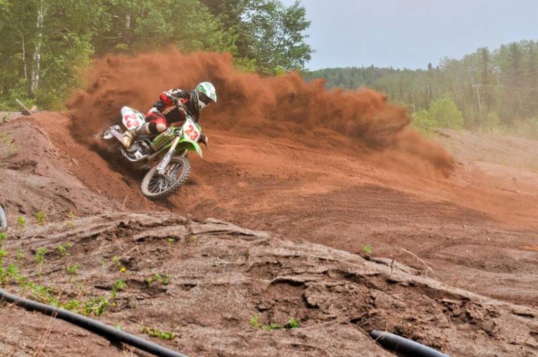
Where can you go Motorcross Racing, Mountain Biking, Horse Riding and Snowmobiling?
At the Charleson Recreation Area in Atikokan, Ontario. The Charleson Recreation Area (CRA), often called the Charleson Pits, is located in Atikokan, halfway between Fort Frances and Thunder Bay. It takes its name from the original Canadian Charleson Iron Mine (a subsidiary of Charleson Iron Mining Co. of Minnesota), which operated sporadically in Atikokan from 1958-64 in the region of what is now the hub of the CRA, the Sno-Ho chalet.
The CRA committee was formed in 2005 in an effort to consolidate the different users of the Charleson area. Amazingly, the users include snowmobilers, motocrossers, 4-wheelers, mountain bikers, horseback riders, Ride for Sight, canoeists, anglers, hikers, picnickers, snowshoers, skiers, and more. The area has grown into an awesome multi-use recreational area that is improving each year.
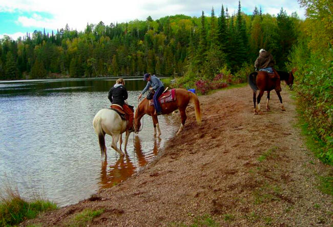
Horse riders get together and camp for the weekend, using the trails and water in the daytime and relaxing in the evening. For campers, there are 9 high ties, and 8 permanent pens are now available on-site to keep your horse in, as well as permanent washrooms with running water. To get an idea of how both the horses and riders enjoy the trails, visit the Equine Riders Horse Club Image Gallery.
The Atikokan Motorcross Club was one of the first users of the Charleson Recreation area. The AMX has 2 race tracks; a fenced-in mini track for 50cc bikes and quads for the up-and-coming rider as well as a more challenging larger track with a 24-position starting gate with lights. The AMX race tracks are open to the public except during race weekends. The AMX is part of the Northern Ontario MX series of which there are 8 races held in the region.
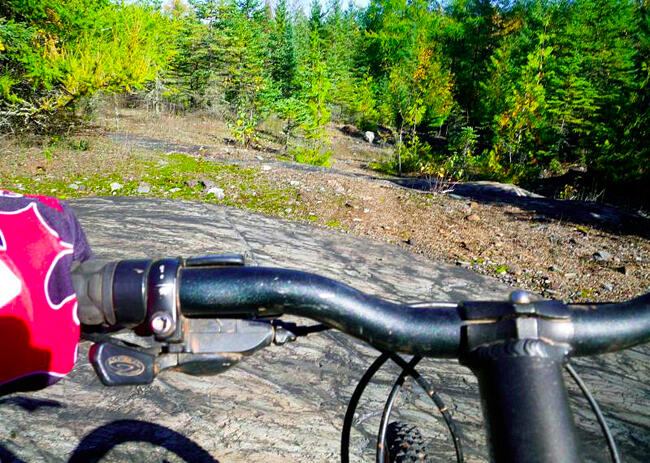
The old roads, trails, and single-track mountain bike trails in the Charleson Recreation area make it perfect for mountain biking. The Airport trail area is a combination of old roads, double track, and single track. They are mostly accessed off the Steep Rock Mine Road (“the paved road”) or the Steep Rock Landing Rd. Trails range from relatively easy (Mirkwood, Evinrude, Bobsled) to more technical single track (D’yer Maker, Over the Hills) to short but steep downhills (Cronk’s Crash, Wipeout, Mikey’s). While all trails are open to mountain bikers, only some are open to horse riders. You can download a map of the mountain bike trails (as well as other trails) to see which trails are accessible to whom. Try the Steep Rock Loop or the Pal Lake Lookout Trail for a less technical ride with awesome views.
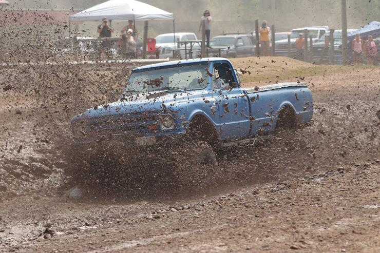
The Atikokan Mudslingers use the area for "Mudflings". Water is added to the reddish soil of the Charleson Recreation Area to make a really nice mud pile. The Mud Track, the only one in Northwest Ontario, is 300 feet long. The Atikokan Mudslingers 4x4 club holds an annual Mudfling. In 2010, they had 40 trucks and 63 drivers, and just over 1800 spectators over the weekend.
There are snowshoe trails that are accessible across from the Charleson sign and also at the bottom of the hill. The South Don Park Loop system has a variety of trails that interconnect over various terrain and totals about 5km. Watch out for the Lookout points that overlook the town. It also links up with the Bike trail system around the Airport. The North trail system makes a loop that takes you to Pal Lake, over to Pete Lake, and back to the Minnow Pond which is just over 10km.
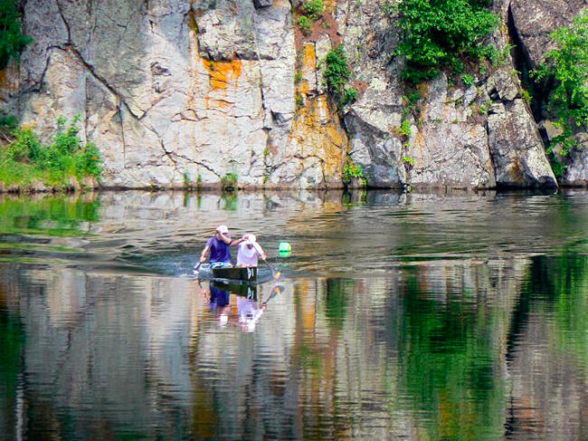
The Bow to Stern Canoe Association uses the area for canoe races. The Atikokan Sno-Ho Club uses the area for snowmobiling and for snowmobiling events that are based from the Sno-Ho Chalet in the Charleson Recreation Area. There is also an annual Ride for Sight at the CRA.
All in all, the Charleson Recreation Area truly has something for everyone all year round. Check them out!
Recommended Articles
Is the 1,400 Kilometre Drive to Northwest Ontario For a Fishing Trip Worth it?
8 must-see waterfalls

6 Ways to Get Your 10,000 Steps This Fall
Top 5 Reasons You Should Be Fishing in Morson, Ontario
Discover The Winnipeg River
Enjoy Sunset Country's Fall Colours on Your Next Road Trip

Fishing in the Fall?
6 Reasons to Book a Fall Vacation to Sunset Country
10 Reasons to Avoid Ontario’s Sunset Country
Heading Across Canada?
A Guide to Sunset Country Museums
The Promised Land: Best Muskie Fishing in Ontario
Fall Fishing Tips
5 Essential Boreal Experiences in Ontario's Sunset Country
5 Obscure Facts About Northwestern Ontario: Were You Aware of These?
Great Food in Relatively Unknown Places
Outdoor Medicine
A Guide to Bringing Your Pets on Vacation to Canada
There's more than just fishing in the Red Lake Region
5 Amazing Sights You Can Only See By Boat
Going Fishing in Canada?
Going fishing in Ontario?
Outdoor Adventure in Ontario's Northern Paradise
Planning A Family Fishing Trip to Canada
Tips from a Fishing Legend
