16 Best Places to Paddle the North Shore
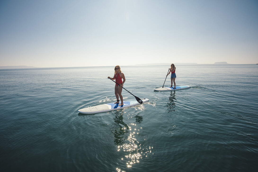
Superior Country is a region scattered with countless water systems, from rivers to inland lakes, and of course Lake Superior. It is no wonder why it is such a popular region for paddling. For those looking to paddle via canoe, enjoy an afternoon of kayaking or discover a leisurely paddleboarding destination, here is your guide.
Although this guide isn't comprehensive, it gives a good insight into some of the best paddling locations on the Lake Superior North Shore.
Thunder Bay
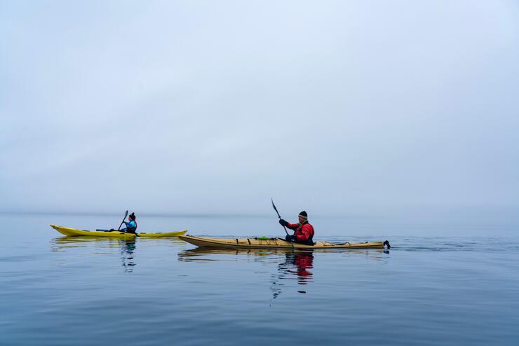
Superior Country’s largest and most populated city, Thunder Bay, is a paddler's paradise. Being located right along Lake Superior and having multiple water systems flowing into the big lake, opportunities are merely endless.
1. Thunder Bay Marina – Prince Arthur's Landing
Located downtown Thunder Bay, Prince Arthur's Landing is located just off S Water Street. The easiest entrance is on the right side of Water Street down Pearl Street, parking is located on the right side of the roundabout.
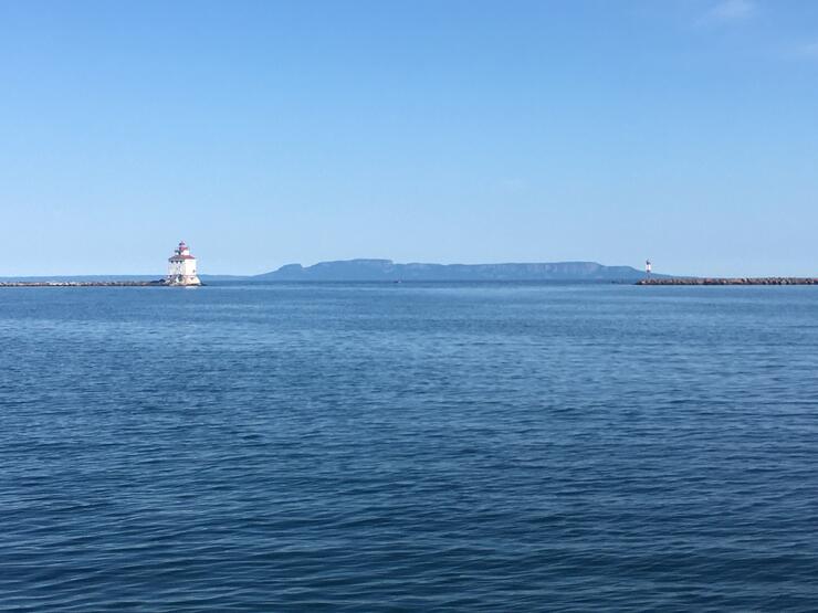
The local marina offers paddlers the opportunity to use the boat ramp to access Lake Superior. There is a small fee associated with utilizing the ramp. However, the views and conditions are well worth it. The marina harbour is enclosed by a large break wall, offering protection from the everchanging Lake Superior conditions. Looking out to the east, the Sleeping Giant rests upon the horizon, providing awe-inspiring views.
2. Thunder Bay Marina – Fishermans Road Boat Launch
Located just up the shoreline from Prince Arthur's Landing, Fishermans Road Boat Launch is another option for paddlers to set out onto Lake Superior. The easiest access to the launch is found at the Cumberland Street N to Hodder Avenue intersection. At said intersection take a right down Grenville Avenue. At the Y, merge right onto Shipyard Road, from there Fishermans Road will be visible on the left hand side to where the launch is located at the end.
This area is also protected by the break wall and is nestled just below Current River. Paddlers at this location can also enjoy views of the Sleeping giant, as well as the old grain elevators.
3. Thunder Bay – Mission Island and McKellar Island
Heading down the shoreline south from the Prince Arthur Landing location, Mission and McKellar Island is a more secluded area to enjoy a paddle. To get to the launch located on Mission Island: hop onto Pacific Avenue from Simpson Street, at the T, take a right onto Island Drive crossing the Kaministiquia River, another bridge crossing will be found further up the road. At the next intersection take a left onto 106th Street, on the left-hand side 107th Avenue will bring you right to the launch and parking space.
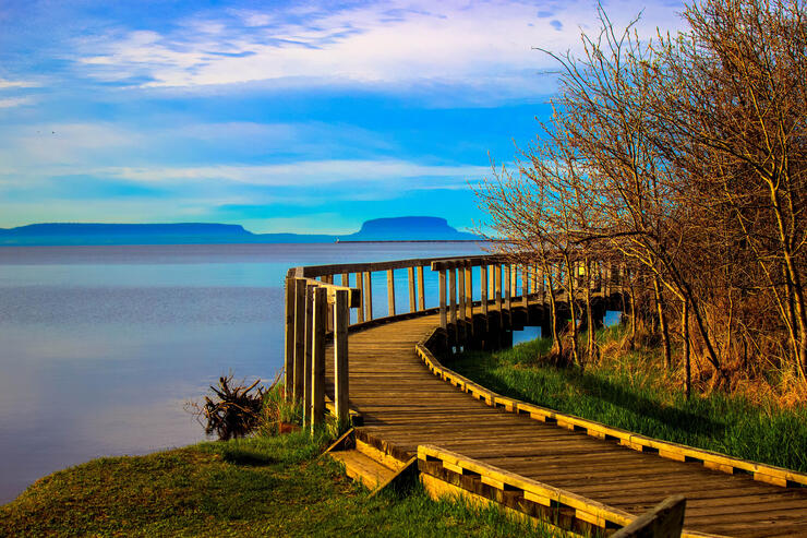
Down at this location there is a conservation area and bird observatory – it is a nature lovers dream location to paddle! The two islands are situated alongside one another offering protected paddling conditions. Although the break wall does not extend as far down the shoreline as the islands are located, one can paddle into the section protected by the break wall on the far side of McKellar Island. Between the two islands would be an ideal location for paddle boarding with the ample protection offered.
Surrounding Area of Thunder Bay
When looking for a close destination to paddle outside of the city limits without trekking too far, these two locations offer stunning views, a sense of seclusion and are lower trafficked. The furthest of the three locations below is just 85.7 kilometers from Thunder Bay!
4. Silver Harbour Conservation Area
Located down Lakeshore Drive is the locally cherished Silver Harbour Conservation Area. The area has two long concrete launching ramps, making it easily accessible. Upon venturing out onto the water, paddlers will be greeted with a stunning Lake Superior view. Coming out of the harbour to the west is Mary Island, on calm days adventures can paddle out around the island.
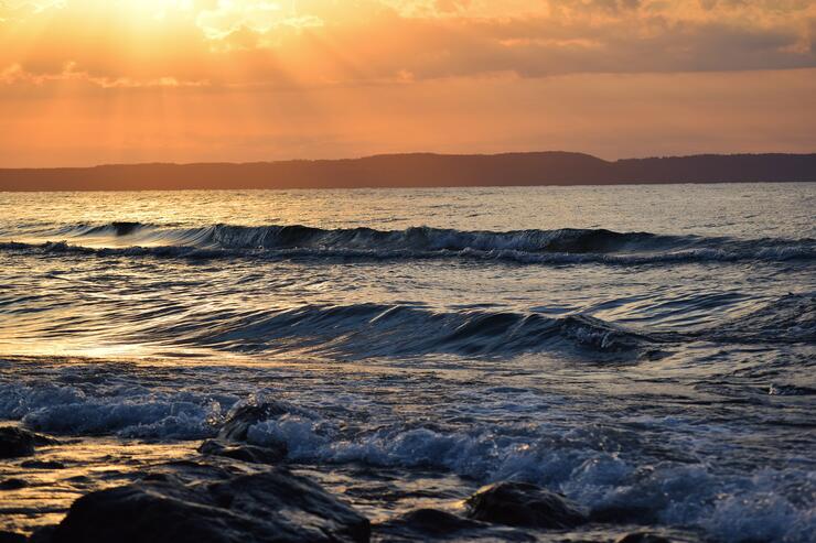
To find the Conservation Area, exit Thunder Bay taking Lakeshore Drive off Hodder Avenue. Upon following the road, Silver Harbour Drive will be found on the left-hand side and the boat launch is at the end of it with ample parking room.
5. Sleeping Giant Provincial Park
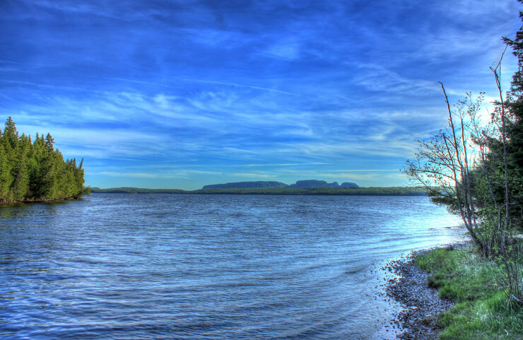
Just outside of Thunder Bay is the cherished Sleeping Giant Provincial Park. The park offers breathtaking Lake Superior views, ample wildlife viewing and plenty of paddling opportunities. The park is located on the Eastside of Thunder Bay. Upon travelling Highway 11/17 to the Pass Lake turn off down Highway 587 (Pass Lake Road) and following it all the way through to the park, information on open launches / launching sites can be inquired. Along with access to Lake Superior, Marie Louise Lake is also a paddling option!
6. Silver Islet
Perfectly situated just further down the road from Sleeping Giant Provincial Park is the community of Silver Islet. This is a quaint North Shore community that serves as a perfect destination for paddlers to enjoy some Lake Superior history and beauty.
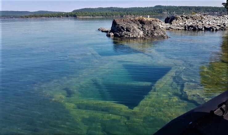
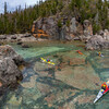
Upon entering the community, the Silver Islet General Store can be seen, there is a break wall and large dock within the little harbour. There is endless beauty to be seen paddling in this area, the crystal-clear waters that are tinted to resemble tropical-like waters, and a submerged mine! Straight out from the dock area is Burnt Island which offers some protection, around the island in the Southeast direction is the smaller Silver Islet and Silver Islet Mine. On calm days the mine shafts can be seen from atop the water!
Hurkett
7. Hurkett Cove Conservation Area
A small community along the Northshore and Highway 11/17, Hurkett has access to Lake Superior offering paddlers another picturesque location to enjoy. To access the Hurkett Cove Conservation Area, travel Highway 11/17 to Black Bay Road (on the left hand side coming from the East and right hand side coming from the West). Upon following the road to the end, the launch area and parking can be found.
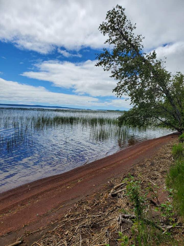
The Hurkett Cove Conservation Area is a great location to set out onto the big lake. With ample wildlife viewing, especially birds, it is the perfect destination for nature lovers.
Another great area to set out atop Lake Superior is at the Hurkett Cove Boat Launch. This area is located down the Hurkett Loop which has 2 access points along Highway 11/17. From there, Dock Road can be found which if followed will lead right to the boat launch and parking area. The interior of the cove is protected and calm, when exiting out further onto Superior, the vastness of Black Bay is found.
Red Rock
Situated just 8km off Highway 11/17, Red Rock is a gateway for endless Lake Superior ventures. When travelling down Highway 11/17 the signed turnoff for the community can be seen, when following the road in, the Red Rock Marina will appear on the left hand side.
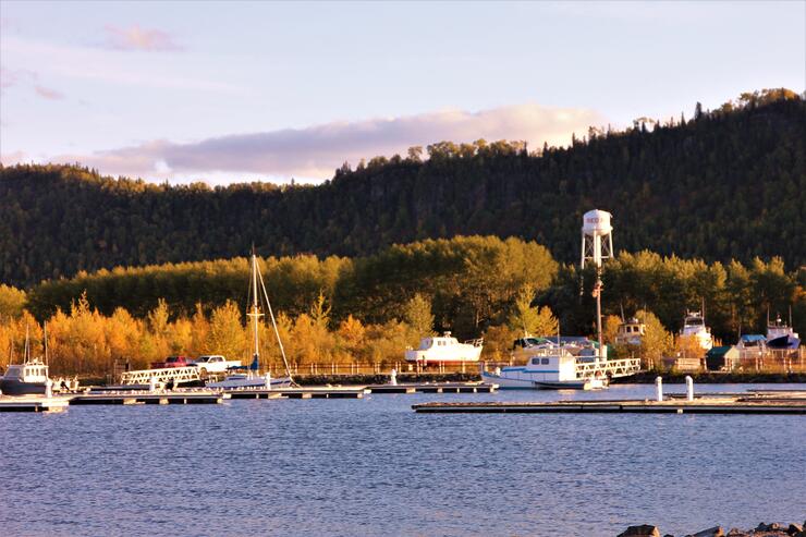
The Red Rock Marina is a great area for paddlers to launch. With an accessible for all launch on the far-left side of the marina, all paddlers can enjoy the wonders of Lake Superior. Almost straight out from the marina in a Northeast direction, historic Indigenous pictographs can be found on the large red rock cliffside.
Nipigon
10. Nipigon Marina
Located just off the 11/17 Highway, the community of Nipigon is located right on Lake Superior as well as its biggest tributary: the Nipigon River, making this a great destination for paddlers. Just 110km East of Thunder Bay, the Nipigon Marina is a gateway to endless paddling adventures. Upon entering Nipigon from the second entrance, just before the Nipigon Bridge, follow Railway Street to the first intersection and take a left across the tracks. Follow Front Street and take the first left, this will bring you right down to the marina.
There is a fully accessible kayak launch at the far end of the marina and ample parking availability throughout. The Nipigon Marina offers stunning views of the Nipigon Bridge and Dog Head Mountain, one can also paddle up into the calm Nipigon Lagoon to view the painted turtles.
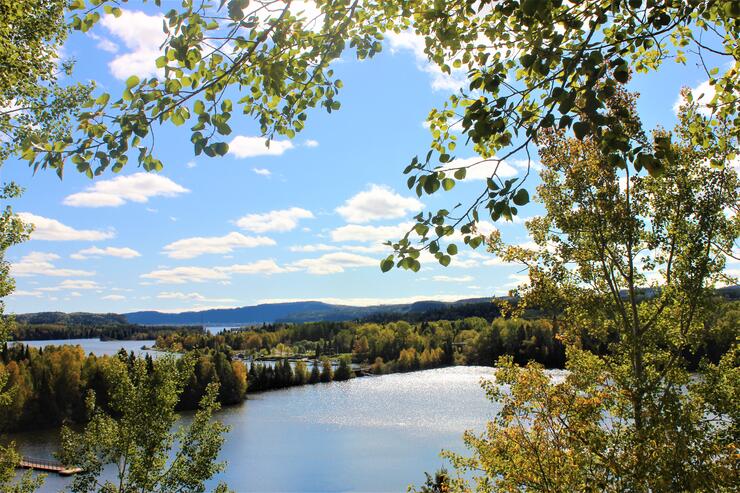
The Nipigon River is also a great paddling destination. Alexander Dam is located roughly 15 km up Highway 585 on the right hand side. There is a concrete boat launch and is suitable for kayak launching. Paddlers should be aware that depending on the season and whether the dam is open or not, the current can be strong in the river. Paddlers should use self directed judgment to decipher if the river is a suitable area to paddle down. From Alexander Dam, down the river, into Lake Helen and down to the Nipigon River, the entire route is roughly 20 km.
Rossport, Schreiber, Terrace Bay and surrounding area
11. Rossport
184km from Thunder Bay, Rossport is arguably among the most picturesque locations to paddle along the North Shore. This is a location where you're able to enjoy a fully guided tour with Such a Nice Day Adventures!
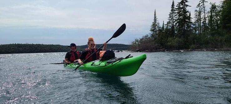
SAND offers a variety of excursions to suit interests and needs of individuals. Learn about Lake Superior, Rossport and the surrounding region while enjoying an unforgettably unique paddle.
12. Schreiber
Schreiber is just over 200km from Thunder Bay to the East. This quaint community is located right along Highway 17, the local Schreiber beach is just off the highway. Although there are no kayak launches, the beach itself is good to depart from. With stunning Lake Superior views and clear waters, paddlers will find a new love for the big lake when paddling from Schreiber.
A short 15km East from Schreiber, Terrace Bay is the next North Shore community offering paddlers the opportunity to take advantage of beautiful Lake Superior views. The local beach is just a short drive down to the lake from the main highway.
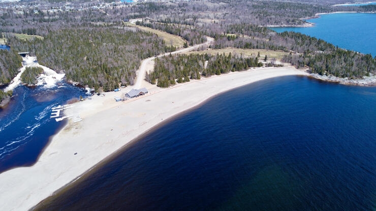
Terrace Bay Beach is fully serviced with a boat launch as well as a fully accessible kayak launch. The Terrace Bay Beach paddling area features a partially blocked-in bay from the beach's sand bar, inflow from the Aguasabon River and view of the gorge from the base of the river!
Travelling 50 km from Terrace Bay East, Neys Provincial Park is an oasis for all those who visit. Similar to most provincial parks along Lake Superior, there are lots of paddling opportunities! The park entrance is on the right-hand side of Highway 17 with signage leading to the main area. From there you can access the nearby beaches and launches for paddling.
Marathon
15. Pebble Beach
300km east from Thunder Bay is Marathon. This community is located just off Highway 17 and has one of the most stunningly unique Lake Superior shorelines. Peninsula Road is located off Highway 17 on the right-hand side and goes through the heart of Marathon. Upon approaching the T section where Peninsula Road meets Stevens Avenue, turn left, and continue to Howe Street. Turn right down Howe Street and the parking area for Pebble Beach will appear.
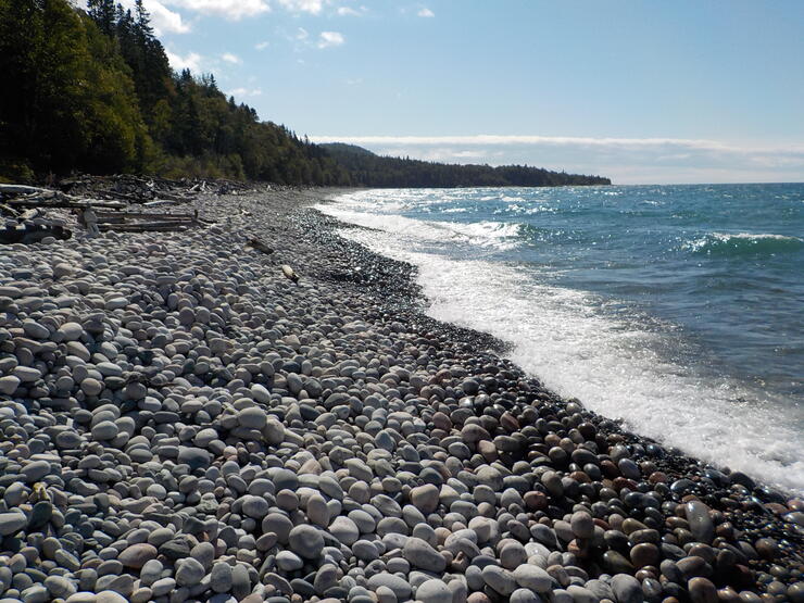
As the name suggests, the beach is made up of pebbles, rounded and smoothed by the rolling waves of the big lake. Paddlers can launch off the pebble shores on Lake Superior to enjoy a grand adventure!
Just a bit further East on Highway 17 from Marathon, Pukaskwa National Park is the final North Shore paddling oasis. As they say: save the best for last - Pukaskwa arguably is the best! Highway 627 is on the right hand side of Highway 17 and leads right into the National Park.
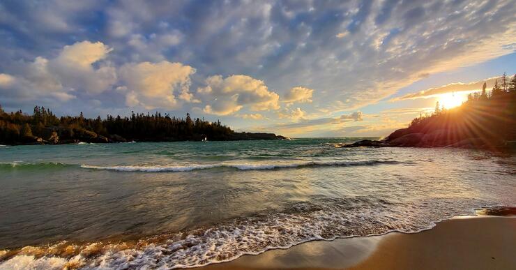
“Hattie Cove is a great place to spend the day paddling. Bii to bii gong is the Anishinaabe name for Hattie Cove and means "water between two rocks''. This protected cove, even on Lake Superior’s roughest days, remains calm for beginner and expert paddlers alike. Pack a picnic lunch and explore the Hattie Cove wetlands or simply float around for an afternoon!” – Parks Canada.
Editors note:
Paddlers on any body of water should always use caution to changing weather and water conditions. Use self judgement to determine if your skill level is adequate to the conditions of the weather and water. Always inform others of your paddling route and plans. Have Fun, Be Safe.
Recommended Articles
10 Reasons to *NOT* Travel the Lake Superior Circle Tour
Canoeing the the Slate Islands near Terrace Bay
6 Amazing Facts About Red Rock, Ontario
11 Things to Do in Silver Islet, Ontario
Incredible Fishing at Dog Lake Resort

Best Roadside Picnic Spots in Northern Ontario
A Father and Son Tradition at Miminiska Lake Lodge
Hikes, Bites and Sights on the North Shore of Lake Superior
A Day Tripper's Guide to Nipigon
A Historic Lodge in Red Rock, Ontario
Hunting for Yooperlites Along Lake Superior
