Best Places To Go For A Run
Leave right from your hotel front door, or take a short drive to one of these picturesque locations and experience the best run of your life!

Hiawatha Highlands
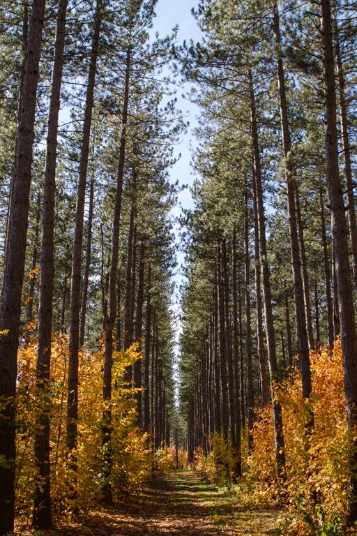
Kinsmen - All the trails on the Crystal Creek Trail System start on this route. A gentle loop with gradual up hills and down hills. The simple turns and hills makes for an easy run.
Crystal Creek Falls - Is part of Kinsmen Park located adjacent to Hiawatha Highlands. The entrance to the park is located a few hundred metres past the Kinsmen Centre at 780 Landslide Road. Follow the road into the park until you reach the parking lot next to the pond. It's about a 1 km/0.6 mile stroll to get to the top of the falls. You will arrive there upon a wooden walkway that parallels the Crystal Creek with platforms at the base, beside and above the falls. Take advantage of the picnic area to relax and enjoy a quiet lunch. If you want to explore a little more, hike, run around the pond crossing Crystal Creek, walk along the causeway and then across a footbridge and back to the parking lot.
Hiawatha Extension - The trail branches off the Crystal Creek Trail around the 1 km point. The trail has lots of hills and curves, sharp turns, up hills, and fast descents. It rejoins the Crystal Creek Trail just past the 1 km point.
Inner Loop - The trail branches off the and rejoins the Crystal Creek Trail around the 1.5 km point. The level terrain allows for a fast pace on this loop. There are small rolling hills surrounded by beautiful scenery.
Olympic Extension - The trail branches off the and rejoins the Crystal Creek Trail around the 2.5 km point. A challenging trail with an enjoyable balance of flats and hills.
Mabel Lake Extension - Crystal Creek Trail around the 2.5 km point.
The Pinder Trail - This Trail follows a gentle terrain and has no large climbs or down hills. There is a lookout and rest area around the 2 km point. The trail then passes through a large section of maple sugar bush.
The White Pine Extension - This trail follows a gentle terrain and has no large climbs or down hills. The extension leaves the Pinder Trail around the 1 km point, just before the turnoff for the Mockingbird Hill Extension. It rejoins the main trail at the same point.
The Mockingbird Hill Extension - There is one small downhill this trail offers. It passes through a section of farmer’s field from which the Mockingbird Pioneer Farm and Christmas Tree Farm can be viewed. The extension leaves the Pinder Trail around the 1 km point and rejoins the main trail three hundred meters down the trail.
Sugar Bush Extension - A gentle loop with only one easy hill. The combination of hardwood and pine trees adds to the beauty of the trail. The extension leaves and rejoins the Pinder Trail around the 3 km point.
Fort Creek Conservation Area - Into The Woods
The Fort Creek Conservation Area is owned by the Sault Ste. Marie Region Conservation Authority and was purchased to address flood control concerns experienced by businesses and residents living downstream. The Fort Creek Dam was constructed between 1968 and 1971 and has a reservoir of approximately 3.24 hectares (8 acres).
In addition to its primary purpose of flood control the Fort Creek Conservation Area also provides the ancillary benefit of green space, recreational opportunities and wildlife habitat. In the summer the hikers and runners alike can enjoy the diversity of scenery and trail difficulty level or have lunch under the sheltered picnic area. Offering a delightful diversion in the winter visitors can go snow shoeing, tobogganing or cross country skiing. This conservation area covers approximately 77 hectares (191 acres) and is situated off Second Line, east of Peoples Road creating a sense of tranquility in the heart of the city and is a small example of the beautiful Great Lakes-St. Lawrence Forest and wetlands.
John Rowswell Hub Trail - City Slickers
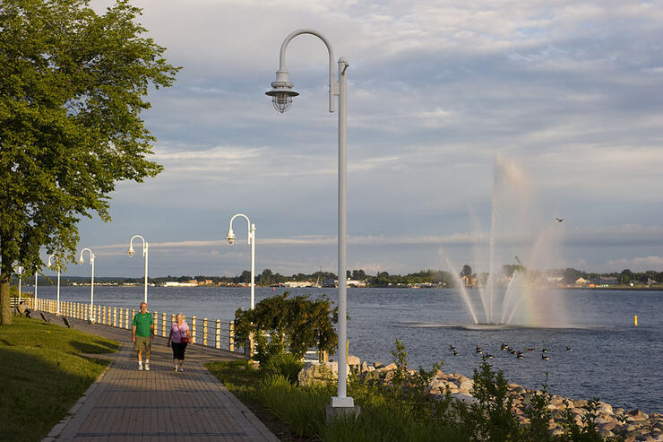
The Hub Trail is a 24-km multi-use, non-motorized trail system for various types of users, such as running, cycling, walking, in-line skating, cross-country skiing. The trail is wheelchair-accessible. The trail connects many significant points of interest including the waterfront walkway, Bellevue Park, Algoma University, Sault College, the new hospital and Fort Creek Conservation Area.
Prior to the construction of the HUB trail, the Sault Naturalists of Ontario and Michigan conducted a Biological Inventory in the Fort Creek Conservation Area in order to identify any species at risk. As a result of this investigation a report was prepared by Don Hall and Marjorie Hall, and later submitted to the SSMRCA, titled "Fort Creek Hub Trail – Biological Inventory."
The Finn Hill extension of the HUB Trail is a 5.2-km/3.2-mile (out and back) paved trail that begins in the parking lot at the bottom of Finn Hill. Winding through a forested area, this trail is mostly flat with a challenging hill at the turn around. In the spring, fresh green ferns carpet the ground and during the fall, tall orange and yellow maples, birch, and poplar colour the canopy overhead. Bring a snack and a beverage and finish your nature walk with a panoramic, seated view towards the East at the top of Finn Hill near the parking lot.
For more information on the Hub Trail please visit the Sault Tourism website.
Local Gyms
Achieve Fitness - For women
Recommended Articles

9 Facts to Know about the Agawa Canyon Tour Train
A Guide to the Best Urban Fishing in Sault Ste. Marie, Ontario

Where to Eat, Dine, and Play on the Sault Ste. Marie Waterfront

Cruising to the Next Level

Canada's Only Bushplane Museum is a Must For Your Bucket List

Why the Fall Is a Great Time to Visit Sault Ste. Marie
Canoe & Kayak Sault Ste. Marie

Peace Restaurant
