Please note this page may no longer be up to date. For new stories about Northern Ontario visit us here.
2014 - Worst flooding in years!
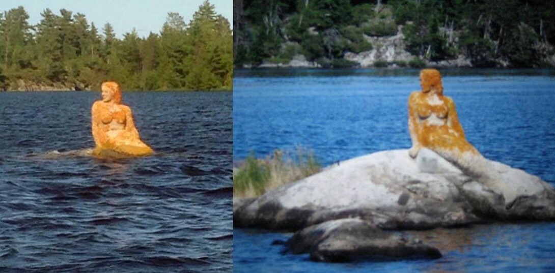
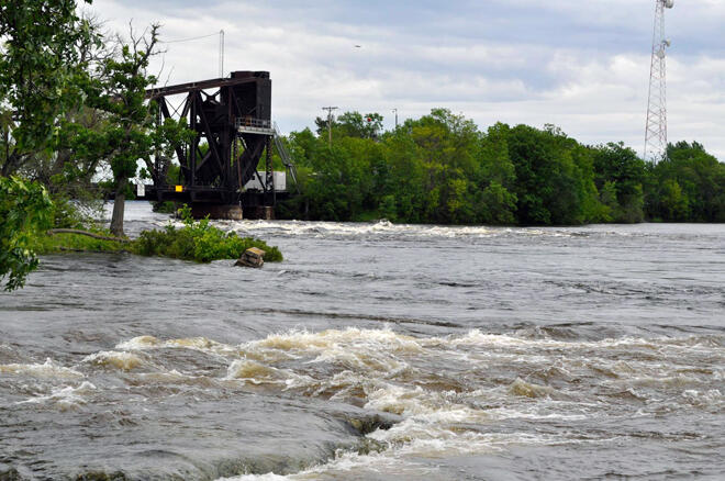
If it wasn't bad enough that we had winter that wouldn't end and left us wondering when the ice would go out in 2014, but the heavy rains in the last month or so have really pushed the water levels dangerously high. The Rainy River District is currently flooding and the high water is working its way up to Lake of the Woods.
Update: 2022 has just exceeded the flooding described in this article. Look for an article in the near future on the 2022 floods.
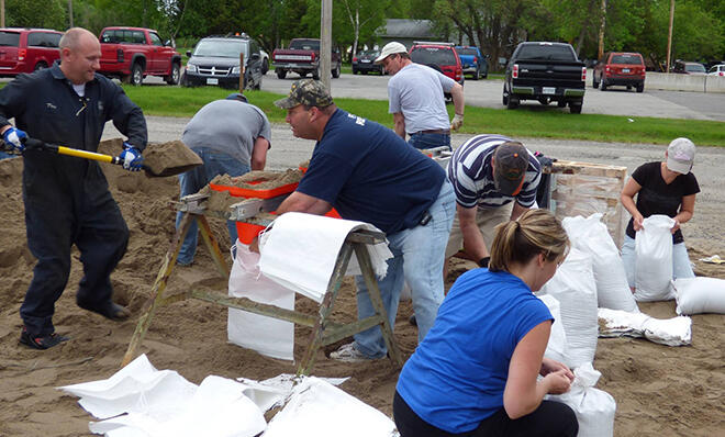
Folks along the Rainy River have been sandbagging for days, hoping to stop the river from spilling its banks. It has been many years since the river has been this high. Riverside homes and businesses have had to be sandbagged in the Town of Rainy River. The Waterfront and Hannam Park are covered in water.
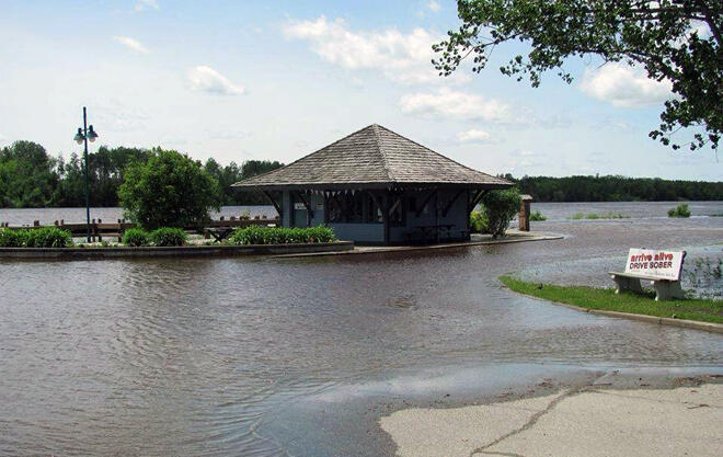
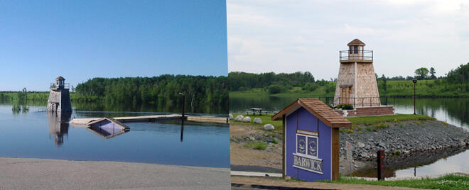
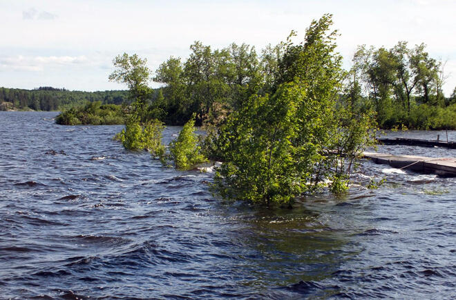
Barwick, which is along the Rainy River between Emo and Rainy River is also flooding. The boat launch and Lighthouse Waterfront Park are submerged. Basically, most docks along the river are submerged.
Fort Frances is currently under a flood warning and residents have been quickly filling and placing sandbags. Rainy Lake is currently at very high levels. Over the next week, Rainy Lake and the upper river may rise an additional 16-24 inches. The Town of Fort Frances boasts a beautiful waterfront park and walkway that will definitely take a hit. As of June 19th, emergency management has still not determined the best method to create a barrier, whether it's stacking sandbags or building a berm. The fortifications will be built from the hospital down to Mosher Avenue. The work will start at one of the lowest elevation points at the end of Crowe Avenue and continue in both directions.
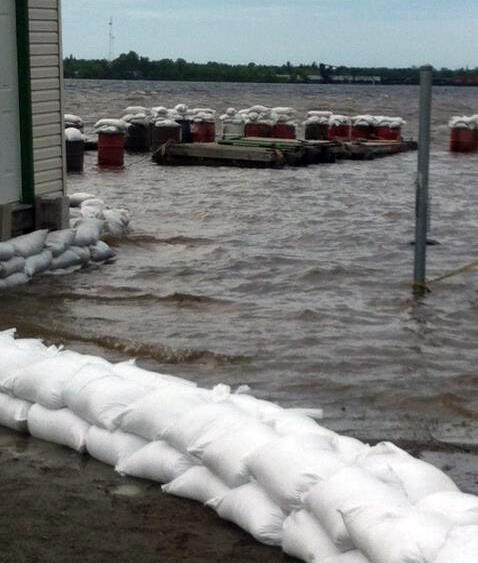
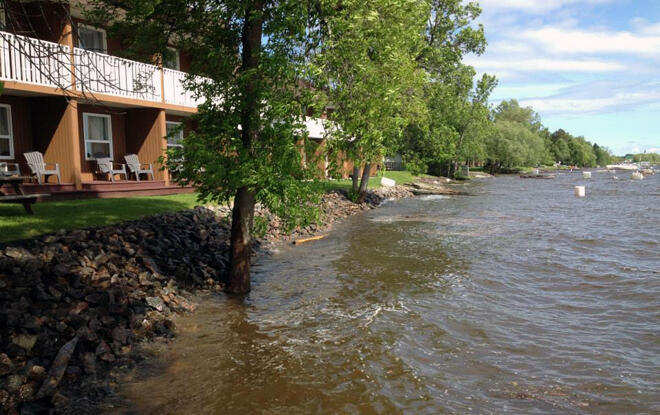
Rusty Myers Flying Service & Outposts is located on Rainy Lake just outside of Fort Frances on Sand Bay. Their long docks that accommodate their float planes are submerged and some have even been severely damaged. They asked the residents to help them secure their building as it seemed the water just kept rising. Here's a photo of the sandbags creating a barrier.
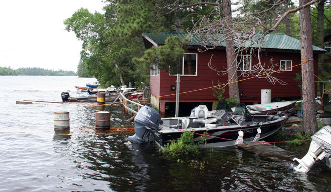
Venture out to the Northwest Arm of Rainy Lake and you'll find Camp Narrows Lodge. While they are reporting that the fishing has been fantastic on Rainy Lake, the docks at the camp have not fared too well. It brings a new meaning to 'lakeside cabins'.
What does this mean for the rest of Sunset Country?
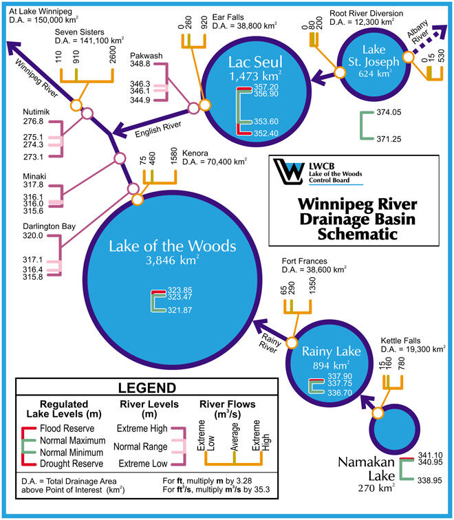
Take a look at the following map that the Lake of the Woods Control Board puts out that shows the Winnipeg River drainage basin starting with Namakan Lake. There are certain dams that control the water levels in these lakes. They are however also subject to Mother Nature.
Continued rainfall has increased streamflows in the Rainy River basin (which flows into the Lake of the Woods) and in the English River system. Flooding has been reported in many locations in both the Winnipeg and English River basins.
In the Rainy River basin, the dams at Namakan Lake and Rainy Lake are passing maximum flow. The Lake of the Woods outflow dam was fully opened on June 14th and is likely to remain fully open for several weeks. Winnipeg River levels downstream of Norman dam are rising as a result of this flow increase. After the initial rise, Winnipeg River levels will slowly rise as lake outflow slowly increases. Additional rises in river levels are possible if runoff from local heavy rainfall occurs.
Lake of the Woods is expected to rise by 8-11 over the next week and Lac Seul is expected to rise by 6-8 inches. Visit the Lake of the Woods Control Board for updated bulletins.
On the north end of the Lake of the Woods, Kenora is seeing high water levels and they are expected to rise even further. There is no flood warning or watch yet, but the citizens are getting prepared for that possibility.
The Dryden area (Wabigoon Lake and the Wabigoon River system, Eagle Lake and the Eagle River system, as well as low-lying areas west of Dryden) has been issued a Flood Watch. Residents are keeping a close eye out on the water levels. Highway 105 at Buller Creek has been underwater a few times this year. Currently, the MTO is requesting all light vehicles take a detour via Highway 647, to Hwy 609 to Quibell, and then to Highway 105.
Lakes around the Sioux Lookout area are also expected to rise. The eastbound lane of Highway 642 about 7km east of Sioux Lookout is closed due to a washout. Keep checking the MTO for road conditions and closures.
The Ontario Ministry of Natural Resources has Two Types of Local Flood Messages
- A flood Warning indicates flooding is imminent or occurring within specific watercourses and municipalities.
- A Flood Watch indicates the potential for flooding exists within specific watercourses and municipalities.
Currently, the Fort Frances area is under a Flood Warning and the Dryden District is under a Flood Watch. Visit the MNR website for any changes and current Flood Watches or Warnings.
How can I find out more about the flooding around Sunset Country? Read these news articles:
- Mitaanjigamiing First Nation declares state of emergency (CBC News - June 19)
- Rainfall threatens other areas besides Fort Frances (CKDR - June 19)
- Swollen Rainy River alarms waterfront tourist outfitters (CBC News - June 19)
- Flood warning extended through Saturday (Rainy River Record - June 17)
- Kenora flooding fears wash over from Rainy River (CBC News - June 16)
What can I do to help?
- Sandbagging is continuing in Fort Frances. If you want to help, call the town's Emergency Call Centre phone at 807-274-1818 and leave your name and contact information, or go to the command site at La Place Rendez-Vous.
- In Kenora: If you are willing to help sandbag if needed in Kenora, please call the Keewatin office of the Red Cross at 807-547-2683 to put your name on a list of people willing to help.
- The Town of Rainy River had issued a call for volunteers to sandbag at the Town Garage at Sixth St. and Highway 11 however, they may have wrapped up. Please call the Town Office to see if they need any further help at 807-852-3244.
- Contact one of the other towns in Northwest Ontario to see if they need help with their flooding efforts.
Is there anything canceled because of the flooding?
- The Third Annual Dragon Boat Festival in Fort Frances has been changed from July 1st to tentatively August 9th. The raging waters are just too volatile right now to hold the races.
- The Ball Diamonds and portions of Mink Bay Trails in Keewatin have been closed until notice due to flooding.
- Follow Ontario's Sunset Country Events on Facebook for more updates or closures.
So what does this mean if I am heading to Northwest Ontario?
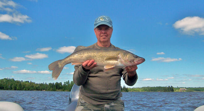
- You can most likely still go fishing (I've heard it's been great so far this year). Watch out for debris floating in the water.
- Call your resort before you go to see if there are any local road closures.
- All communities would like an extra hand if you'd like to help out.
- Just go with the flow. Mother Nature throws us some curve balls sometimes but we just have to make the best of it. We are in God's Country, after all, it shouldn't be too hard to enjoy yourself.
- If you have any questions, you can call Ontario's Sunset Country Travel Association at 1-800-665-7567 and we'll try to answer your questions as best as we can.
Recommended Articles
Is the 1,400 Kilometre Drive to Northwest Ontario For a Fishing Trip Worth it?
8 must-see waterfalls

6 Ways to Get Your 10,000 Steps This Fall
Top 5 Reasons You Should Be Fishing in Morson, Ontario
Discover The Winnipeg River
Enjoy Sunset Country's Fall Colours on Your Next Road Trip

Fishing in the Fall?
6 Reasons to Book a Fall Vacation to Sunset Country
10 Reasons to Avoid Ontario’s Sunset Country
Heading Across Canada?

A Guide to Sunset Country Museums
The Promised Land: Best Muskie Fishing in Ontario
Fall Fishing Tips
5 Essential Boreal Experiences in Ontario's Sunset Country
5 Obscure Facts About Northwestern Ontario: Were You Aware of These?

Great Food in Relatively Unknown Places
Outdoor Medicine

A Guide to Bringing Your Pets on Vacation to Canada

There's more than just fishing in the Red Lake Region
5 Amazing Sights You Can Only See By Boat
Going Fishing in Canada?
Going fishing in Ontario?
Outdoor Adventure in Ontario's Northern Paradise
Planning A Family Fishing Trip to Canada
Tips from a Fishing Legend
