No one seems to be sure how these huge, rounded rocks arrived—or when.
By Backroads Bill Steer
A professor at Canadore College and Nipissing University, as well as the founder of Canadian Ecology Centre in Mattawa.
April 12, 2023
Note: This story originally appeared in 2017 and has been updated.
Myth or belief. Maybe it's like the Loch Ness monster? You see what you want to see—you think what you want to think.
What’s more fun than a mystery where you can write the ending? On a back road near a unique shoreline in Northeastern Ontario is a configuration of huge boulders that pose more questions than answers.
The Northern Ontario Stonehenge?
The unusual aggregation of these rounded rocks may not have the same visual impact as Stonehenge, the prehistoric monument on the Salisbury Plain in England. But there is a similar mystery in their very existence. No one seems to be sure how these huge, rounded rocks arrived, or when. Why does the alignment match exactly with the rising and setting of the sun on the winter and summer solstices? Why do Indigenous Peoples consider this a sacred site? Is it the proximity to nearby mountain top, a retreat for shamans?
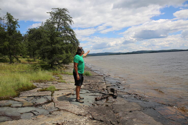
There is an aggregation of 18 huge erratics, some twice the height of a human on the shores of Larder Lake, east of Kirkland Lake. Like members of a small community, these “Stonehenge” rocks are well known to the residents of Larder Lake, situated across the water body of the same name on the northeast shore near the Big Narrows.
A glacial erratic is a piece of rock that differs from the size and type of rock native to the area in which it rests. The erratics here are dissimilar; many of them have different origins and compositions. Another question has been posed by researchers: Could it be possible the rocks were stacked on top of one another and have now fallen over?
The site is found on a flat, almost barren, stretch of bedrock, much different than the surrounding terrain. There are striations everywhere etched into the rock. These are the lines or scratches on the surface inscribed by rock fragments embedded in the base of a glacier as it moved across. When you come to the boulders the immediate difference is noted when compared to the surrounding terrain. That in itself is a geological anomaly. The four-stone alignment matches exactly with the rising and settings of the sun on the summer and winter solstices. Can these rocks' proximity to nearby Mt. Cheminis, a solitary and significant height of land, be simply a coincidence?
geographic coincidence? or ancient indigenous site.
Vernon Dufresne does not think so. He has lived most of his life in the Larder Lake area, and says the rocks have been a “conundrum” for him for years. He thinks the rocks were moved into place for a reason. In the year 2000, he released a study and his interpretation of the site—I was keen to hear his thoughts and so reached out to him for an interview.
“The sock structure is very unique," says Vernon. "There is no other similar site in North or South America. It may be compared to medicine wheels found in the Canadian and American prairies.”
His investigation points to the configuration of four large rocks aligned in a north-south direction in line with Polaris, the North Star. He believes some of the rocks could have been moved to form this significant directional monument for early Indigenous peoples and their seasonal relationships with the land. “It has been fun,” he says. “People either look at me with bewilderment or appreciate the science behind the theory.”
There is little to no soil on the flat bedrock in the immediate area of the boulder field. There is a distinct lack of boulders on the shoreline when compared to the adjacent shorelines, and geologists have made note of this peculiarity. In one Ministry of Northern Development and Mines report, it states, “The edges of the cleared area looked unnatural as well, as though the overburden and boulders had been pushed away.”
An ethnological investigation became part of an archaeological study of the Larder Lake “Mystery Rocks” in 1992. An Indigenous Elder and Shaman, Fred Pine, visited the site with archaeologists.
From the report of archaeologist Thor Conway, “Fred definitely thought that the mystery rocks of Pearl Beach were used for such purposes by prehistoric peoples. He feels there is a power in the rocks underneath the site which he could feel by walking there. He thought the area had been previously cleared.”
Dolstones or rock alignments were used by early Indigenous Peoples as “power snares” to capture spirits which then could be used against their enemies. Locations such as this are known as “power spots.”
Within 300 metres there is a significant Indigenous encampment. Archaeologist Dr. John Pollock discovered the adjacent Pearl Beach had been used extensively as a home by Indigenous Peoples from the earliest post-glacial times (6,000 B.C.) up to the historical present. In fact, 14 other such sites have been identified on Larder Lake.
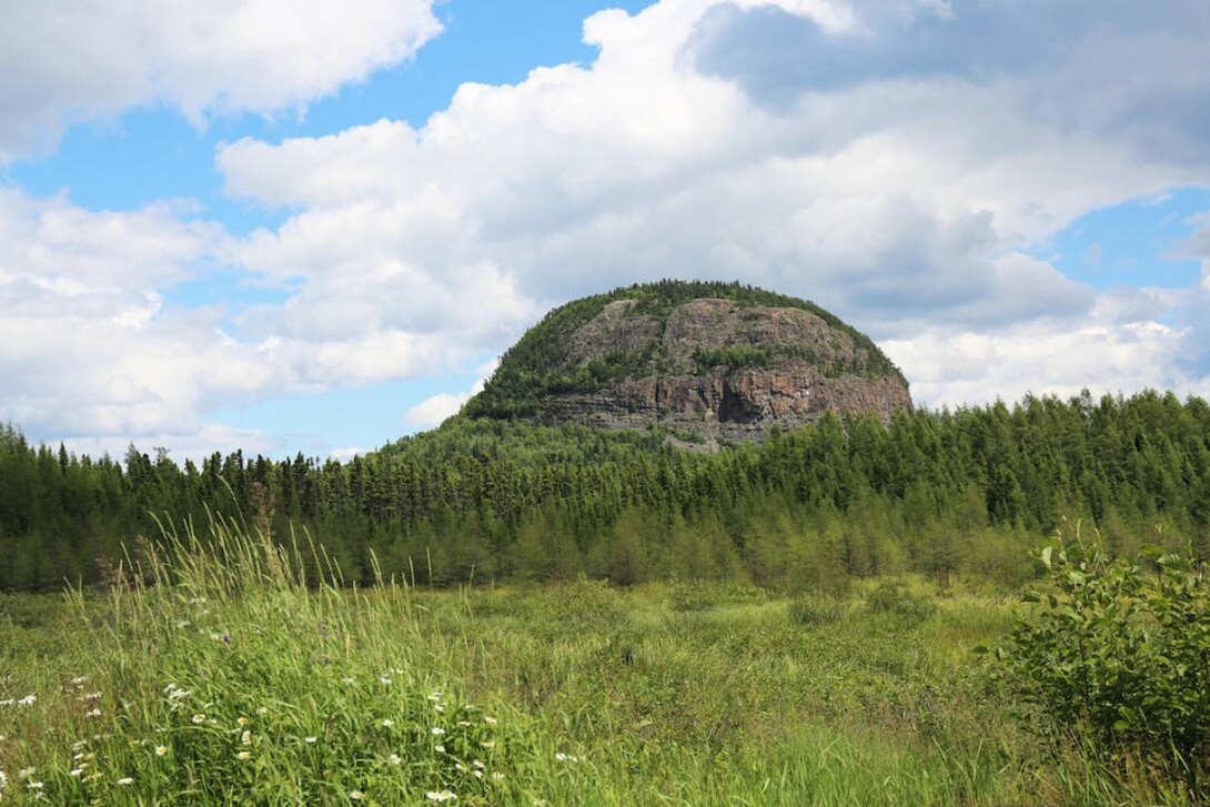
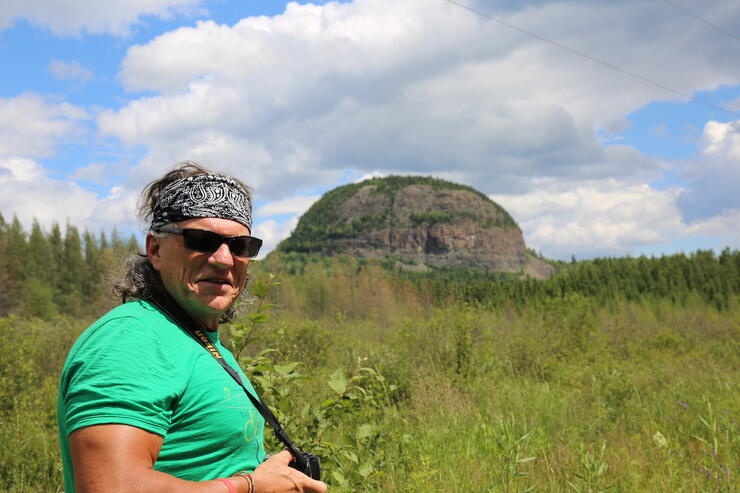
Cheminis Mountain, also called Mount Chaudron, can be seen in the distance from the shoreline. It is located by travelling on Highway 66, just east of Virginatown and straddles the Ontario/Quebec border. It rises like a mirage on the horizon and it seems to be growing straight up out of the highway’s horizon line. What was a volcanic plug is the most prominent feature visible from Pearl Beach. It would have been like a ‘sign post’ in the wilderness. The early Ojibwe held this mountain in great spiritual reverence. They called the hill Shewmeness. The Ojibwe Shamans were known to occasionally retire to the summit of Shewmeness to fast and meditate.
The hike to the top is worth it after you visit the stones. (The road south to the Mt. Cheminis trailhead is located right at the Ontario/Quebec border sign; there are no trail signs; you will find it about a km from the highway.)
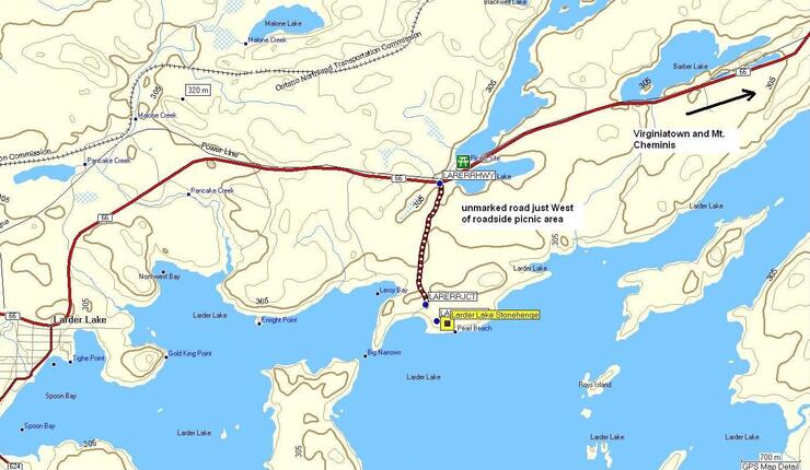
how to get to the northern Ontario Stonehenge
Head east of Kirkland Lake on Highway 66, through to Larder Lake. From the junction of Highway 624 and 66, at the community’s fish monument, travel eastwards on Highway 66 for six km. Watch for an unmarked road (N48º 06’ 56.4” W79º 39’ 00.7” or WGS 84 17 U E 600464 N 5330036) on the right or south side just before the Bob Lake/Tournene roadside picnic area. Travel this side road; there is one hill, for 1.5 km. When you come to the fork veer left or SSE. If you go right or SW you would end up at Pearl Beach. Within 200 m you will park amongst the pines; walk to the SE about 200 m and you will see the exposed bedrock, the large erratics, and Larder Lake. Take a look around and find all the erratics and walk the short distance to the shoreline. Note the absence of broken rock, the striations and align your compass with the four rocks (17 U E 600584 N 5328370 or N48º 06’ 02.3” W79º38’ 56.3”). Look to the ENE for Mt. Cheminis.
In mysteries, there are puzzles to solve. The reader must piece together the clues, this is the mystery of the stones found off of a back road. Whatever you want to believe about this anomaly is for you to solve within your own sense of what is or isn’t.
has a passion for Northern Ontario and the great outdoors.
He is the founder of the Canadian Ecology Centre and remains as the General Manager/Head Master of one of Canada’s leading environmental education centres. It is based on the CEC’s M.A.D.E. principle – Make A Difference Environmentally. He also developed the national geomatics certification program.
He is Back Roads Bill on the CBC. He holds degrees and diplomas from Laurentian University, Nipissing University, McMaster University and Durham College.